
This section is a bit of a catch all for islands that do not logically fit into or are not officially part of any of the main island groups. In general, they are small islands close to the Greek mainland that, in local government terms, are included within mainland administrative areas.
The main exception to this is the large island of Kythira that lies to the south of the Peloponnese peninsula. Both it and its smaller satellite island of Antikythira are sometimes included within the Ionian island group. However, they are very different in feel and appearance from the rest of the Ionians and, therefore, I have included them in this section. I’m not sure which, if any, island group they do actually belong to.
The other smaller islands are often overlooked in guide books and tourism literature. However, while they are generally not as well-known as most other islands – particularly by overseas visitors to Greece – they are definitely not without their charms and attractions. They also have the advantage of usually being within a short ferry ride from the mainland and, in some cases, have road connections to it.
My active interest in these islands is fairly recent after I noticed that some of them had significant resident populations. It’s fair to say that I have found things to enjoy on all of those I have visited to date. They all have unique characteristics, but retain what I would best describe as an authentic Greek atmosphere. Ideal for visitors who maybe want to explore off the beaten tracks.
Aitoliko
First Visited in 2019. Most recently visited in 2024.
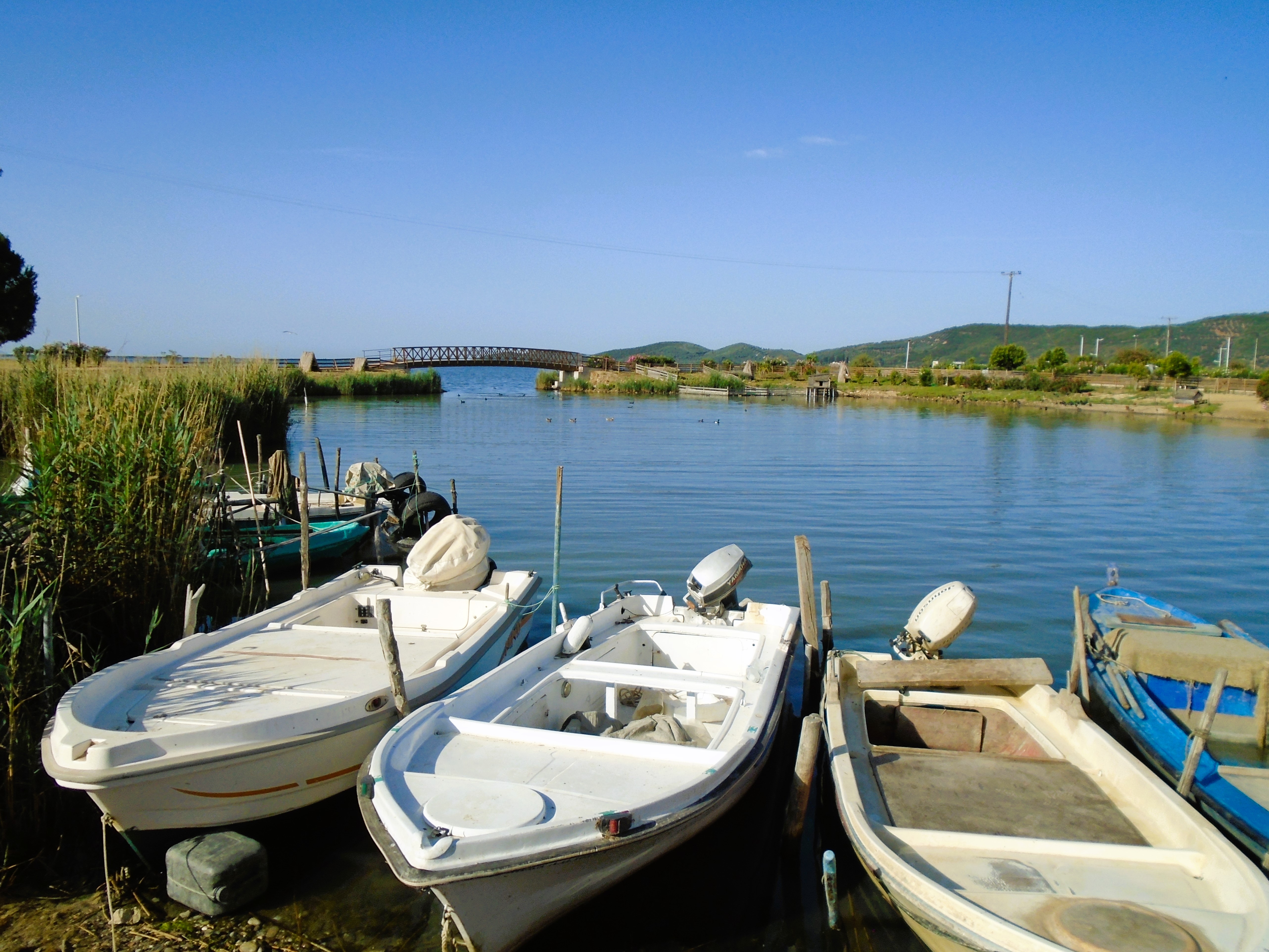
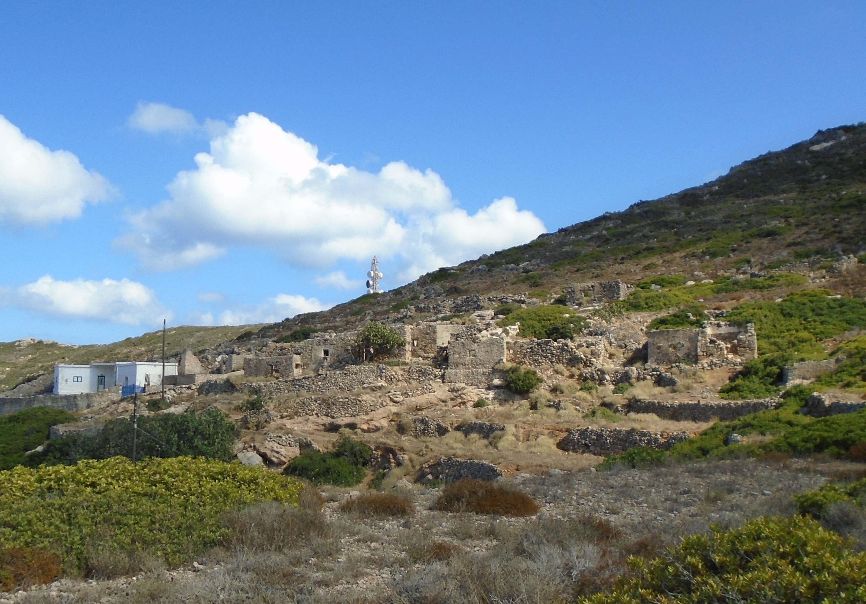
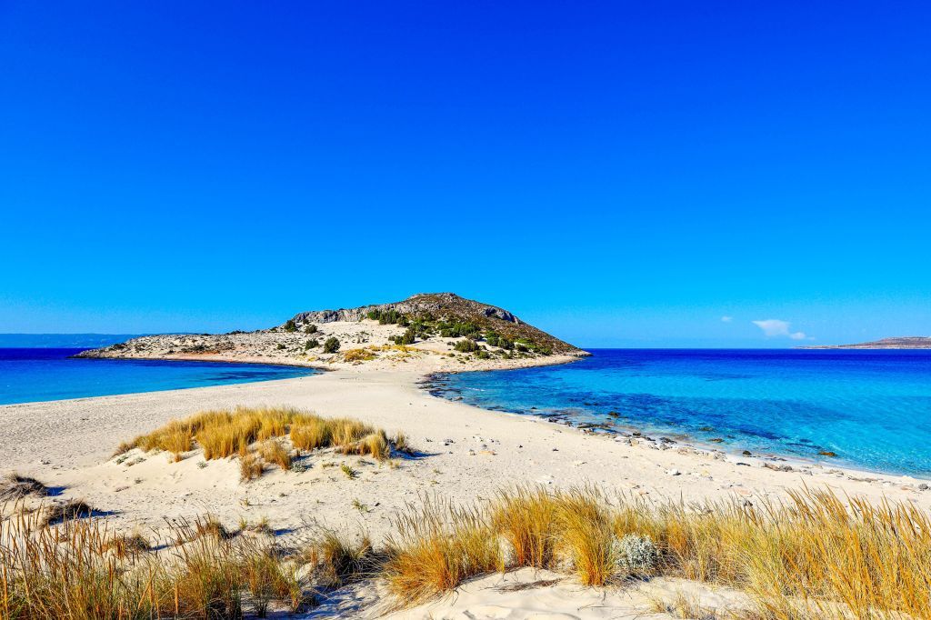
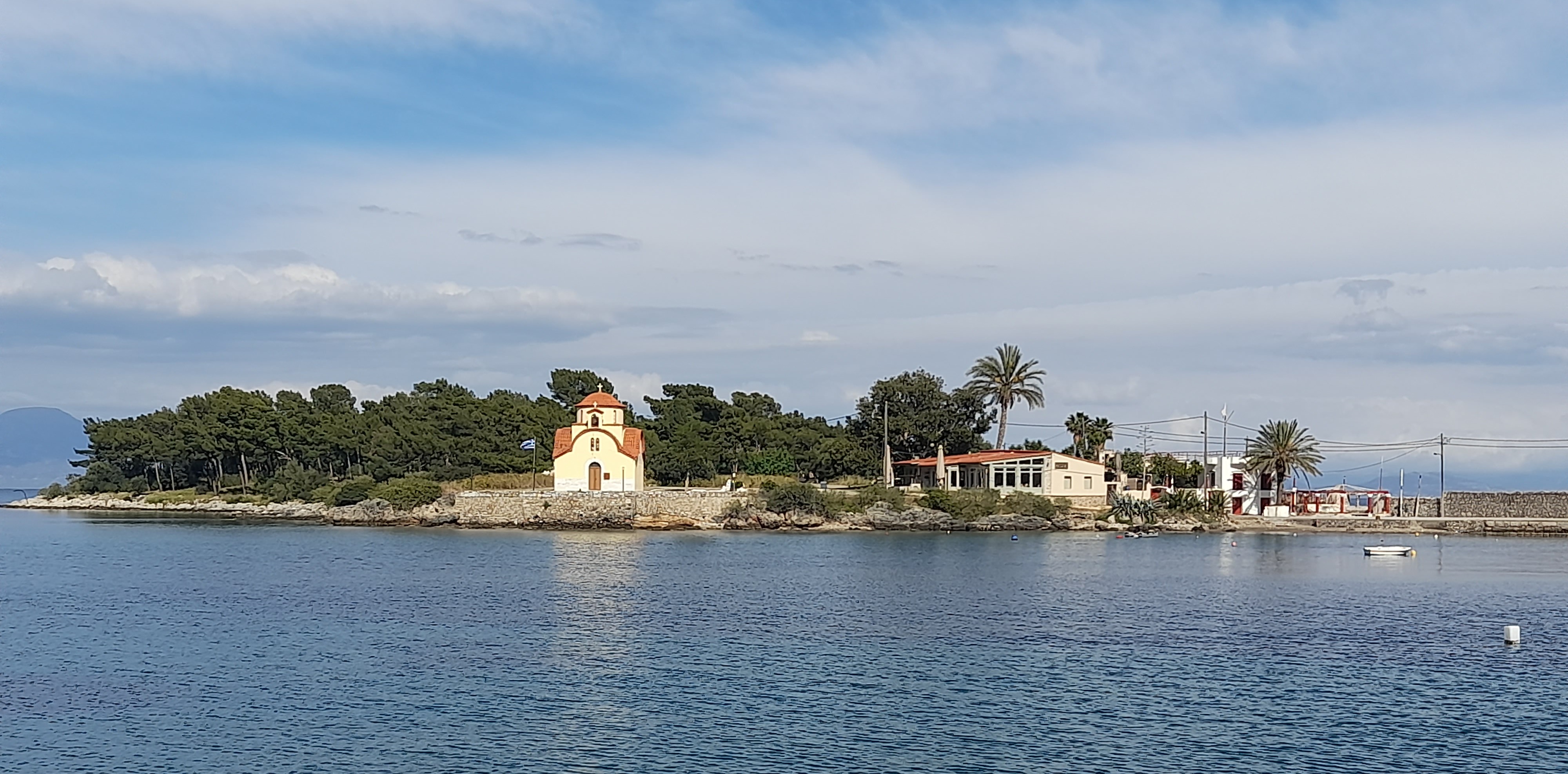
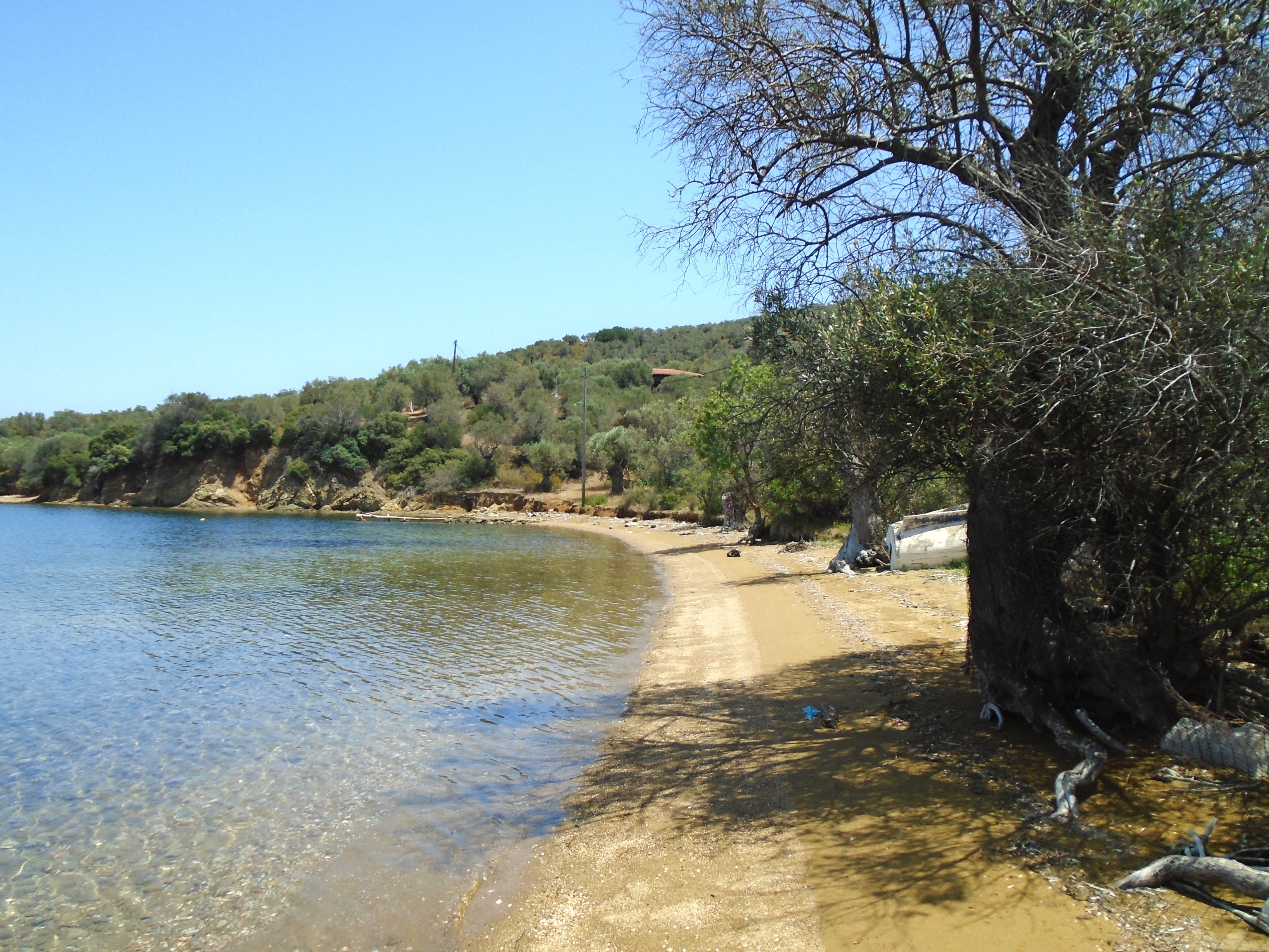
A flat spit of land rising from a lagoon on Greece’s west coast. Very much a working town linked to the mainland by road bridges. Few buildings of note, but not without charm.
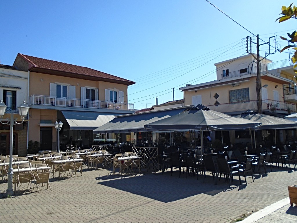
Aitoliko (sometimes spelt as Etoliko) has an official population of 4,000 residents crowded on to a flat spit of land that takes five minutes to walk across. If you’re feeling more energetic, it takes half an hour to walk round its circumference. The municipality of Aitoloko spreads out across parts of the adjacent mainland, but the island is the main centre of population and facilities.
Aitoliko just about sticks out of the shallow lagoon that shares its name and is part of a National Park. It lies off the west coast of Greece, 7 km north of the historic town of Messalonghi and is connected to the mainland by two road bridges that carry a main road route across it. There are regular buses to and from Messalonghi, which are supplemented by a large fleet of local taxis.
Given its position, I had assumed that Aitoliko had originally been some sort of medieval fortified island protecting the lagoon against unfriendly forces. It experienced three sieges by Ottoman forces during the 19th century Greek War of Independence. However, there are no obvious signs of medieval constructions and very few buildings of any substantial age. It is almost entirely built upon with modern houses and apartment blocks laid out in a very tight and un-Greek grid pattern.

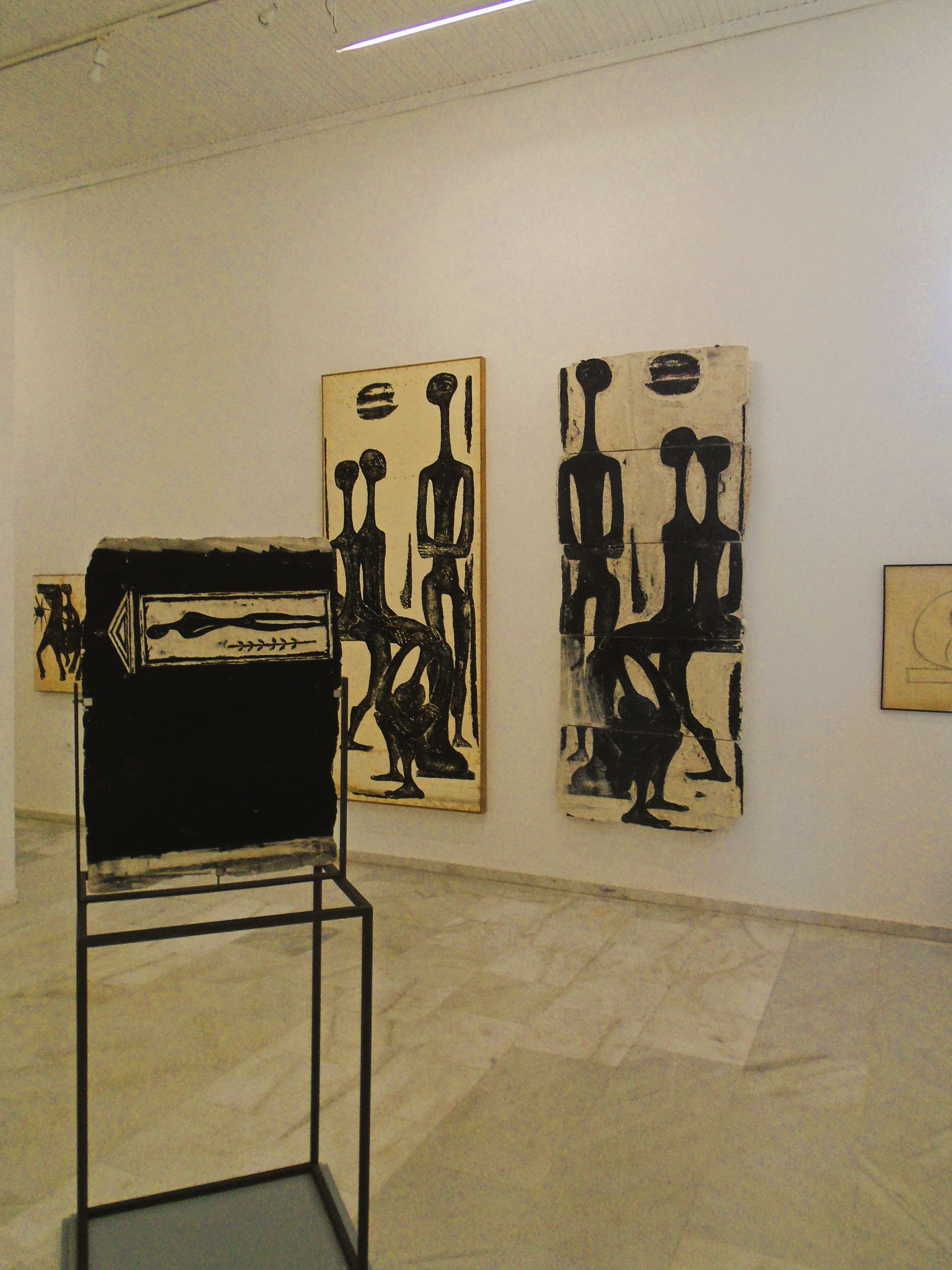
Vasso Katraki Museum/Gallery
The most notable building is a new, neo-brutalist museum/gallery dedicated to the work of Greek artist and engraver Vasso Katraki. This is a surprisingly large building for a relatively obscure artist. At least I had never heard of her and I pride myself as being something of an art buff.
Vasso Katraki Museum/Gallery
The gallery appears to be free admission. I certainly walked into it unchallenged and appeared to have it all to myself. Katraki’s work primarily comprises monochrome paintings and prints that display a strong influence of Pablo Picasso. There is virtually no interpretation of the works in Greek or English and no exterior signage unless it is available online, assuming you can get a phone signal. I can’t think of another small island that devotes such a large gallery space to a single artist.
The gallery aside, the only buildings of any note are: what I initially took to be a derelict school close to the gallery which later turned out to still be fully operational; an attractive town hall; and three churches in its centre, the largest and most modern of which overlooks the main square that appears to be the hub of local life.

Aitoliko New Church
Despite its lack of scenic and historic attributes, Aitoliko is a pleasant place to linger, especially as the sun goes down over the lagoon and locals gather for a Saturday night out on the main square. All local life is here – husbands watching football on big screens in bars; wives gossiping at café tables; teenagers blinking at computer screens in the darkness of the internet café; toddlers running about and falling over; and dogs rolling on their backs and occasionally chasing each other.
As far as I could see, there is only one hotel on the island. I managed to bag the last of its 12 rooms. I am told there is another hotel on the mainland within walking distance of the island, but I never noticed it.
Aitoliko Lagoon
Aitoliko may not be the prettiest or most spectacular Greek island but it has bags of character and atmosphere. Dusk brings a beautiful soft light, the sunsets are amazing and the locals are very friendly. If you are in the Messalonghi area, it’s definitely worth the short trip up the coast to sample it.
Ammouliani
First Visited in 2018. Most recently visited in 2024.
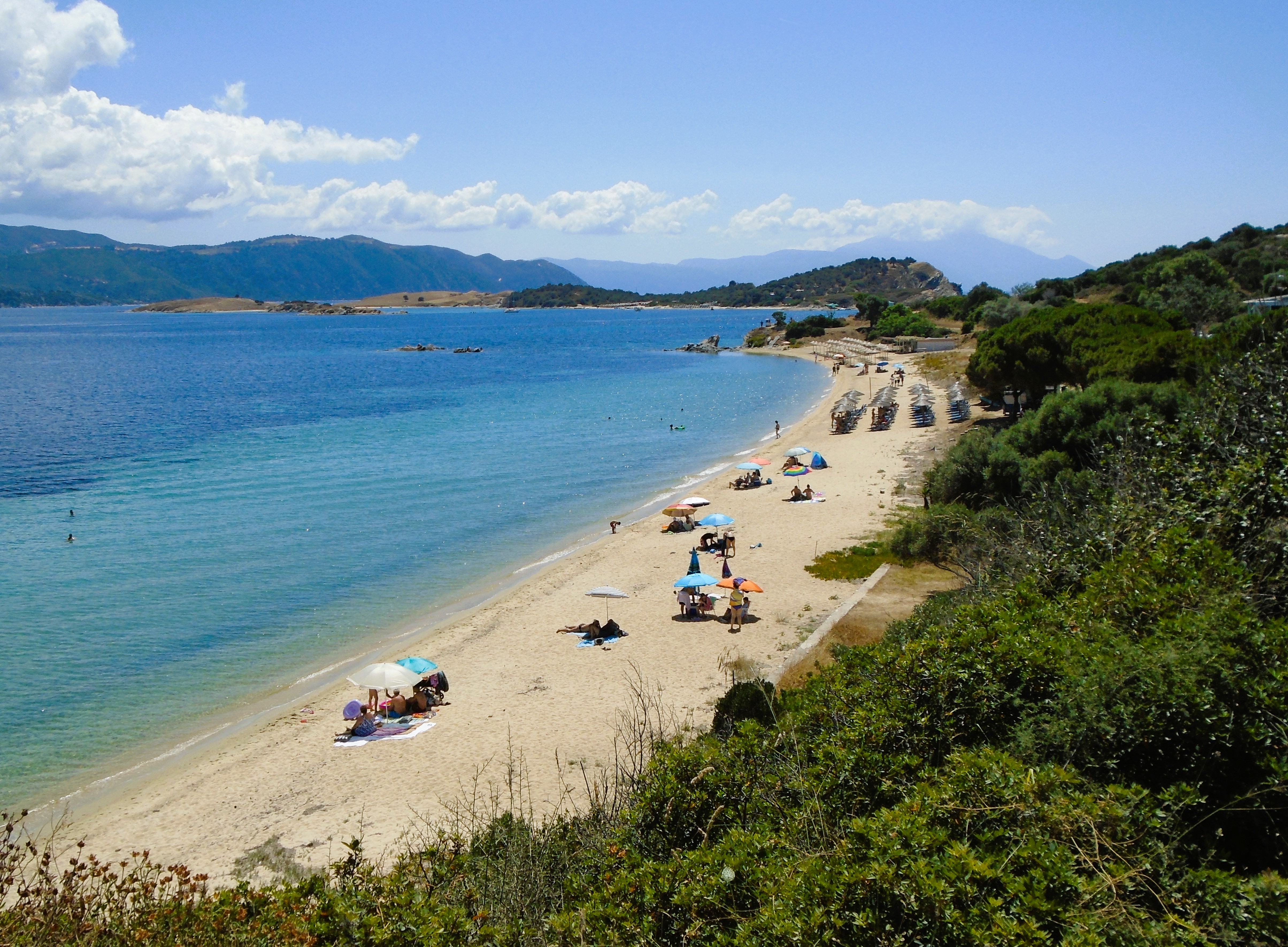
Small, green island lying off Halkidiki. Noted for its range of beaches. Good tourism facilities. Excellent local transport. Popular with Greek families. Can get quite busy.
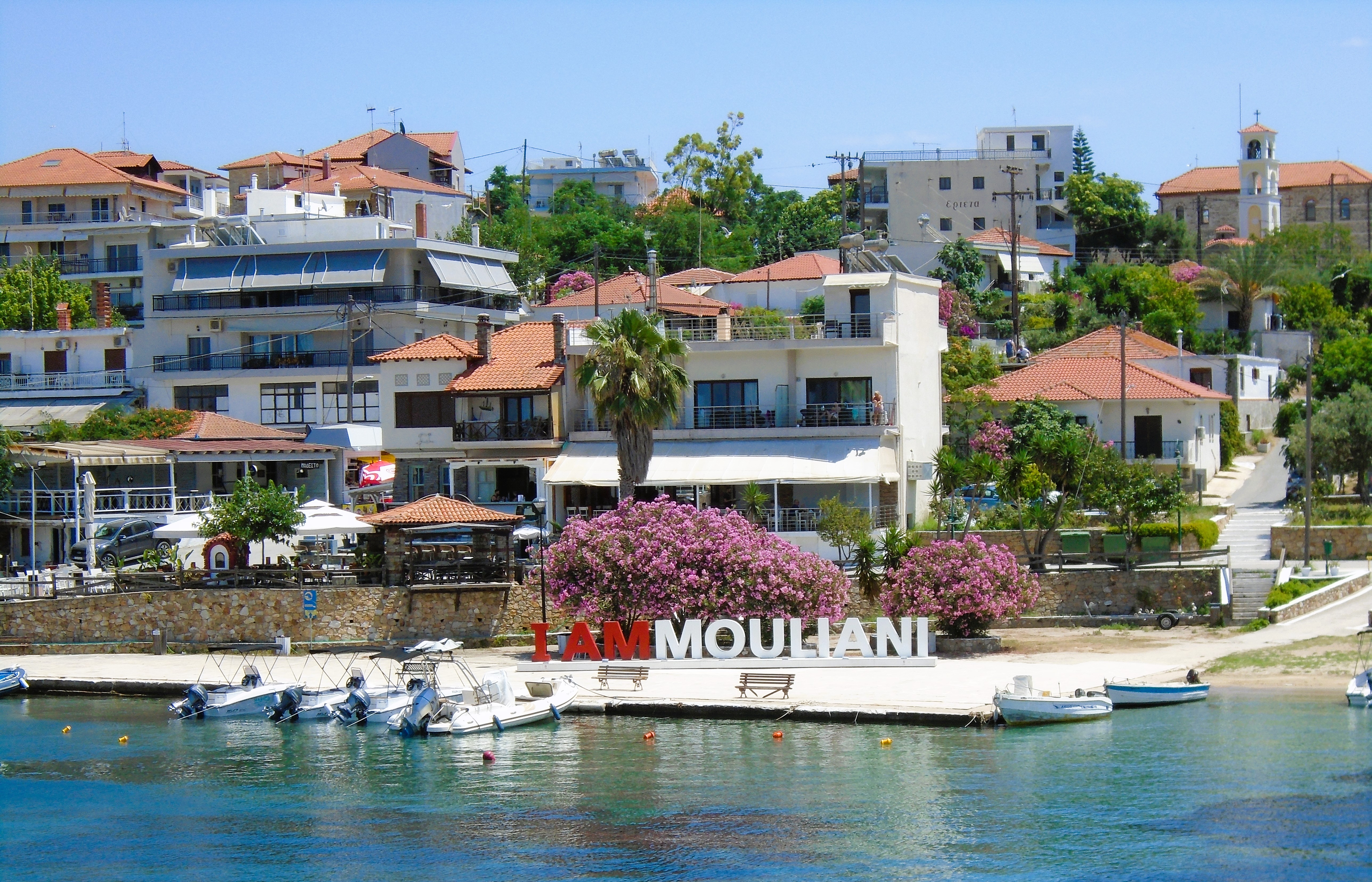
Although Ammouliani lies in the North East Aegean, it is not officially part of that island group. Instead it falls under the local government jurisdiction of the mainland region of Halkidiki.
It’s a small, low lying, wooded island, located a 15 minute ferry ride off the coast of the most easterly prong of Halkidiki, just up from the “monks’ republic” of Mount Athos. Ferries leave from the minuscule mainland port of Tripiti, a 2½ – 3 hour bus ride from Thessaloniki.
Ammouliani has about 600 residents, most of whom live in the attractive main village of red roofed houses. Tourism appears to be the main industry with Greek families making up the predominant visitor market. There are over excited Greek children everywhere. They even have their own little mini-fairground on the edge of the village. However, during both of my visits there was also a fair smattering of Eastern European visitors from the likes of Bulgaria and Romania.

Alykes Beach
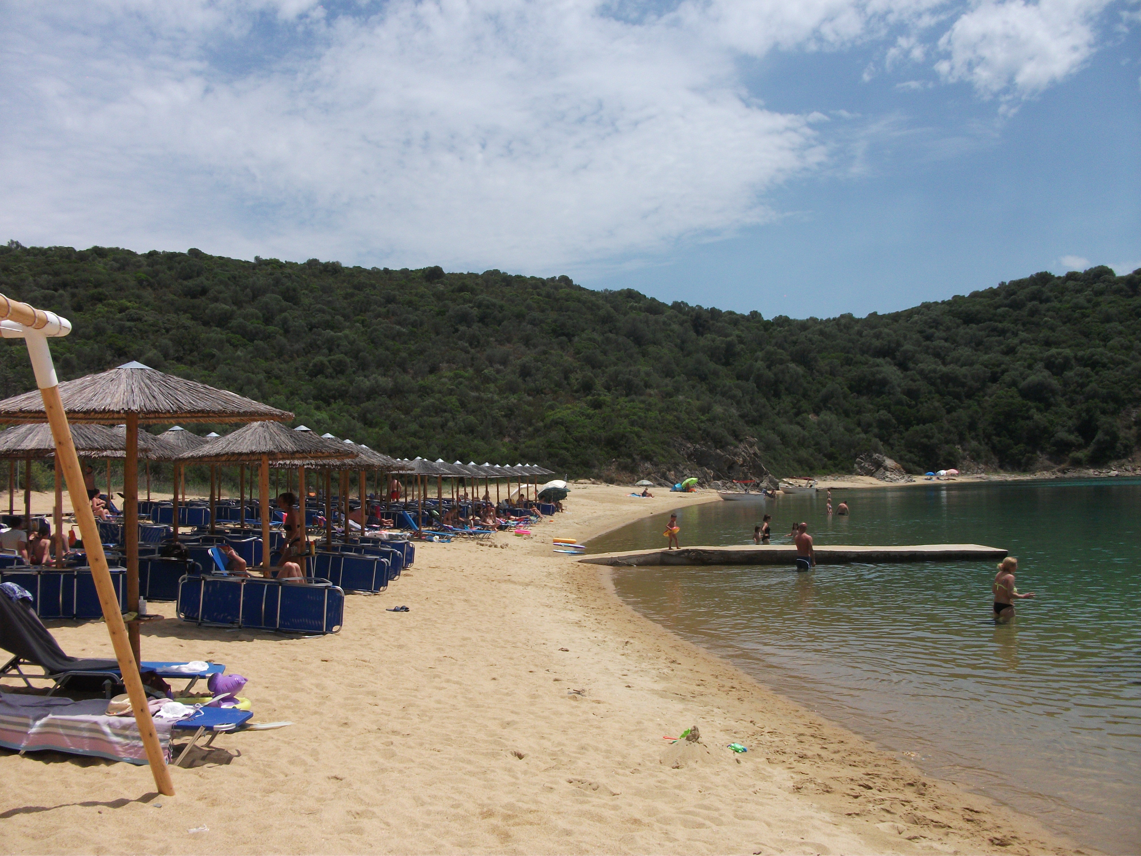
Beaches are one of the main attractions of Ammouliani. There are about half a dozen main ones as well as numerous little coves. A regular minibus operates from the village harbour and covers a circuit of all the main beaches.
Alykes, a 30 minute stroll from the village, is the largest and most popular beach with expansive soft white sand and calm waters. However, it is also the most developed with rows of sunbeds, a string of noisy beach bars, and the island’s only official campsite.
Megalo Ammos Beach
Megalo Ammos on the south of the island is a mini, but much quieter, Alykes with the same soft sand and a couple of beach bars with sunbeds. Karagatis, in the north of the island, was my favourite beach with just one low key bar and plenty of space away from the few sunbeds. It’s an easy, level 3km walk from the village.
Karagatis Beach
During the day, the island hosts a number of excursion boats from Halkidiki, which help to support a good selection of gift and souvenir shops. At night the place quietens down a lot but there are enough tavernas and bars to give you somewhere different to eat and drink every night, even on an extended stay. In general, the quality of food and service is pretty good.
I liked Ammouliani. It’s small and well formed with good facilities and comfortable accommodation. You can walk from one end of the island to the other in a little over a couple of hours. It has a bit of life to it, but it’s not in your face. However, you do need to be able to tolerate a lot of excited and noisy children.
Antikythira
Visited in 2019.
Small, remote island lying between Crete and the Peloponnese. Suffers from severe depopulation. A bit shabby and run down with few facilities. One for committed enthusiasts.
Hidden away between Crete and the Peloponnese, Antikythira is a small, largely forgotten island that made international news a few years ago due to severe depopulation. It has been inhabited since at least the 3rd century BC, but the current year round population was reported as no more than 20 people. The most recent Greek government census records a population of 68. Both figures are probably slight exaggerations.
The Greek Orthodox Church, who own the island, advertised for families to move there, offering them free accommodation and an annual stipend. As far as I am aware, they struggled to find any takers.
Antikythira is a two hour ferry ride from either its parent island of Kythira to the north or the port of Kissamos in the north west corner of Crete to the south. When I visited in early October there were three or four ferries a week in each direction. However, it is a very windy island that is regularly cut off for days at a time when winds blow in certain directions. Guidebooks warn visitors that their stays may be unexpectedly extended due to weather conditions.
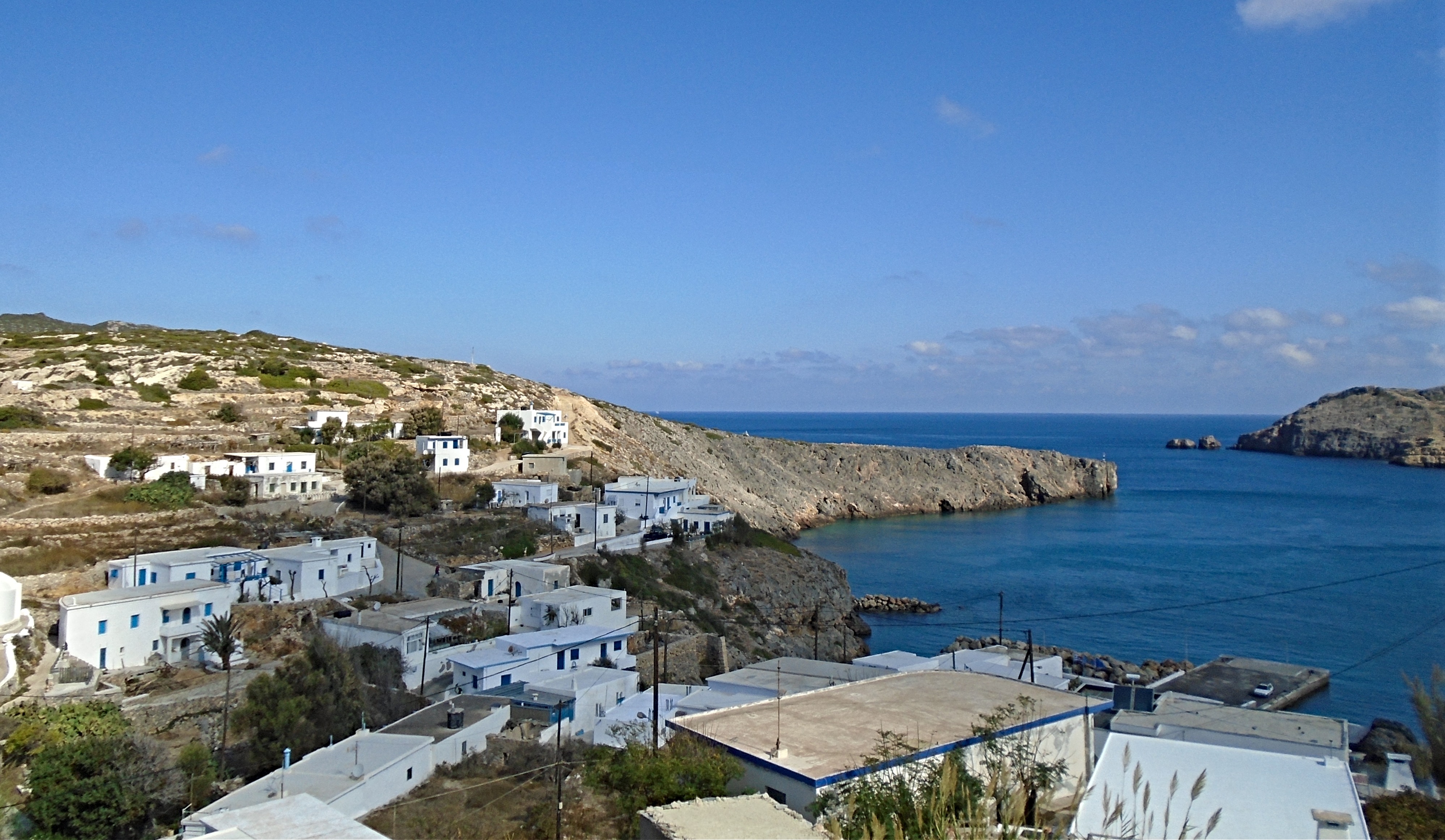
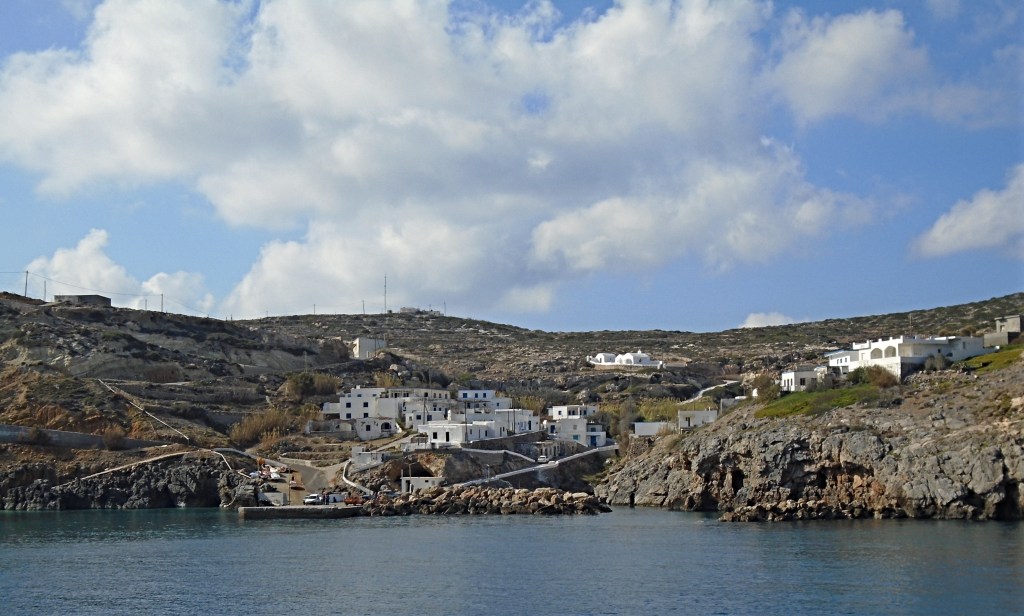
Potamos
The port of Potamos is the island’s main population centre (if such a thing exists on an island of 20 year round residents). It’s a shabby little place with two small kafenions, one of which acts as the island shop and postal agency. Visitor accommodation is limited to a seasonal community run hostel, a couple of locals offering two or three rooms, and an Air BnB located a 25 minute walk out of the village. Advance booking is difficult. I arrived and simply asked locals on the ferry quay. They pointed me to one of their number who owned some of the rooms to let. The rooms were somewhat primitive, but it was that or sleep on the beach. I’m too old for the latter nowadays.
Galaninia
The only other settlement of any note on the island is Galaniana, a 45 minute walk inland along a paved road from which various other roads and tracks dart off to who knows where. Galaninia has about half a dozen maintained houses, a lot more ruined ones and St Myrons, the island’s largest church.
From here a stony dust track leads to the modern lighthouse at the southern tip pf the island. It’s a walk of about 2½ hours each way from Potamos. There is not a lot of see on the way other than abandoned houses and steadings, goats and wide sea vistas. On the way back, St Myrons Church in Galaniana is a welcome shaded resting place with running water to wash some of the dust off weary feet.
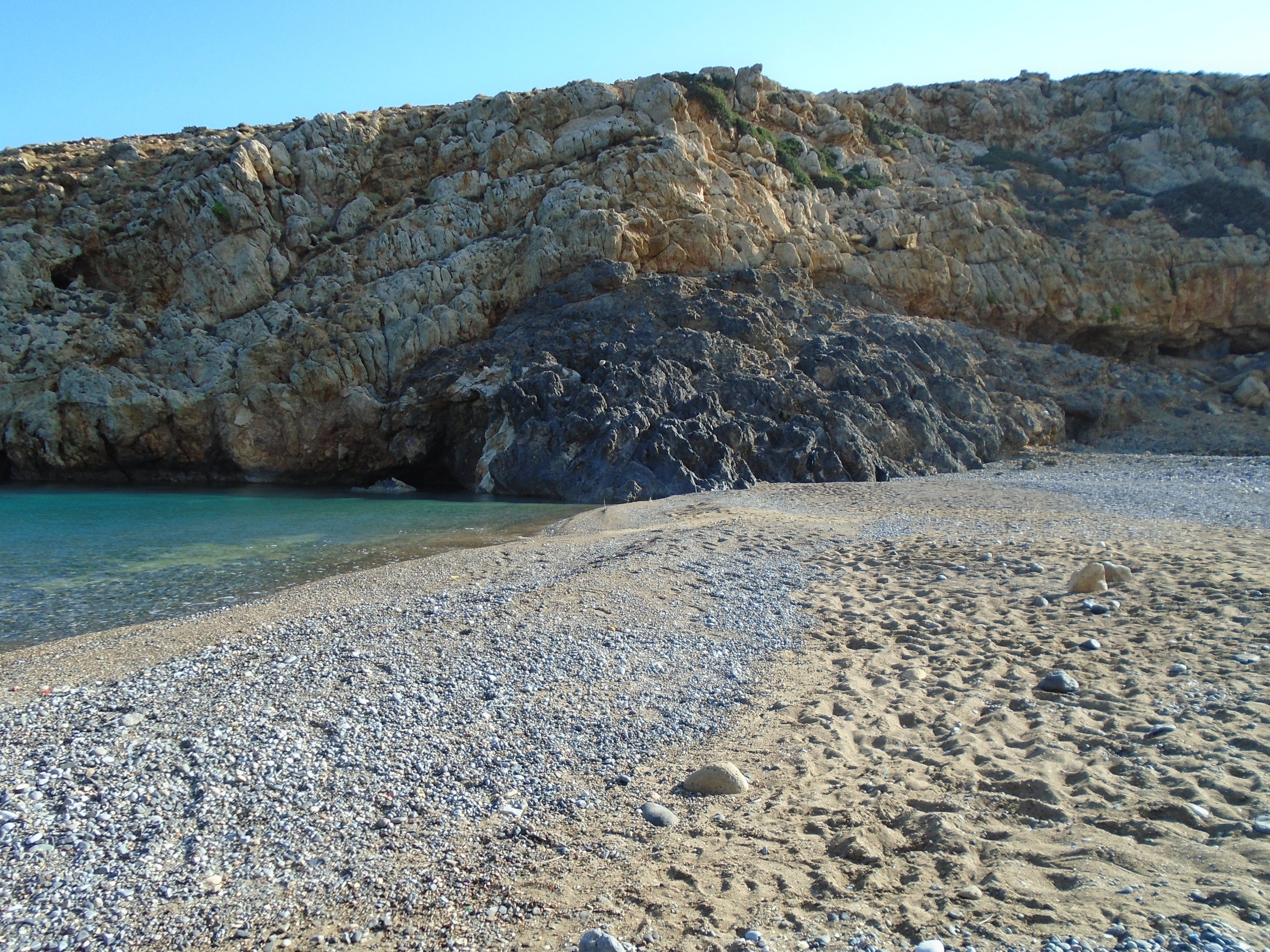
From what I saw of them, Antikythira’s beaches are mainly less than spectacular pebble and rock coves. The main exception is Xiropotamos, a 30 minute walk from the port where a sizeable strand of pebbles and gritty sand is overlooked by the ruins of a 3rd century BC kastro. I shared the beach with two goats and a lot more flies, although the strong breeze ensured they were not too irritating. The rocky beach at Kamarela on the other side of the island is poor for bathing, but the place to go for spectacular sunsets.
Xiropotamos
Antikythira is a rough and ready little island. Don’t expect too many luxuries or too many other visitors. The number of abandoned and ruined houses do make it feel a bit like a community on the edge. However, on a balmy evening when the local menfolk gather in one of the kafenions to chew the fat and set the world to rights over soft drinks and bottles of water, it is a friendly and relaxing place that you hope can survive as a viable community.
Elafonisos
Visited in 2023.
A small but popular island lying off the southern Peloponnese. Best known for its beaches. A short ferry ride from the mainland with a good range of visitor facilities.
Elafonissos
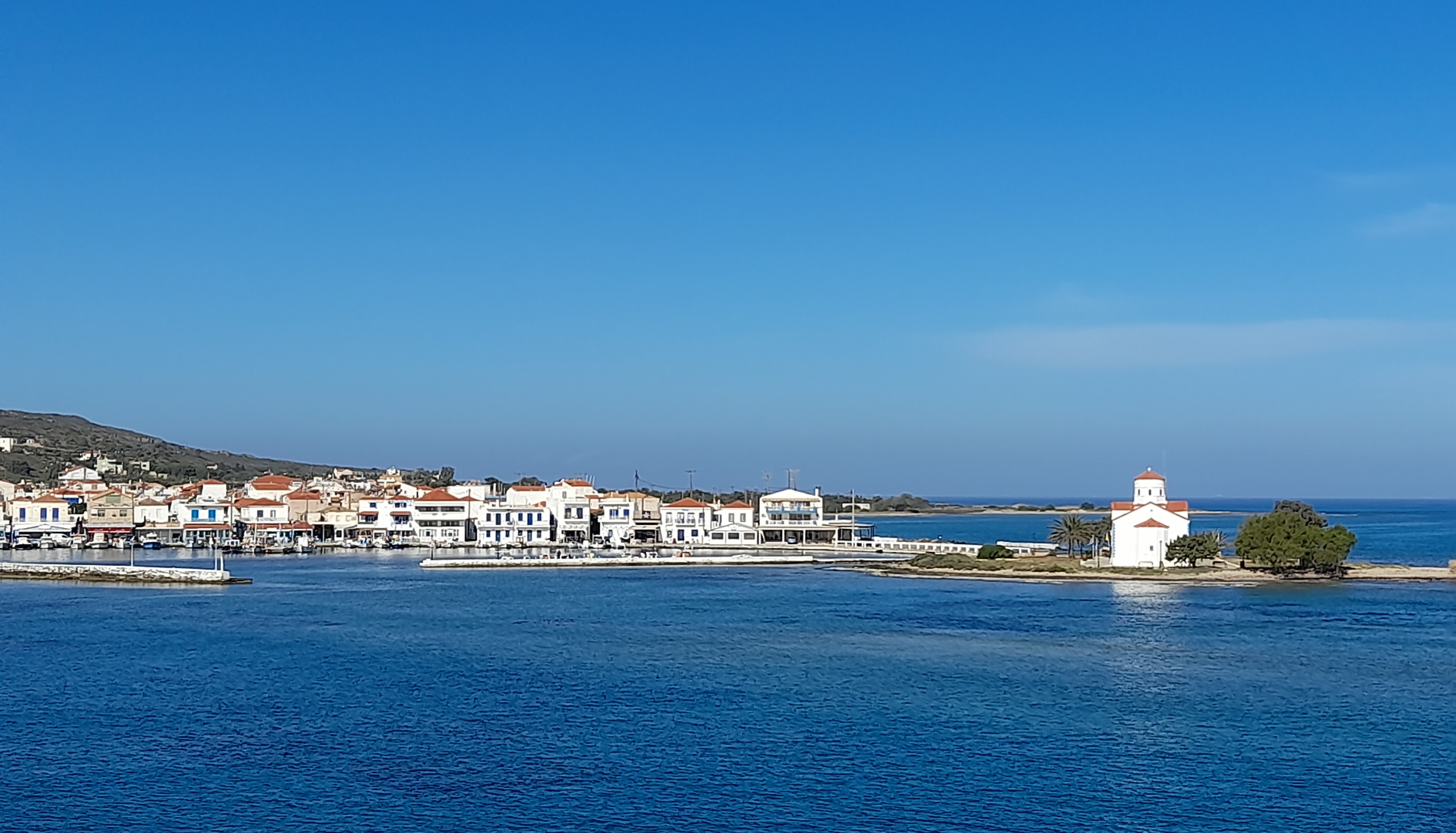
Not to be confused with the similarly named beach on Crete, Elafonissos is a small island located in the south east of the Peloponnese peninsula, the most southerly part of the Greek mainland. The nearest mainland town is Neopoli, a pleasant place with direct bus links to and from Athens, which normally take around 6 hours each way. From Neapoli it is a short taxi or bus ride to Pounta, a miniscule port from where regular ferries cross over to Elafonissos. The bus service is very limited and taxi may be the best option for the last stage of this journey.
Elafonissos Ferry
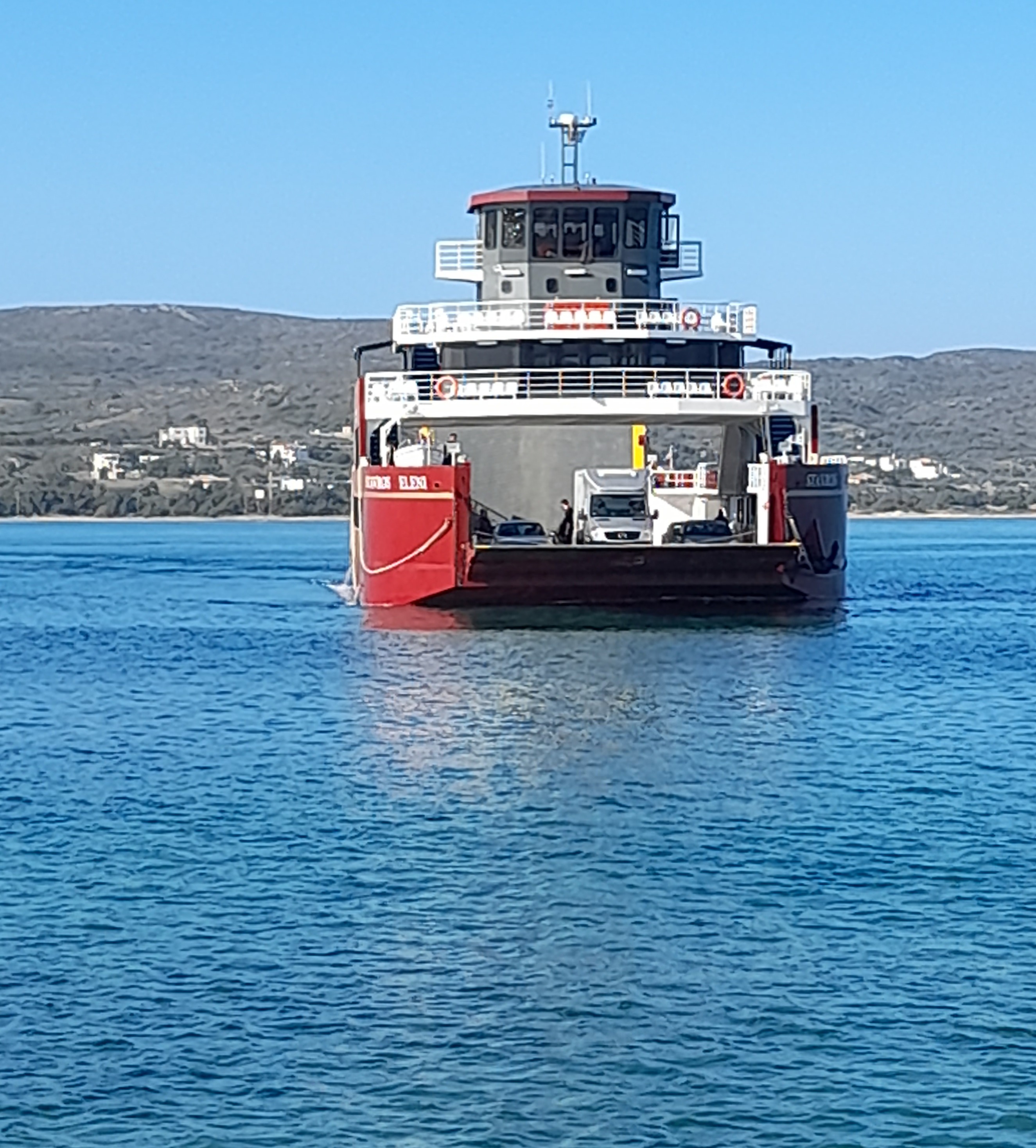
The crossing from Pounta to Elafonissos only takes about 10 minutes and currently costs 2 euros for a foot passenger. When I visited in May, there were 18 crossings each way every day, starting at 0730 and finishing at 1930. Only 3 of these crossings were served by buses to and from Neopoli. Two companies operate the ferry service, both with vessels that also carry motor vehicles. There is a large parking area at Pounta for drivers who prefer to leave their cars on the mainland.
Despite being somewhat out on a limb away from any other islands, Elafonissos is a popular holiday destination for Greeks and, based on my own experience, also attracts a good number of northern Europeans touring the Peloponnese. The main attractions are its large, sandy beaches.
Visitors arrive at the only village on the island, which is also known as Elafonissos and is home to the majority of the 1,000 or so local residents. It’s a friendly little place stretching out on a headland which separates a busy harbour area from the long, serviceable but slightly scruffy Kontagoni beach There is a wide range of places to stay and numerous tavernas, cafes and minimarkets.
Sarakiniko
The best beaches lie a little out of the village. Prime amongst them is Sarakiniko, a vast spectacular curve of soft sand backed by a protected dune system. Sarakiniko is just over 4 km from the village and has the beginnings of some tourism development including the island’s only campsite and some new looking studios and apartments.
There is a choice of other, smaller beaches nearby, all easily accessible along well paved roads or dirt tracks. The best of the rest is probably Simos, which conveniently is also the closest to Sarakiniko, being backed by the same dune system.
Elafonissos is a fairly flat island and cycling appears to be a popular way to get around. Certainly I was passed by more cyclists than walkers as I explored on foot. Bikes and E-Bikes are available for hire in the village. Signage is pretty good and local maps are easy to obtain. As far as I could see, there is no organised public transport on the island, at least not when I visited.

Elafonissos
Elafonissos is an island for sun worshippers who want to spend most of their days browning on a sandy beach and most of their nights relaxing in a friendly, traditional taverna. Despite its popularity, it still retains an authentic Greek ambiance.
Ioannia Island
Visited in 2022.
Greece’s only inhabited fresh water island lying on a lake opposite the city of the same name. Small but packed with interest. A popular day visit destination for school groups.
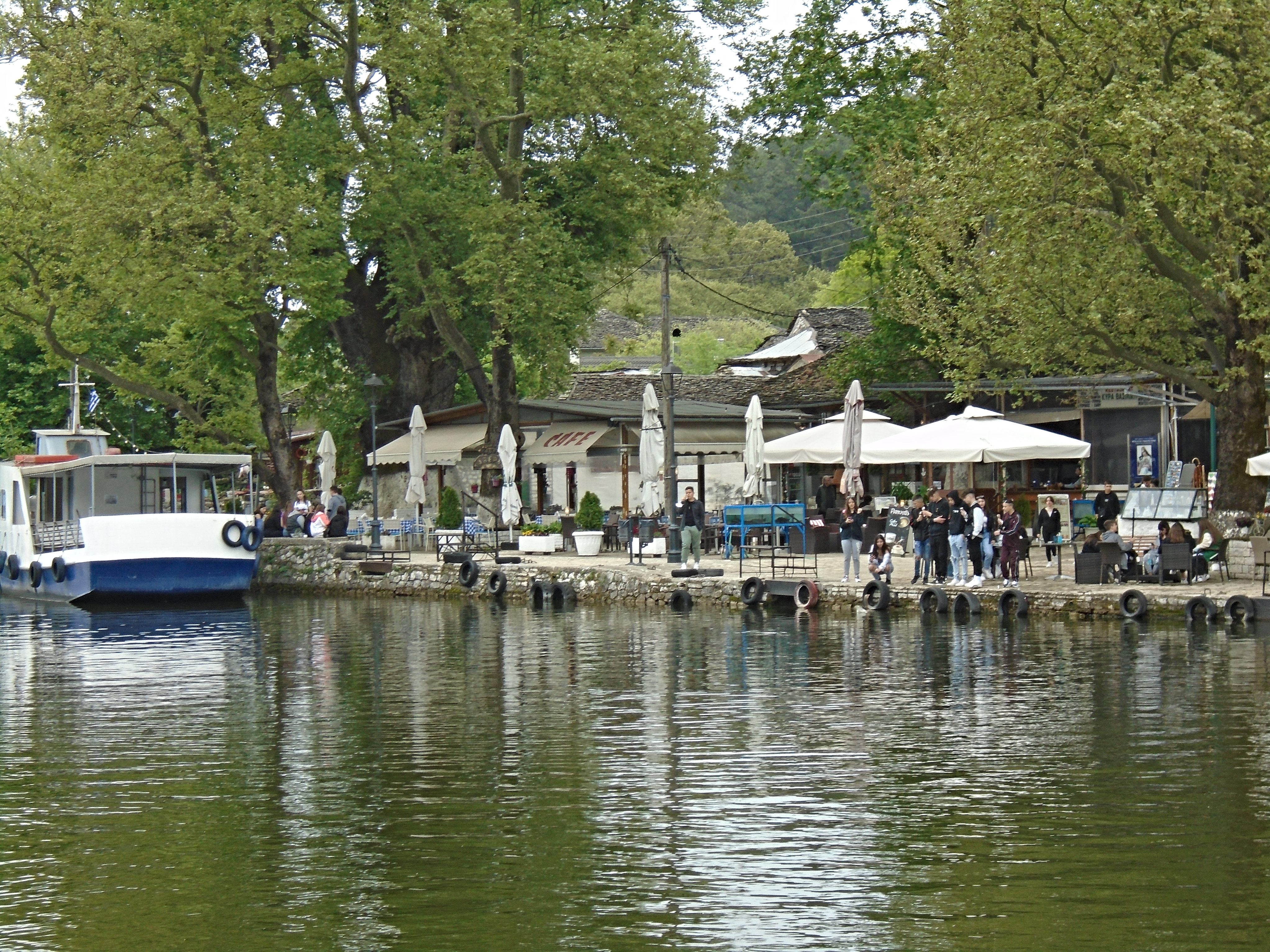
Ioannia is the largest city in the rugged, mountainous Epirus region of north west Greece. Lying a three hour bus ride from Thessaloniki or a one hour flight from Athens, it was once an important strategic centre of Ottoman rule. It’s present day population of around 65,000 is swelled by students at two universities who help to give the town a young and lively atmosphere, especially at night.
The town lies on the shore of Lake Pamvotis, which claims to be the second oldest lake in Europe (whatever that means). Out on the lake lies the only permanently inhabited fresh water island in Greece, which is known as either Ioannia or Pamvotis Island.
The island is reached by half hourly passenger ferries from Ioannia that run from early morning until around 10pm. There is also a rudimentary car ferry that runs from the opposite shore of the lake, presumably to bring supplies to the 150 or so island residents.
It’s a small island. You can walk around the perimeter in about half an hour, often to the accompaniment of the sounds of the ducks, geese and frogs that hide in the rushes that cover much of the shoreline. However, despite its limited size, Ioannia Island packs a fair punch in terms of things to see.
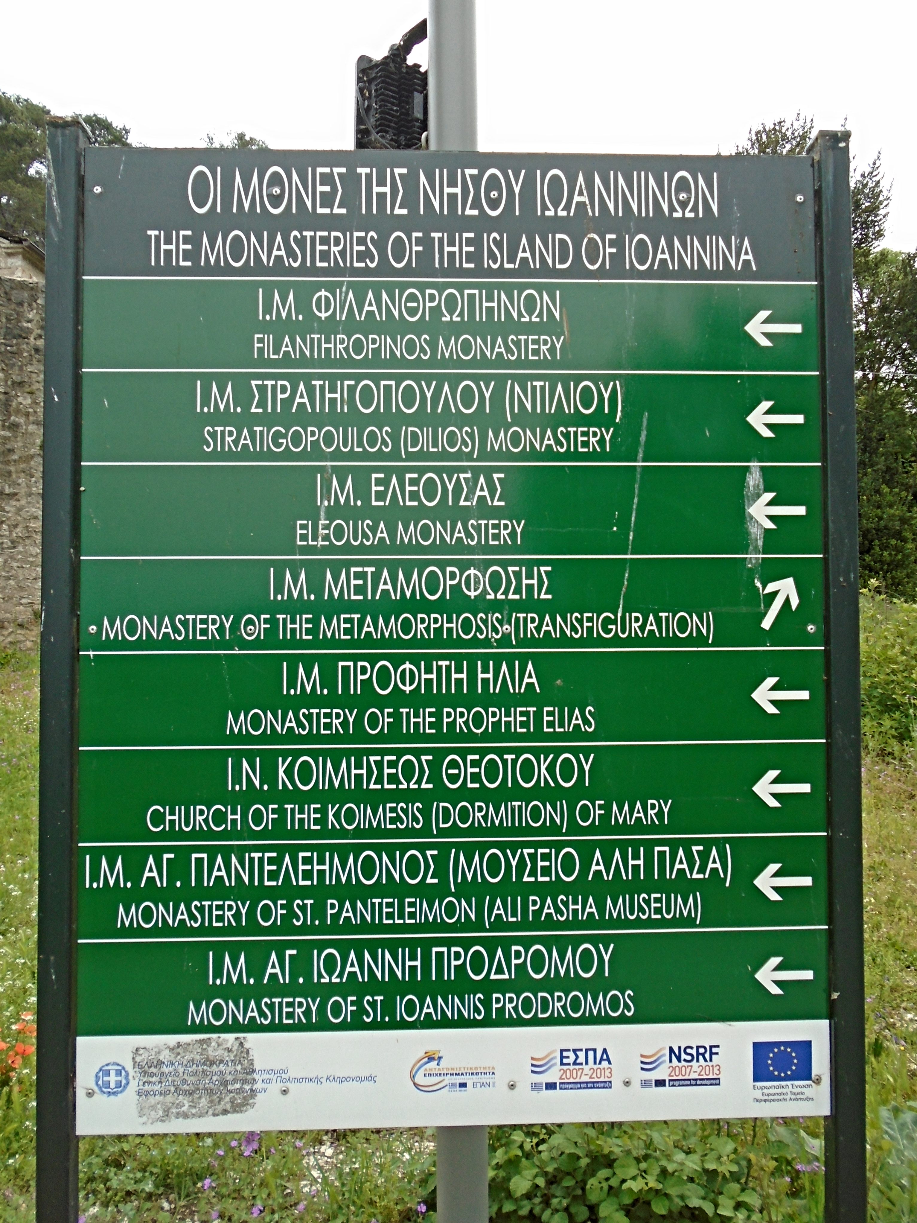
Ioannia Island Monasteries
There are no less than eight monasteries, although most are really glorified parish churches built by rich Ioannian families. The majority are not normally open to the public, although they are easy to view from the outside and often have interpretive boards detailing their history.
There are also two excellent, must see museums, run by enthusiastic staff. The first tells the story of the ecology and wildlife of the lake and the steps being taken to reduce pollution and maintain fish stocks.
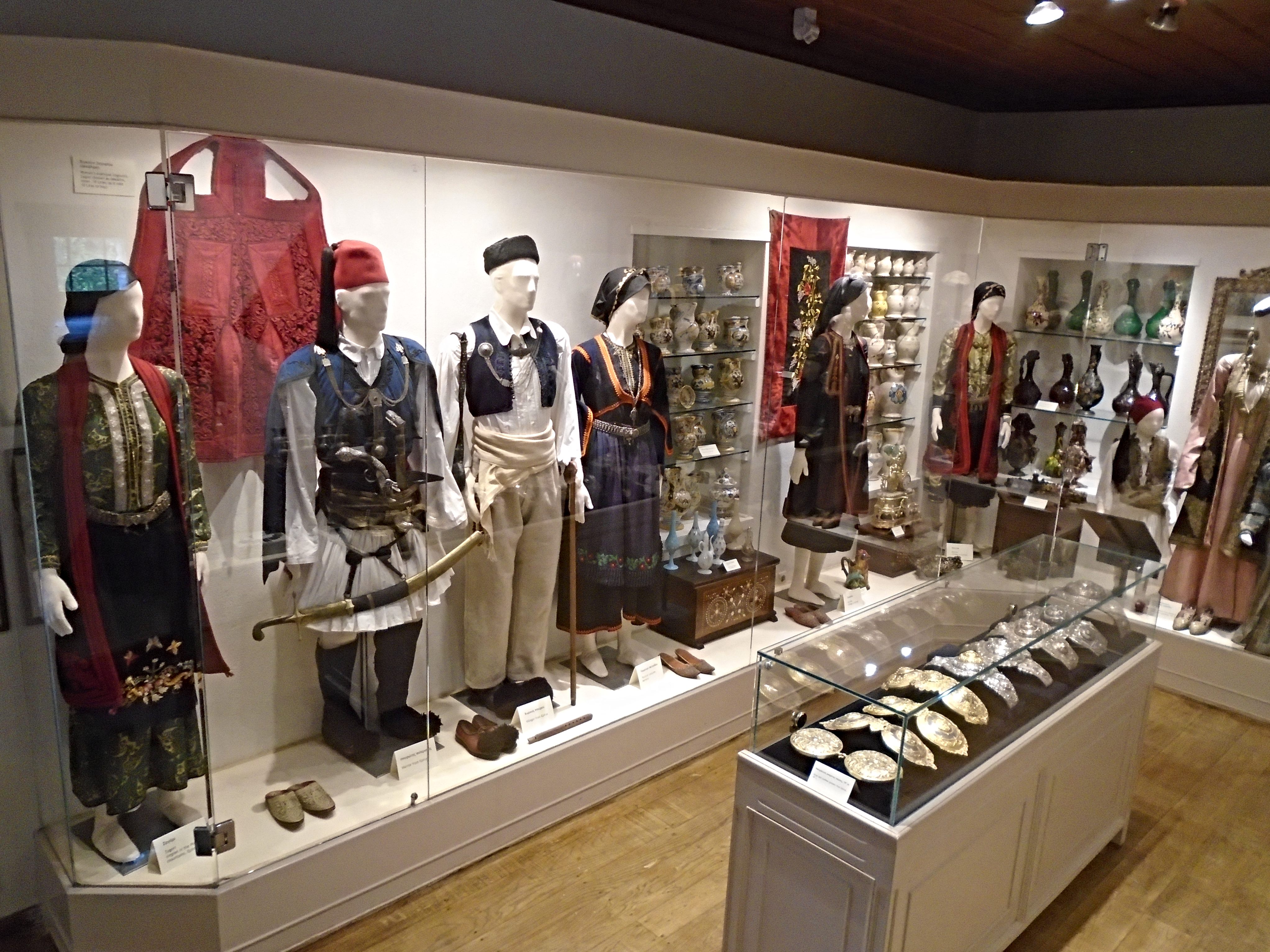
Museum of Ali Pasha
The second is the Museum of Ali Pasha, a brutal Ottoman despot who ruled over much of western Greece and Albania, nominally on behalf of the Ottoman Sultan in Constantinople but largely to his own writ. Despite his numerous acts of cruelty, he was popular locally as he promoted native Greeks to positions of influence and supported the Greek Orthodox Church. The poet Lord Byron visited his court and was most impressed by its sophistication and organisation.
Eventually the Sultan in Constantinople grew tired of Ali Pasha’s insubordination and laid siege to Ioannia and the island before finally decapitating him in 1822. The museum is located in the house where he lost his head and displays many artefacts from the late 18th and early 19th centuries.
Ioannia Island is a popular day visitor destination with lots of souvenir shops, cafes and tavernas to cater for the hoards of visitors than can descent on it during daylight hours. When I first visited it was packed with innumerable school groups of young children. At night it has a quieter, more intimate atmosphere that is a pleasant counterpoint to the noise and activity of Ioannia city.
Ioannia Island is pretty unique as Greek islands go. I really enjoyed my time there.
Kranae
Visited in 2023.
Tiny island connected by a causeway to the Peloponnese town of Gythio. No permanent inhabitants but home to an impressive museum and a notable lighthouse.

Historical & Ethnological Museum of the Mani
Kranae (also called Marathonisi in some guide books) is a tiny islet located less than a 100 metres from the southern Peloponnese coast at the town of Gythio, to which it is attached by a causeway. It has no permanent inhabitants and you can walk from one end to the other in about 5 minutes. So, why is it worth a visit? There are a number of reasons.
Firstly, legend has it that this is where Paris, Prince of Troy, and Helen, Queen of Sparta, first consummated their relationship after they eloped together. This led to the 9 year Trojan War, which was recorded by the writer, Homer, in the Iliad and the Odyssey. No one knows for sure if this war actually happened or was just Homer recounting ancient legends with little basis in fact. Nonetheless, it’s a damn good story that is well worth reading.
Kranae
Secondly, Kranae is home to the wonderfully named Historical & Ethnological Museum of the Mani, the wild and rugged peninsula on the south of the Peloponnese. The people of the Mani played a leading role in the 19th century Greek War of Independence, which led to the creation of the modern Greek state. The museum is housed in the imposing 19th century Tzanetakis Tower and outlines the writings of foreign travellers to the Mani from the 15th century onwards. It also displays detailed plans for the construction of the fortified towers that are unique to the area.
If that is not enough, there is also a splendid 19th century lighthouse at the far end of the island and a pretty little church that is a favourite spot for local wedding photographs.

Kranae Lighthouse
And what of Gythio, the mainland town of which Kranae is a part? It’s a busy little port with a pleasant waterfront, the ruins of an ancient theatre and a great beach a couple of kilometres along the coast at Mavrovouni. It has direct bus links to and from Athens and a wide choice of places to stay, eat and shop.
It is also the largest town in the Mani and the gateway to the Inner Mani, the wildest and most spectacular part of the region. Traditional villages such as Lagia, Gerolimenas and, particularly, Aeropoli are picture postcard perfect and a must for any visitor to this part of Greece. They can all be visited in a single day via the roads that loop around the coast of the peninsula.
Kythira
Visited in 2019.
Sizeable island lying to the south of the Peloponnese. Lots of small villages and a wide choice of beaches. The main town is particularly attractive. Not that easy to get around.

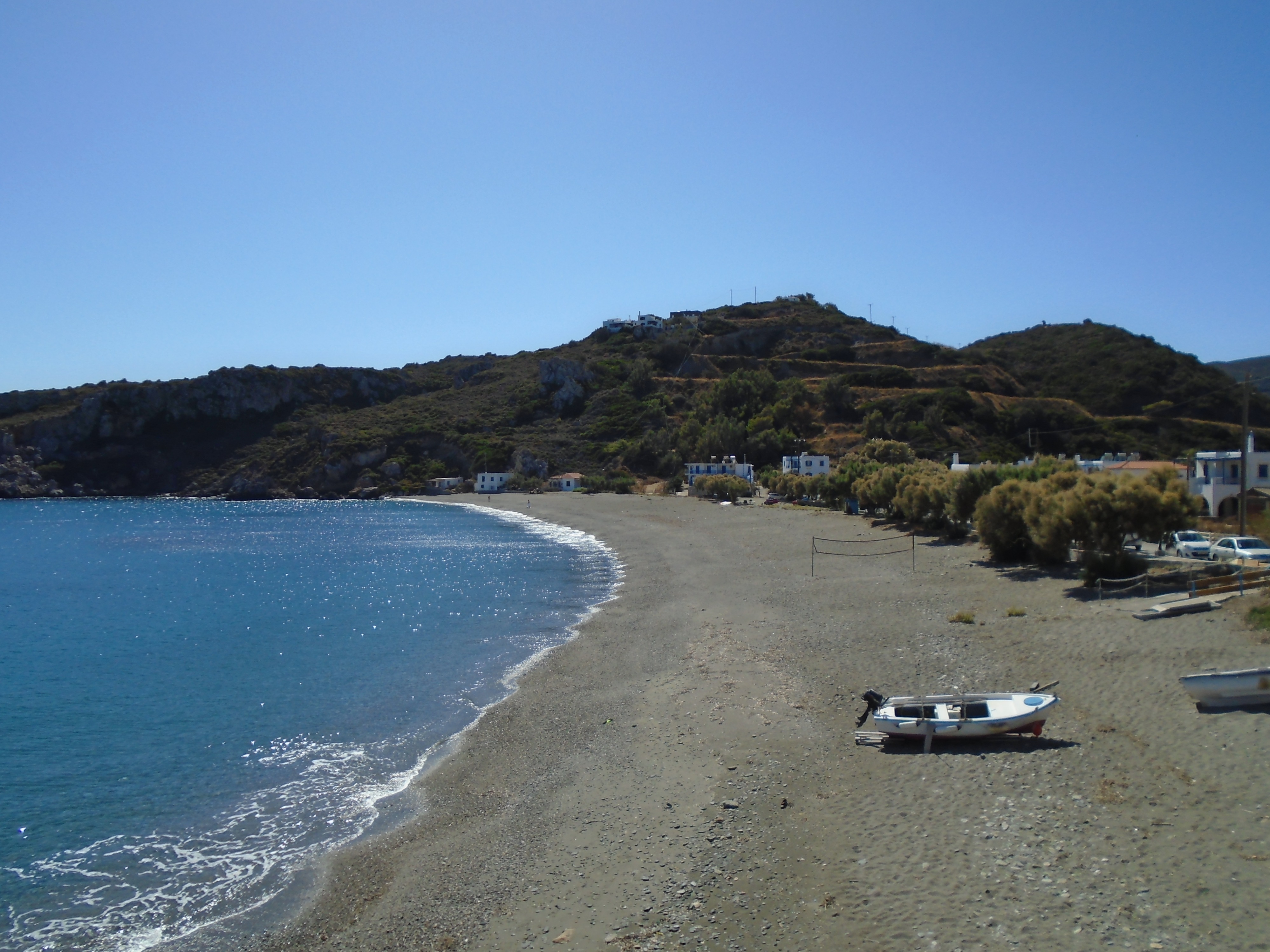
Kapsali
Kythira is a medium sized island with about 3,500 year-round residents living in over 60 little villages. Remote from most other islands, it has one or two flights a day to and from Athens on most days of the week. The quickest ferry service is the two hour ride from the friendly, little town of Neapoli on the south east corner of the Peloponnese peninsula, which is a lengthy six hour bus ride from Athens. However, it also has direct ferry links to and from Crete and Piraeus.
I got off to a bad start on Kythira, arriving at its very isolated ferry port of Diakofti on a cool and windy afternoon a few days into October to find a village that had already closed for the season. A couple of studio operators were still open, including the one I had booked in advance, but a tiny mini market was the only source of food and other sustenance. The owner of my studio had to wake up the mini market owner to persuade her to open up and ensure I didn’t go hungry that night. The single other visitor facility was the long and attractive but windy sandy beach.

Diakofti
There is very little public transport on Kythira and a limited number of taxis, so car hire is pretty much essential if you want to get around. However, it is an island that is worth exploring. There is a good road network and well-signed hiking trails that appeared to be much used by guided walking groups.
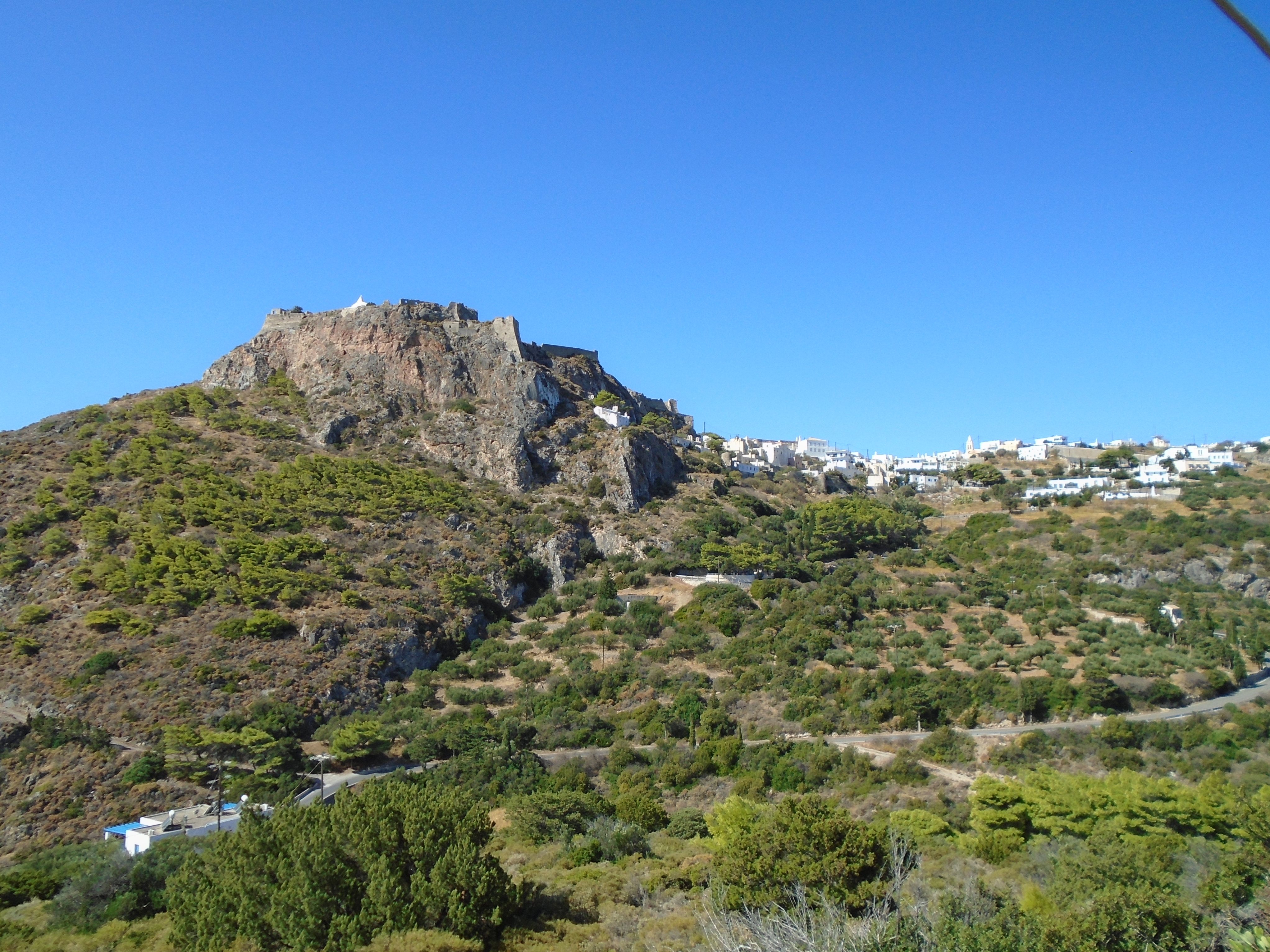
The highlight of Kythira is its Chora, located in the south of the island. This is a classic, well-kept warren of lanes and alleyways meandering between whitewashed houses on the way up to the extensive, cliff top ruins of the medieval kastro. From there, breathtaking views stretch out across the sea and down to the picturesque little beach resort of Kapsali, which was once the island’s main port. Today it is a sleepy line of tavernas and studios overlooking a long sandy beach and turquoise water.

Kapsali
There are a number of good beaches dotted about the island. Some of them accommodate purpose built beach resorts of studios and apartments that have little authentic local flavour. Agia Pelagia in the north of the island is the largest with two huge sand and pebble beaches, but little charm. Avlemonas on the east coast to the south of Diakofti looked the prettiest and most relaxing although it has no beach as such and bathing is from rocks or manmade stone platforms.

Avlemonas
Inland, Kythira has attractive areas of forestry and greenery. Potamos, the island’s largest village, has a busy main square full of local life. Karavas to the north lies in an attractive wooded setting close to historic springs and the sleepy beach resort of Plateia Ammos. In the south of the island, many of the villages on the main road merge into each other to create the feel of a single, larger conurbation.
Plateia Ammos
Kythira is a bit out on a limb. Flights from Athens are by far the quickest and easiest way to get there. It is definitely worth visiting, for the area around the Chora and Kapsali in particular. However, its visitor season appears to be limited and pre booking of accommodation and car hire is advisable.
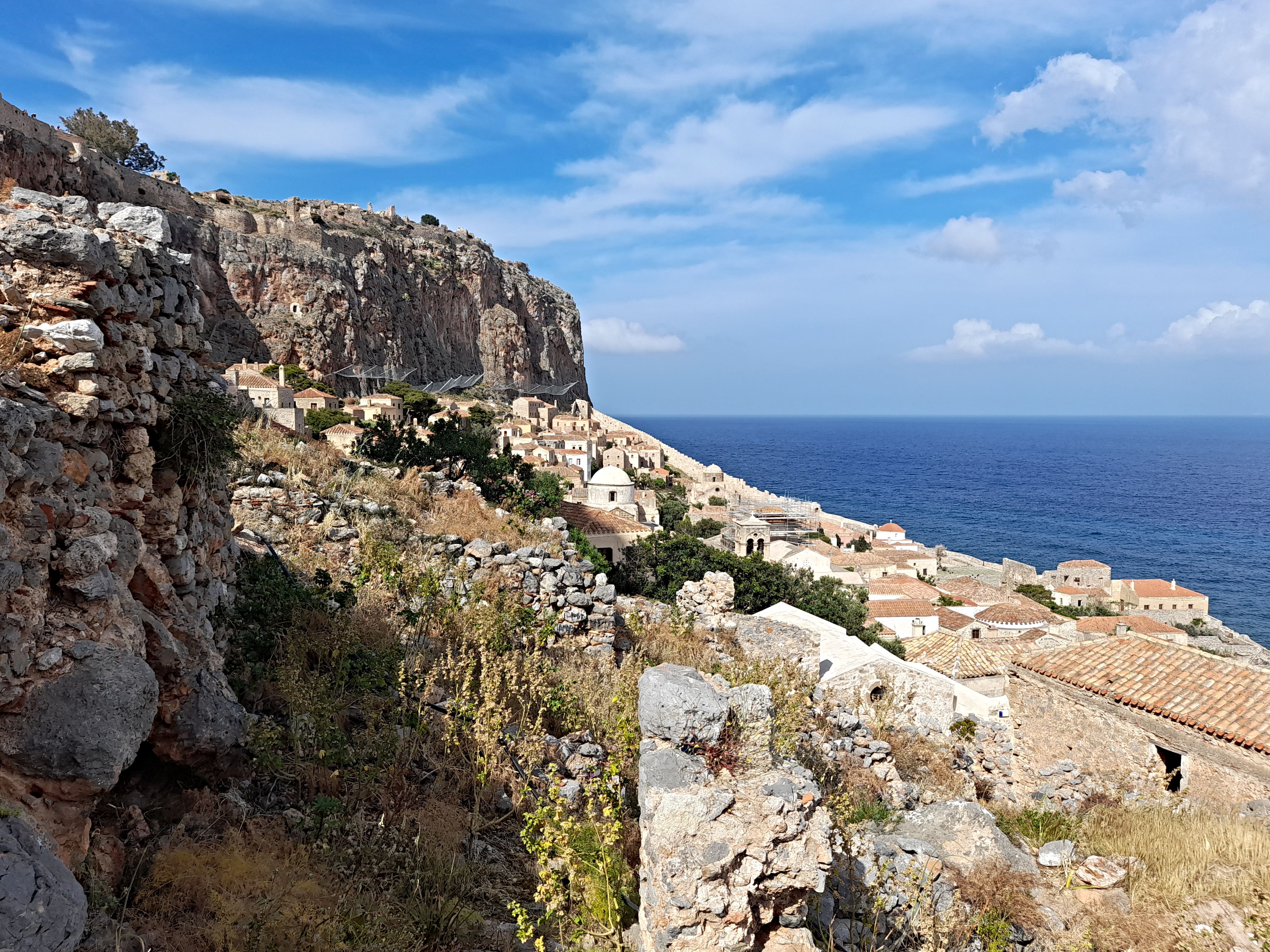
Monemvasia
Visited in 2023.
A fascinating medieval walled village on a huge rock lying off the Peloponnese. Linked to the mainland by a causeway. Deservedly one of Greece’s most visited historic destinations.
Monemvasia
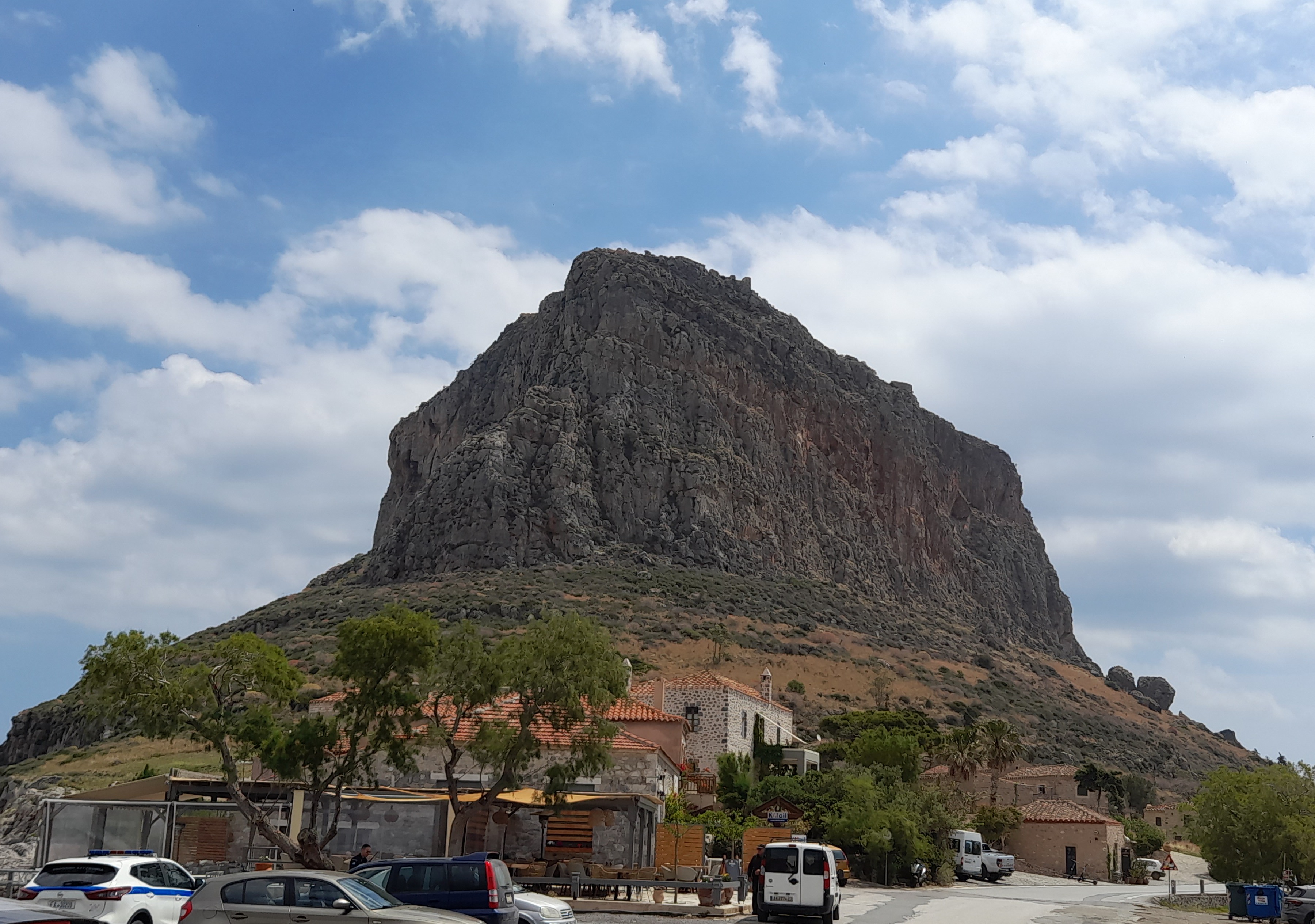
The island of Monemvasia is essentially a large rock sticking out of the sea just off the south east coast of the Peloponnese peninsula. It was originally part of the mainland, but was separated from it by an earthquake in 375 AD.
It was first inhabited in the 6th century AD and grew significantly in the 11th and 12th centuries as it held a strategic position on major shipping routes. Often besieged and fought over, it alternated between Venetian and Ottoman control in the 15th – 18th centuries before becoming part of the new, modern Greek state in the 1820s.
Approaching Monemvasia
The name Monemvasia means “single approach” and today the only way on to the island is along a 400 metre causeway from the mainland. This causeway was built in the late 19th century and replaced earlier drawbridges. From the mainland there is no indication of there being any significant buildings on Monemvasia. However, a short walk to the south east of the island reveals a hidden but strongly fortified and well preserved medieval village, which once housed close to 1,000 inhabitants.
The village is protected on one side by the sea and rocky foreshore; on another by high cliffs; and on the remaining two sides by impressive fortified walls, each of which has only one easily defended entrance gateway. Within the walls, reroofed houses, churches and other buildings are tightly packed and linked by a network of narrow lanes and alleyways that occasionally open out into public squares.

Monemvasia Lower Town
The village is divided into two parts, the upper town and the larger lower town. Both are overlooked by the impressive Church of Agia Sofia, which sits on the edge of the overhanging cliffs.
Basic services such as electricity and running water only came to Monemvasia in the early 1970s, by which time the population had fallen to around 30 people. Since then, sensitive restoration of old buildings has seen the creation of upmarket boutique visitor accommodation, restaurants, cafes and shops. Today Monemvasia is one of Greece’s most popular visitor attractions.

Monemvasia
The atmosphere and appearance of Monemvasia today is very similar to that of Carcassonne in south west France, albeit on a smaller village scale and by the sea. In the summer, it can get packed with day visitors and coach groups, but evenings are quieter and more relaxed. There are further, lower cost accommodation and dining options in the adjacent mainland village which shares the name of the island but is also known as Gefyra.
You can drive along the causeway and round the island up to the main West Gate, but there is limited parking which tends to be grabbed by early morning. There is more parking in Gefyra and a shuttle bus runs from the mainland to the West Gate for those who can’t manage the 20 minute walk.
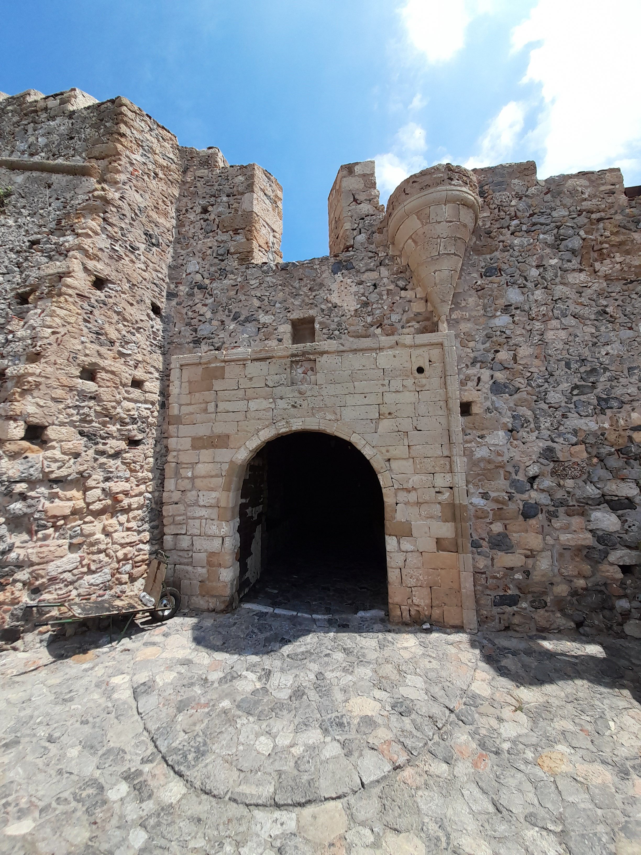
Monemvasia Main Gate
Monemvasia is linked to Athens by 3 or 4 direct buses a day. The journey takes around 6 hours. You can drive there in significantly less time, although there is a lot to be said for meandering down the Peloponnese coast rather than speeding on the admittedly excellent toll motorways that reduce journey times.
If you are a medieval and Byzantine history buff Monemvasia will be a highlight of any visit to Greece. Maybe best to go there outwith the peak season in order to have more space to enjoy it fully.
Paleo Trikeri
Visited in 2024.
Small, sparsely populated island located off the southern tip of the Pelion peninsula. Fascinating history and a calm, relaxing atmosphere. Not that easy to get to.
Paleo Trikeri from the Pelion Mainland
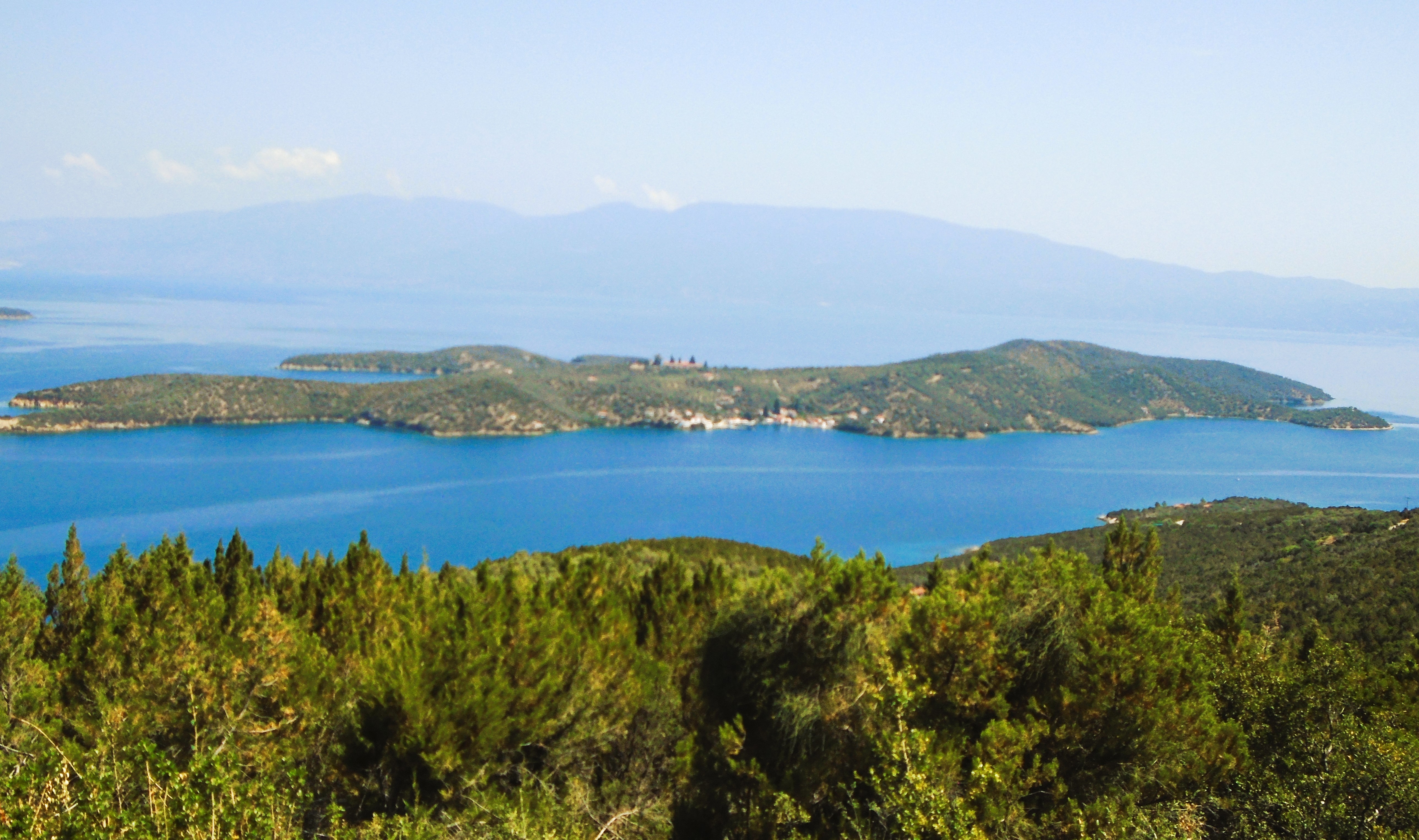
The Pelion is a peninsula that juts out into the Aegean Sea roughly halfway between Athens and Thessaloniki. Horseshoe in shape, it creates the Pagasitic Gulf, a large offshoot of the Aegean. At the top of the gulf lies the city of Volos. At the bottom of the gulf and the southern end of the Pelion lies Paleo Trikeri, the only inhabited island in the region.
It’s about a 2 hour drive from Volos to the tiny mainland port of Amaliapolis, from where you can catch a water taxi over to the island. It’s a ten minute crossing. Two buses a day run between Volos and Trikeri, the main local inland village. From there it’s a six kilometre walk or taxi ride to Amaliapolis, assuming you can find a local taxi. The walk is likely to be a lot tougher on the way back as it is largely uphill with little shade or cover.
Alternatively, there is a passenger ferry service between Paleo Trikeri and Volos four days a week that takes about 1 hour 10 minutes to make the crossing. It continues on to the charming, southern Pelion village of Agia Kiriaki. The ferry caters primarily for locals, leaving Paleo Trikeri at 0830 in the morning and returning from Volos at 1540 in the afternoon.
Paleo Trikeri is part of the southern Pelion municipality of Trikeri, an area famed for its traditional shipbuilding, which continues today at Agia Kiriaki. It is also renowned for its vast number of olive trees. An information board on the island claims it has over 70,000 olive trees and who am I to doubt it?

Paleo Trikeri Village
Paleo Trikeri is a small, relatively low lying island with a year round population of just under 20. However, this more than quadruples during the summer months. In the past, it has been used as a prison island, housing over 5,000 Bulgarian prisoners of war from the Balkan Wars of the early 1910s and a similar number of female supporters of the communist forces during the Greek Civil War of the late 1940s.
There is only one village on the island. This lies on its southern coast and is an attractive cluster of a few dozen sea front houses, a couple of tavernas, a mini market and a children’s playground. Many of the houses in the village and elsewhere in the island’s hinterland are now holiday lets.
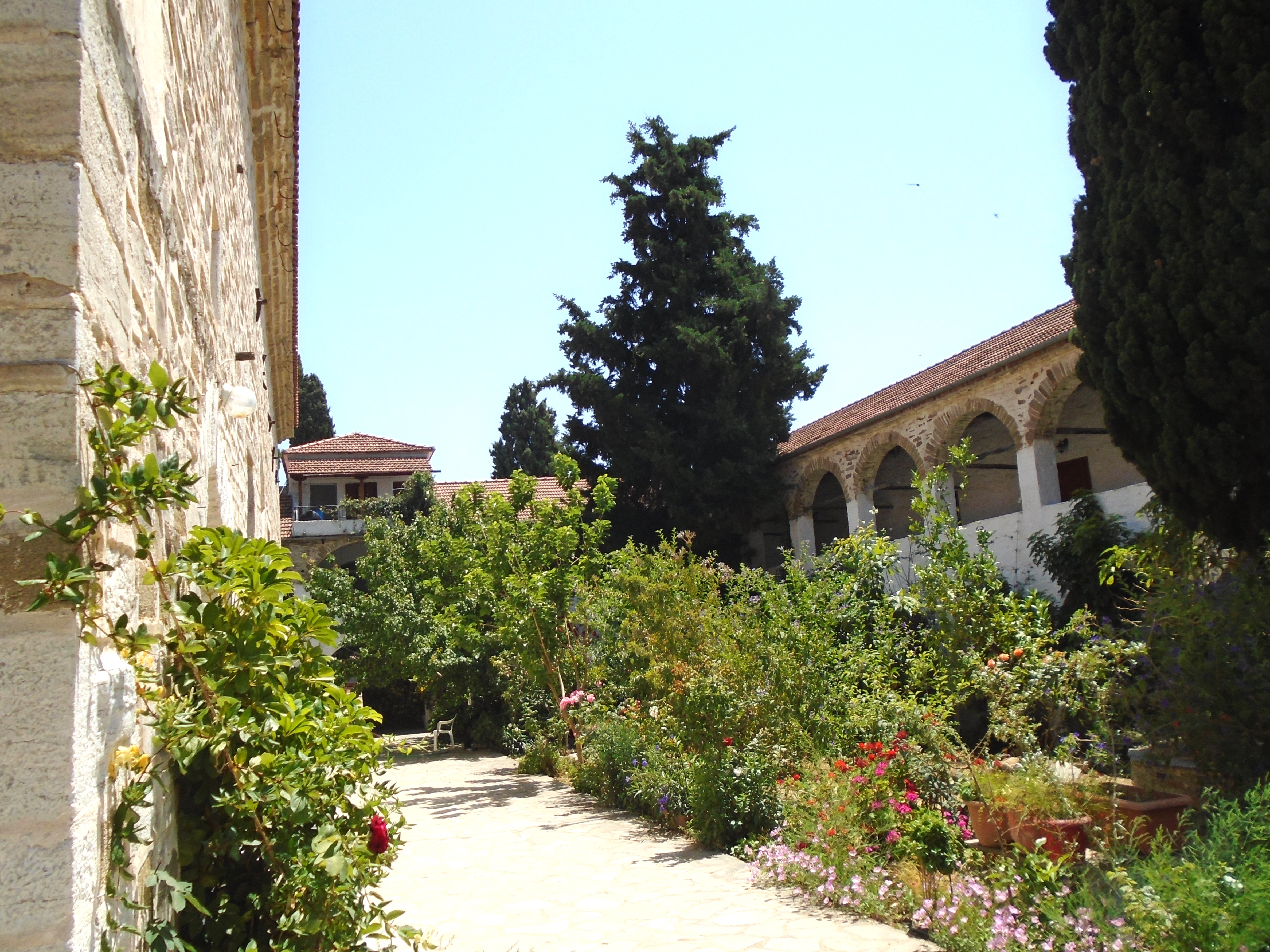
The main built attraction is the large 19th century monastery dedicated to the Virgin Mary that sits on the island’s highest point. This is a gentle uphill walk of about 20 minutes from the village. It is open to the public and appeared to be populated by a small group of elderly ladies who were keen to talk to new visitors. It’s a tranquil spot for a little contemplation.
Paleo Trikeri Monastery
From the monastery, a couple of signed footpaths run down to small sandy beaches on the north side of the island. Agios Georgios, the longer, narrower and more appealing of the two, is reached by a well made stone footpath. It’s smaller and scruffier counterpart is signed as Green Beach, presumably on account of the greenish hue of its sand. It is reached by a dirt track that gets steeper and rougher the further you go. Both beaches are within a 10 – 15 minute walk from the monastery.
Agios Georgios Beach
A further well made stone footpath marked “To the Beaches” runs from the eastern edge of the village along the south coast of the island passing a number of small, narrow pebble coves set in bays that appeared to be popular anchorages for passing yachts.
I day visited Paleo Trikeri, leaving my hire car in the large car park at Amaliapolis. Don’t get there too early. The water taxi operators didn’t appear keen to answer their telephone (number displayed on the boat) much before midday. The crossing currently costs 10 euros return.
Paleo Trikeri Village
I really liked Paleo Trikeri. It has a relaxed, friendly ambiance and offers some easy walking with things to see along the way. I visited it midweek in June when myself and a lovely German couple were the only day visitors using the water taxi. I imagine it will be busier at weekends and in the peak season. If I’m being honest, I preferred Paleo Trikeri to much of the Pelion mainland where I stayed for a few days. The mainland felt a bit scruffy and commercialised in places. However, that may just be me showing my bias towards islands.
Tourlida
Visited in 2019. Most recently visited in 2024.
A small. low lying island of traditional fishermens’ houses and salt pans. Located off the west coast of Greece and linked by a causeway to Messalonghi. Popular with birdwatchers.
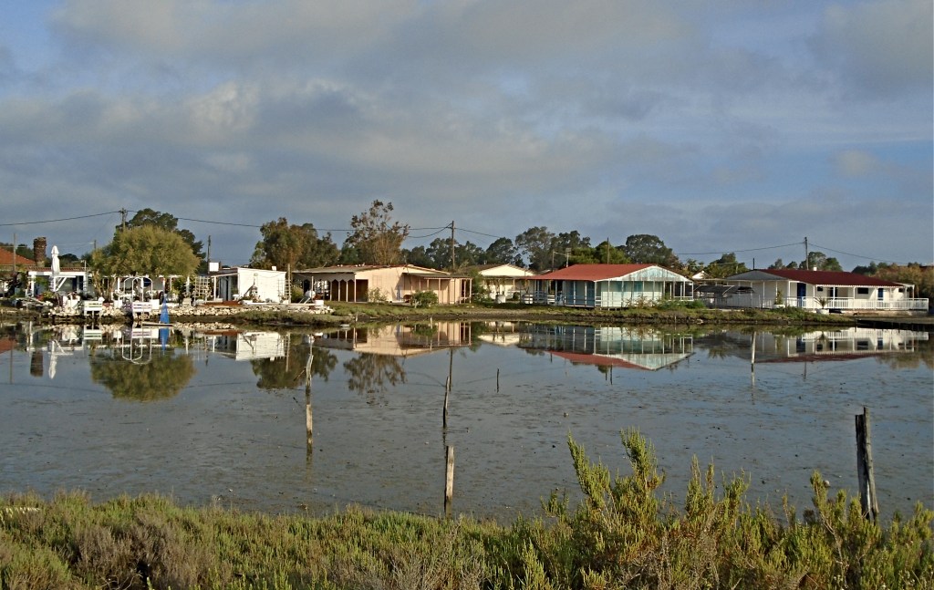
A flat spit of land barely rising out of the shallow waters of the Messalonghi Lagoon on the west coast of Greece, Tourlida is a small but surprisingly interesting little island.
It is attached to the “sacred city” of Messalonghi by a three kilometre causeway with a well maintained road and separate cycle and foot paths. The causeway runs across the lagoon, which is a favourite spot for birdwatchers at certain times of year. In my first visit in May 2018, I was able to view at close quarters a large flock of migrating flamingoes who appeared totally unperturbed by the human activity going on around them.

Tourlida
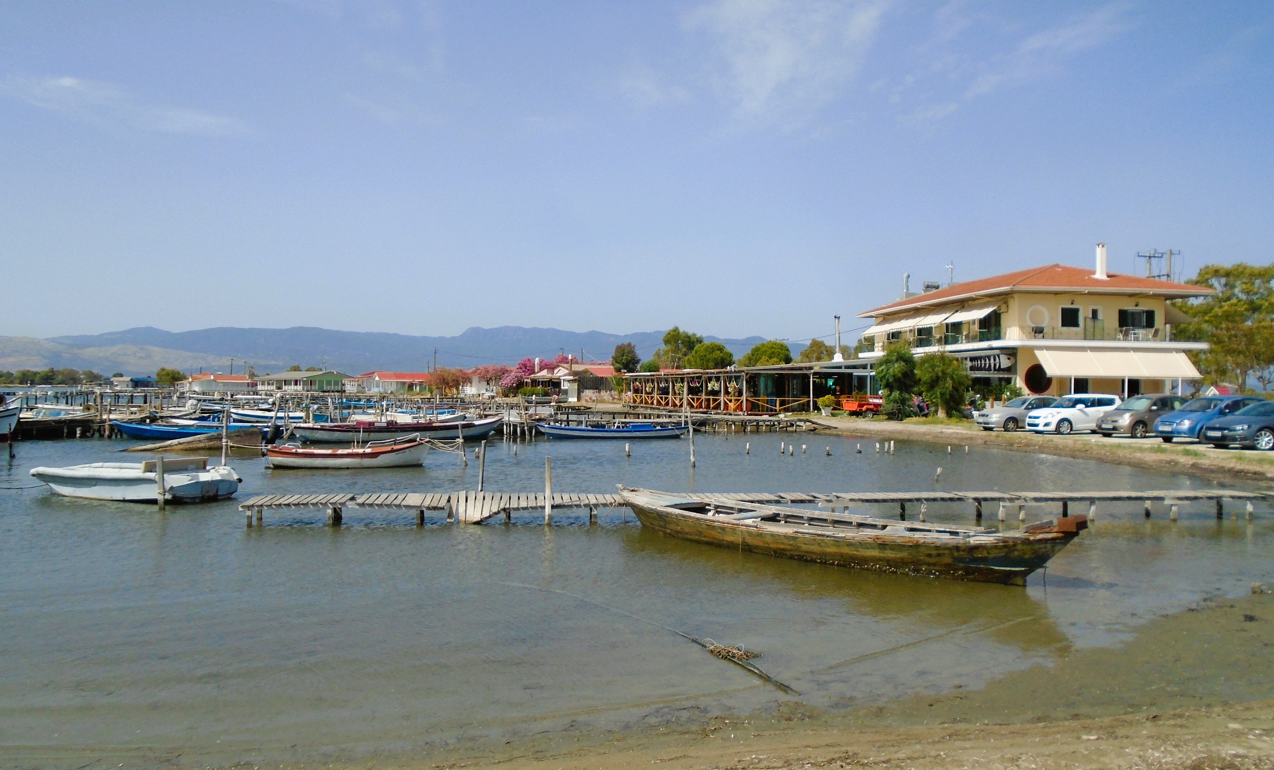
Nowadays, Tourlida has a permanent population of just under 20 residents but, traditionally, it has been known for two main industries – fishing and salt panning.
Traditional fishermen’s wooden houses make up most of the buildings on the island with some being built on stilts to stay above the lagoon waters. Most houses have been gentrified to some extent and are almost certainly holiday homes or holiday lets. However, you can still watch the small local fishing boats gearing up and heading out across the lagoon first thing in the morning.
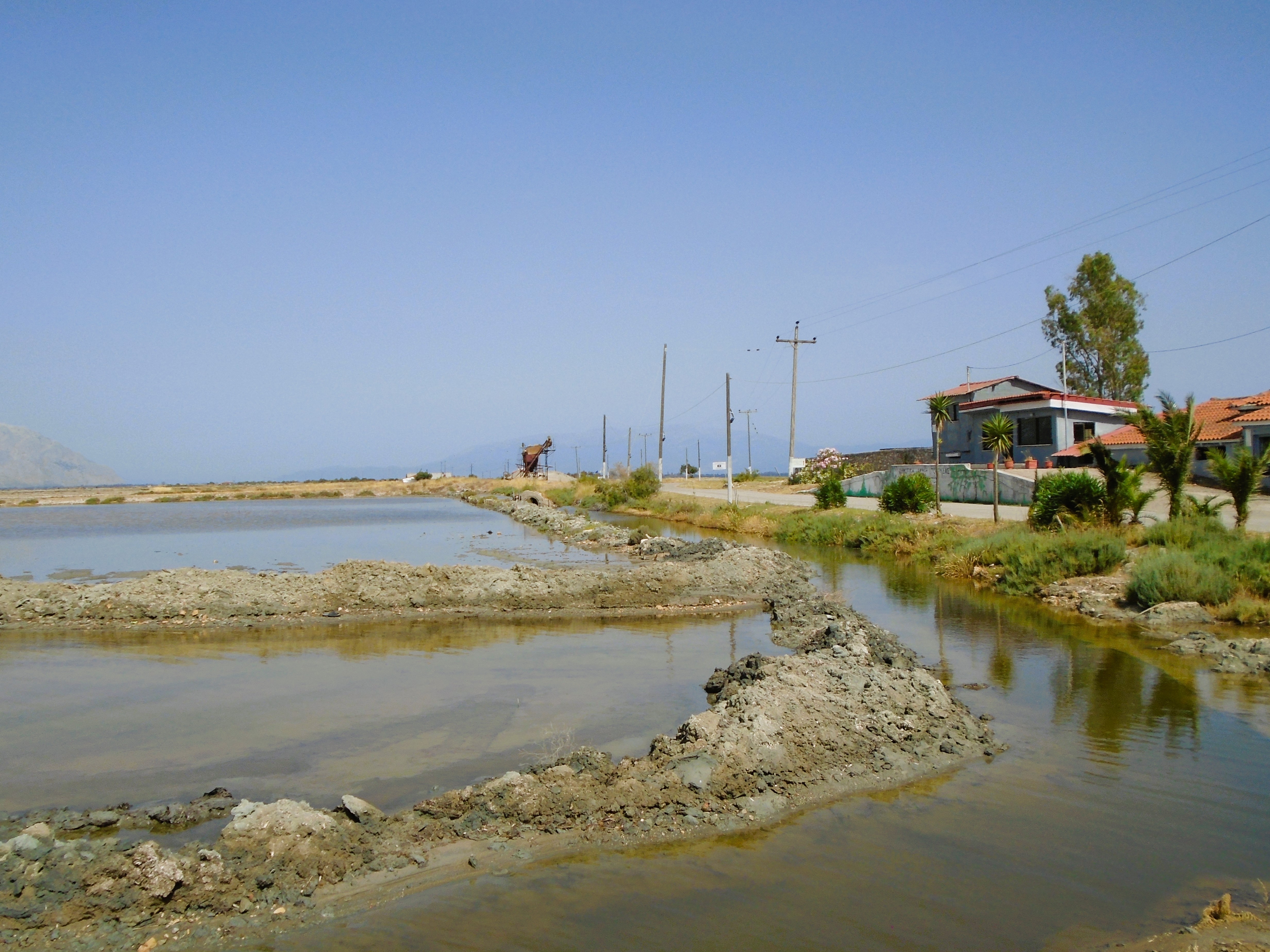
Tourlida Salt Pans
The larger part of the island is taken up with salt pans that produce a high quality product that is popular as tourist souvenirs. There is now a Salt Museum at the start of the pans. It is open Wednesday – Sunday. Typically I was there on a Monday, so cannot comment on its visitor offer.
Messalonghi residents flock to Tourlida for its beach which is reputed to be the best in the area. It’s a long curve of greyish sand with sunbeds and umbrellas, beach volleyball nets and a large beach club at one end providing cool drinks and snacks to sun worshippers.
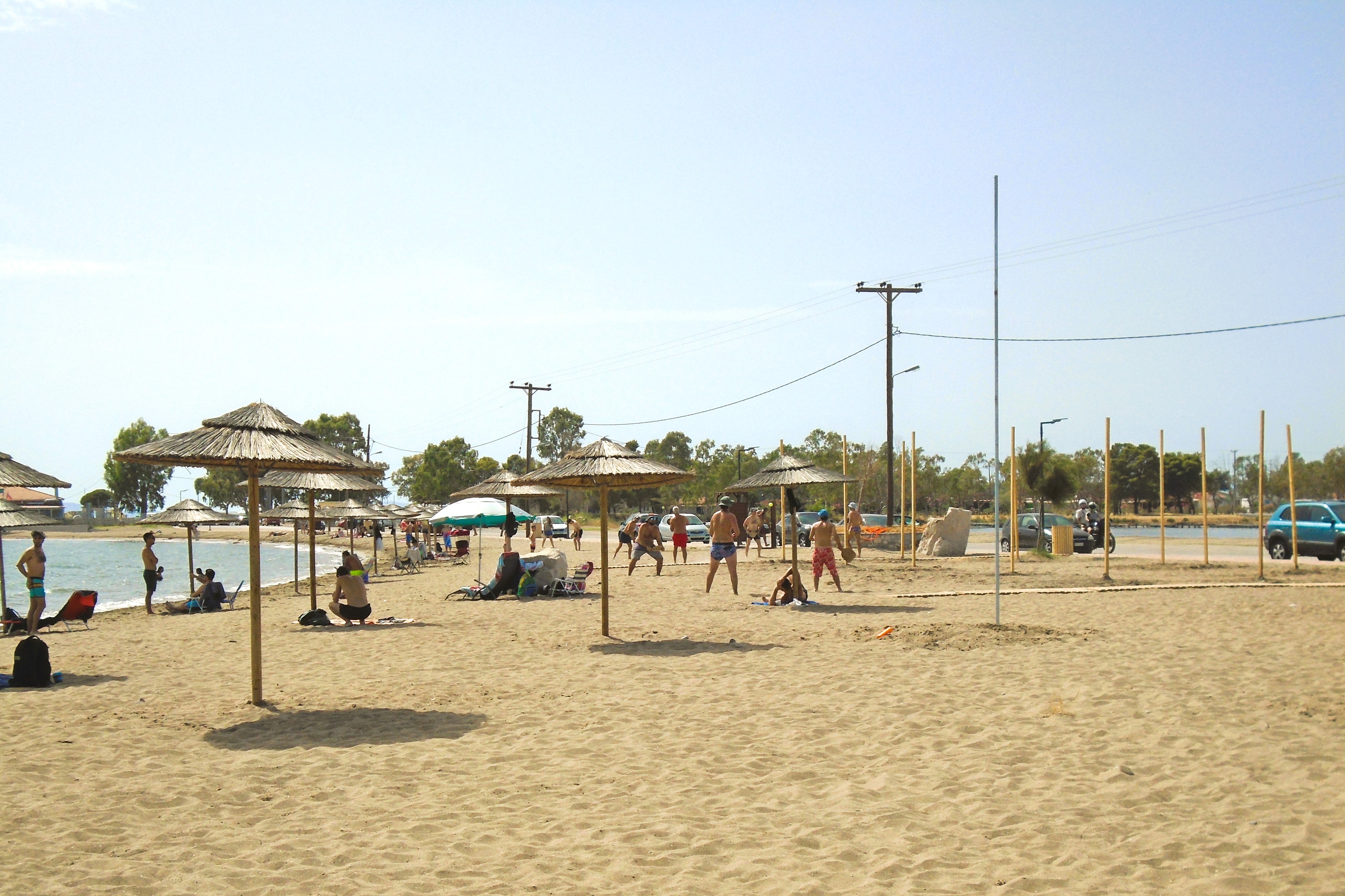
Tourlida Beach
There is also a concrete quay that was crumbling into the lagoon on my first visit. It has now been totally refurbished with attractive flagstones and ladders to give access to the water for those who don’t like sand between their toes. I assume it is still used by the local anglers I saw on it during my first visit.
The beach club aside, there is one large taverna, above which are 8 boutique studio apartments. They are managed by different operators but both have been significantly upgraded since my first visit. Both offer spectacular sunset views when the weather conditions are conducive.
Tourlida, Taverna & Apartments
Tourlida is not your typical Greek island, but holds a lot of interest. There is something very seductive about the soft colours of the lagoon with its endless skies and still waters. It is well worth a trip along the causeway to visit if you are in the area.
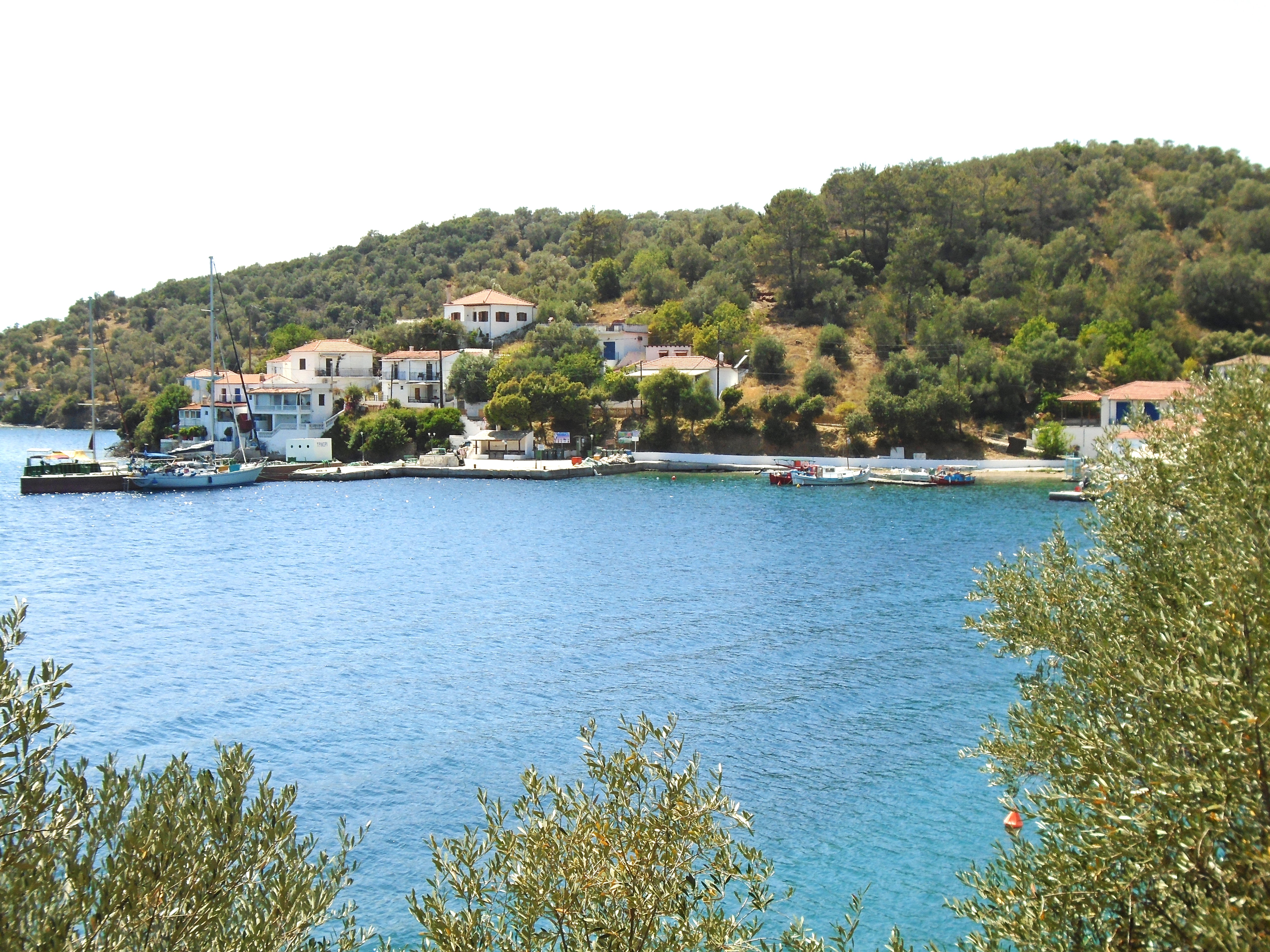
Trizonia
First Visited in 2019. Most recently visited in 2024.
The only inhabited island in the Gulf of Corinth. Remote from all other islands. Small with a lovely village, enjoyable walks and good facilities. A short ferry ride from the mainland.
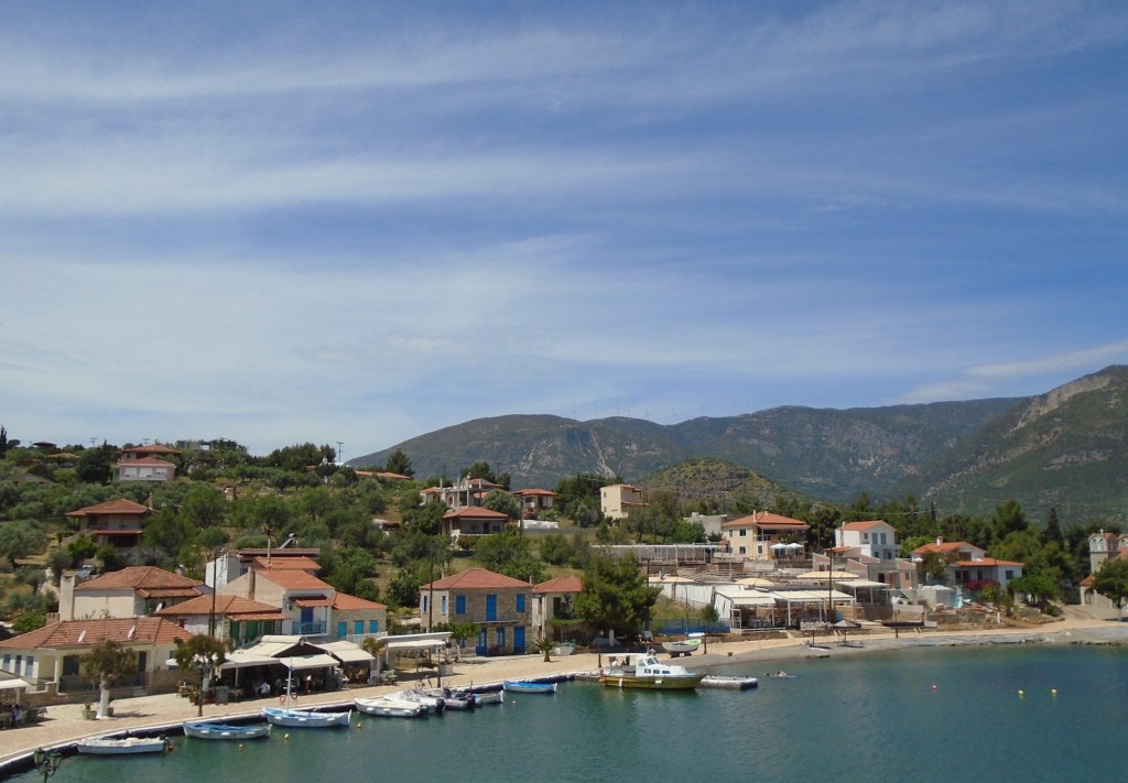
Trizonia is the only inhabited island in the Gulf of Corinth which separates the Peloponnese peninsula from the larger, more northerly part of the Greek mainland. It lies a short distance off the north coast of the gulf opposite the village of Glyfada, which is a little under an hour’s drive east of Patras, Greece’s third largest city. Access to the island is via a passenger ferry that makes the ten minute crossing several times a day. There is a published ferry timetable but the skipper will make additional crossings if there is enough demand.
Info boards at Glyfada harbour quote the island’s population as being a very precise 64 people. There is one island village directly opposite Glyfada and a few other houses scattered here and there in the island’s hinterland.
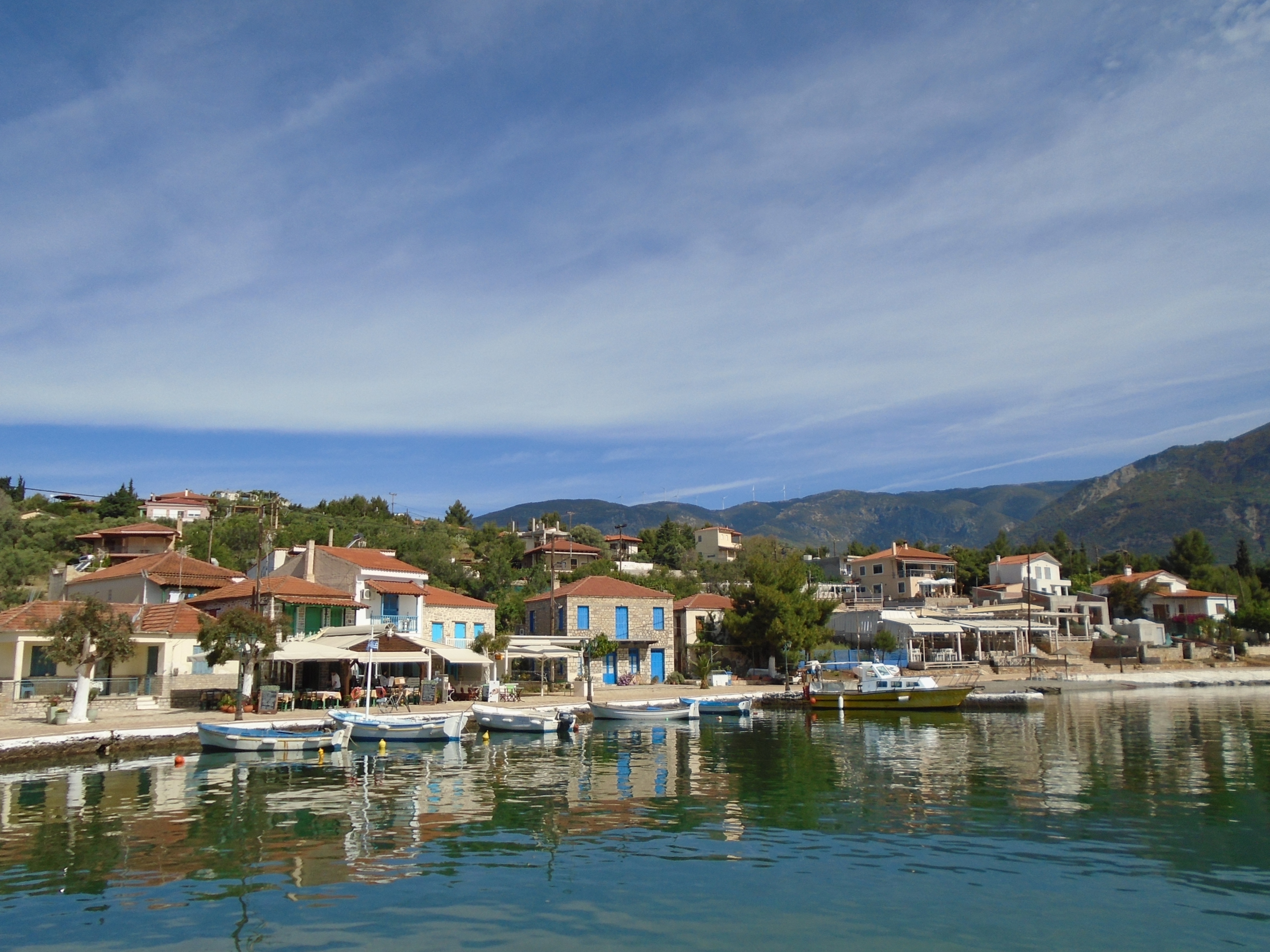
Trizonia
I first visited Trizonia in 2018. I planned a day visit but liked it so much that I decided to stay. I returned in 2024 to find a few unobtrusive changes.
The village lies on a curved bay with the ubiquitous Greek church at one end and a headland at the other. Beyond the headland is a large marina which I guess is used by yachts passing through the Corinth Canal. There is a hotel overlooking the marina that offers shower and laundry facilities to the yachties.
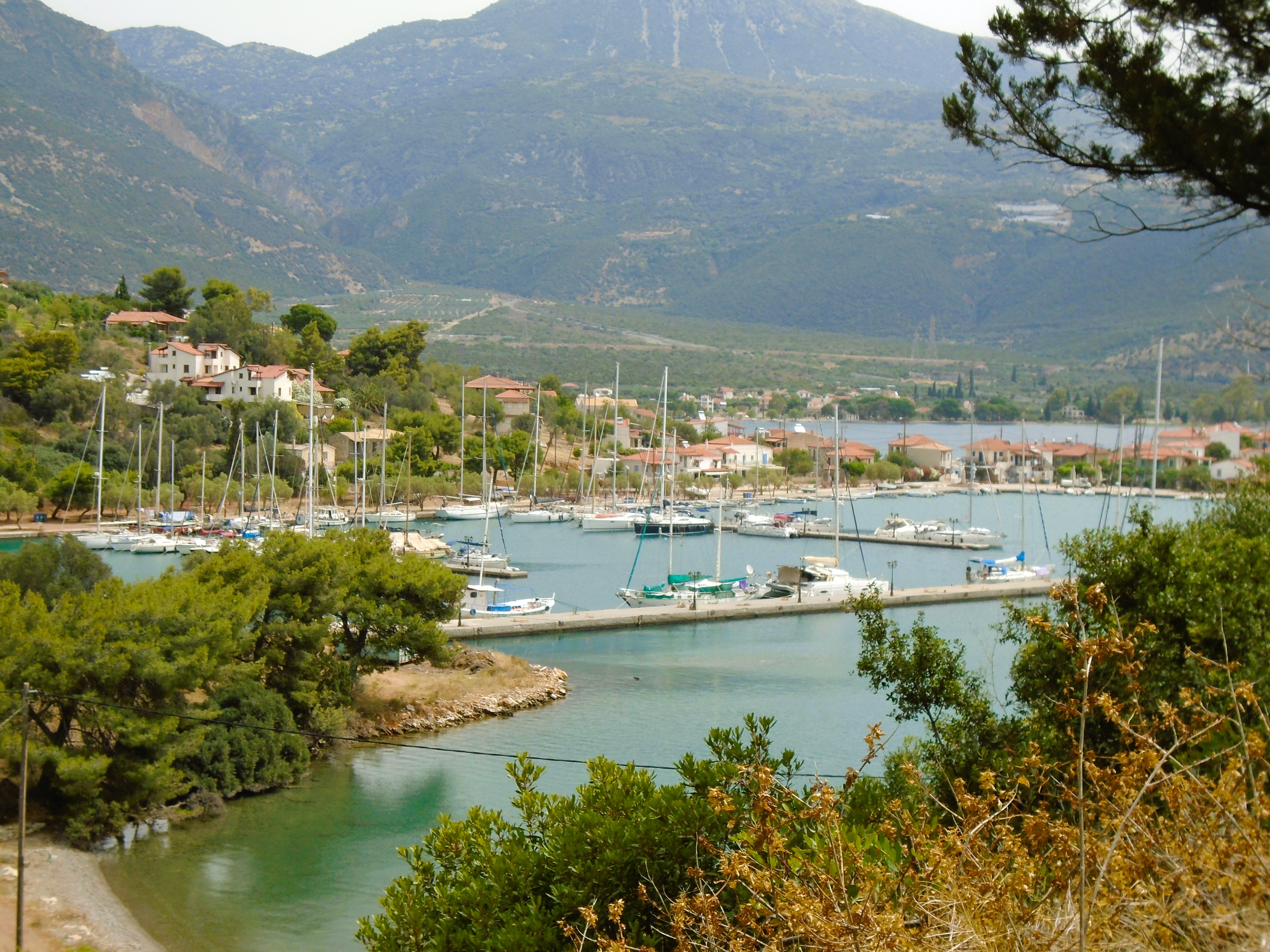
Trizonia Marina
The village itself has an excellent boutique hotel next to the landing point of the ferry. This is where I stayed. The Hotel Iasmos – I highly recommend it.
A new addition is a large upmarket resort style hotel which has been built on the headland between the village and the marina. This has extensive sunbathing platforms, massage treatments and the like. Its landscaping is still a bit raw, but it is not visible from either the marina or the village. A good example of unobstrusive architectural design.
There are about half a dozen tavernas/cafes strung along the village waterfront including a large new beach bar/bistro that appears to have created a small man made beach to accommodate sunbeds for its customers.
A map near the ferry landing point outlines three signposted trails that radiate out from the village along stony dirt tracks. I combined two of them on a walk that took a little over an hour. I first followed an obvious dirt track that started from the back of the church and swept along the north coast of the island to a small cape. From there, it was a brief uphill scramble to connect to a circular path through the centre of the island.
I met no one on my trek and had only the noisy cicadas for company. Oh, and the spiders. Watch out for spiders webs and some of the spiders who look large enough to take your arm off.
Trizonia has three beaches of which the locals seem to be particularly proud. All are within a 30 – 45 minute walk from the village. By chance rather than design, I visited the furthest away one known as Red Beach, where I had a 100 metre strand of gritty red sand and pebbles all to myself for a bit of sunbathing and swimming au naturel.

Trizonia, Red Beach
Evenings on Trizonia are hushed and quiet, even when there are a few dozen yachts in the marina. When I stayed there in early May everything closed by about 10pm. It may be very different in peak season.
You don’t find much information about Trizonia in most of the standard guidebooks. This is a bit of a shame, but maybe helps to preserve its tranquil atmosphere. It can get busier with Greek day visitors at weekends, but they generally add a bit of authentic colour.
You really need your own transport to get to Glyfada for the ferry but it’s certainly worth the journey, perhaps as a next stop after ancient Delphi, which is about one and a half hours drive to the east.
