
The Dodecanese islands lie to the east of the Greek mainland, close to the coast of Turkey. Prior to the First World War they remained part of the Ottoman Empire. When it disintegrated, they were administered by the Italians on behalf of the League of Nations as the powers that be weren’t comfortable joining them to the relatively young, modern Greek state which they viewed as unstable and sympathetic to Germany.
When the fascist Mussolini came to power in Italy, he began a programme of public building throughout the Dodecanese and started militarising some of the islands as a step towards creating a glorious Italian Empire. His plans were thwarted by World War 2 when the Dodecanese suffered heavy fighting due to their strategic position. After the war, the islands were finally re-joined to their mother country in 1947.
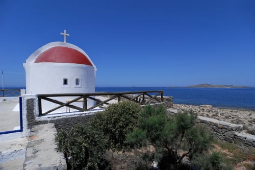
Although the name Dodecanese means the 12 islands, there are almost 20 permanently inhabited islands in the group, ranging from the busy main island of Rhodes to tiny dots like Pserimos and Marathi that might have about a dozen year-round residents. The group covers a vast area stretching from Agathonissi in the north to Kasos in the south and from Astypalea in the west to Kastellorizon in the east.
International flights from other parts of Europe come into Rhodes, Kos and, to a lesser extent, Karpathos. There are also airports handling internal Greek flights on 5 other islands. Most of the islands have regular ferry services to and from Piraeus, although journey times to some can be considerable. The majority are linked during the summer months by the hydrofoils of the Dodecanese Seaways company. Those in the north of the group are also served year round by the redoubtable Nissos Kalymnos ferry, which operates out of the island of that name. Smaller islands are linked to larger neighbours by a host of local ferries that also act supply boats.
In the mid 2010s, their proximity to Turkey has brought waves of displaced Middle Eastern and African migrants to various islands. Tiny Agathonissi woke up one morning to find that local residents were outnumbered three to one by bewildered migrants dumped there during one night of activity by people smugglers. The flow of migrants has now largely stopped but there are still pockets of displaced people living rough or in cramped conditions on a few of the islands. In general, they do not harass tourists and are simply keen to move on or find work locally to support their families.
Tourism is a significant industry on most of the Dodecanese islands, a few of which have highly developed package holiday trade and are amongst the busiest visitor destinations in Greece. However, on all islands it is still possible to find quiet, unspoiled villages where the pace of life hasn’t changed too much over the centuries.
Agathonissi
First Visited in 2013. Most recently visited in 2023.
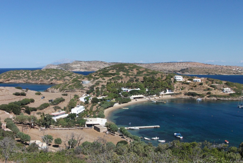
The most northerly of the Dodecanese islands. Small but perfectly formed with limited tourism infrastructure. Quiet, peaceful and friendly. An island for escapists.

In some ways Agathonissi inspired my quest to discover Greek islands I had not previously visited. I was sailing between Patmos and Samos on the Nissos Kalymnos when it called in at an island I didn’t know existed. I thought I knew most Greek islands but this one had somehow escaped my attention. A study of the nautical chart on display on the ferry told me it was called Agathonissi. I had visited Samos about 8 or 9 times without seeing it mentioned or promoted anywhere on its larger neighbour. I was intrigued and wondered how many more islands I knew nothing about. The idea of my island bagging quest was born and, when I started it in 2013, Agathonissi was the first island I visited that was new to me.
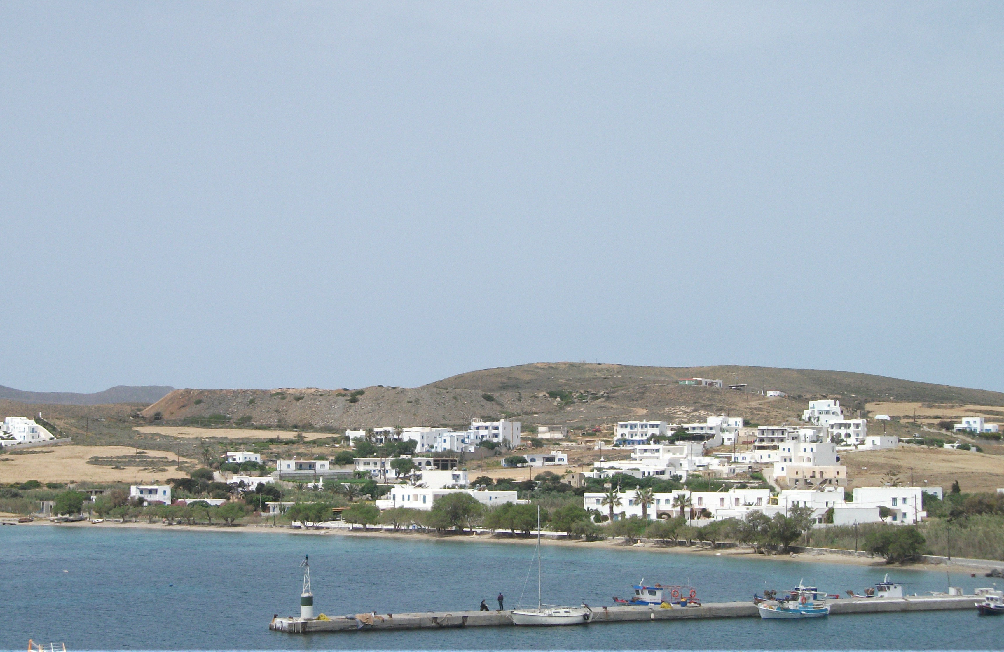
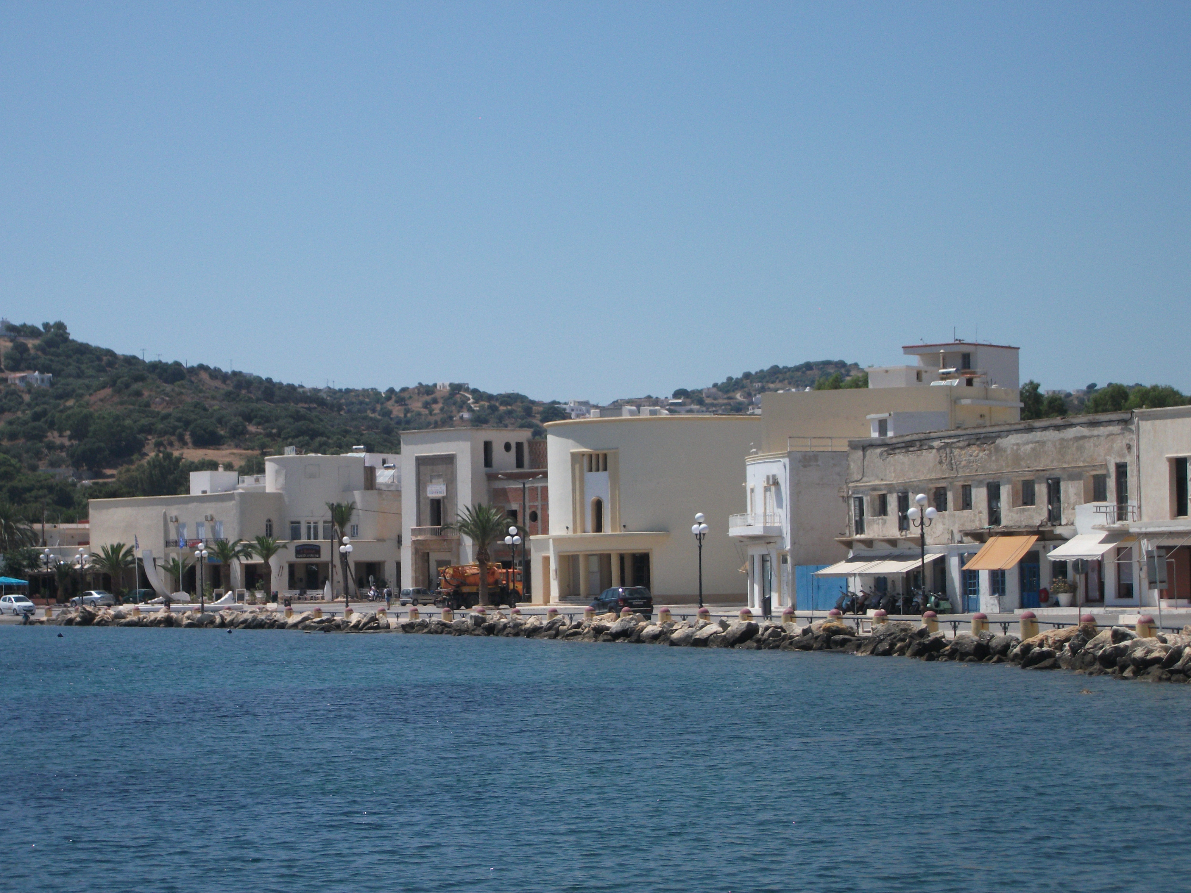
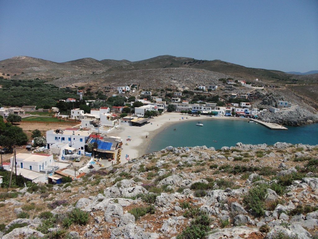
Probably best described as sleepy, Agathonissi is the most northerly of the Dodecanese islands with just under 150 residents spread across three tiny settlements.
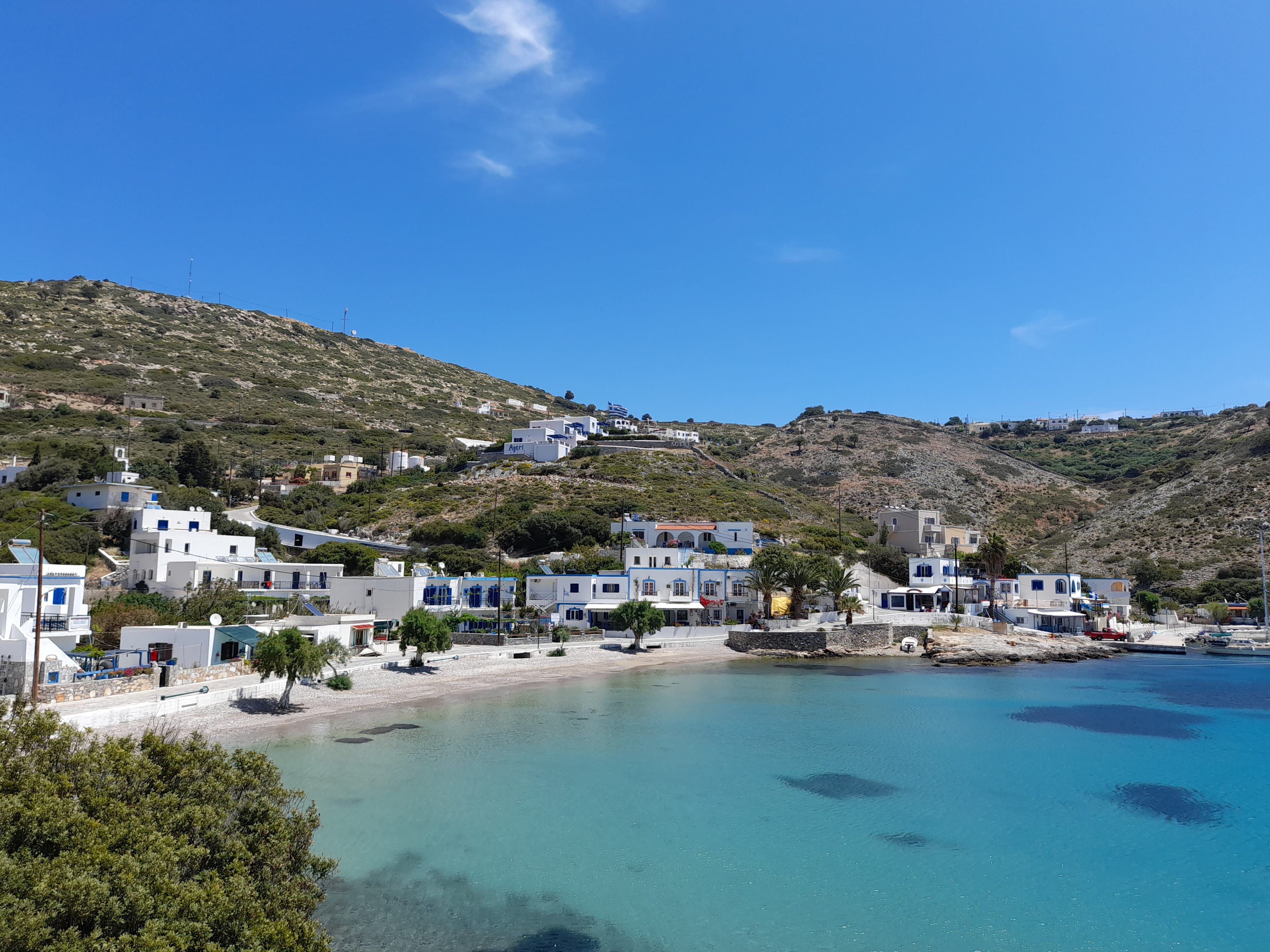
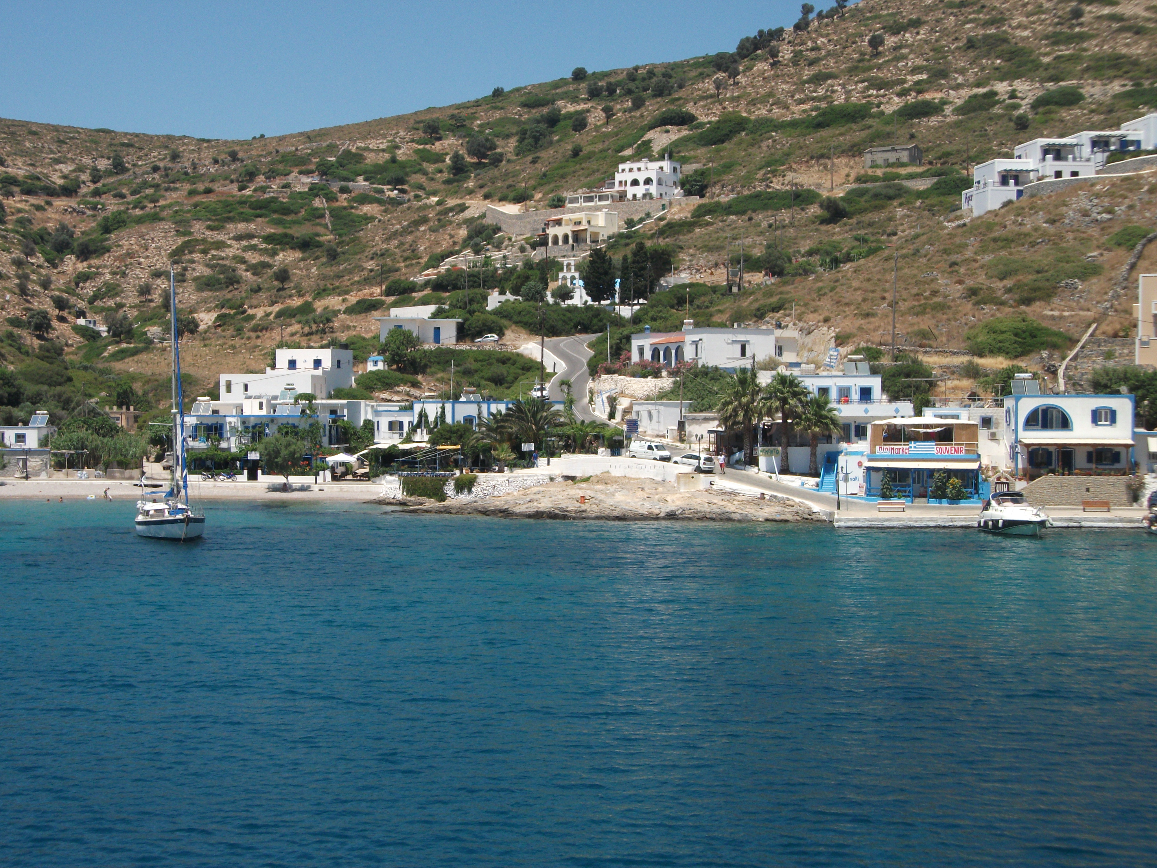
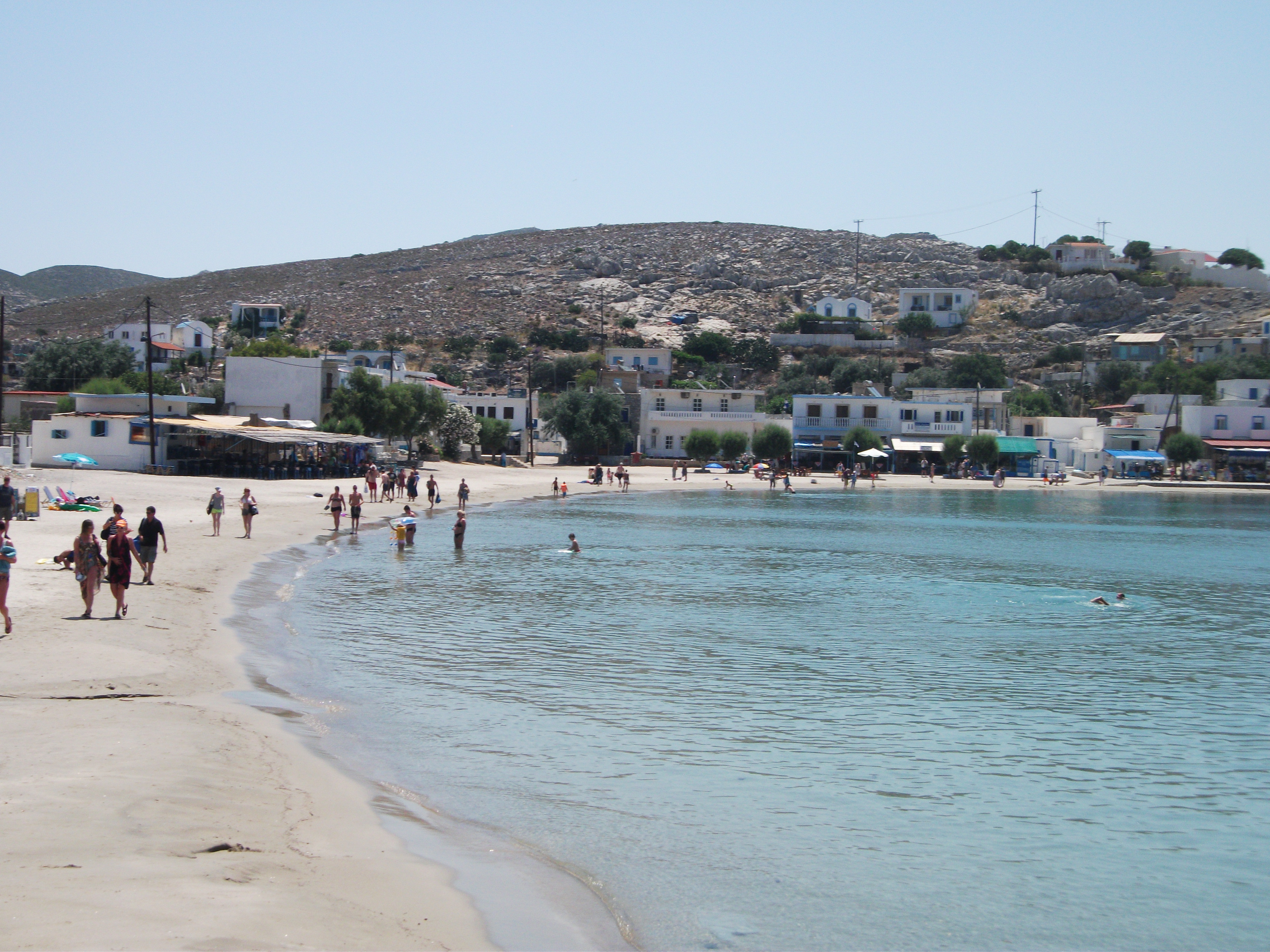
Ayios Yeorgios
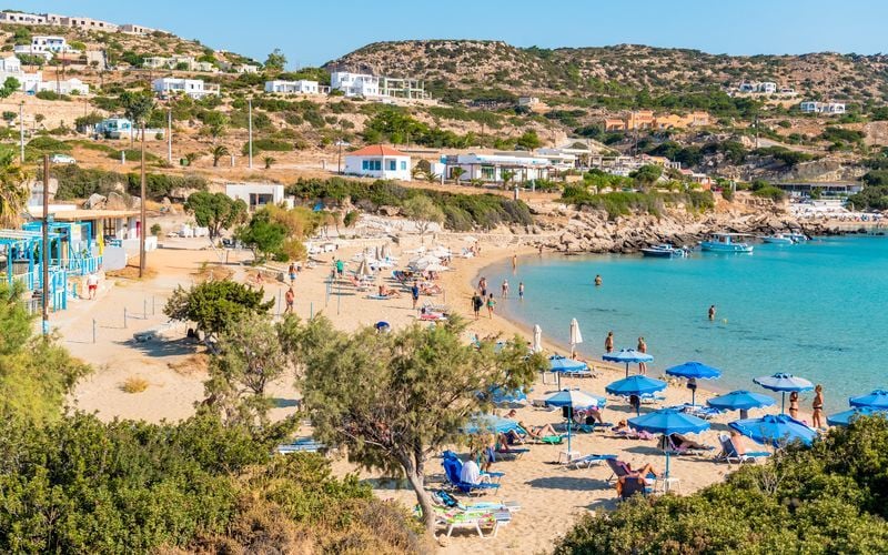
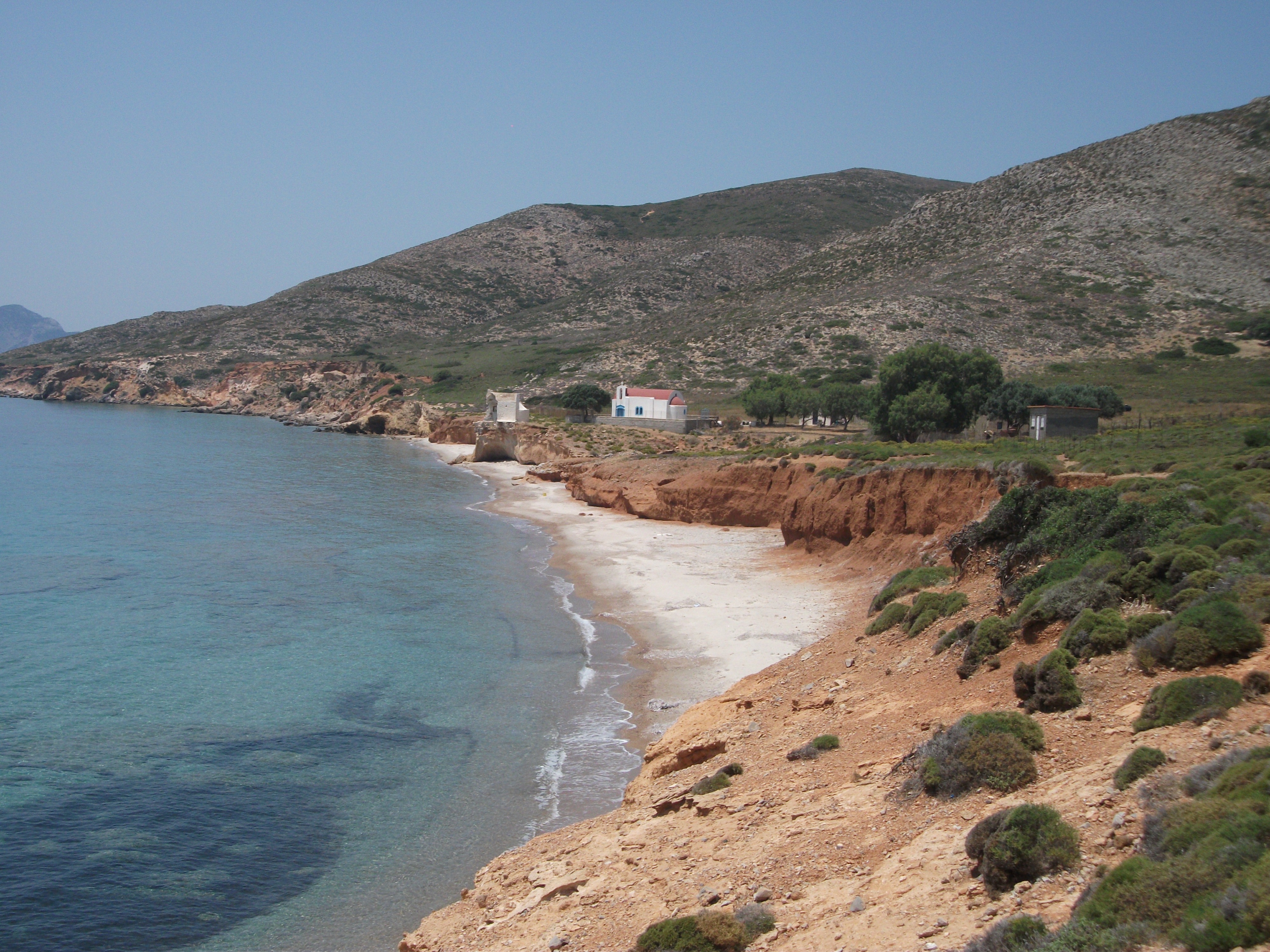
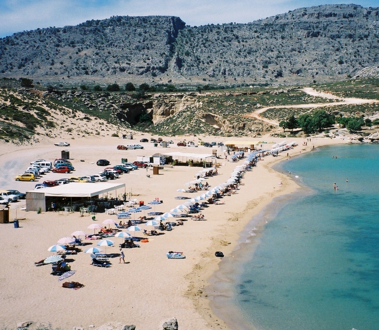
The port of Ayios Yeoryios has three or four locals letting out rooms, some new upmarket visitor accommodation, a few tavernas and cafes, and a mini-market, which combine to make it the busiest place on the island. It also has a sizeable pebble and sand beach with shady trees. There is a slightly grittier, but more secluded beach within a 10 minute walk around the headland at Spilia. This is signed as “Cave Beach”, presumably on account of the fairly shallow cave at one end of it. It also has shade and some benches.

Megalo Horio
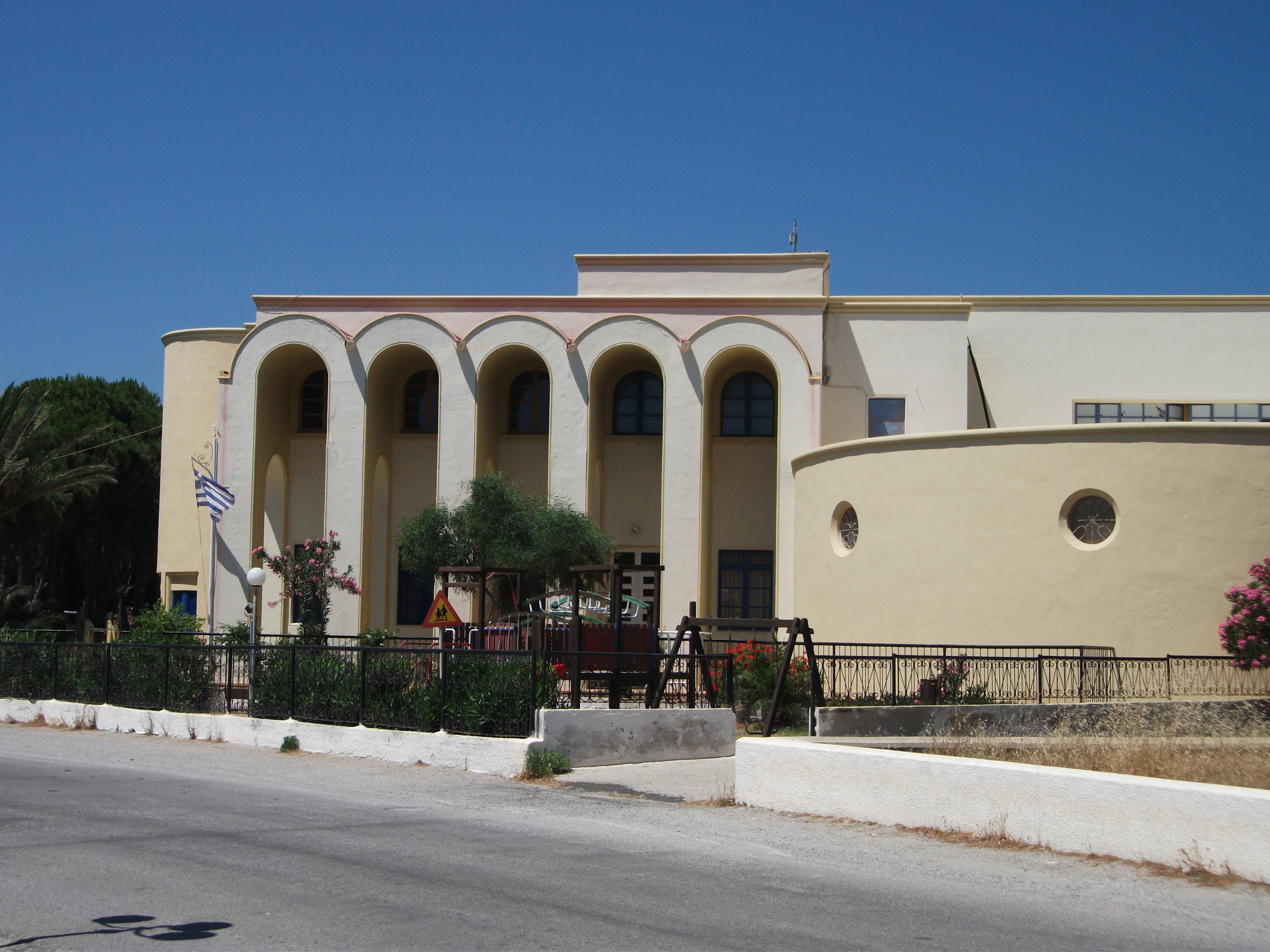
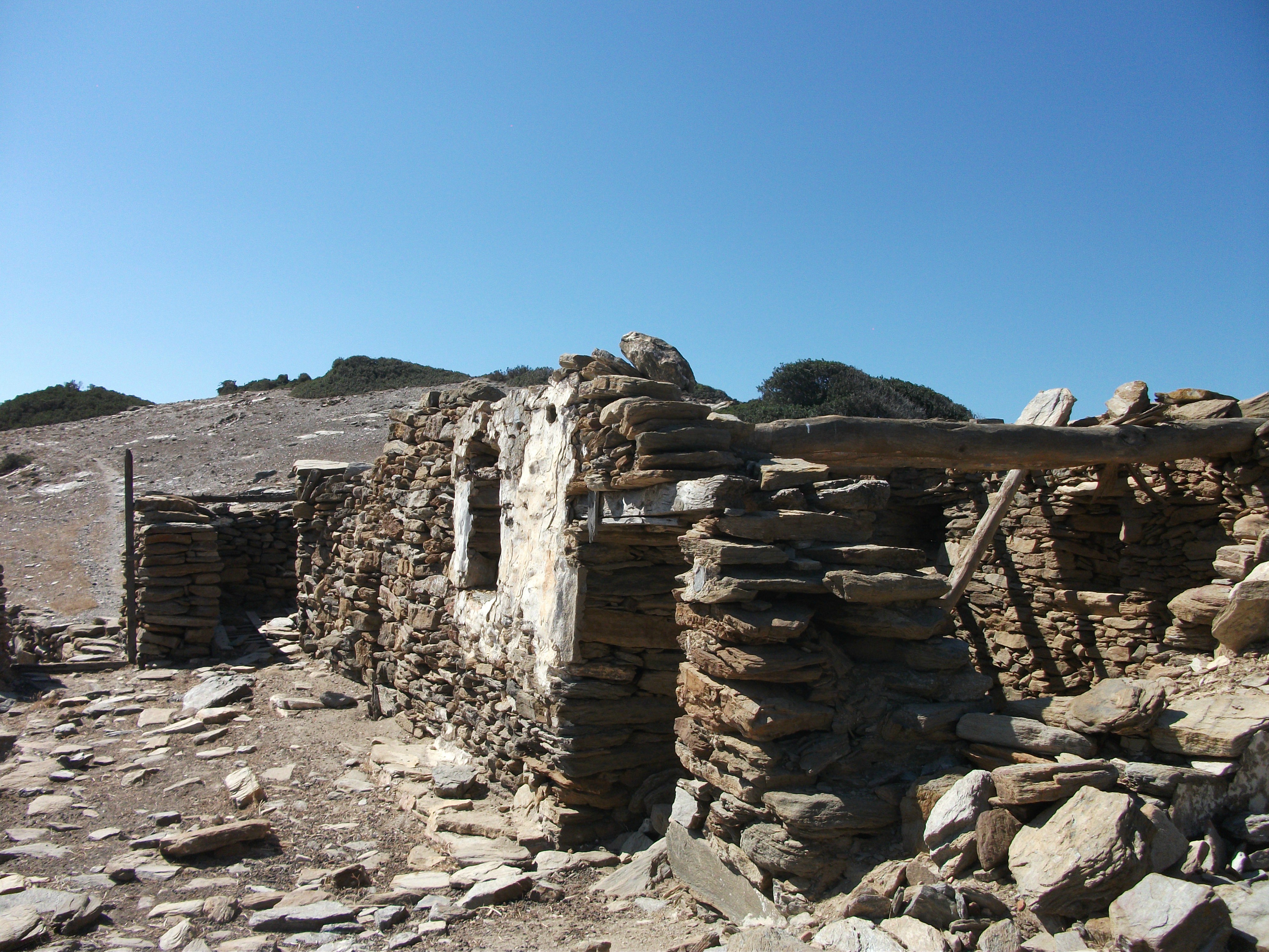
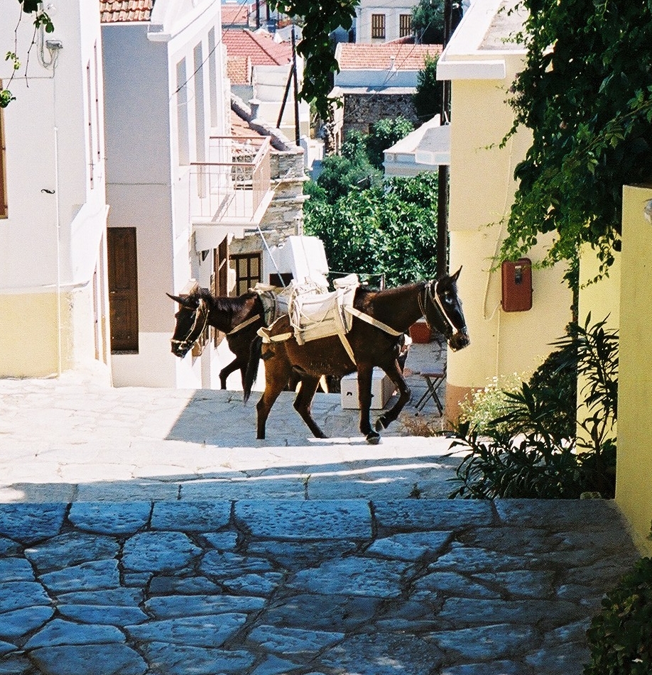
The main village of Megalo Horio is a 15 – 20 minute walk uphill and has a town hall, school, post office and ATM as well as a mini market and a couple of tavernas that seem to open as and when they feel like it. There is also one of those ubiquitous mini football pitches with artificial grass that were built all over Greece after the national team surprised everyone, including themselves, by winning the European Championships in 2008 (I think). There is a further settlement of about half a dozen houses across the ridge at Mikro Horio, which has no amenities other than a picturesque church that gives panoramic views down to the port.
When I first visited in 2013 rough dirt roads spread out from the two inland villages. Many of them have now been upgraded to tarmac, primarily to cater for the industrial scale fish farms, which are housed in a number of the sheltered bays on the east side of the island. A local taverna owner informed me that most of their produce is exported to Italy and the USA. There are a few gravel and shingle beaches dotted around the island that offer almost total seclusion. Most are within a one hour walk of the villages.
There are quite a few soldiers stationed on Agathonissi. They were moved there to deter people smugglers from Turkey. As far as I’m aware, that particular issue is no longer ongoing.
Agathonissi is a tranquil and pretty little island with no antiquities of any great note. Ayios Yeorgios has that classic Greek small island evening ambiance of softly spoken conversations over carafes of wine in local tavernas. There is a good choice of easy and enjoyable walking around the island and a couple of spacious beaches on which to rest tired feet.
Ayios Yeorgios
Dodecanese Seaways hydrofoils call in at Agathonissi two or three times a week during the summer and it is currently possible to make a day trip from Samos once a week. The crossing takes less than an hour and gives you around 6 hours on the island, enough time to see most of it and get a feel for its atmosphere. The Nissos Kalymnos calls in to a varying schedule pretty much all year round.
Overall, Agathonissi is a place to lie back and do nothing much other than walk, sunbathe, eat and drink. I enjoyed doing all those things.
Arki
First Visited in 2015. Most recently visited in 2017.
A smaller neighbour of Patmos. A bit rough and ready with little outstanding scenery. Mostly attracts yachts and day visitors from other islands.
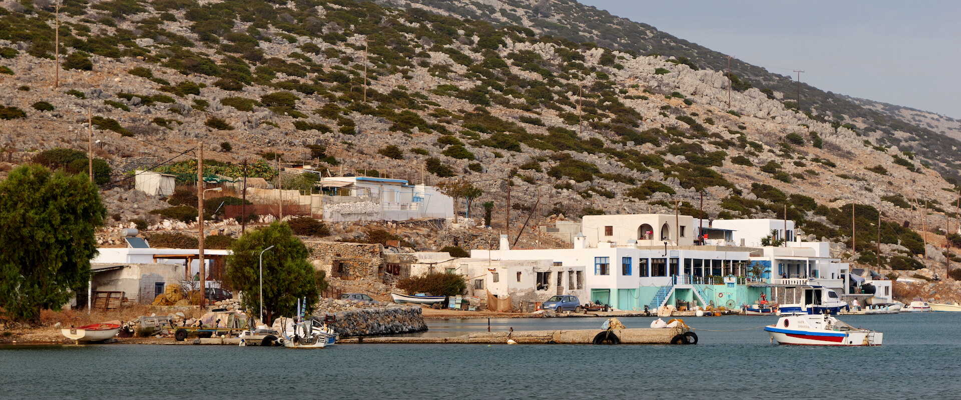
Arki is the largest of an archipelago of small islands that lie about a one hour ferry ride to the east of Patmos. It’s a popular stop over for yachts and day trip excursion boats operating out of its busier neighbour, to which it also has a regular local ferry service that appears to carry significantly more supplies than passengers. In addition, it has regular, summer calls by the Nissos Kalymnos ferry and the Dodecanese Seaways hydrofoils.
Arki has about 50 permanent residents who mostly live in the scattered main port settlement. This lacks the traditional Greek village layout of closely packed houses in a jumble of shady lanes and alleyways. Instead, houses straggle over the slight hillside up from the harbour, giving the settlement something of a rough and ready feel.
There are a few places offering rooms to let and three tavernas down near the harbour quay. That’s pretty much it in terms of amenities, apart from a small kiosk at the harbour and a poorly stocked minimarket with indeterminate opening hours.
Arki
The neighbouring bay of Dhidhymi Ormi is a ten minute walk away and is also popular with yachties. It has a taverna which is considered by some to be the best on the island.

Arki, Blue Lagoon Beach
Arki is fairly flat and scenically undistinguished. Excursion boats tend to stop at the sandy Blue Lagoon beach on the south east tip of the island before heading up to the main settlement. This is by far the best local beach but is a bit of a walk from the main village, whose own beach at Patelia is rather rough and scrubby.
In general, walking on Arki is not as easy as on most other islands. There is little waymarking of trails and a lot of rusty gates and fences to be negotiated. They are there to keep the numerous local goats under some semblance of control.
Arki
I’ve been on a couple of day trips to Arki and have failed to be particularly enthused by it on either occasion. However, I know people who love its tranquillity and simplicity. From the accents I’ve heard on the island, it appears to be particularly popular with younger, French visitors, although the yachts probably provide the majority of its tourism business. There can be over a dozen moored along the main quay at any one time.
For me, Arki is an island to tick off on an island hoppers list. The locals are friendly enough, but the place feels a bit unfinished with little of genuine interest to detain visitors other than its peace and quiet.
Astypalea
Visited in 2017
A butterfly shaped island rather out on a limb with an atmosphere and architecture more like the Cyclades than the Dodecanese. A beautiful main town, but can be difficult to get to.

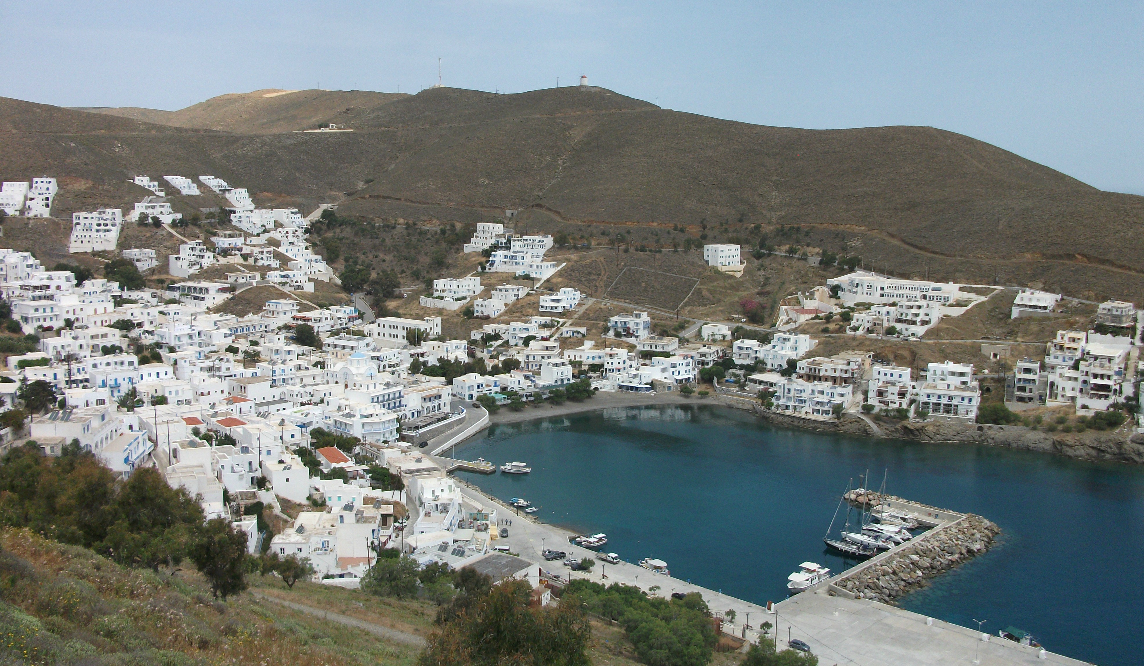
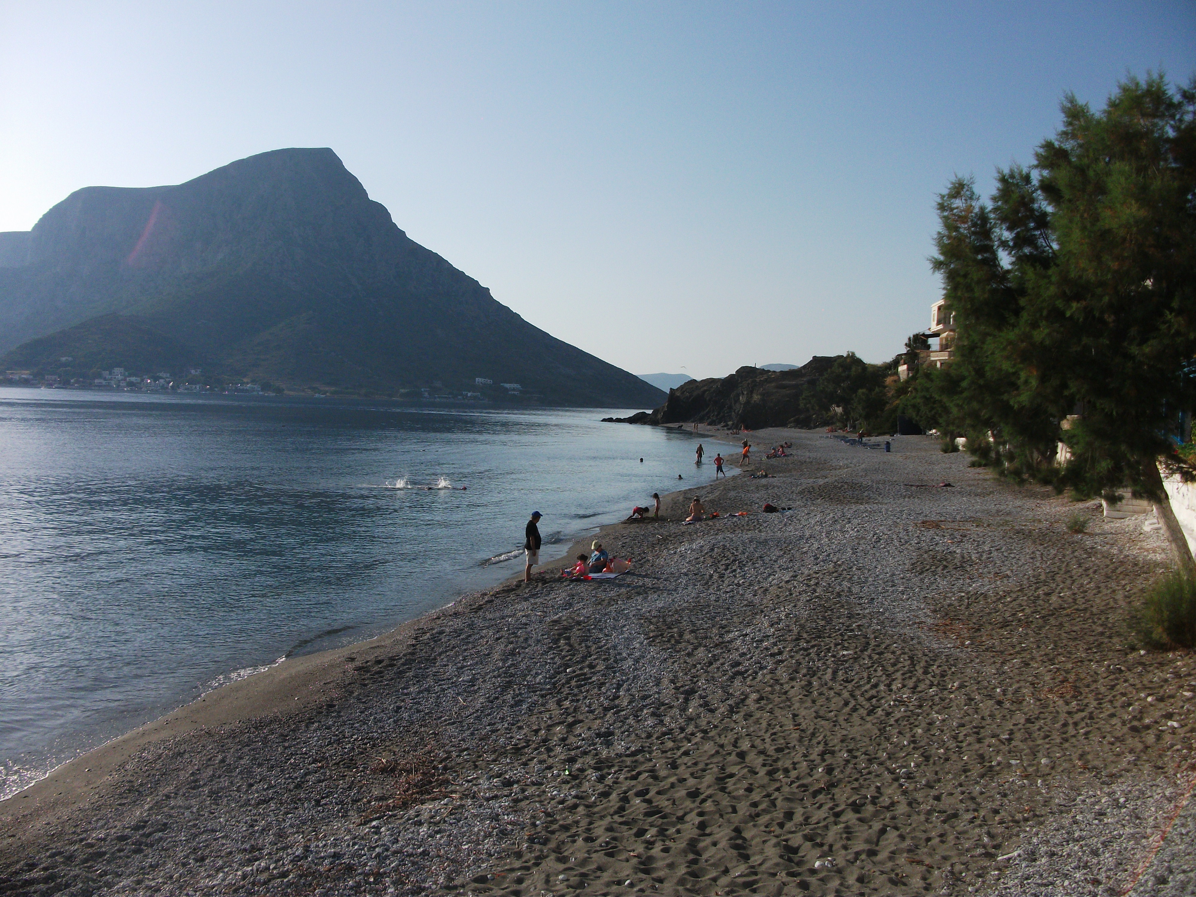
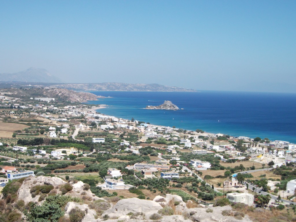
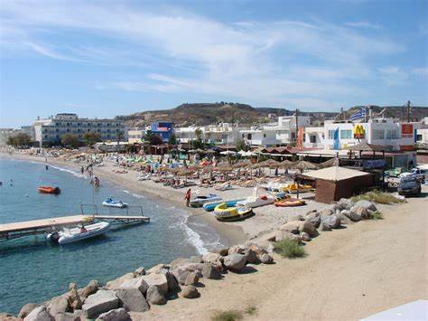
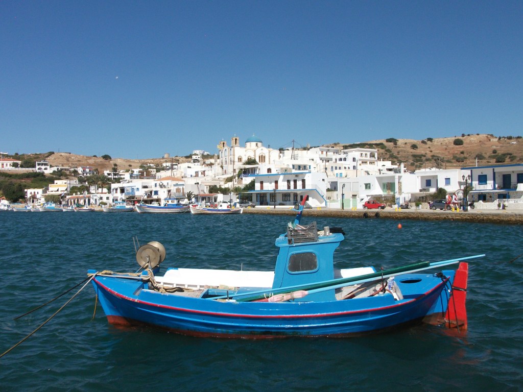
Astypalea is a large island of about 1,300 residents that is somewhat out on a limb, seemingly miles from anywhere. It looks and feels more like part of the Cyclades rather than the Dodecanese islands.
It has regular direct flights to and from Athens and Leros that take under an hour. However, ferry journeys can be lengthy. Ferries from Piraeus can take up to 12 hours and often arrive and depart in the small hours of the morning. They dock at Agios Andreas, a purpose built port on the north side of the island, miles from where anyone actually lives. Local accommodation providers meet most ferries irrespective of their arrival time, but booking in advance is advisable if you’re scheduled to arrive at something like 3am.
Dodecanese Seaways have recently introduced a summer hydrofoil service from Kos twice a week and the Nissos Kalymnos provides a regular ferry link to and from Kalymnos two or three times a week. However, it leaves its home port at 0600 and takes about 3 hours each way. Nonetheless, it does at least dock in the traditional port of Pera Yialos, which is within walking distance of the Chora, the main island settlement.
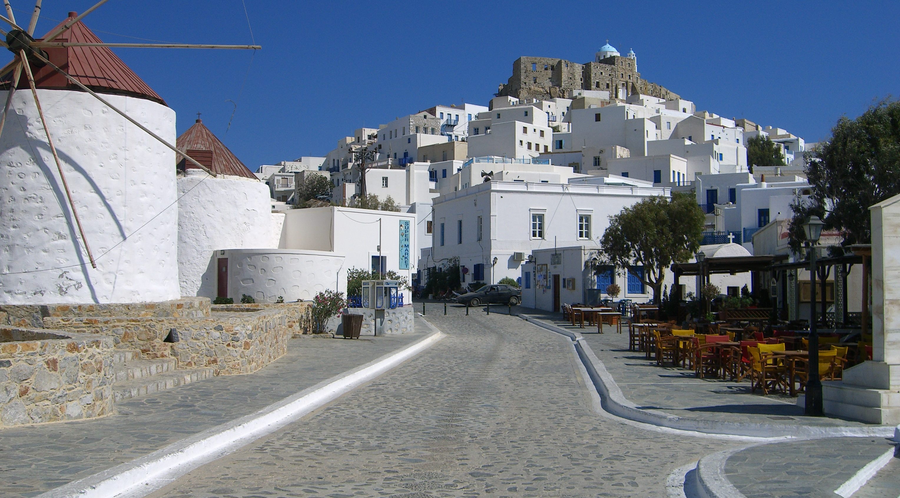
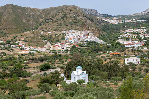
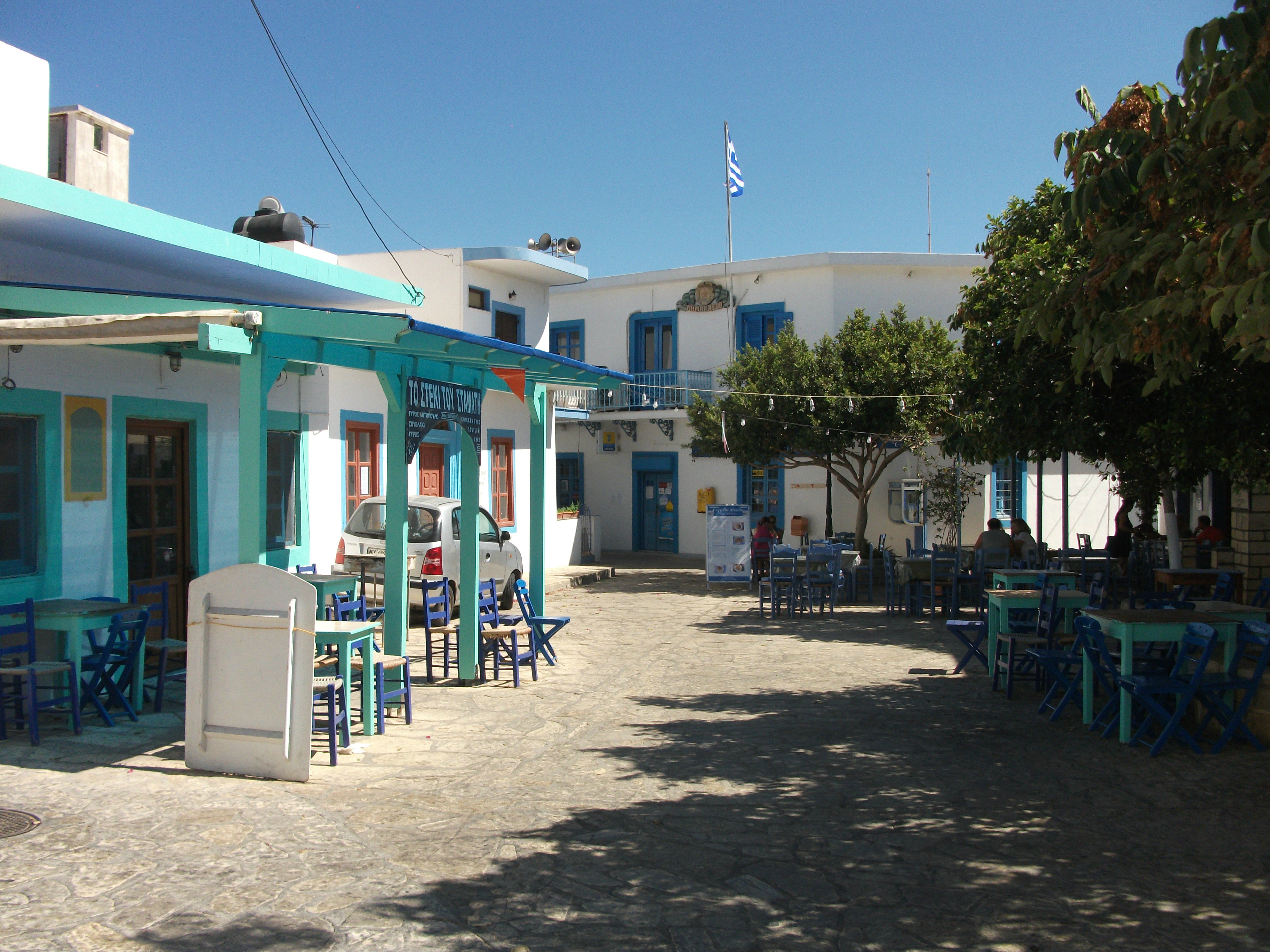
Chora
The Chora is beautifully located on a hillside ridge that climbs up to a ruined 13th century castle. It’s a classic Greek island village of whitewashed buildings, whose flaking wooden balconies hang over narrow lanes and alleyways. Halfway or so up the ridge the village centre boasts a row of renovated windmills with adjacent shops and tavernas. I enjoyed a couple of spectacular fish dinners at ridiculously low cost in one of the tavernas. I can’t remember its name but the charming owner was called Maroula.
Peri Yialos
The Chora tumbles down to sea level at the traditional port of Pera Yialos, which is a bit more workaday but has further tavernas and a reasonable choice of places to stay. This is where any passing yachts tend to dock. A tarmac road links the port to the Chora, but there are also more interesting footpaths and staircases between the two. They can be a fair old climb but are worth the effort.
Livadia
On the opposite side of the Chora, the beach resort of Livadia has more accommodation and tavernas. It’s a 20 minute walk downhill from the Chora – and a fair bit longer back up – but was largely closed when I visited in early May.
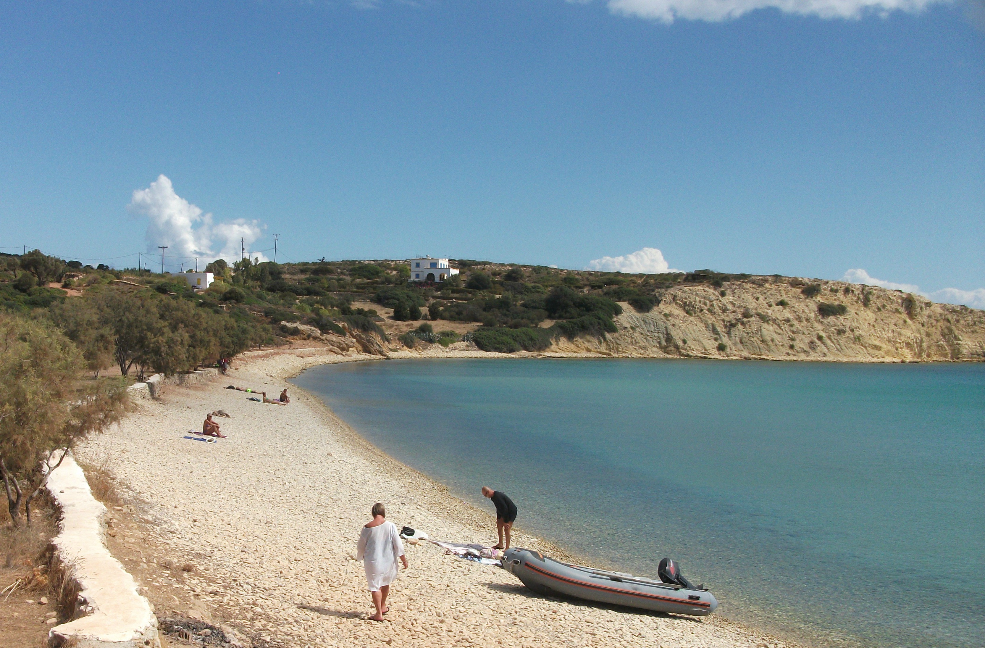
Apart from the area around the Chora, much of the rest of Astypalea is rather dull scenically. I was struck by how brown and barren it appeared in spring. There are few awe inspiring mountains or sea views; the beaches are pretty mediocre; and the villages are fairly nondescript.
Analipsi
Analipsi, which is about 10 km from the Chora, is the island’s second largest settlement and has a large beach of the standard hard packed, grey, local sand. It was another sleepy hollow with few signs of active life when I visited. However, it is next to the island airport, although the one or two flights a day are unlikely to wake up the locals too much.
The most attractive scenery lies beyond Analipsi on the road to the small fishing village of Vathy, which sits on a long, narrow inlet. A recently paved road climbs to spectacular viewpoints before ending abruptly in the middle of nowhere and deteriorating to a very rough track for the final few kilometres. A jeep is maybe a better choice than a standard car if you’re hiring to drive to Vathy. Some excursion boats make the journey from Pera Yialos in the summer months.
Vathy
Overall, Astypalea has little to detain visitors for too long other than the attractive Chora and the very friendly residents. Getting there is not that easy. You have to be pretty determined and willing to endure lengthy ferry rides at odd times of night. Is it worth it? Questionable when there are so many other options across the Greek islands. However, I’m sure it has its fair share of devoted, regular visitors.
Halki
First Visited in 1979. Most recently visited in 2017.
Small, upmarket and cosmopolitan. Rhodes’ nearest neighbour. Only one village, but it’s an attractive and lively one. Good but relatively expensive choice of visitor accommodation.
Little Halki (sometimes spelt as Chalki) is Rhodes’ closest neighbour and is serviced by: the occasional large ferry from Pireaus; regular Dodecanese Seaways hydrofoils in the summer months; and three peak season local ferries operating out of the tiny port of Skala Kamiros on the west coast of Rhodes.
When I first passed through in 1979, Halki’s only village, Emborio, had a lot of crumbling, empty buildings and only a nascent tourism industry. In the 1980s, specialist, upmarket Greek island tour company, Laskarina, took over the promotion and filling of most of the visitor accommodation stock and encouraged the renovation of many buildings. When they went bust in 2006, local providers largely reverted to on-line bookings.
Today, Halki maintains a position as a quiet, upmarket destination with high quality accommodation that can be more expensive than on other islands. Emborio is one of the prettiest villages in Greece. It still has a few empty buildings, but they are vastly outnumbered by mansions converted into apartments and studios whose pastel coloured exteriors give the village a somewhat Italian look.

Emborio
The village is located on a wide bay which has a broad promenade along most of its length. This is where the majority of tavernas and other amenities are located. In peak season, overnight visitors can seem to outnumber the 300 or so locals, giving it a cosmopolitan feel.

Pandamos Bay
The nearest beach of any note is a 15 minute walk away at Pandamos Bay. This sandy beach is the most popular on the island and comes with its own taverna. However, there are a couple of small pebbly beaches closer to Emborio and good swimming from bathing platforms in the village centre. Peak season excursion boats run to remote beaches on the uninhabited north coast and to the neighbouring island of Alimia, which was abandoned in the 1960s and has a deserted village, some interesting wartime history and soft sand.

Inland from Emborio, a well paved road skirts the abandoned Chora, which is crowned by a ruined crusaders’ castle whose spectacular views across to neighbouring islands make the sweaty climb up to it worthwhile. From there, the road, which was largely financed by expats in Florida and is known as the Tarpon Springs Boulevard, continues to the island’s main monastery.
Halki attracts a fair number of day visitors from Rhodes, mostly through Dodecanese Seaways, but has nothing like the crowds that gravitate towards Symi. Evenings are relaxed with a variety of languages floating up from harbour front tavernas. The island has carefully positioned itself as a high-end, longer stay destination and is all the better for it.
Kalymnos
First Visited in 2015. Most recently visited in 2017.
Famed as the island of sponge divers. Rugged and barren, but popular with rock climbers. and younger outdoor activists. It’s bustling main town is a popular day visitor destination.
Rugged Kalymnos is a bit like the Crewe Junction of the Dodecanese. It is served by large ferries from Piraeus; Dodecanese Seaways hydrofoils; the Nissos Kalymnos; and flights from Athens and other Dodecanese islands.
It was once the busiest sponge fishing centre in Greece although that industry has largely ended as sea conditions changed. Nonetheless, local sponges are still a prime tourist souvenir.
The main town and port, Pothia, is a large, bustling place that spreads out along a wide bay encircled by barren mountains. The legacy of the Italian inter-wars period is prominent in some of its public architecture and there is a wide choice of places to stay, eat and shop. The town beach is a fairly rough mixture of pebbles and grit but it’s a pleasant enough place to kill a couple of hours.
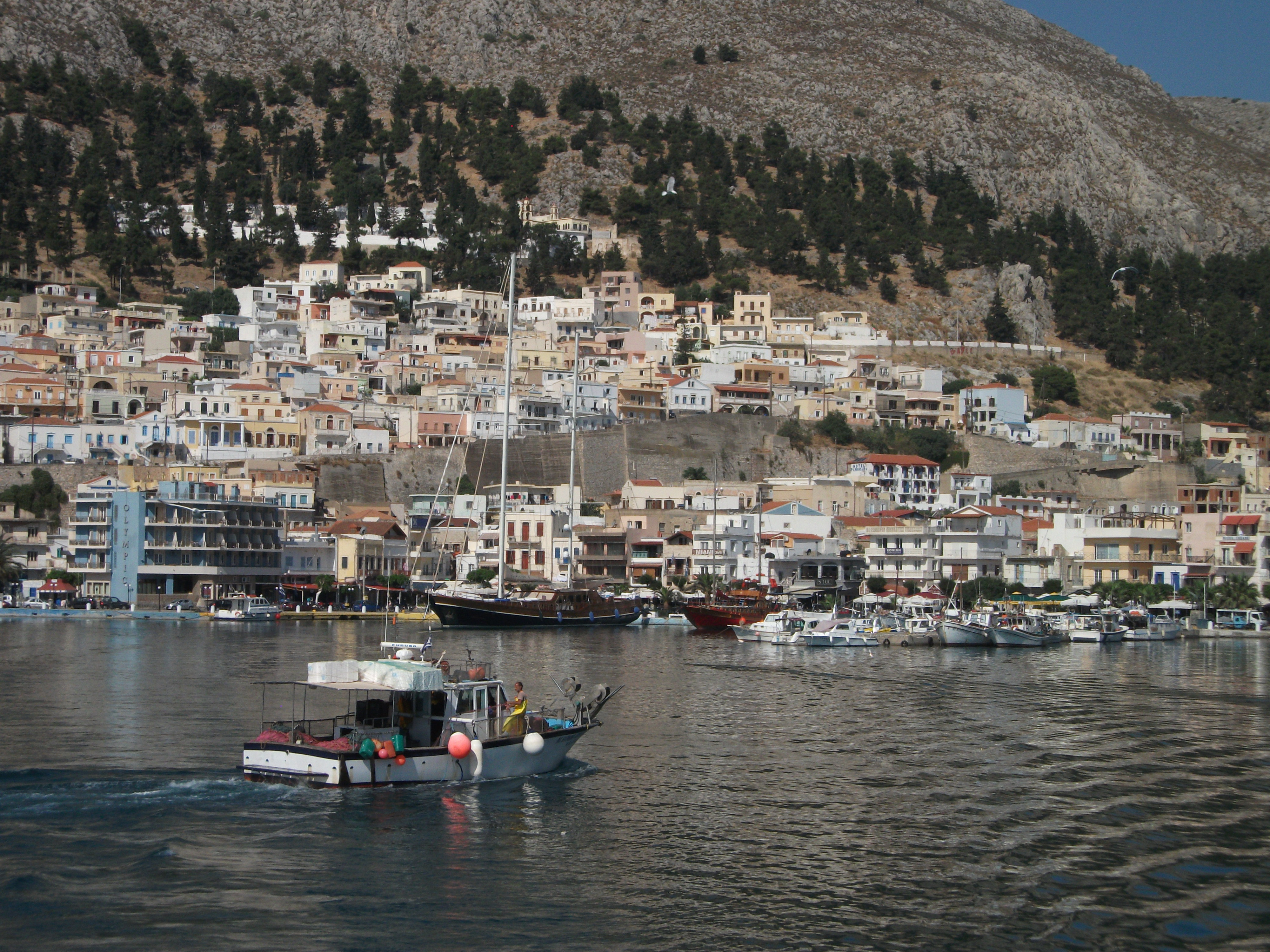
Pothia
Regular buses run from Pothia along the west coast of the island to a string of largely undistinguished beach resorts that suffered a rash of construction in the 1980s to cater for package holiday business that never materialised. This led to a glut of accommodation and a fair number of buildings that are now closed up and decaying. Platy Yialos probably has the best beach on this coast, but little else to commend it. Myrties is the largest resort in terms of size. Massouri maybe pips it for being the liveliest.
Myrties Beach at Sunset
This part of Kalymnos is extremely popular with climbers who come to tackle the challenging cliffs and rock faces that rear up immediately behind the resorts. This has stimulated new complementary activity businesses like cycling and kayaking, as well as music bars and lively tavernas where climbers can watch the sunsets over the neighbouring island of Telendos while noisily celebrating surviving another day without serious injury.

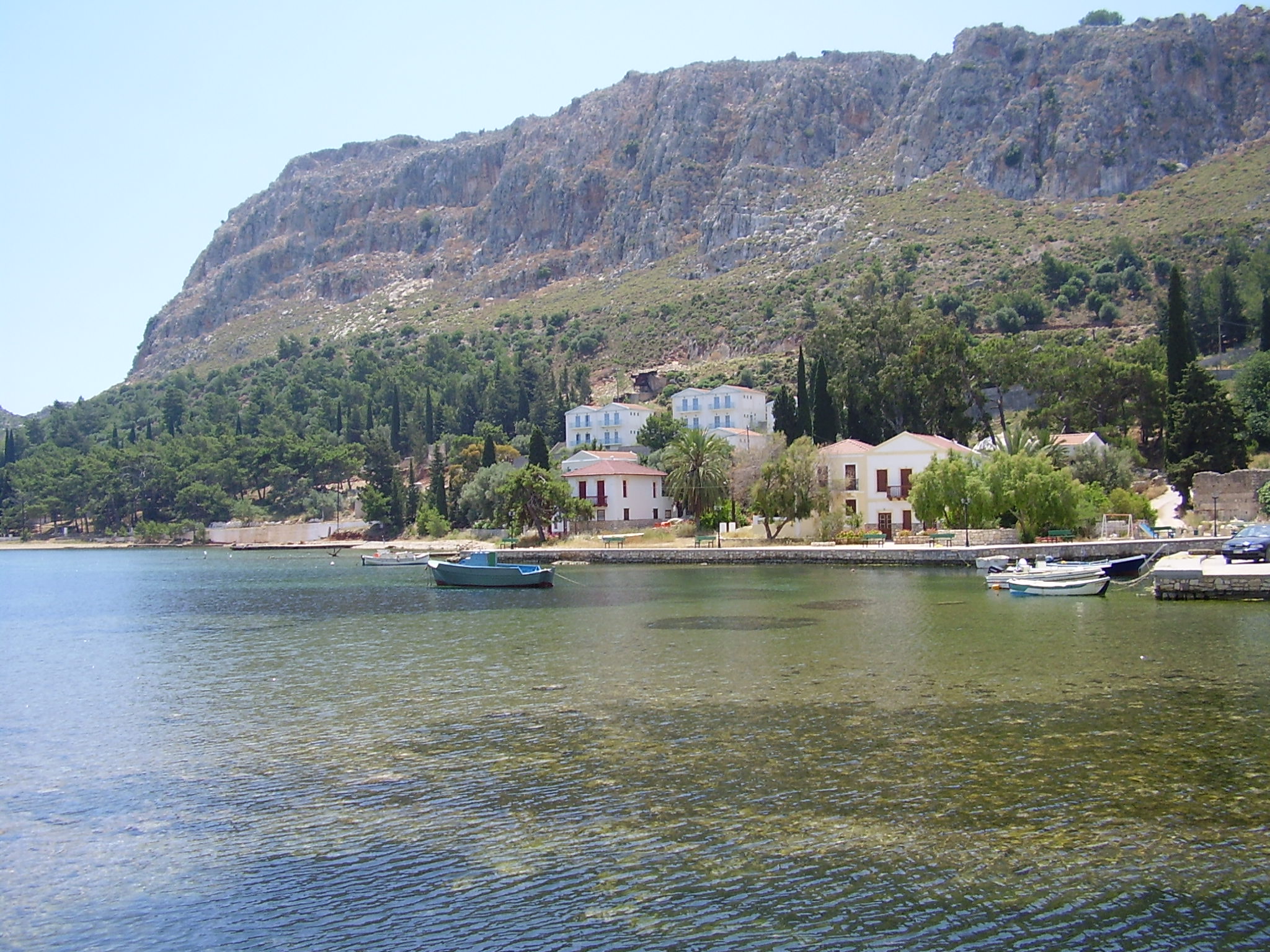
Massouri
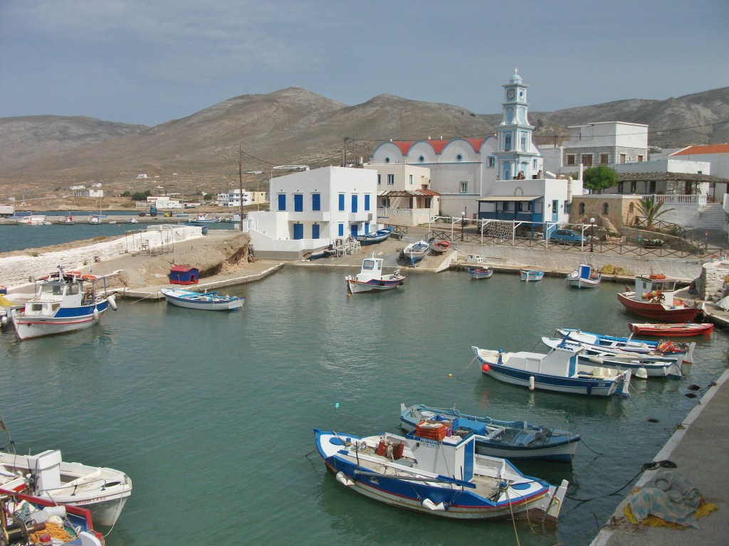
A more peaceful alternative to Pothia and the west coast is the deep, narrow inlet and valley of Vathy on the east coast, which has three or four buses a day from Pothia and is a popular stop for excursion boats. Usually described as fjord-like, the harbour at Vathy, which is also called Rina, is popular with yachts and has a good choice of tavernas, a few mini-markets and a limited range of accommodation. It’s something of a ghost town until excursion boats come in. Then every house seems to bring out tables selling local honey, aromatic herbs and/or sponges.
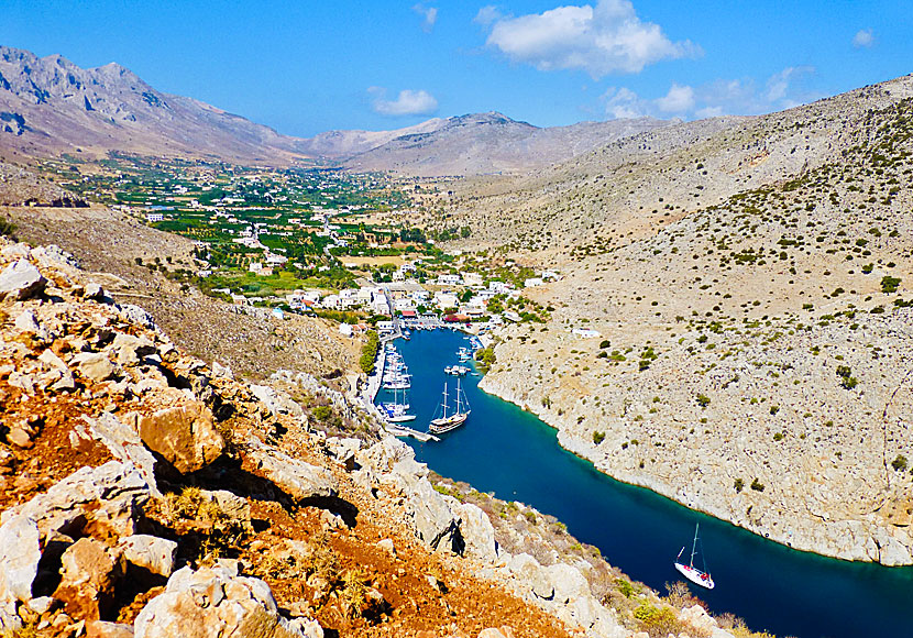
Rina, Vathy
There’s no beach at Rina, but a concrete bathing platform with ladders gives easy access into the sea. Some of the excursion boats continue onwards to remote beaches further up the east coast or to the sea cave at the mouth of the fjord, all of which are only accessible from the water.
From Rina, the fertile valley of Vathy stretches inland for about eight kilometres and offers peaceful walking through citrus groves and tiny hamlets with blue domed churches. There is a footpath back to Pothia that takes about two hours to walk but it can be hard to find – I couldn’t locate it.
Kalymnos offers a mix of experiences that will suit different people: the buzz and history of Pothia; the young active vibe of the west coast; and the peace and tranquillity of Vathy. Personally, in these days of my ageing dotage, I go for the latter.
Karpathos
First Visited in 1988. Most recently visited in 2017.
Wild and rugged. Divided in half by high mountains. A bit remote from the rest of the Dodecanese. Unique traditional village in the north. Excellent uncrowded beaches.

I have something of a chequered history with Karpathos. My first attempt to visit in the 1980s was stymied by a ferry captain deciding he couldn’t be bothered calling in at Halki in the middle of the night to pick me up. Oh, how I laughed – and then swore – as I watched the ship sail by at 3am.
When I finally did get there a few years later, my first visit coincided with a local strike that closed down public transport and most local businesses.
A subsequent trip brought with it the stormiest May weather seen in many a year, resulting in the cancellation of all excursion boats and most ferries. My most recent visit was curtailed by a national ferry strike that left me unexpectedly stranded on neighbouring Kasos. Consequently, my experiences of Karpathos have been somewhat brief and limited in their scope. I’m not sure if the island is trying to tell me something.
Pigadia
Pigadia, the island capital, is a town of modern apartment blocks rather than traditional whitewashed houses. However, it’s a friendly, relaxed place that combines the necessities of local day-to-day life with the demands of tourism. A spectacular but rather windy beach of soft sand stretches north from the town for about two miles and there is a wide choice of accommodation, eating places and shops.
Karpathos attracts a good amount of package holiday business from northern Europeans who fly direct into its international airport at the far south of the island – the only place flat enough to build a runway. This is a rather desolate area although the prevailing weather supports accommodation and facilities catering for windsurfers from all parts of the world. Amopi, between Pigadia and the airport, has another excellent beach but feels more like a purpose built tourist resort than an authentic village.
Amopi
Arkassa on the west coast is divided into two parts – a tourist resort at beach level and a more traditional village above it inland. Finiki, a couple of miles to the north is a tiny fishing village with a pretty setting close to a number of quiet beaches. It’s a good place to escape from the hustle and bustle of everyday life. The centre of the island has a string of attractive and prosperous looking mountain villages linked by a well surfaced circular road. They can all be easily visited on a day car or scooter trip from Pigadia. Aperi is probably the most attractive; Othos lays claim to being the highest village on the island. This area also has a good network of walking tracks.
Aperi
For reasons (or excuses) outlined above, to date I have not made it to the northern half of Karpathos, which for years was largely cut off from the rest of the island by high mountain ridges and best reached by boat.

Olymbos
Northern Karpathos houses the mountain village of Olymbos, once a must-see attraction of authentic traditional village life where the locals spoke a unique version of ancient Greek and the women wore traditional medieval dress. However, some people I have spoken to say it has now been largely spoiled by commercialism and cheap imported souvenirs. One guidebook describes it as having a “theme park feel” although it concedes that its setting on top of a high mountain ridge remains spectacular.
Diafani
Olymbos and its port of Diafani can now be reached by a paved road from the south. By all accounts it’s an exhilarating drive, but when I last visited the occasional buses from Pigadia hadn’t started running for the summer season.
The north reputedly has some excellent walking with waymarked trails and paths to remote valleys and beaches. Daily excursion boats run to Diafani from Pigadia – weather and demand permitting – and there are regular boat trips to remote beaches along the east coast.

Karpathos Transport
For me, Karpathos is something of an enigma. Parts of the southern coasts display the ravages of mass tourism, but the inland villages in the centre of the island are pretty much unspoiled and worthy of a visit. Someday I’ll maybe make it up to the north. God knows I’ve tried often enough.
Kasos
Visited in 2017
Rarely visited, very barren and a little shabby. However, it has a strong sense of place that I absolutely loved. A island with soul. To quote a cliche, Greece as it used to be.
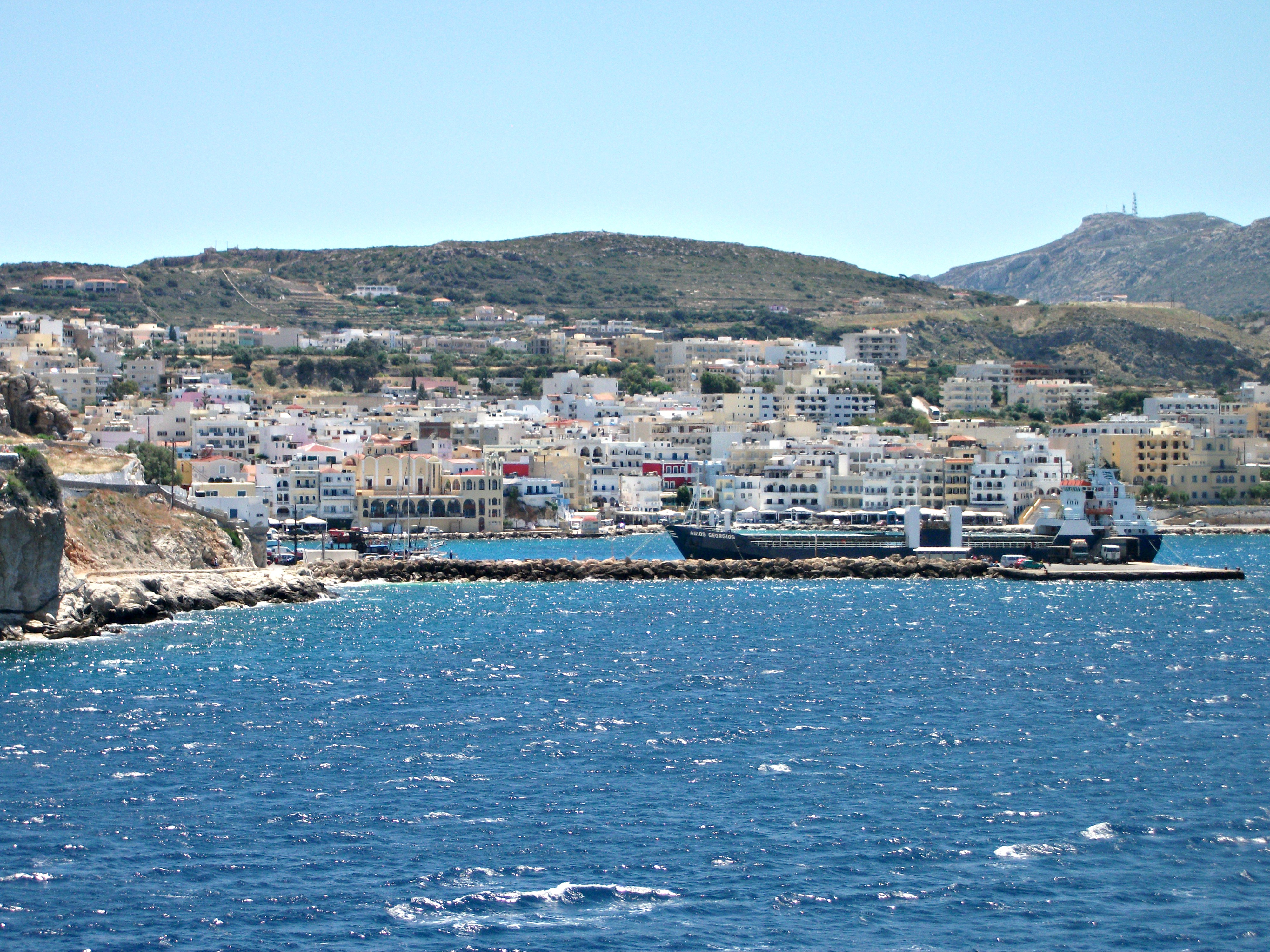
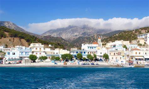
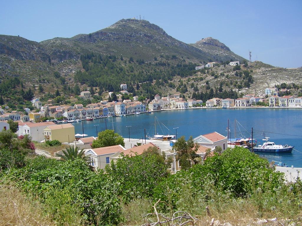
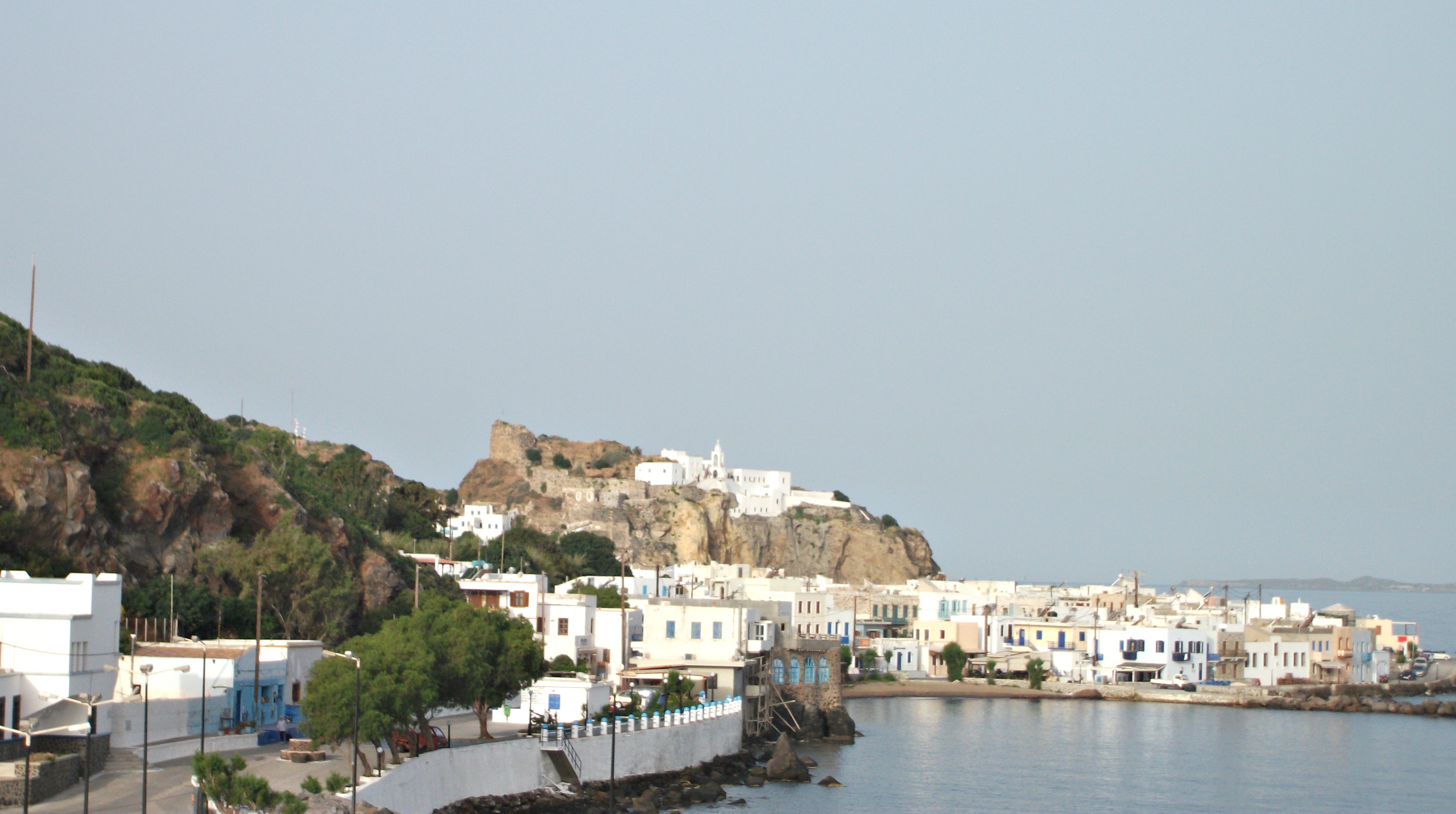
The most southerly of the Dodecanese, Kasos feels isolated and very remote from the rest of the world, near neighbour Karpathos excepted. It does have fairly regular flights from Crete and Rhodes, but a ferry journey from either can take up to 7 hours. Conversely, flights from Karpathos take only 6 minutes, making them the second shortest scheduled passenger flights in the world – allegedly.
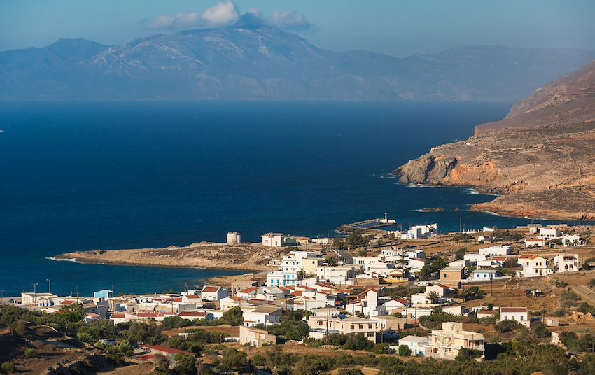
Fry (Karpathos in the background)
Whether you arrive by plane or ferry, your first port of call is likely to be Fry (pronounced Free), the island’s capital and its only coastal village. It is a ramshackle, rather neglected looking place that acts as an authentic introduction to Kasos, which is a strange but unexpectedly enticing little island.
With somewhat shabby villages, few beaches worth the effort of visiting, even fewer antiquities and a barren, almost lunar landscape, at first sight Kasos has little to offer the few visitors who make it there. However, what it does have in abundance is an almost tangible sense of place and local identity. Kasiots are like their landscape – tough and somewhat stoic, but they are incredibly friendly once you get to know them and immensely proud of their island and its history.
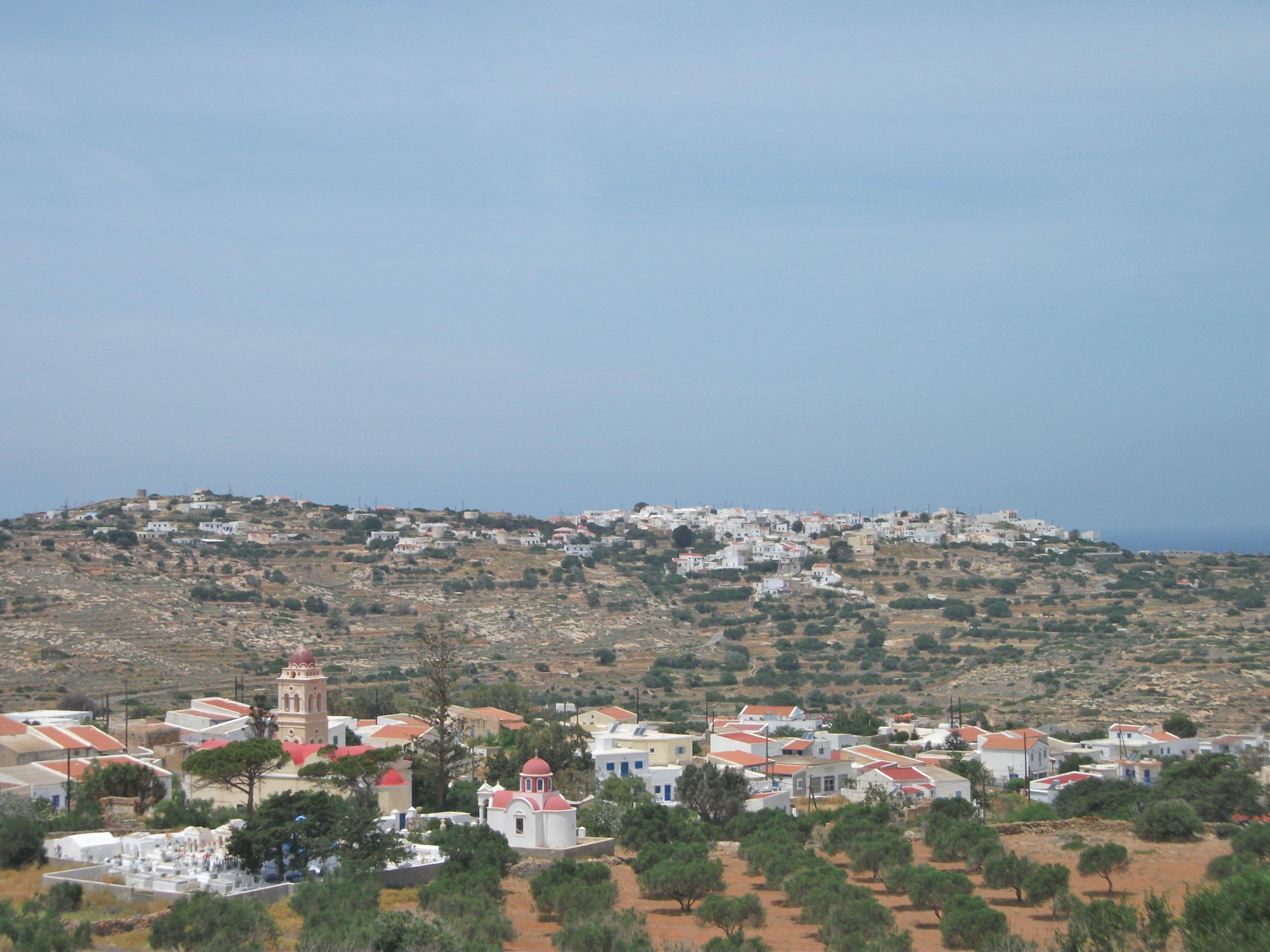
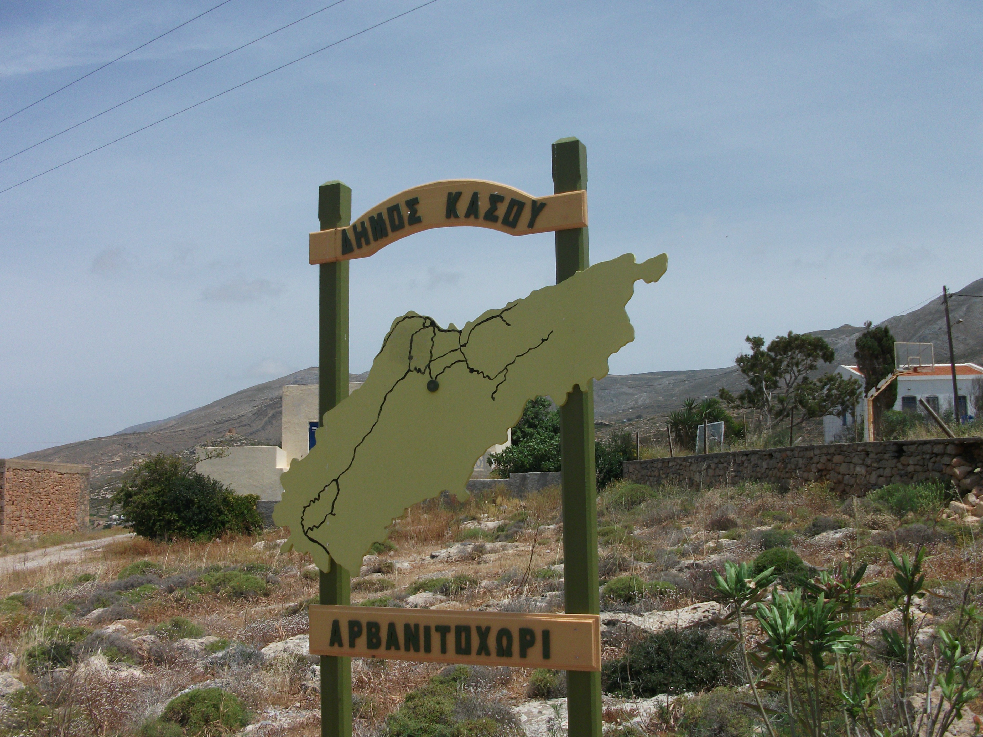
Arvanitohori (foreground) and Agia Marina
There are five villages on the island – Fry, Agia Marina, Arvanitohori, Poli and Panagia, which was once the island capital. The circular road linking Fry with the four inland villages provides three or four hours of enjoyable and comfortable walking on well paved surfaces.
Arvanitohori
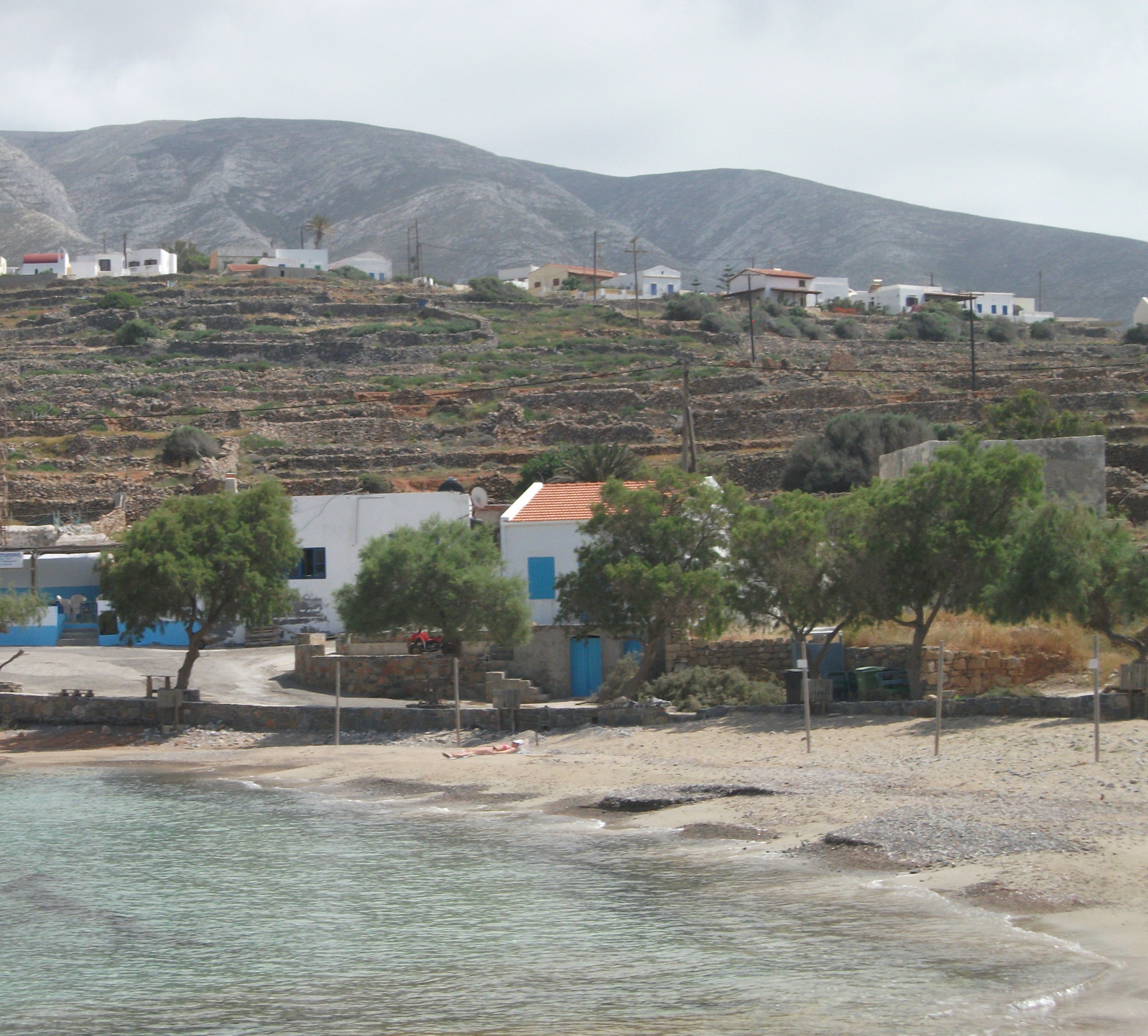
A separate road leads down the coast to the little chapel of Agios Konstantinos, passing another church and ruined basilica along the way. In the opposite direction it’s a short stroll from the centre of Fry to its coastal “suburb” of Emborio, which feels semi-derelict but has what is maybe the most popular beach on the island.
Emborio & Panagia
There is a further road down to a monastery and beach on the uninhabited south side of the island, but it’s about 25 km there and back and I was too lazy to tackle it. In peak season, the locally based passenger ferry that provides a regular link to Karpathos also runs excursions to the nearby islet of Armathia, which has some renowned sandy beaches but no residents.
Night time on Kasos is much the same as day time – quiet and relaxed. What little “action” there is mainly centres around the few tavernas and bars at Bouka, Fry’s little harbour for fishing boats.
I found myself temporarily stranded on Kasos due to Greek ferry workers calling a 48 hour strike. In the end, I was genuinely delighted to have been able to spend more time on the island than I had originally planned.
Kasos
Kasos is the kind of place that somehow gets under your skin. Some people will hate it, finding it too rough and primitive for their sensibilities. Personally, I can’t wait to go back. To use a cliché – it’s maybe about as close as you will get to the Greece of 40 years ago. Rough and ready but with loads of character and soul.
Kastellorizon
First Visited in 2000. Most recently visited in 2011.
The most easterly Greek island, closer to the Turkish mainland than the rest of Greece. Quiet and historic with a spectacular sea cave. Attracts regular day visitors from Turkey.
Isolated Kastellorizon is the most easterly outpost of Greece lying almost 70 nautical miles from Rhodes, but only 2 miles from the coast of Turkey. There are three or four ferries or hydrofoils from Rhodes most weeks. They take up to four hours each way. A daily flight from Rhodes takes just over half an hour. Day trip excursion boats from the Turkish resort of Kas make the 30 minute crossing on most days during the summer months.
Kastellorizon is actually a small group of islands of which only the largest, Megistri, is now permanently inhabited. In the early 20th century almost 10,000 people are said to have lived on the island. Now the population is down to around 300. Consequently there are a lot of empty buildings, many of them ruined as a result of an explosion in a munitions dump in World War 2 that damaged half of the island’s houses. Thankfully a number of them are now being renovated and brought back into use, mainly by expat Australians.

Megistri
Locals live in the main island village and its adjacent suburb of Mandraki. The main village has a colourful waterfront with tavernas that almost tumble into the sea, a few shops and a limited range of visitor accommodation. It also has a small local museum and is separated from the much quieter Mandraki by a ruined crusaders castle.
There are no beaches worthy of the name on Kastellorizon and most swimming is from bathing platforms around the deep bay on which the main village sits. The local waters seem to be a haven for sea urchins, so be careful.
The prime local excursion is a trip by inflatable rib to the Blue Grotto where a low gash in the face of a sea cliff gives access to a huge, translucent chamber within. Entrance and exit have to be judged carefully to coincide with troughs in the waves and, even then, it is necessary to lie flat on the bottom of the rib to make your entry. However, it’s worth any discomfort.
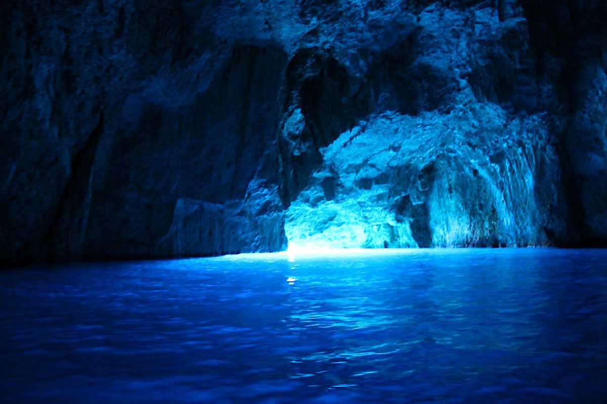
Blue Grotto
Less regular excursions go to the smaller island of Ro, resting place of the Lady of Ro, the island’s famous final resident who would hoist the Greek flag and loudly play the Greek national anthem every morning to annoy the Turks. Nowadays only a small garrison of Greek soldiers stay on the island, presumably to continue to annoy their near neighbours.
I’ve only visited Kastellorizon on a number of day trips from Turkey. You do appreciate the difference in atmosphere between Turkey and Greece as soon as you arrive and not always in favour of Kastellorizon. It can feel a bit shabby and lackadaisical after Kas where everyone is working very hard to make a buck. It is just about possible to day visit by hydrofoil from Rhodes about once a week, but most ferry services give you only 10 – 20 minutes on the island before returning.

Kastellorizon is escapism at its best. It can have a slightly other worldly atmosphere and the main local action is probably the odd tipsy visitor sliding off his taverna chair into the sea.
Kos
First Visited in 1979. Most recently visited in 2018.
Large with a lot of history, but many of its coastal resorts are spoiled by over development aimed at the low end of the tourism market. However, there are quieter exceptions.
The village of Kardamena on Kos is a prime example of tourism gone bad. A holiday brochure photograph of it largely inspired my first visit to Greece in 1979. Then it was a compact village whose first hotel had just been built and whose 2 mile beach of soft sand housed posses of northern European students under each of its trees. Days were spent lying in the sun and evenings revolved around chaotic tavernas and communal beach campfires where guitars and joints were passed round late into the night.
Kardamena
Nowadays Kardamena is an ugly and dusty sprawl of cheap accommodation and cheaper bars. Much of the beach has been decimated by obtrusive road building which has exposed rocks and reduced soft sand to grit. The emphasis is on noise, booze and casual sex. Avoid at all costs if seeking quiet relaxation.
Tingaki
Sadly, other parts of Kos suffer from the same over-development of low value package tourism. Tingaki and Marmari on the north coast are mini-Kardamenas. They have good beaches but very limited charm. The inland mountain village of Zia, which attracts busloads of visitors to view its sunsets, is more like a Far Eastern bazaar than anything Greek. Every souvenir seems to be made in China or Taiwan.
The capital, Kos Town, hasn’t experienced the same level of degradation, partly because it is big enough to absorb large visitor numbers. However, it has always struck me as something of a smaller version and poorer relation of Rhodes Town.

It has pretty similar ancient ruins; almost identical, but less impressive, medieval Crusader ramparts; stylish Italian era buildings; windy beaches filled with sunbeds; and a modern area full of noisy bars and night clubs. However, it is not without charm and its ancient ruins and its beaches are probably a bit superior to what you will find at Rhodes Town.
Asklepion
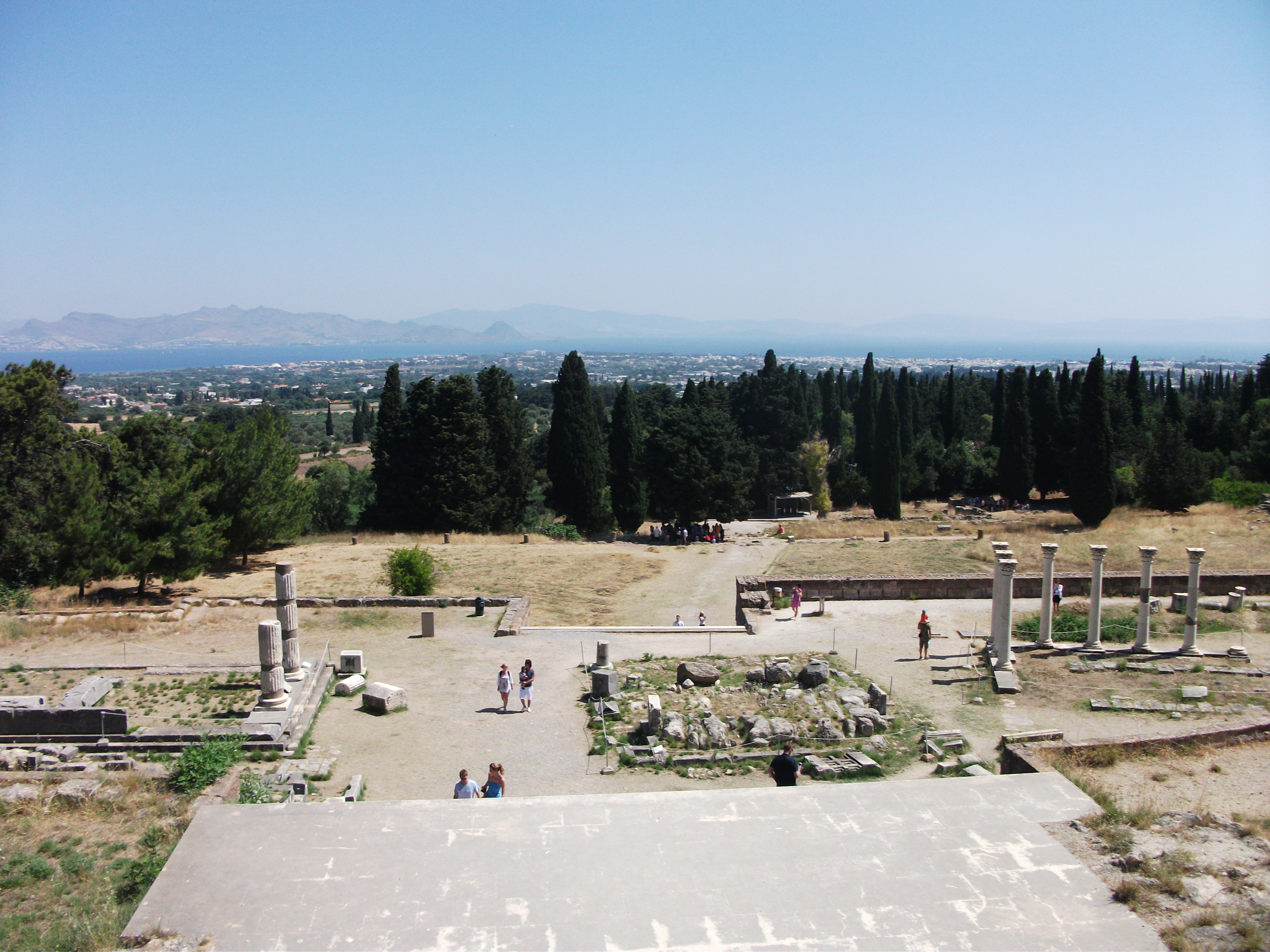
The main point of interest is the Asklepion, a classic Greek ruin a couple of miles out of town which claims to be the first medical school in the world. It was established to spread the work of Hippocrates, the father of modern medicine, who was born on the island. With magnificent views across to Turkey, it’s extensive enough to cope with the bus and car loads of tourists who visit it.
It’s not easy to find a total escape from the crowds on Kos, but Kamari, the beachside area of Kefalos in the far south west of the island, is large and scattered enough to provide some space to breathe. The huge beach and beautiful seascapes are the main attractions as the village itself is largely uninspiring. There are other quieter beaches nearby within a short drive. It’s still cheap package holiday country but with gentle relaxing rather than frantic boozing and shagging at its core.
On my most recent visits to Kos I have stayed in the north coast village of Mastichari, partly because it is the nearest village to the airport – handy when flights from Scotland generally arrive late at night. It has a local ferry service to Kalymnos and provides a good stepping stone for exploring the Northern Dodecanese.

Mastachari
It also still feels like a real village rather than a pop-up tourist resort. The wide sandy beach is well maintained, the visiting clientele tend to be more mature and the tavernas play soft background music rather than in-your-face banging beats or whatever. It’s more Dire Straits than Dr Dre. If that makes me sound like an old fogey, I’ll wear that badge with pride.
Leros
First Visited in 1979. Most recently visited in 2017.
Pretty island with a troubled history that has left some unique architecture. Beaches are unexceptional but the villages are attractive and friendly. One of my favourite islands.
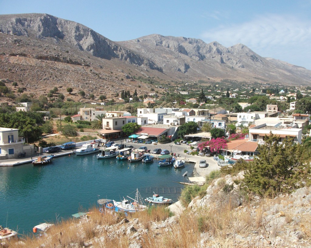
I visited Leros on my first trip to Greece back in 1979. Then it boasted Greece’s largest and most notorious psychiatric hospital and felt like a dark, creepy place full of the ghosts of World War 2.
The island’s traditional port of Lakki is like nowhere else in Greece. It lies on the largest natural harbour in the Eastern Aegean. When the Italians administered the Dodecanese between the wars, Mussolini began constructing a major naval base and a town for 7,000 people. more than the island’s current population. War put an end to his scheme but only after he had laid out broad boulevards and built a series of art-deco or rationalist style public buildings.
When I first visited Leros, Lakki was a sorry place that the locals were deliberately allowing to disintegrate to remove its fascist legacy. Since then, a change of attitude has seen many of the buildings restored and brought into new uses. As a consequence, Lakki is now a bright little port with a large and well used marina supporting a range of yachting and other visitor facilities.
Lakki
Thankfully, the psychiatric hospital, which was housed in the Italian naval base, is now closed. So visitors can no longer stumble upon lines of seriously disturbed and drugged patients shackled to each other at the ankles being marched along local roads accompanied by armed guards. The EU made its closure a condition of allowing Greece into membership.

Platanos
Elsewhere, the charming island capital of Platanos climbs up a ridge towards a large medieval crusaders castle. A series of renovated windmills that are lit up at night tumble down the ridge to the fishing harbour of Pandeli where the tables and chairs of tavernas and bars spill out over the beach and whispered conversations are carried on cooling evening breezes.
Pandeli
The road down to Pandeli still passes a disco (it’s term, not mine) where, in 1979, my mate and I were sort of adopted by a wild group of Irish nurses, partly as protection against the unwanted and over-amorous attentions of the local Greek lotharios. We subsequently went with them to Patmos (the nurses, that is, not the lotharios), but that’s another story.
In general, Leros’ beaches are fairly gritty and rather narrow as at Alinda, the main resort area just to the north of Platanos. Vromolithos to the south has a similarly gritty and narrow beach, but boasts what I would consider to be the best accommodation on the island – Tony’s Beach Hotel. I can’t recommend it highly enough.
Vromolithos
A circular paved road loops round the east and west coasts in the centre of the island and provides a pleasant half day’s walking. It takes in the moving Allied War Graves Cemetery at Krithoni and the German wartime command tunnel complex just outside Lakki, which is now promoted as a Tunnels Museum. A road south from Lakki stretches 5 kilometres to the beach at Xirocambos where there is some small scale tourism development and a regular caique to Myrties on Kalymnos.
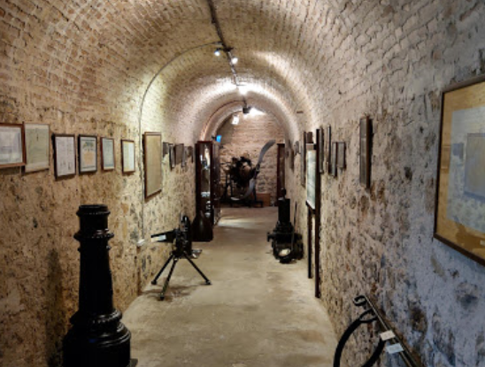
Lakki Tunnels Museum
To the north of Alinda another road heads to the rather isolated island airport which has regular flights to and from Athens. Nearby, an Italian era army base was used a political prison during the time of the Colonels in the late sixties and early seventies. A chapel displays murals painted by the prisoners.

Xirocambos
Leros had a chequered history in the 20th century. It is now putting that behind it, but remains distinctive and different from most other islands. It’s one of my favourite places in Greece.
Lipsi
First Visited in 2002. Most recently visited in 2017.
Known as Calypso’s Island and famed for the beauty of its women. A picture postcard main village and an extremely relaxed atmosphere. Big on environmental protection.
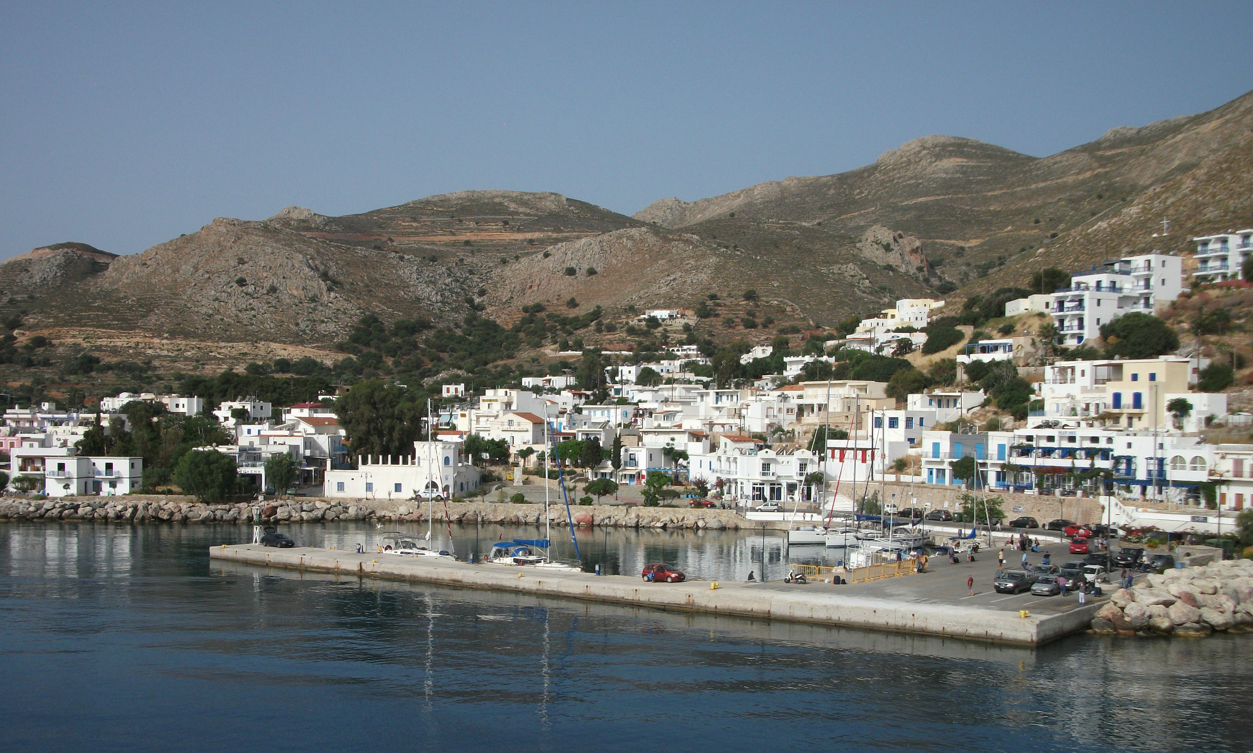
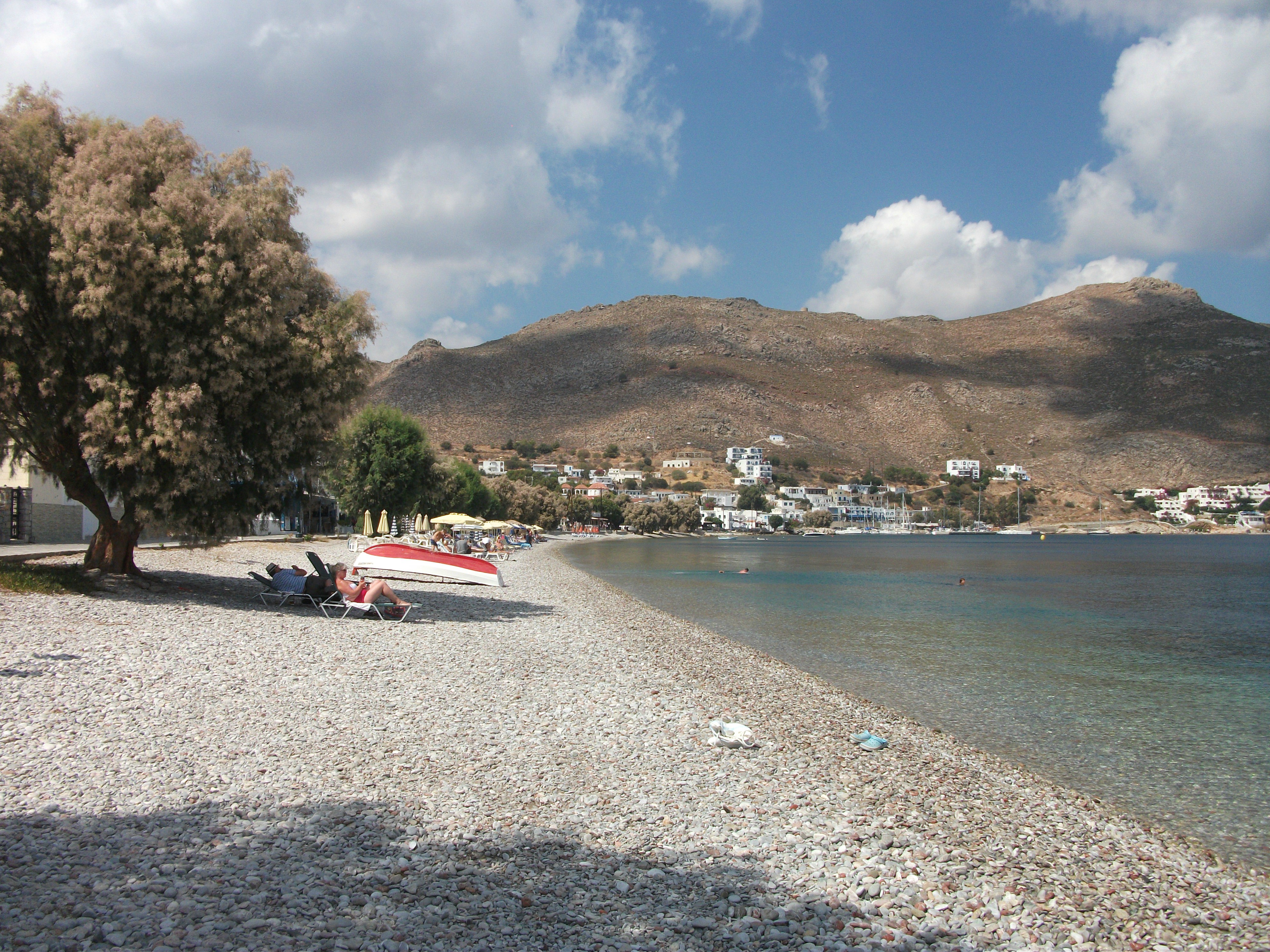
Lipsi is pretty damn near the perfect small Greek island, with a charming traditional village on a deep bay with turquoise water; attractive beaches; and good walking along paved roads and well surfaced paths. It’s also on a number of main ferry routes giving plenty of options to come and go.
Known as Calypso’s Island and allegedly famed for the beauty of its women, most of the 700 or so residents live in or around the main village which spreads out along the shore from a classic centre of tightly packed white washed houses interspersed with shops and tavernas. There’s a good choice of comfortable places to stay, eat and make merry. You’ve got to love a place that has an official street name sign for Ouzo Corner.
Hohlakoura Beach
Away from the village the island is fairly flat and criss-crossed by roads and paths, some of which lead to deserted sand and pebble beaches while others, rather annoyingly, lead to nowhere in particular and just stop when they get there. There’s little in the way of sites of antiquity, but the countryside is dotted with blue domed churches and well maintained farms. There is a wine trail you can follow round local vineyards and it was encouraging to stumble across hi-tech recycling facilities in the middle of nowhere and to see signs advertising local organic produce.
When I last visited, there was quite a lot of building work going on in some parts of the island, mainly small scale villa developments no doubt aimed at foreign markets. “A lot of building work” is maybe a misnomer. There were a lot of partially completed buildings often with one or two workmen nearby having lunch or a siesta. Lipsi is one of those places where you can’t imagine construction, or anything else, happening quickly.
Lipsi
When it does come time to leave, be aware that different ferries come and go at different quays on opposite sides of the main bay and may change their embarkation point without much advance notice depending on sea conditions. As the ferries tend not to hang around, I imagine a few people have been caught out and have seen their vessel leave while they are still hurrying round from the other quay. That could mean an unscheduled extra night on the island. Not a major trauma unless you have a flight to catch.
Marathi
Visited in 2017
A tiny dot of an island with three tavernas on its only beach. Popular with day visitors from Patmos looking for somewhere with space to stretch out.
Marathi is a 10 minute ferry ride from its larger neighbour, Arki. Alternatively, it is just over an hour from both Patmos and Lipsi by local ferry or excursion boat. Depending on which reference source you believe, it has a population of somewhere between 3 and 10 permanent residents.
The main attraction of Marathi is its beach, a long curve of soft, golden sand with good shade and excellent swimming. This beach is served by three tavernas, two of which also offer rooms. One of them is quite famous locally for its somewhat eccentric and characterful (i.e. certifiably mad) owner. Look for the taverna with the St Pauli pirate’s flag flying above it.
Marathi Abandoned Village
Aside from the tavernas, there are a few holiday homes overlooking the beach, a small hotel and an abandoned village with 3 or 4 crumbling houses and a small church. It is accessed via a rough track that leads on to the top of the island from where there are spectacular views across to its neighbours. You can walk from one end of the island to the other in about 20 – 25 minutes. It’s that small.
Marathi is a popular lunch and swimming stop for excursion boats operating out of both Patmos and Lipsi. I visited on a day at the end of the season when I basically had the place to myself until a group of Brits and Scandinavians arrived for lunch on a private charter power boat. Even their rather loud conversations about each other’s sexual indiscretions couldn’t spoil the peaceful ambience.

Marathi
Marathi is perfect for a chill out day trip where you can work up a bit of a sweat walking up to the abandoned village and then soak it off in a warm, still sea before browning on a perfect beach. Next time I may well stay over for a couple of nights to switch off completely.
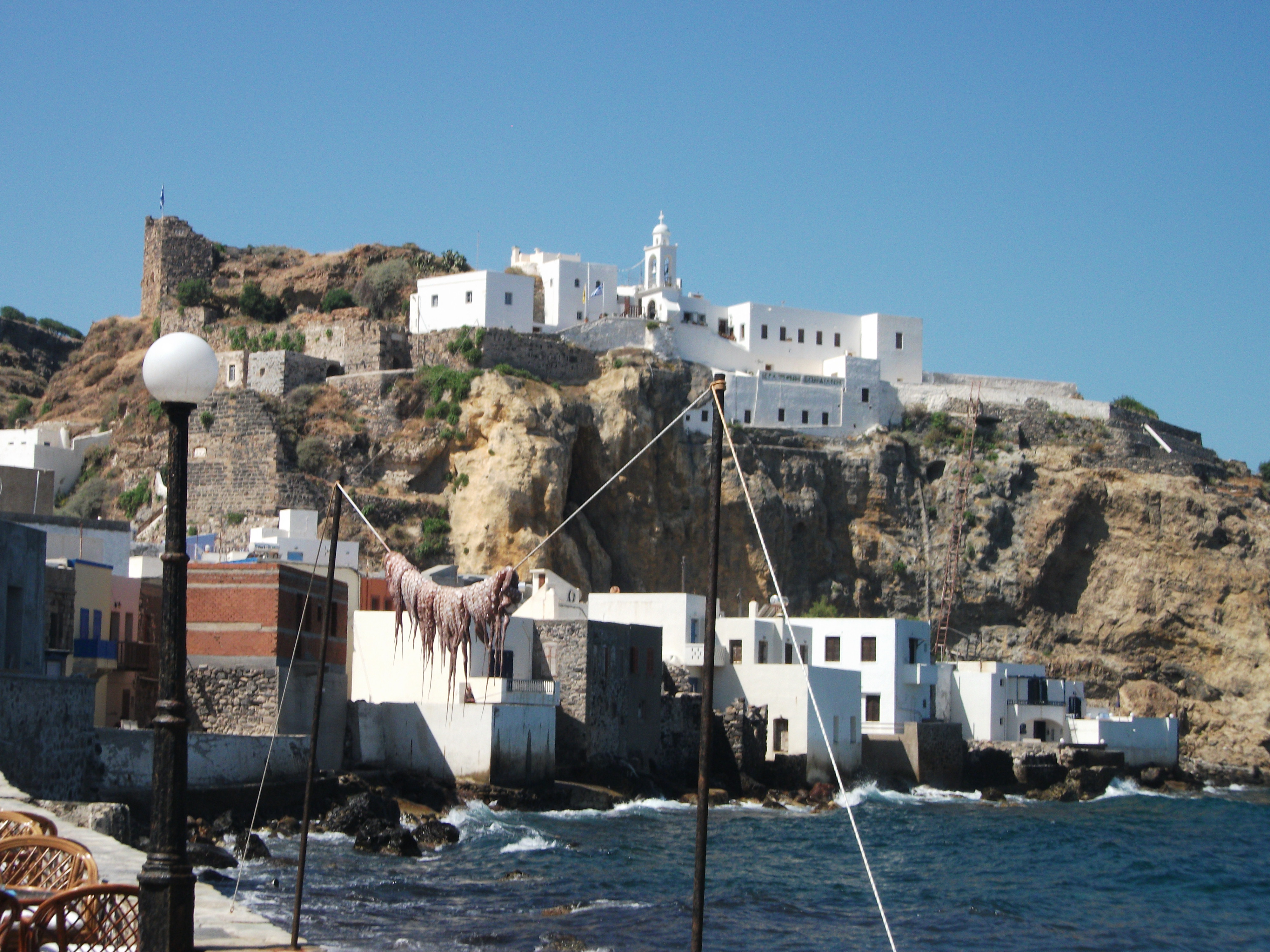
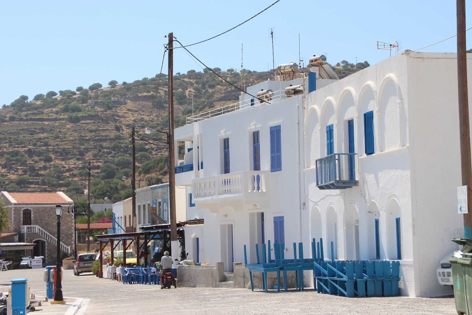
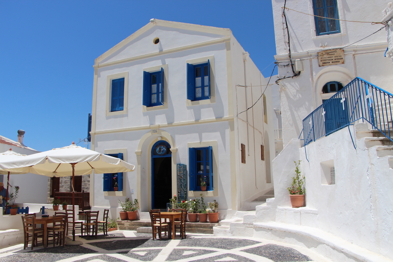
Nisyros
Visited in 2015.
Basically the top of a volcano sticking out of the sea. Has the world’s second largest active volcanic crater and three sleepy villages. Popular day visit excursion from Kos.

Barren little Nisyros lays claim to having the world’s second largest active volcanic crater, an attraction that draws both overnight visitors and day trippers from neighbouring Kos.
Ferries and excursion boats approaching the island pass the nearby islet of Yiali which is gradually being eaten away by a huge industrial pumice quarry that provides a large annual income for the 1,000 or so residents of Nisyros.
Tour buses run from the port of Mandraki to the volcanic crater which you tend to smell before you see it. The stench of sulphur hangs in the air and the main crater has a warm, crusty surface with lots of blowholes constantly puffing out jets of steam. There are also some boiling mud springs around the perimeter.
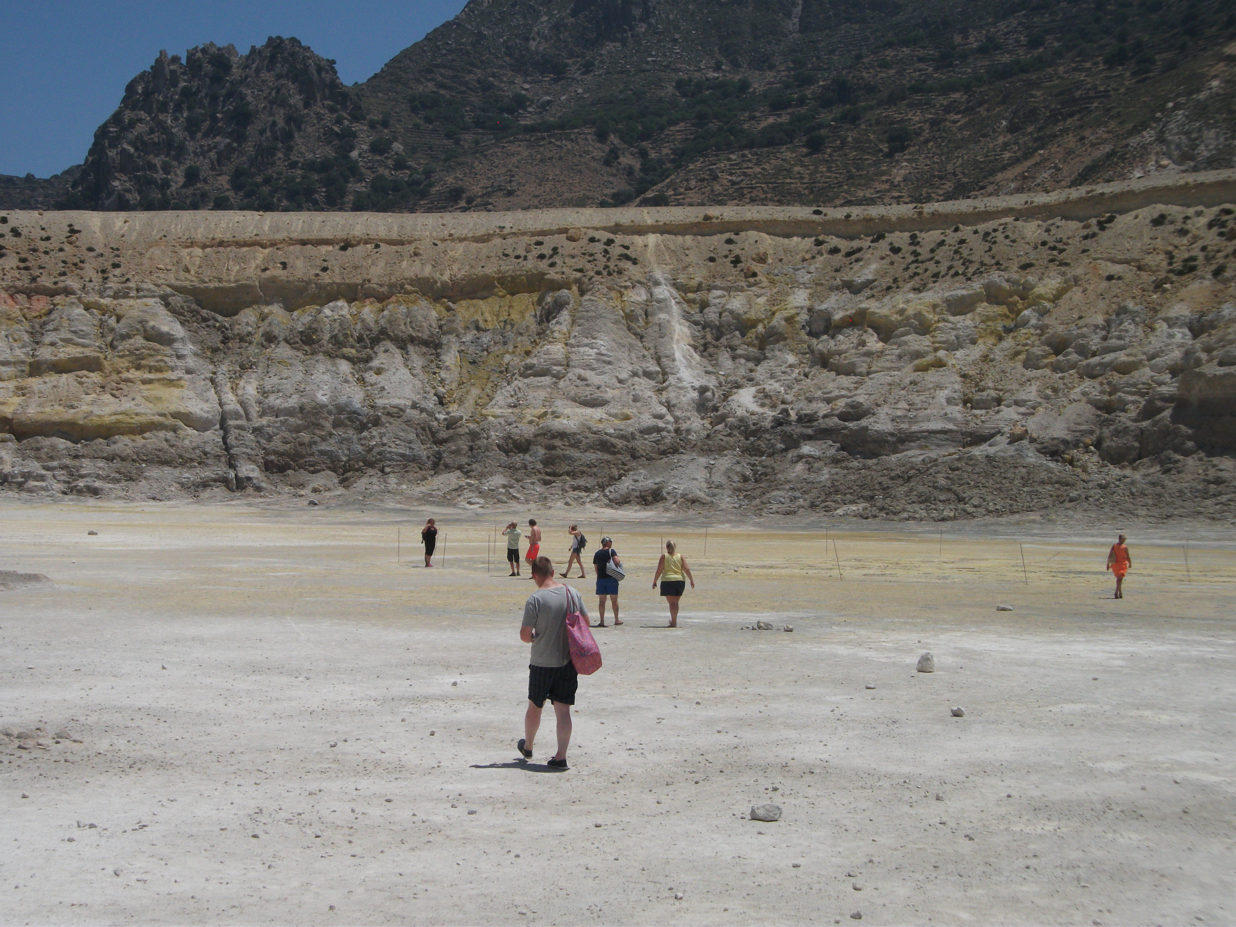
The Volcano
Visitors are free to walk around apart from a few cordoned off areas where the ground is liable to collapse. The whole place looks a bit like one of those sets of a strange and desolate planet that you see in Doctor Who. There is a little interpretive centre by the car park to explain more of what you are experiencing. There’s also a café serving much needed cool drinks.
Mandraki
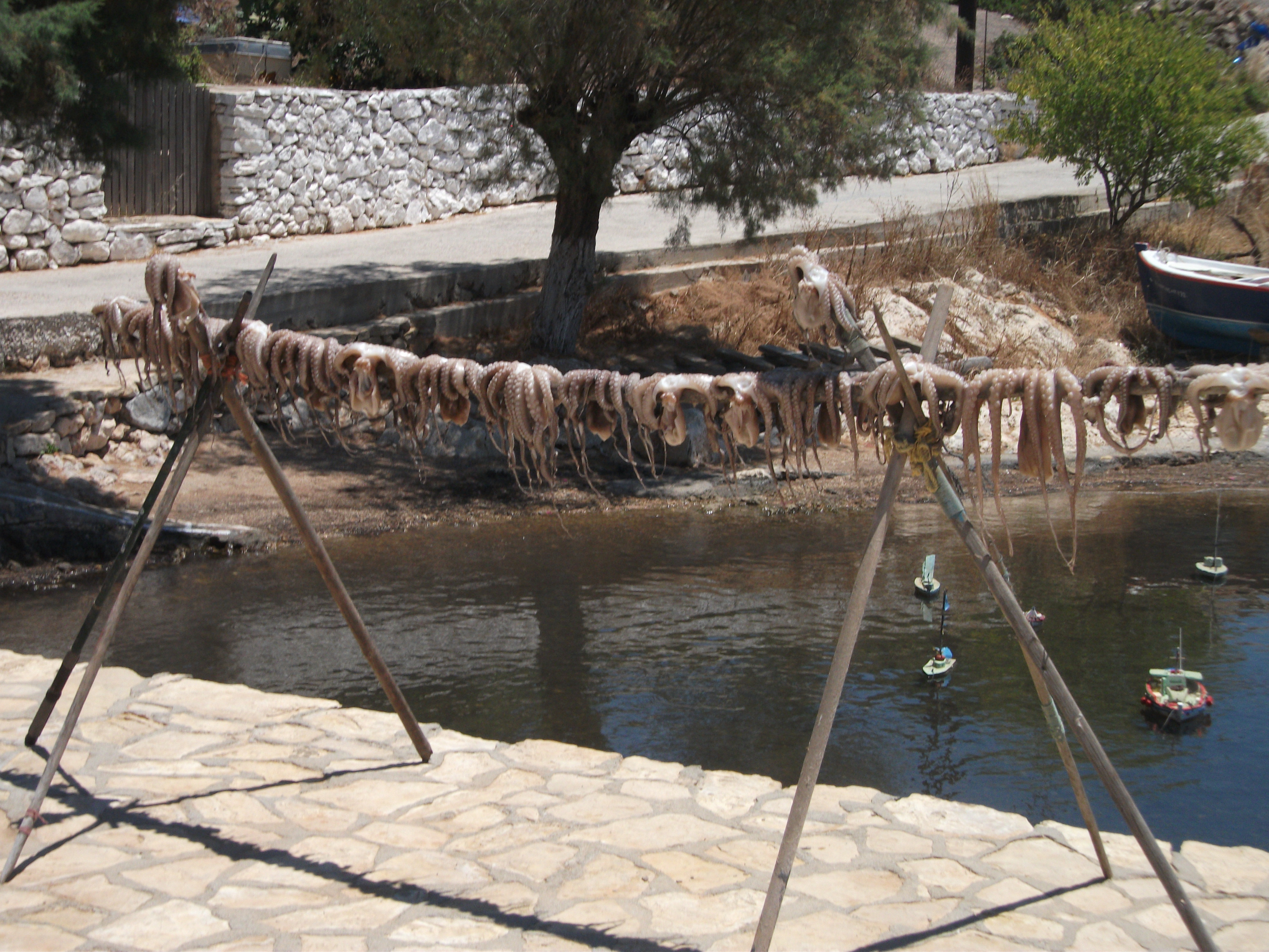
Away from the crater, Mandraki is an attractive and welcoming little village leading up to a ruined crusaders castle and a small monastery. It’s the kind of place where the tables of tavernas spill out on to the streets and freshly caught octopus hangs drying on lines. The area around the ferry quay has its share of tacky souvenir stalls for the day trippers – “get your genuine volcanic lava necklaces here” – but they can soon be left behind.
Mandraki
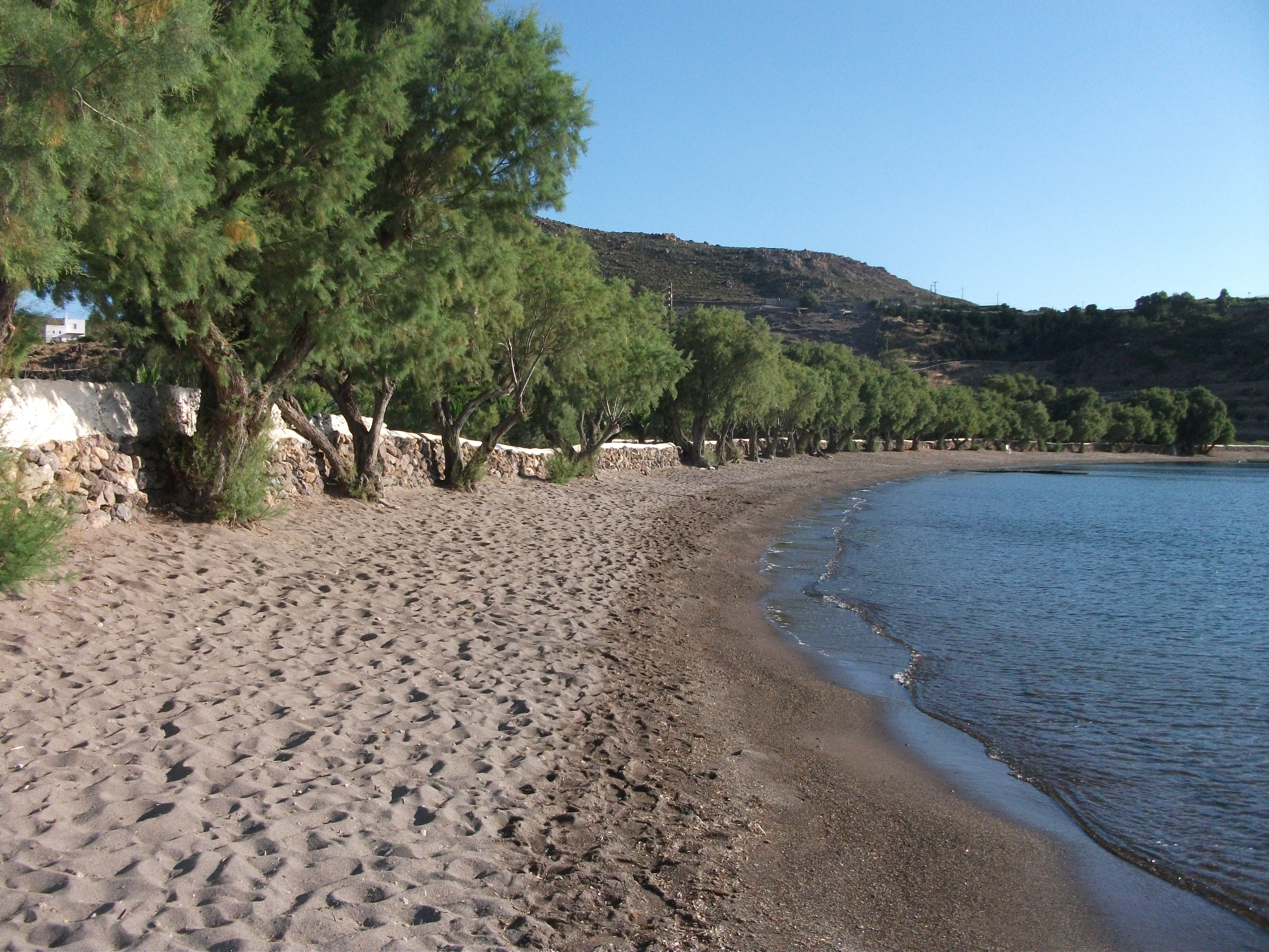
A good paved road meanders east along the coast to the smaller and quieter fishing village of Pali before heading inland to the crater. Pali has a few tavernas and a couple of accommodation outlets. The island’s best beaches are nearby. Most are of volcanic sand which can be very hot underfoot.
Pali
The inland road continues past the crater to the island’s third village of Nikia, which is perched on the lip of the volcano and gives spectacular views south across the sea to Tilos. There is a good network of walking paths and tracks on Nisyros which act as a rougher but quieter alternative to the paved road. It’s an enjoyable two hour walk from the crater back to Mandraki.
Nikia
Nisyros is another of those islands that changes in the evening once the day trippers have departed. Mandraki has a good range of lively but unobtrusive tavernas and bars that are used by locals as much as overnight visitors. However, remember you are staying on an active volcano, even if it has been sleeping for quite some time. Don’t disturb it too much.
Patmos
First Visited in 1979. Most recently visited in 2017.
One of Greece’s most important religious sites, but also has lots for non believers to see and do. In many ways, a perfect introduction to small Greek island life.

In the 1st century AD, St John, the last surviving apostle, was exiled to Patmos where he lived in a cave and recorded his visions in the Book of Revelation, in which he depicted the Day of Judgement and the end of the world. Unwittingly he established Patmos as one of the main sites of religious pilgrimage in Greece.
His cave and the large monastery on top of the island’s Chora now attract monks, nuns and worshippers from all over the world, as well as merely curious cruise ship passengers and other visitors. I know of no other island where you can follow road signs to the “Cave of the Apocalypse”.

Cave of the Apocalypse
Religion aside, Patmos is an attractive island of deep indented bays. The port of Skala is a busy and cheerful village that spreads out across the narrowest part of the island. With its clusters of shops, tavernas and bars, and a wide choice of accommodation, it is the most popular place to stay. The main village beach is on the east coast of the island, a short walk from the ferry terminal. It is adequate rather than spectacular. The west coast alternative of Hokhlakas is pebbly and stony but offers spectacular sunsets.

Chora
Excursion coaches and scheduled buses plough the 4km uphill to the Chora throughout the day and into the early evening. There are wonderful views looking over Skala and the north of the island, but the village can be crowded during daylight. However, at night it descends into a much gentler atmosphere of secret corners and shadowy lanes that hide some of the best restaurants on the island. Be warned, buses stop at around 8pm outside the main season and it can be a lengthy and sometimes dangerous walk back down to Skala on the main road if you can’t find a taxi.
Meloi
To the north of Skala, it’s a short walk to the attractive and shaded sandy beach at Meloi, which also has the island’s main campsite. It’s a bit longer to the larger and more developed strand at Agriolivadi. The road north continues to the hilltop village of Kambos whose beach below it is possibly the most popular on the island. Other highly rated beaches in the north include tamarisk shaded Livadi Yeranou and the multi coloured pebbles of Lambi, which are nice to look at but not that comfortable to lie on.

Grikos
To the south of Skala buses run to Grikos, a pretty little resort village on a reasonable beach that is the main package tourism venue on the island. From here, another road swings uphill to Chora giving an attractive and relaxing circular walk that takes 2½ – 3 hours. The concluding section back down to Skala can be shortened by following the old traditional footpath that cuts off the hairpin bends of the main road. However, this path is largely unlit and not recommended at night unless you have a good torch and stout shoes.

Grikos
In some ways, Patmos is the perfect Greek island. There are interesting places to visit and things to see; a choice of good beaches; attractive countryside; enjoyable walking; and enough nightlife to entertain without swamping the traditional island atmosphere. It’s also a good base for day trips to nearby islands in both the Dodecanese and the North East Aegean. All in all, well worth a visit, irrespective of your religious beliefs.
Pserimos
Visited in 2015.
A tiny, one village island between Kos and Kalymnos. Most visitors are day trippers on short stay excursions from its two larger neighbours. Beaches are its main attraction.
Pserimos is a small island located roughly halfway between Kos and Kalymnos. It has one village called Avlakia and a year round population of just under 30. It’s a popular 1 – 2 hour stop on “three island” excursion boat trips from both of its larger neighbours, but also has a regular local ferry service on the Nissos Pserimos, which operates out of Pothia on Kalymnos.
The main attraction for day trippers is the wide soft sand beach at the village and the tavernas that back on to it. The beach is large enough to provide lounging space for visitors from a fair number of excursion boats at the same time. Once these boats leave the atmosphere completely changes. There are a few places to stay, so the island does get some limited degree of overnight business.
Avlakia
I visited Pserimos for the day on the local ferry. I first followed the track across the island to the beach at Vathy, which was pebbly and rather strewn with debris thrown overboard from passing boats. Returning to the village, a local taverna owner pointed me on to the track to Grafiotissa, a fairly rough, half hour walk to a long, mostly sandy beach backed by gradually eroding, low sandstone cliffs. I had Grafiotissa all to myself and enjoyed an hour or so of skinny dipping and all over tanning.
Grafiotissa
Back in Avlakia, grilled prawns were on the menu for a late lunch on the beach before the ferry took me back to Kalymnos, some six hours after I had arrived.
Pserimos is an enjoyable day trip from Kos or Kalymnos. It’s a pretty little island with an attractive village and a couple of good beaches. I’d recommend using the local ferry if you want to avoid the excursion boat crowds and have a bit more time on the island. However, even when the excursion boats are in you can still escape to quiet parts where, like me, you might be lucky enough to find your own deserted beach.
Rhodes
First Visited in 1979. Most recently visited in 2017.
One of the most popular holiday islands in Greece. Large with an unmissable medieval main town, a “Greek Pompeii” and numerous beach resorts. Truly has something for everyone.
Rhodes is the largest island and busiest tourist destination in the Dodecanese. In any peak peak season day, it’s airport normally accommodates numerous flights from throughout northern Europe, as well as several flights to and from Athens and other major Greek islands. International flights can arrive and depart at all hours of the day and night. something to bear in mind if thinking about booking accommodation close to the airport. Don’t count on getting too much undisturbed sleep!
The airport is a short and relatively inexpensive bus or taxi ride from Rhodes Town on the northern tip of the island. This is by far the largest town on Rhodes and a must-visit destination, despite the vast number of visitors it attracts.

Rhodes Old Town, Palace of the Grand Masters
The medieval Old Town in a magnificent walled city full of spectacular buildings that were built by and once housed crusader knights. Some of the main buildings were spruced up by Mussolini in the 1930s, but that doesn’t detract from the tangibly historic atmosphere. You could spend days exploring quiet little lanes, mighty ramparts and secret churches and museums. A real journey through time in every sense.
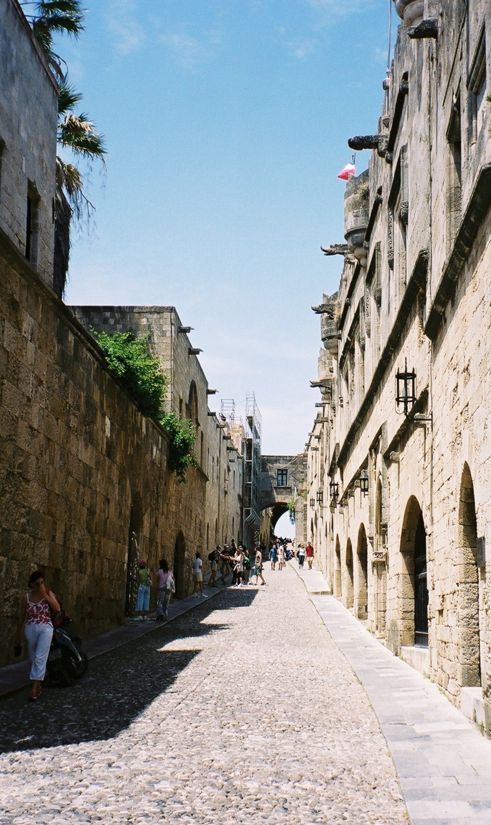
Rhodes Old Town, The Street of the Knights
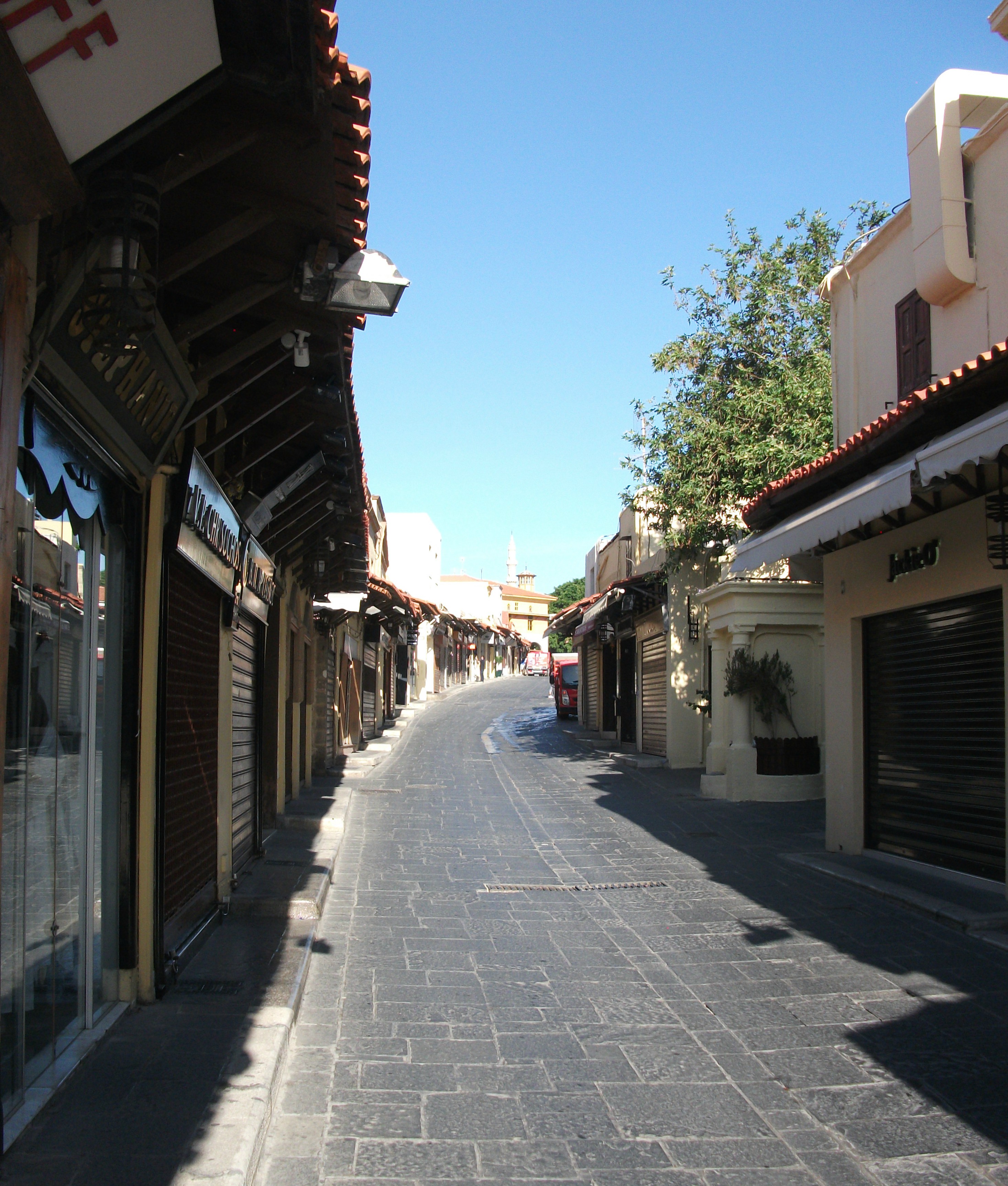
The busy, pedestrianised main streets of the Old Town are a huge and sometimes frenetic bazaar of shops, bars and restaurants. The busiest bars are great for people watching but, as a rough guide, the best food (and service) is usually found in quieter back streets where there is also a good choice of upmarket boutique accommodation. It’s advisable to book accommodation in advance, particularly in peak season.
Rhodes Old Town, Early Morning
The adjacent, and larger, New Town has the bulk of visitor accommodation, mostly in nondescript modern buildings that are intermingled with some attractive inter-war Italianate architecture. This is a lively and often noisy area, especially at night when bars and clubs pump out loud music well into the small hours of the morning.
Mandraki Harbour and the New Market are picturesque dining and drinking spots on the edge of the New Town, but some of their tavernas are rather polluted by car fumes. However, this is where you’ll find both the daily excursion boats that head off to all parts of the island and its near neighbours, and the main bus station which has an extensive network of services throughout the island.
The main departure point for the numerous inter island ferry and hydrofoil services that leave from Rhodes is located some distance away on the opposite side of the Old Town. It’s about a 25 – 30 minute walk from Mandraki.
The wide, shingly and usually windy town beach stretches down the west coast for about 15km to the airport and beyond. The coastal villages closest to Rhodes Town – such as Ixia and Trianda – have been pretty much gobbled up by large, four star hotel developments which thin out the further south you go.

Kremasti Wartime Bunker
Things get a lot quieter after the more attractive village of Kremasti and the airport. If you explore the pebbly beaches around here, you may stumble across WW2 defensive bunkers built by the occupying Germans. Some of them still have graffiti and messages that homesick soldiers carved into their inner walls, many of them not particularly complimentary of Hitler and his associates. However, be careful clambering over any bunkers. They are not maintained or conserved in any way and many are falling into severe disrepair.

Kamiros
It’s worth continuing down this west coast road to the extensive ruins of ancient Kamiros, which is sometimes described as Greece’s Pompeii. Kamiros is not on the same vast scale as its Italian equivalent, but is still an interesting and rewarding visit. Regular buses run there from Rhodes Town, with some going in to sleepy Skala Kamiros, a coastal hamlet with daily peak season ferries to the small nearby island of Halki. Further south the mountain scenery and coastal views around the village of Monolithos are also worthy of a visit.
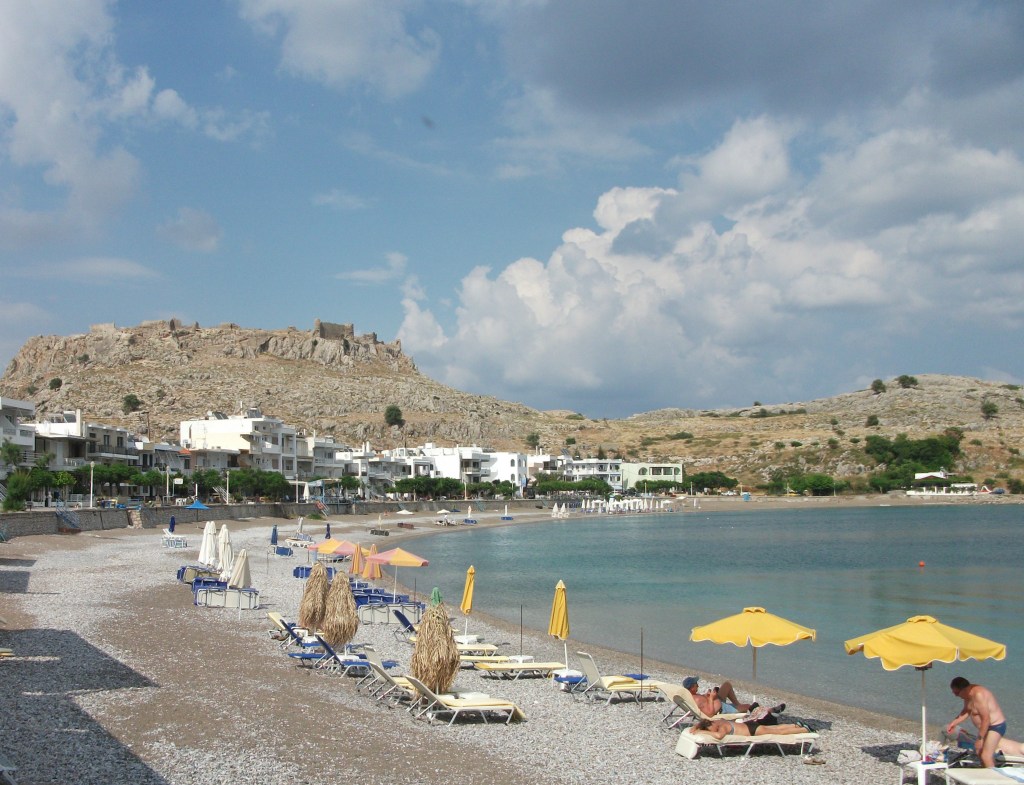
The more sheltered east coast of the island starts with the soulless package hotels of Kallithea and the notorious, tacky booze resort of Faliraki, after which there are a series of sandy bays, which are much favoured by excursion boats from Rhodes Town. There are also some pretty inland villages like Arhangelos before calendar favourite Lindos, where a vast ruined acropolis and crusaders castle overlooks two bays and a stunningly beautiful village of traditional whitewashed houses.
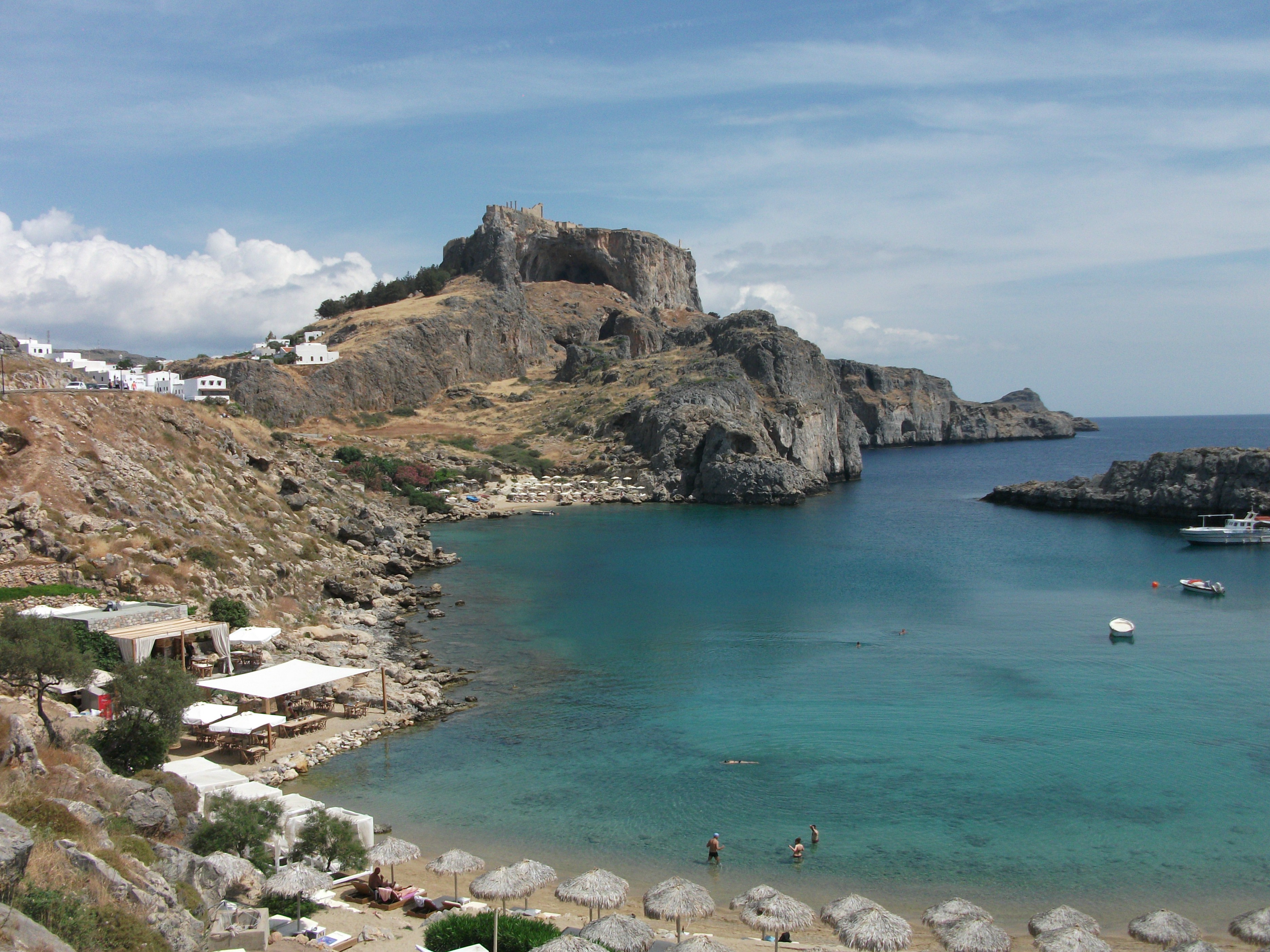
Lindos, Acropolis & St Paul’s Bay
Lindos has conservation restrictions on building and traffic, but that hasn’t prevented its own version of urban sprawl with undistinguished studios and apartments spreading out from the edges of the village. It can be unpleasantly crowded during the day when dozens of tour coaches and excursion boats disgorge crowds of day trippers into its narrow lanes and alleys. Evenings are a bit quieter, but still far from sedate.
In 1979, I wild camped on the beach at Lindos’ St Pauls Bay for almost two weeks and was largely undisturbed, except by feral cats. Nowadays you can’t see the sand on the beach for forests of sunbeds and can’t hear the sea for the noise from the new beachfront tavernas. Nonetheless, it is still a spectacular setting with views up to the acropolis.
Pefkos
South of Lindos and the featureless, but popular, beach resort of Pefkos, the east coast stretches down past the more traditional villages of Lardos and Gennadi, which have some low key tourism development. This part pf Rhodes suffered from extensive wild fires in 2023, which necessitated the emergency evacuation of tourists and locals. It is likely to be some considerable time before the landscape and some of villages regain their previous charm.

Prassonissi
The east coast road ends at the huge, open beach at Prassonissi with its windsurfing schools and scattering of tavernas with rooms to let. By now, you are almost 100 km from Rhodes Town. Buses do come down this far, but they are very irregular. Car or motorbike hire is advisable if you want to explore these southern reaches.
When I visit the island, as I do fairly regularly, I tend to split my time between Rhodes Town and the low-key and relaxed east coast village of Haraki, some 10km or so north of Lindos.
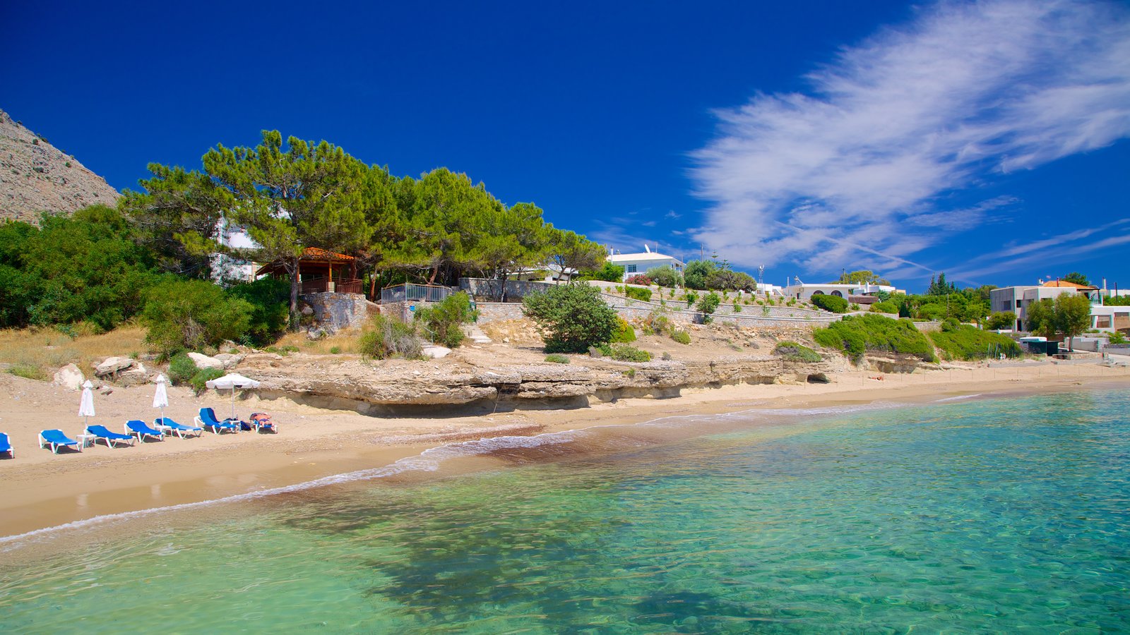
Haraki has two or three streets spread round a wide bay overlooked by yet another ruined crusaders castle. The sand and pebble village beach is okay for sunbathing, but a much better option lies a 20 minute walk away at Agathi, where the soft sands and shallow sea are served by three seasonal cantinas.
Agathi Beach
Like Lindos, I first discovered Haraki in 1979. My first ever attempt to drive a motorbike ended abruptly when I fell off there. The village has grown a bit since then but, unlike Lindos, it hasn’t been completely engulfed by day trip and package holiday tourism.
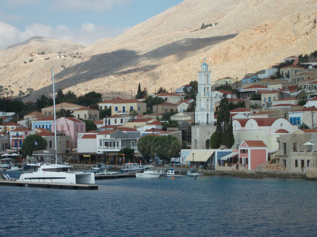
Symi
First Visited in 2004. Most recently visited in 2017.
Small, rocky and popular with British visitors, many of whom come on day trips from nearby Rhodes. Busy when the excursion boats are in. Much quieter and relaxed when they leave.
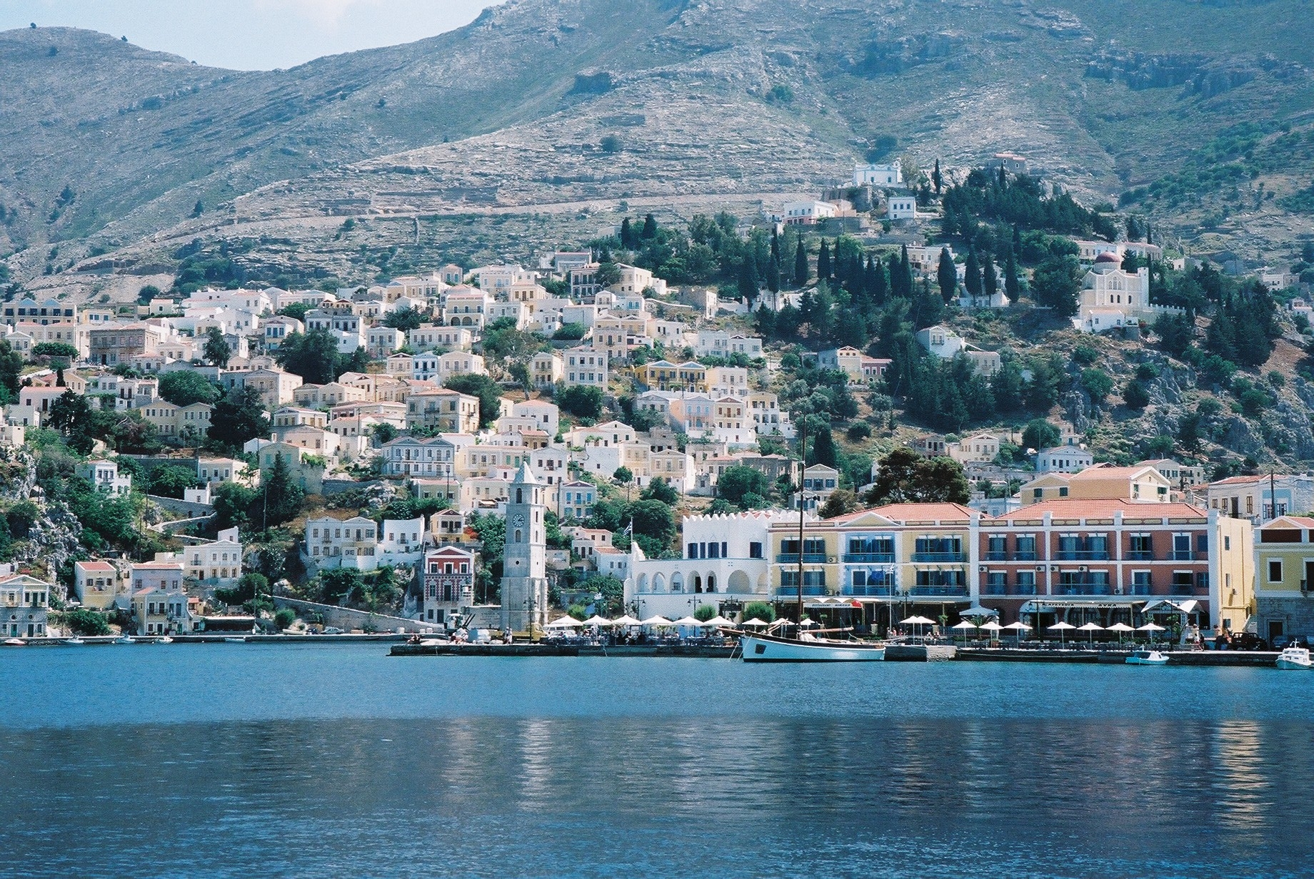
Symi is perhaps best known as a day trip destination from Rhodes, which is about an hour away by hydrofoil. However, it also has an extensive choice of accommodation to cater for large numbers of overnight visitors at all price points.
The view as you sail into the deep harbour of Yialos is one of the prettiest in Greece as colourful houses spread out from the waterfront up the hill to the Chora. The port and the Chora are linked by two impressive pedestrian stairways carved into the rock with houses on each side. There is also a road on which the local community bus runs a regular service that continues on to the somewhat nondescript beach resort of Pedi with its hotel, rooms to let and handful of tavernas.
Yialos
Beaches are not Symi’s strong point. There are plenty to choose from but they tend to be small, cramped and stony. The best sand can be found at Agios Nikolaos, a 30 minute walk along a rough path from Pedi. It has a taverna and shady tamarisk trees. There are other largely mediocre beaches like Nos and Nimborio within comfortable walking distance of Yialos and some more remote ones that are visited on round-island boat trips.

Agios Nikolaos
Several excursion boats a day arrive in Yialos from Rhodes during peak season, many having stopped first at the large Panormitis monastery in the south of the island. Day trips that offer meaningful time for independent exploration can also be made on the regular Dodecanese Seaways hydrofoils and ferries.

Panormitis Monastery
Yialos can seem rather frenetic when the excursion boats are in and many local shops and tavernas aim for low value, quick turnaround sales rather than offering any genuine quality. The day trippers generally leave around 4pm and Symi sinks back into a gentler, more relaxed frame of mind. There is a sizeable British expat community on the island, some of whom lead regular organised walks into the attractive countryside often visiting local artists and craft workers along the way.

Yialos – Chora Staircase
With significant numbers of overnight visitors, Yialos can still be quite lively in the evening with a wide choice of bars and restaurants. However, little is too much in your face. The cooler alleyways of the Chora and its more atmospheric restaurants offer a much quieter alternative.
Symi is popular for package holidays, many of which combine a week there with a week on Rhodes. It is pretty and relaxing but you may want to escape Yailos when the day trippers arrive en masse. Thankfully there are plenty of both organised and independent escape options.
Telendos
First Visited in 2015. Most recently visited in 2017.
A mountain top sticking out of the sea. Once part of neighbouring Kalymnos. Now a mecca for rock climbers. A quiet escape from the busier resorts on its neighbour.

Telendos used to be part of the neighbouring island of Kalymnos until it was separated by a volcanic eruption about 1,500 years ago. Now it is essentially a mountain top sticking out of the sea a few hundred metres off the west coast of its larger neighbour.
Small ferries ply the 10 minute crossing from the beach resort of Myrties on Kalymnos throughout the day until around midnight.
Like Kalymnos, Telendos is popular with rock climbers who savour the challenges of its high cliffs and sheer drops. Ferries also transport climbers direct to a couple of specific rock faces on the island. You can generally spot the free climbers pretty easily. They are the people with leather skin and dried blood on their elbows and knees.

Telendos
The single village on Telendos spreads out along the shore from the ferry jetty. You can walk from one end to the other in about 10 minutes, but there is a reasonable choice of places to stay as well as tavernas, bars and shops that mostly cater for day visitors and people who come over from Myrties to enjoy their evening meal in quieter, more relaxed surroundings.
Island beaches are nothing spectacular. The largest at Hokhlakas is a stretch of black, gritty volcanic sand on the west coast of the island, a ten minute walk from the village. It’s the place to go for spectacular sunsets.
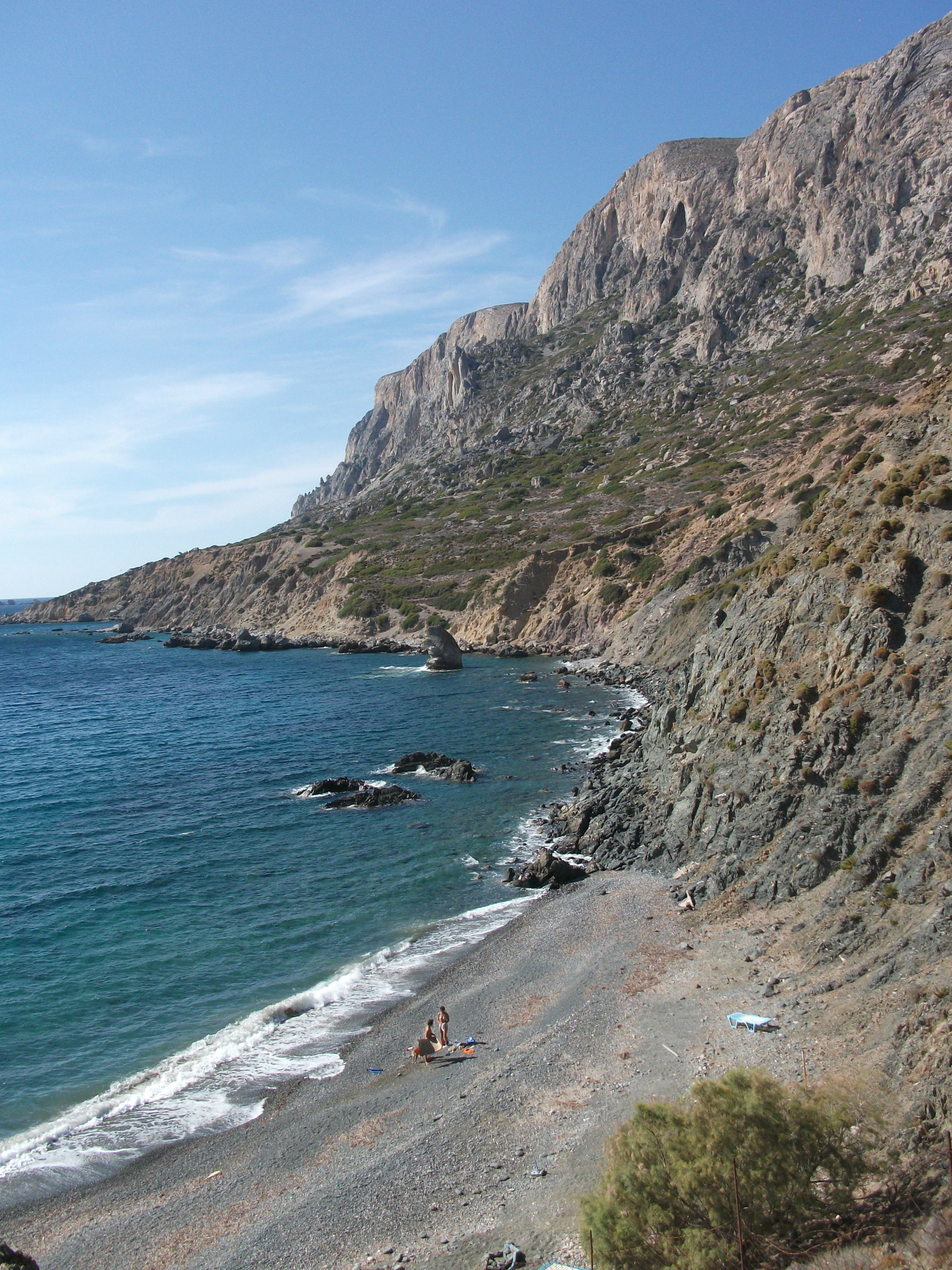
Hohlakas Beach
Other beaches closer to the village on the east coast are a mix of hard sand, pebbles and rock. They tend to be rather cramped and lose the sun in the afternoon when it goes behind the mountain. Paradise Beach is well signed from the village and popular with nudists, but is particularly rocky and cramped.
I first visited Telendos to eat one evening when staying on Kalymnos. I liked it so much that I went back and stayed there on a subsequent visit. It can be quite busy during the day when walkers, climbers and the merely curious can descend in significant numbers, but is much more relaxed at night.
There are expansive views across to the cliffs of Kalymnos during the day and lights twinkling across the water at night when everything gets more hushed, despite the best efforts of the island’s only music bar which serves mind numbingly powerful cocktails. I temporarily lost the power of speech after one of its Singapore Slings.
Telendos has a young, active vibe, but old farts like me can still find places to potter around or simply do nothing. Given the choice, I’d rather stay there than in the brash and somewhat tacky beach resorts on the opposite shore of Kalymnos.
Tilos
Visited in 2017.
Located between Rhodes and Kos and popular with walkers. Has an atmospheric abandoned inland village. Often promoted as “an undiscovered island” by British newspapers.
Frustratingly my efforts to stay overnight on Tilos have tended to be thwarted by strikes and delayed ferries. Consequently, my only visit to date has been on a day trip from Rhodes by Dodecanese Seaways hydrofoil that involved a 2 hour crossing each way and gave me 4 hours on the island.
In the limited time available to me, the port village of Livadia looked fairly appealing if a little straggly and lacking much of a traditional village centre.
Livadia
However, I was disappointed in the much vaunted beach that stretches out from the village for several kilometres. For some reason I expected it to be sandy rather than made up of large and rather uncomfortable pebbles. However, there is a wide choice of accommodation and tavernas along much of its length.
It’s sadly typical of some smaller Greek islands that the bus I had hoped to catch to the other main village of Megalo Horio appeared to have left Livadia a few minutes before my slightly delayed hydrofoil arrived. Integration of public transport is not always a strong point of Greece.
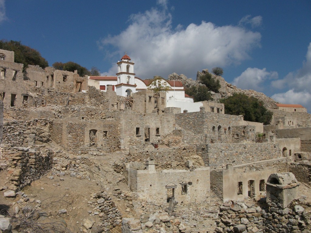
Nonetheless all turned out well as the highlight of my short visit was the 50 minute walk uphill on traditional footpaths to the deserted village of Mikro Horio. This archetypal inland citadel offering protection from medieval pirates was apparently only abandoned in the 1950s when the last remaining residents moved down to Livadia. Now most of the buildings are unroofed and slowly crumbling into the ground on which they are built.
The exceptions are the church, which is well maintained but popular with local goats, and a couple of the larger houses, one of which operates as a bar/cafe. Unfortunately it was closed during my September visit, although posters suggested it is a popular peak season nightspot with live traditional music.
Local maps indicate that Tilos has an extensive network of footpaths and hiking trails and I passed a number of well booted and backpacked visitors heading out for a full day’s walking across the fairly barren countryside.
Livadia
A paved road runs from Livadia to the elusive Megalo Horio which apparently lies in farmland and has a ruined crusaders castle and a small museum. Roads continue on to highly rated beaches that will have to wait for my next visit.
Tilos remains on my “to do properly” list. My short day visit taster wetted my appetite to see more. However, I suspect I won’t hurry back as quickly as I might to some other islands that I have only briefly skimmed. It’s attractive but maybe not particularly distinctive.
