
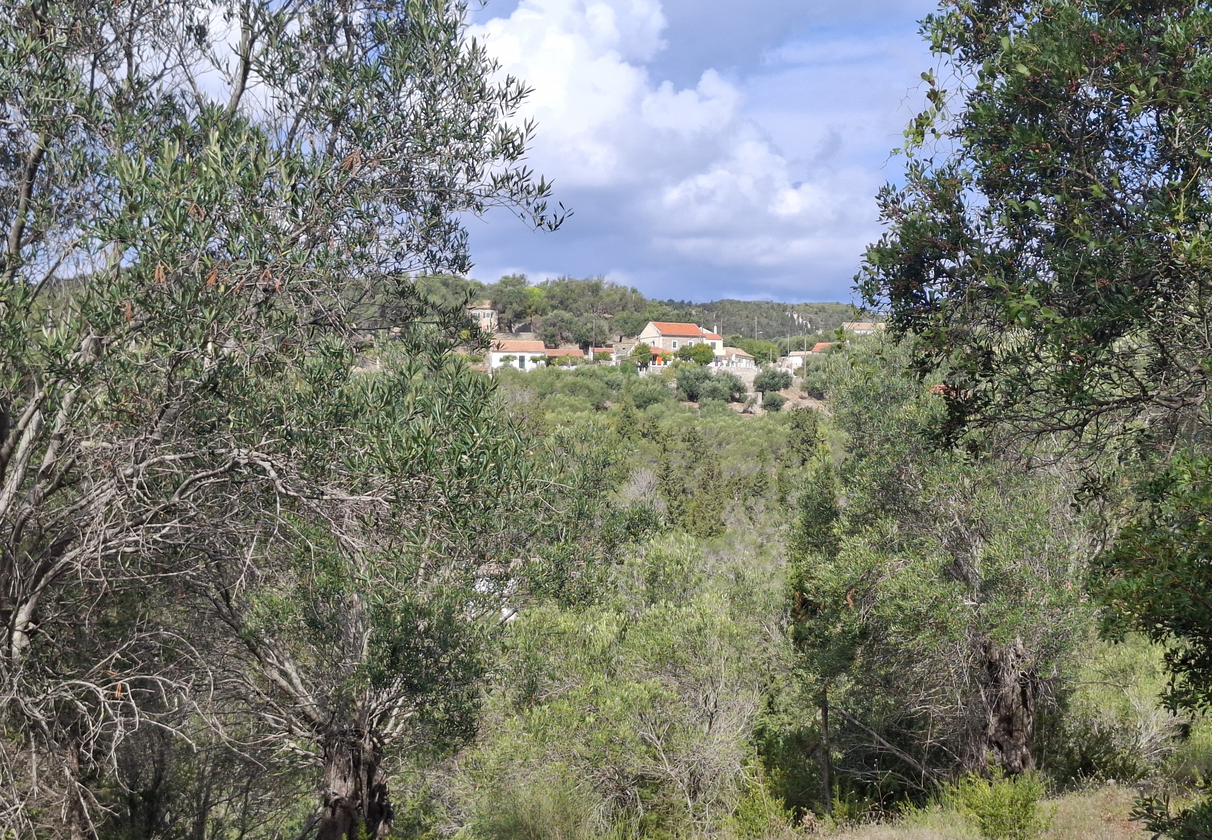
The Ionian Islands are the most westerly part of Greece. Separated from other island groups by the Greek mainland, they primarily look north up towards the Adriatic Sea and west to the coast of Italy.
The group was ruled by the Venetians for over 4 centuries and, in places, they retain a distinctly Italianate feel, particularly in their architecture. The islands can attract relatively heavy rainfall in the winter months and, consequently, are greener and lusher than many other parts of Greece. Wet and windy weather can also continue into April and May, giving them a shorter visitor season than some other parts of Greece. In recent years, I have made two visits to the group in May to find many accommodation operators and tavernas were not yet open for business.
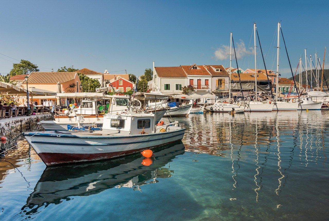
There are six main islands in the Ionians and a broadly similar number of smaller satellite islands. Corfu is the most populous and best known island in the group. It also has the most developed tourism infrastructure. However, all of the main islands have a significant tourism sector, some of it operating at high end value; some of it catering for the lower end of the bucket, spade and cheap booze market.
There are four international airports in the Ionians at Corfu, Kefalonia, Preveza (on the mainland but mainly serving Lefkada) and Zakynthos (aka Zante). All of them attract budget and charter airline flights from across Europe as well as internal Greek flights. There are also regular peak season services between the four airports making it possible to visit most of the main islands in a relatively short period of time.
The main islands are also accessible by regular ferry services from a variety of ports on the Greek mainland and, since 2018, a service has linked the six main islands six days a week, sailing north to south and south to north on alternate days. At the time of writing, this is operated by the Lefkada Palace, an adapted, passenger only excursion boat with capacity for up to 200 people.
There are various other ferry links between different islands but they can be spasmodic or seasonal and often leave from out of the way harbours with limited onward connections.
Links to the smaller satellite islands tend to be by locally operated ferries from their nearest large neighbour. Most of the smaller islands are also accessible by day excursion boats from their busier neighbours in peak season. These provide opportunities for shorter visits that are not available through local ferries whose timetables often necessitate overnight stays, particularly outwith the main summer months. Accommodation can be limited and at a premium on some of the smaller islands where advance booking is advisable (if it’s possible).
It is worth highlighting that some guide books include the large island of Kythira and its smaller satellite Antikythira within the Ionian island group. However, they are located some distance from the rest of the group at the very south of the Peloponnese peninsula. In addition, they have a somewhat different topography and atmosphere from the rest of the Ionians and very few, if any, direct links to them. Consequently, I have listed them under the “Other Islands” section of this site.
Antipaxos
First Visited in 2019. Most recently visited in 2025.
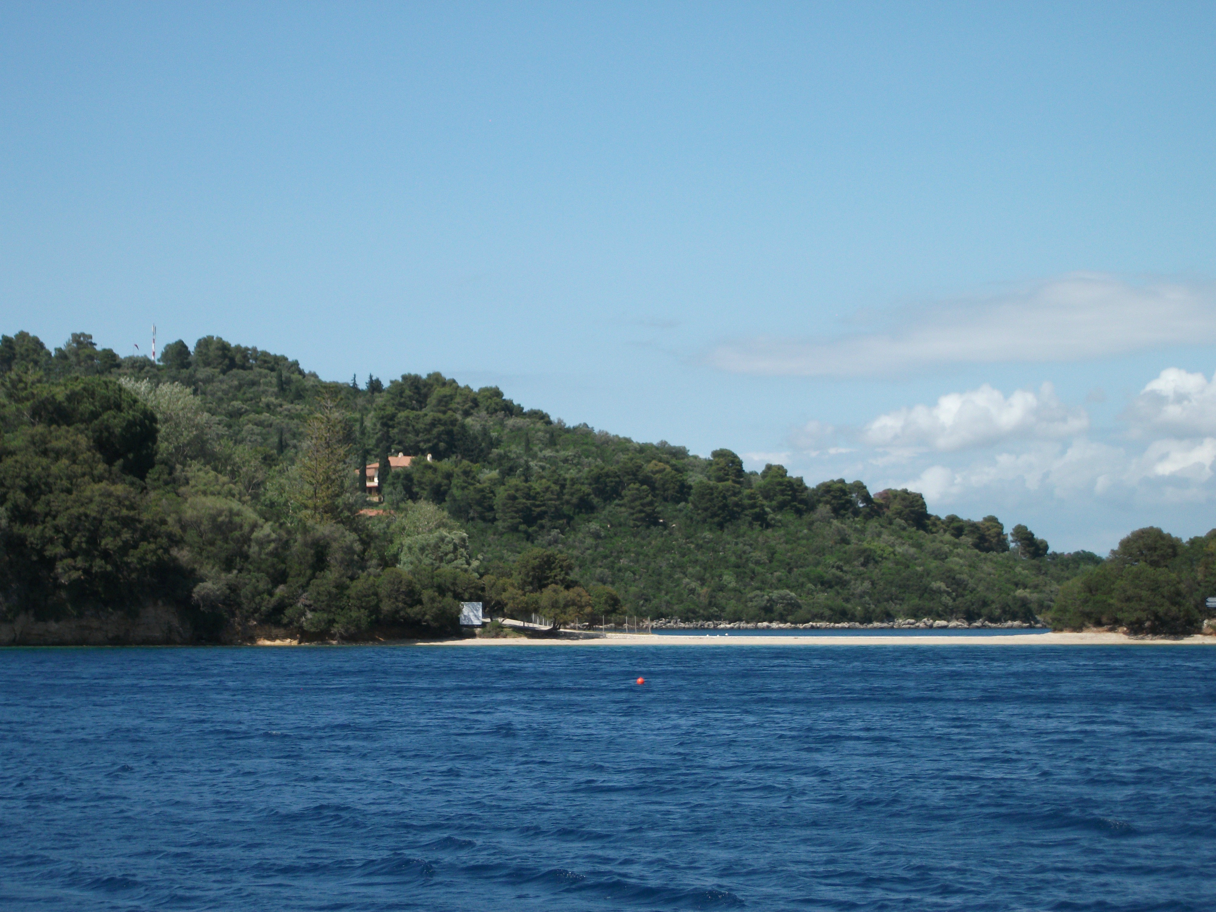
Much smaller neighbour of Paxos. Popular day visit destination for is beaches and sea caves. Limited visitor infrastructure but some excellent walking.

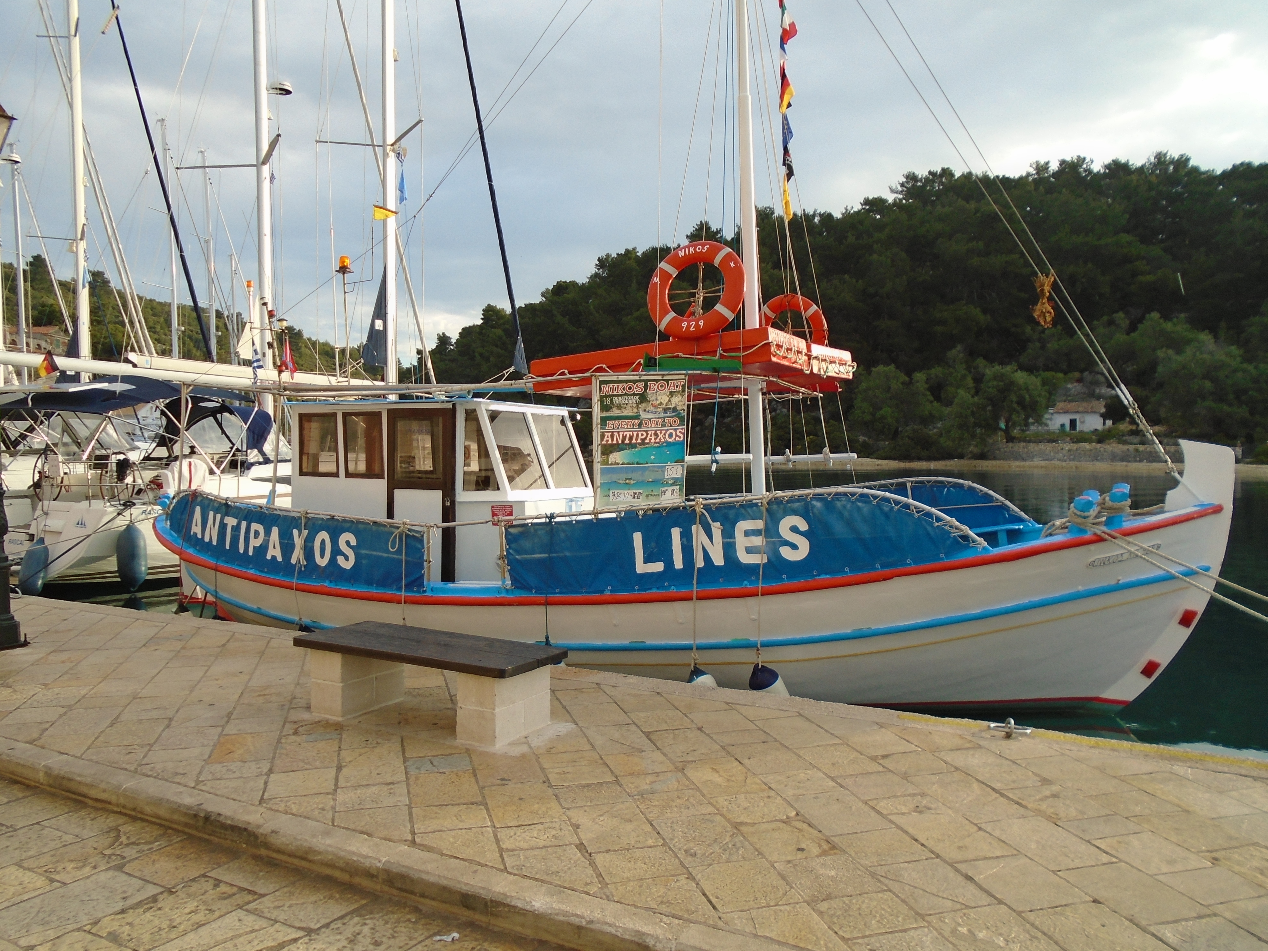
Like the majority of visitors, I first came to Antipaxos on a day trip from its larger neighbour, Paxos.. My return visit some years later was the same. For most people a day trip is the only viable option as Paxos’ smaller southerly neighbour has very little visitor accommodation and, it must be said, very few visitor facilities.
In May 2017, I travelled from Paxos on a traditional wooden caique excursion/supply boat that sailed most days at 1000. At that time this was the only option available to get to Antipaxos and gave you about 6 hours to explore the island before its return journey. In September 2025, I travelled on one of the many more modern excursion boats that lined the quay at Gaios, the main village on Paxos, offering a variety of trip options and lengths of stay throughout the day. The lovely old caique was nowhere to be seen.
In addition to arrivals from Paxos, some excursion boats from Corfu also make landfall on the island, although others just sail round it to view its cliffs and sea caves. A lot of the Corfu excursion boats anchor for half and hour or so off one of the main beaches to allow passengers to swim from the boat. A few swimmers even make it as far as the island’s shore, but not many.
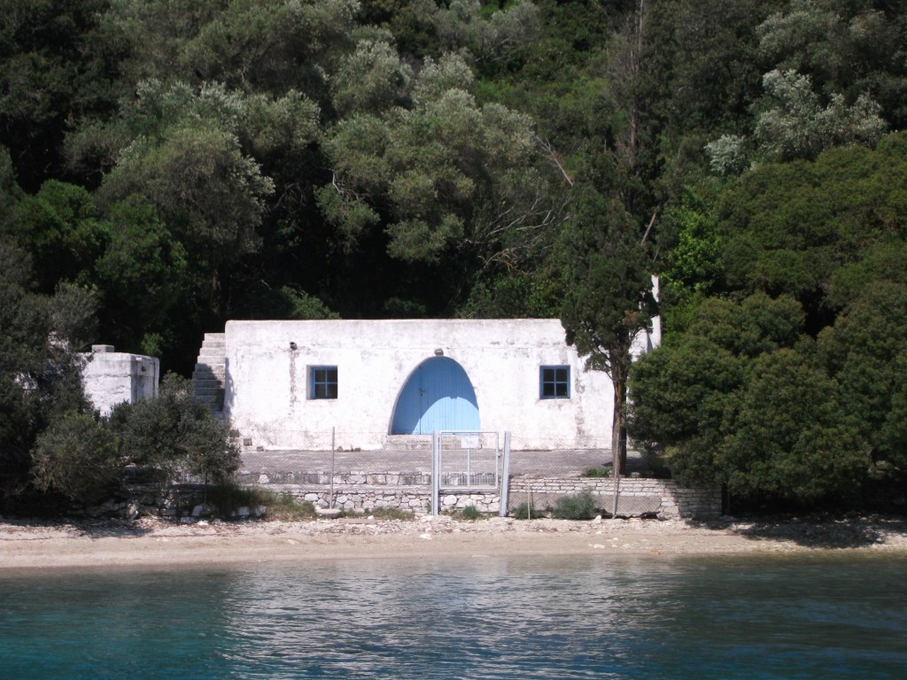
Antipaxos Ferry (2019)
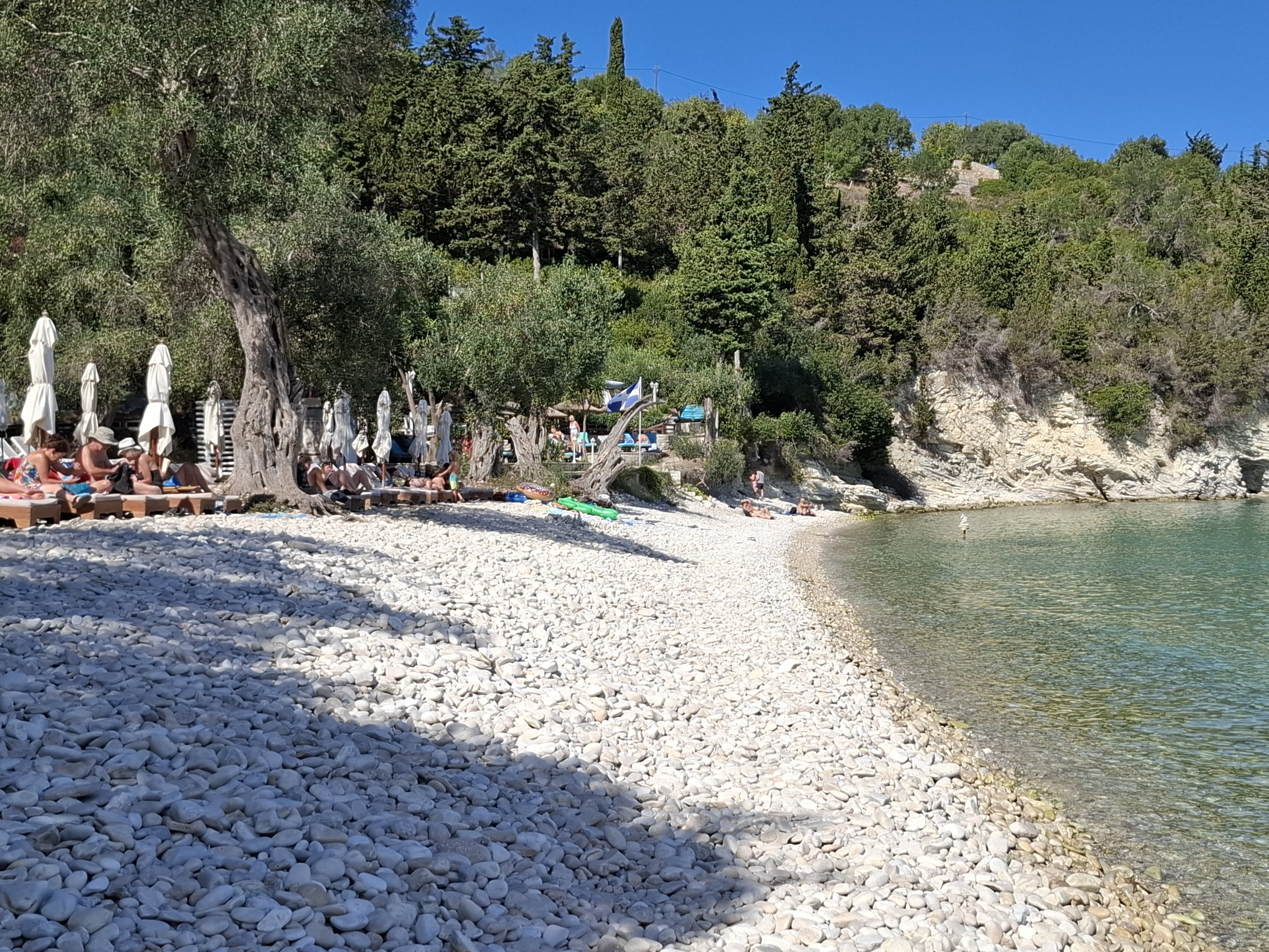
Although there is a recognisable harbour at Agios Agrapidias about half way down the east coast of Antipaxos, virtually all excursion boats and sea taxis drop visitors off at one of two beaches on the north east coast closest to Paxos.
Voutoumi, the larger of the two, is mainly pebbles but sandy underfoot in the water. Smaller Vrika offers soft sand. which is increasingly being filled with sunbeds and umbrellas. Both have beautiful, clear turquoise water as well as a couple of seasonal tavernas at beach level.

Voutoumi Beach & the Bella Vista Taverna
There is a further taverna high above Voutoumi that is accessed by a stairway from the beach. It lives up to its name of Bella Vista with spectacular views down to the beach and beyond to the mainland. It’s worth the climb up to it, especially as the food and service are also pretty good.

Vrika Beach
The few local residents of Antipaxos are mostly spread out along the island’s central ridge where there are olive groves and vineyards. Antipaxos is famous for its wine, which can be purchased on Paxos and is often sold from the barrel. The “main” village of Vigla is on the central ridge, but blink and you’ll miss it. There’s not a lot there and no obvious visitor facilities.
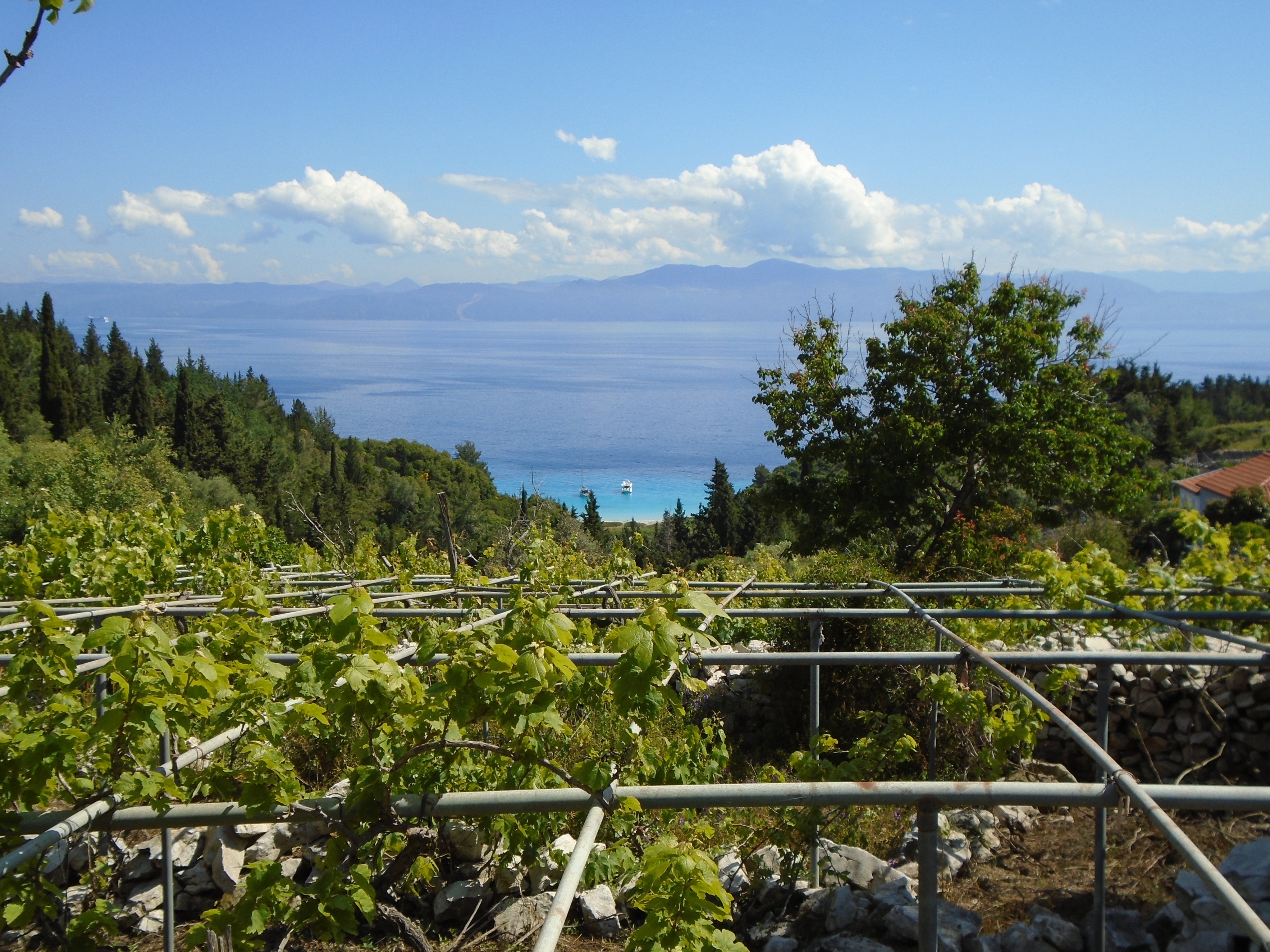
Antipaxos Vineyards
A network of tracks and trails spread out across the island leading to deserted coves like Sarakiniko. The longest route ends at the unmanned lighthouse at the southern tip of the island. There are no shops or tavernas other than those at the two main beaches and little of significant historical interest.
Nonetheless, Antipaxos is enjoyable walking country. It takes about 1½ – 2 hours to walk from Vrika beach in the north to the lighthouse in the south, depending on how many detours you take and how often you get lost. Trail signage ranges from rudimentary to non-existent and the Bleasdale Walking Map of the island is well-nigh essential to get the most out of a visit and ensure you get back to your boat on time for its return journey.
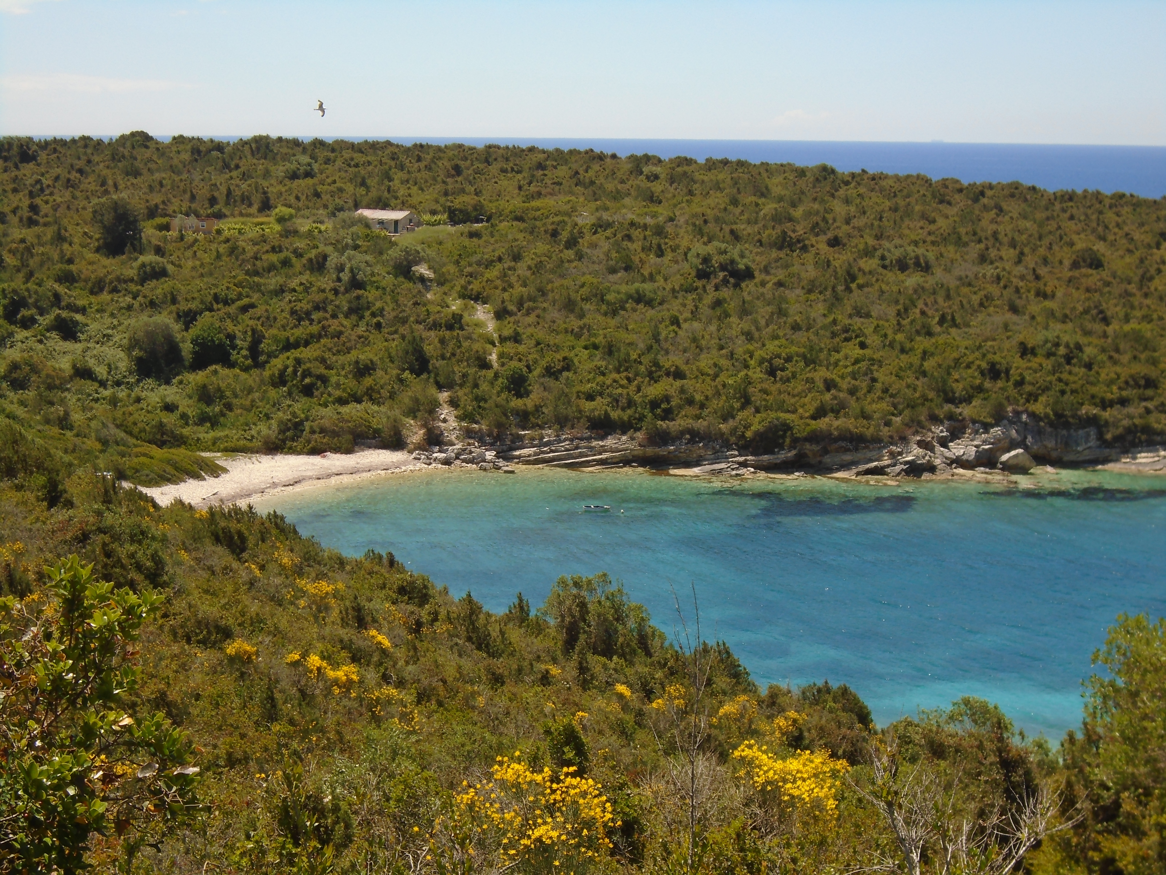
Sarakiniko Bay
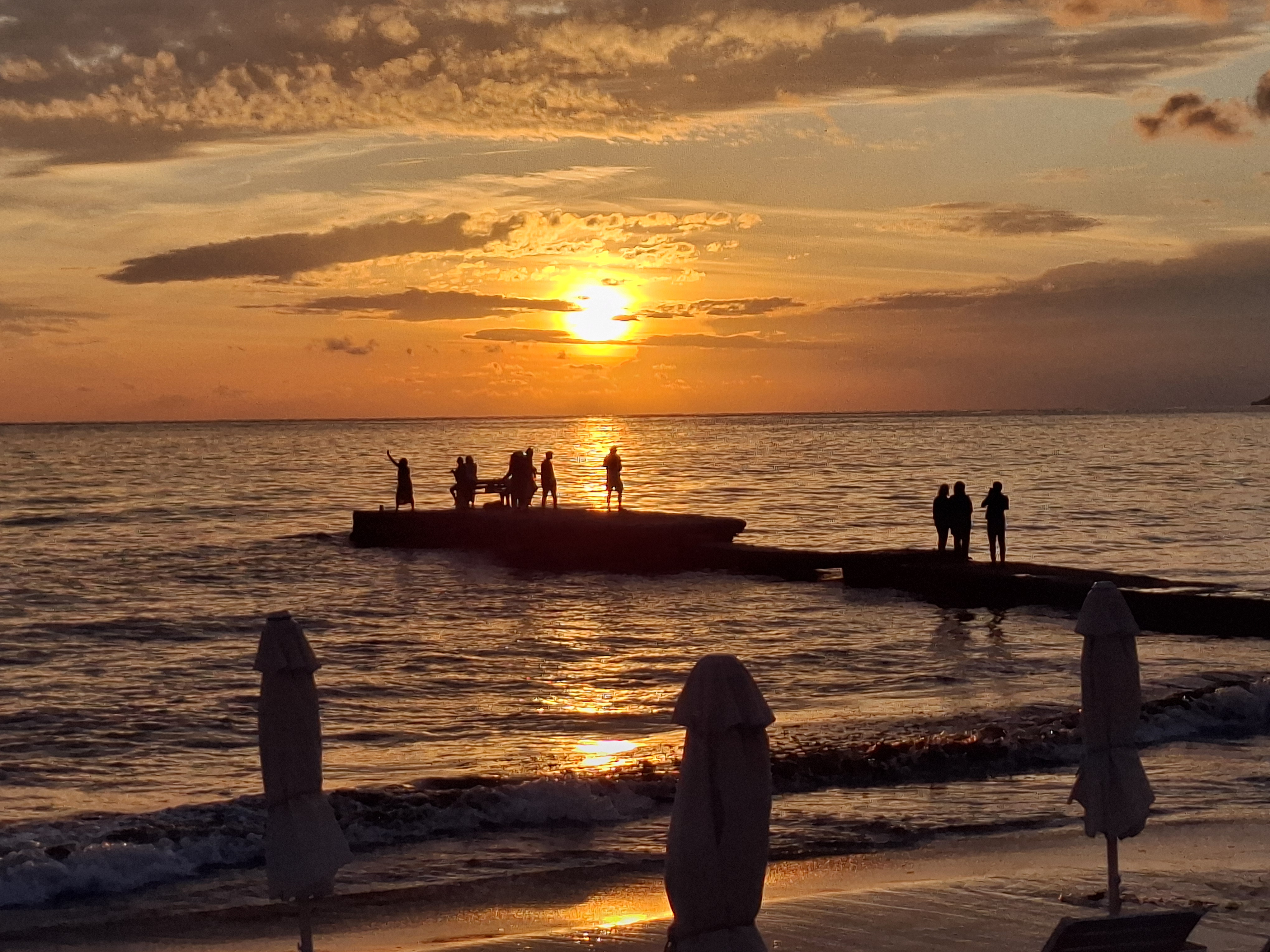
In 2019, I enjoyed a wonderful May day on Antipaxos in the company of a lovely couple from the Midlands who had come prepared with maps and walking boots. On that day, the caique brought twenty visitors to the island. The day before, which was wet and cloudy, it brought two.
In peak season, the excursion boats and sea taxis can bring a few hundred visitors each day to the island. These are supplemented by a significant number of rental boats that can be hired on Paxos. However, the vast majority of visitors never explore beyond the two main beaches, leaving the interior quiet and peaceful. I hope it stays that way.
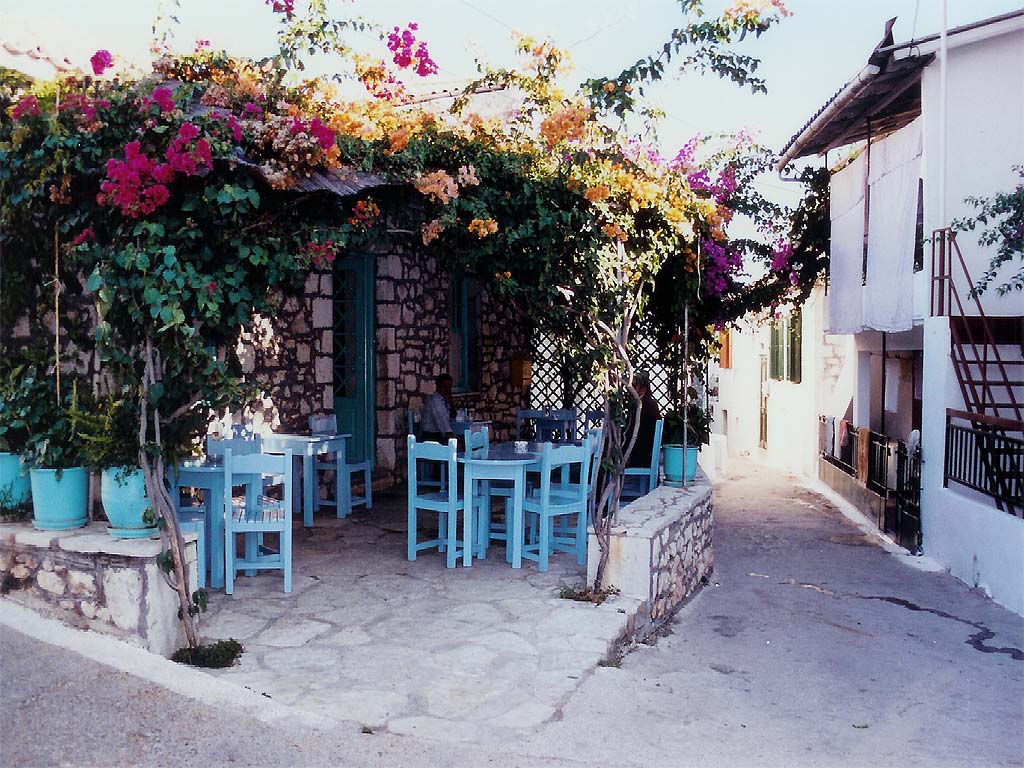
Corfu
First Visited in 1986. Most recently visited in 2025.
Lush, large and busy. Very popular with Brits. The main town is an architectural gem, but many of the beach resorts are tacky and over developed. Still some quiet corners though.
Corfu is the most populous island in the Ionians and was one of the first Greek islands to be actively developed for mass tourism. It is served by numerous scheduled and charter flights from all parts of Europe, as well as regular internal flights from other parts of Greece. There is also a round-the-clock schedule of ferries each day from the mainland port of Igoumenitsa, as well as direct ferry links to Italy.
Corfu Town and Surroundings
Corfu Town, the capital, is located centrally on the east coast of the island. It is divided into two distinct areas, the Old Town and the New Town.

Corfu Town, Old Town
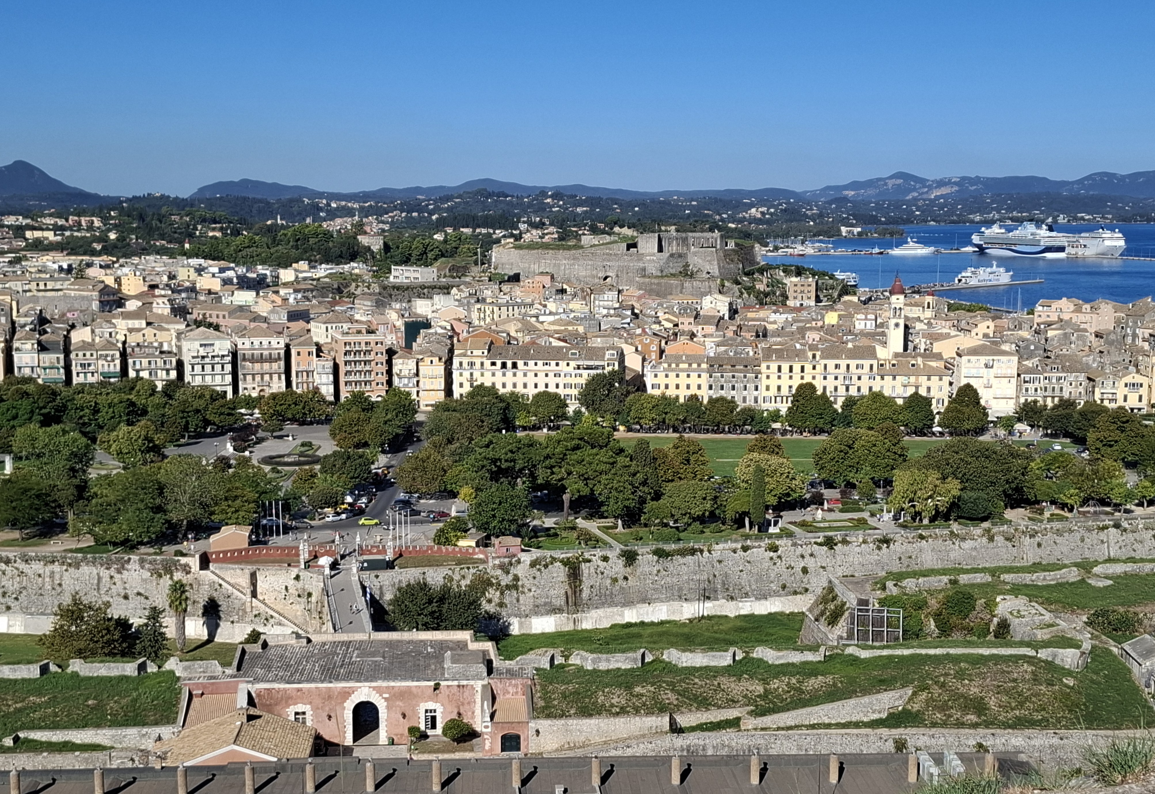
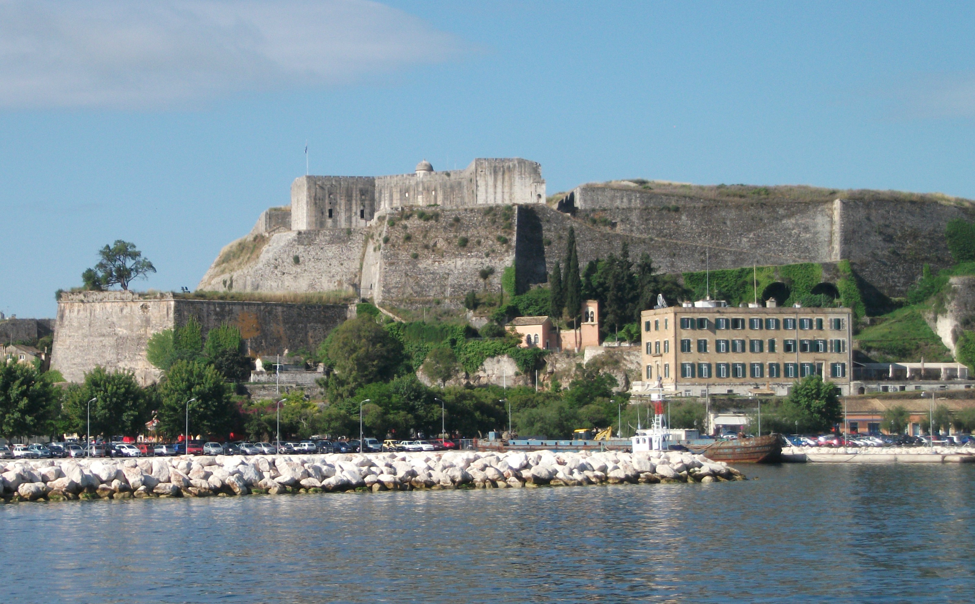
The compact Old Town has a beautiful Italianate centre with narrow pedestrianised streets, public squares, gardens, historic buildings and an attractive waterfront. It basically lies between two forts: the seafront Old Fort or Paleo Frourio. which dates back to the12th century Byzantine era; and the New Fort or Neo Frourio which was begun by the Venetians in the 13th century and overlooks the New Port from which most ferries and excursion boats leave. Both are impressive structures that have been extensively modified over the years and offer a lot to see. Personally, I preferred the smaller, less well preserved Old Fort, mainly for the sea views and the vistas over the Old Town.

The Old Fort, Corfu Town
It only takes 15 – 20 minutes to walk from one fort to the other, if you know where you are going and you don’t get sucked up by the crowds that can jam the the crowded streets and alleyways. Along the way you’ll find interesting churches, museums and galleries as well as a plethora of souvenir shops. restaurants and bars.
The Old Fort has the advantage of being adjacent to The Spianada, a large, attractive open park area that regularly hosts outdoor concerts and cricket matches, a legacy of 50 years of British rule of Corfu in the early 19th century. Next to the Spianada is the Liston, a spectacular building whose arches and columns house a host of cafes and bars. It is very much the centre of nightlife in the Old Town.
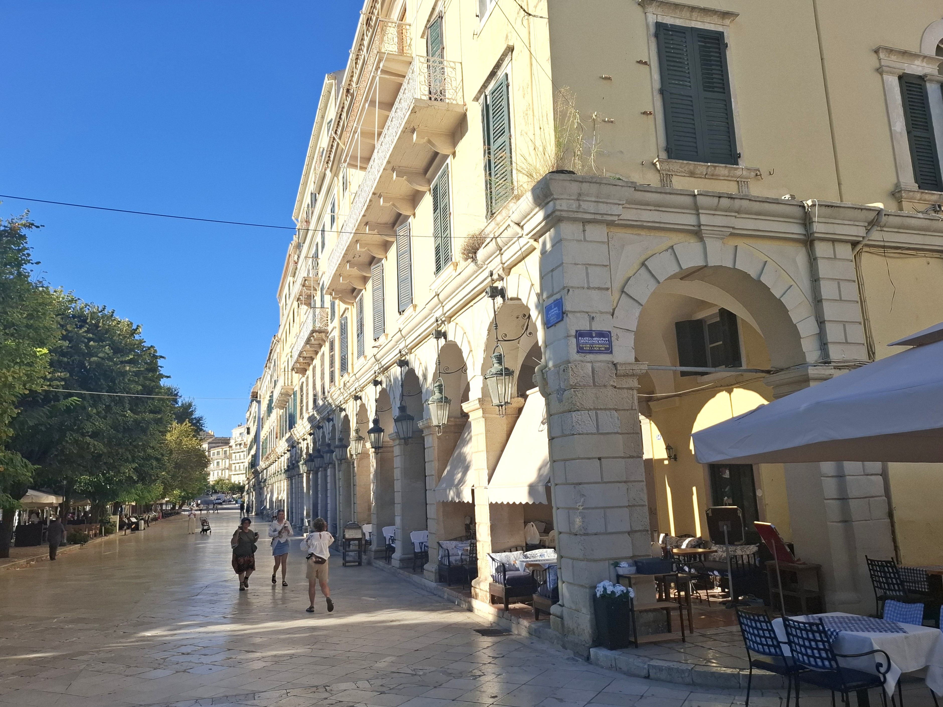
Corfu Town, The Liston
There are two other buildings of particular note overlooking the Spianada. First is the Palace of Saints Michael and George, which was originally built as the residence of the British High Commissioner of Corfu and now houses a Museum of Asian Art and the Municipal Gallery of Corfu. The second, smaller building at the opposite end of the park is the Cavalieri Hotel, which claims to have the only roof top bar in the Old Town and is a popular gathering place for viewing sunsets over a cocktail or two.
The New Fort, Corfu Town
The New Town is less interesting. Although it has some attractive mansions, much of the architecture is nondescript modern apartment blocks and the roads are increasingly choked by unmanageable amounts of motorised traffic. San Rocco Square is a main focal point as this houses the main station for the local Blue Buses that run throughout Corfu Town and its immediate surrounding areas. The streets around the square are a busy shopping and cafe area.
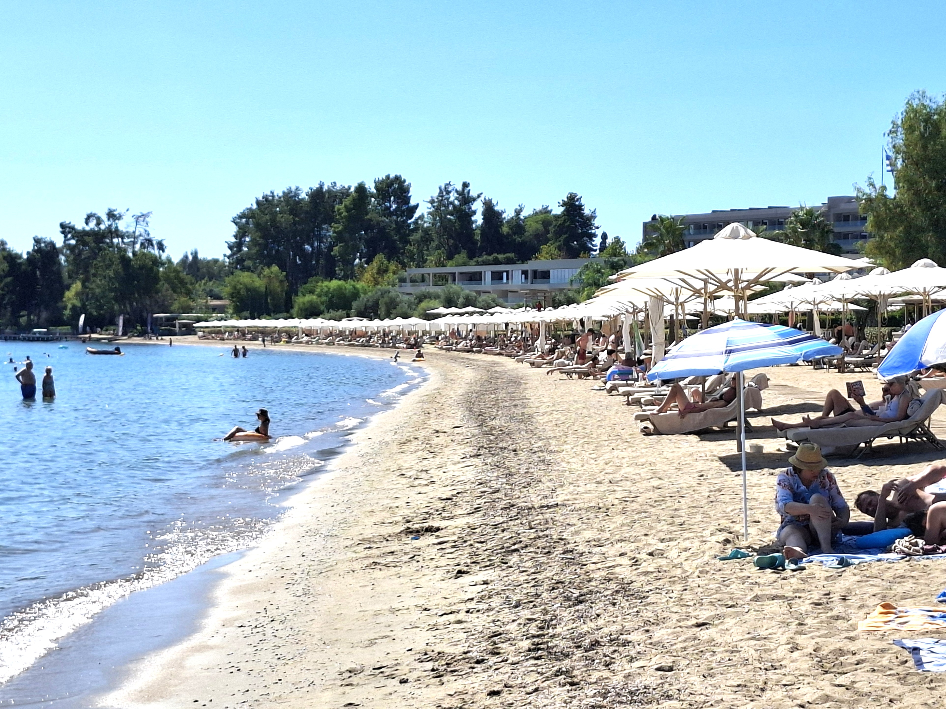
Things get a little quieter as you move south of the New Town and into the Kanoni peninsula. There is a good mix of accommodation here and some small and often crowded, but pleasant sand and pebble beaches.
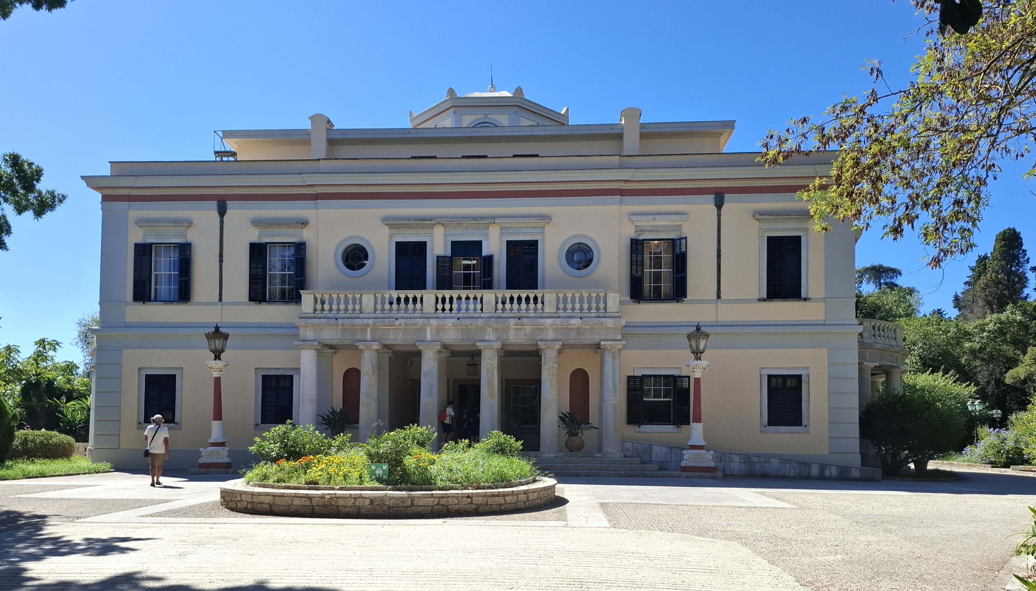
Mon Repos, Corfu Town
Kanoni is where you will find Mon Repos estate, which houses the mansion where Prince Philip, the consort of Queen Elizabeth II, was born. The house itself is less spectacular than you might expect, but holds a small museum of archeological finds and period furniture. There is a small entry charge into the house, but the rest of the estate grounds are free admission and include the ruins of a small Doric temple and an open air theatre.
The southern most tip of Kanoni overlooks two small islands that are among the most photogenic in Corfu. Tiny Mouse Island, or Vlaherna to give it it’s proper name, is reached by a short causeway and houses a small church and convent. The slightly larger Pondikonissi is a three minute boat ride from Kanoni and is much greener with another small church. Legend has it that it is the petrified remains of one of Odysseus’s fleet.

Mouse Island & Pondikonissi, Kanoni
Kanoni can be reached from the Old Town by a 20 minute journey on a Blue Bus that runs from the Liston every 20 minutes until about midnight. It also attracts a lot of excursion coaches and taxis that usually only linger for a few minutes to allow their occupants to photograph the two islands.
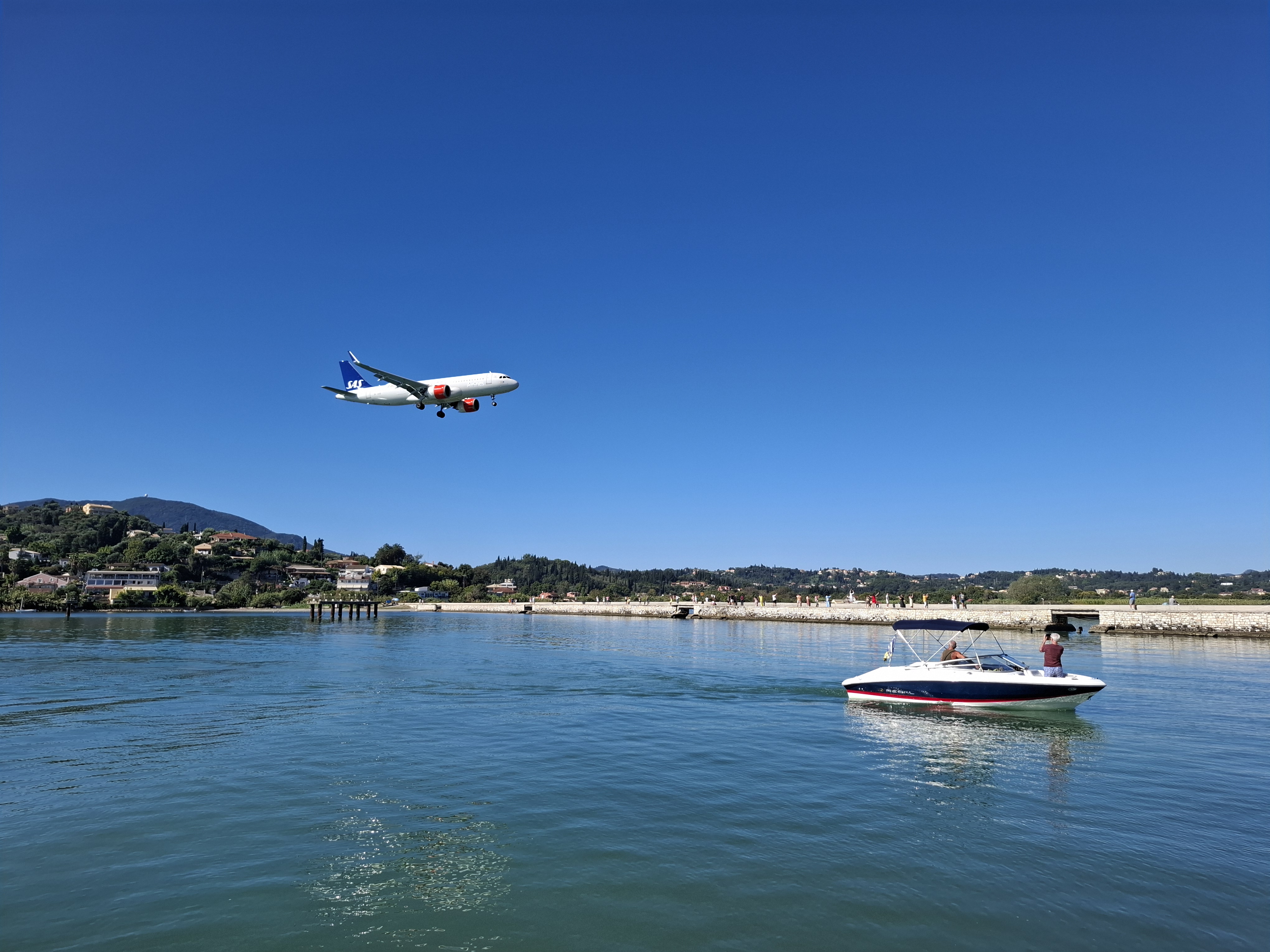
For better or for worse, Kanoni is very close to Corfu Airport. The runway is only a few metres from Mouse Island and you feel as though you could almost touch the landing gear of aircraft as they approach touch down.. Some people find this exciting and you will generally see groups of plane spotters savouring every landing and take off. Other people may find the ongoing aircraft noise more irritating, especially if they have booked into one of the large 4 or 5 star hotels in the immediate area.
Coming Into Land at Corfu Airport
The airport itself is within walking distance of the Old Town – if you don’t mind a walk of four or five kilometres. However, traffic congestion in the town is such that walking can sometimes be a quicker option than buses or taxis. Another Blue Bus line – No. 15a – links the airport to the New Port via the Old Town.
The main island bus station is located about one kilometre from the airport: a 10 – 15 minute walk. Services run to just about every part of the island on Green Buses to differentiate them from the local Blue Buses. Services to some of the more far flung parts of the island can be rather spasmodic, but the Green Buses provide by far the cheapest way to get around Corfu, even if some journey times can be lengthy and routes on the island’s crumbling road network can take a lot longer than timetabled.
Sticking with the Local Blue Buses, they extend their services to a number of largely undistinguished resort villages with mainly mediocre beaches and little genuine Greek character stretch along the east coast to the north and south of the capital.
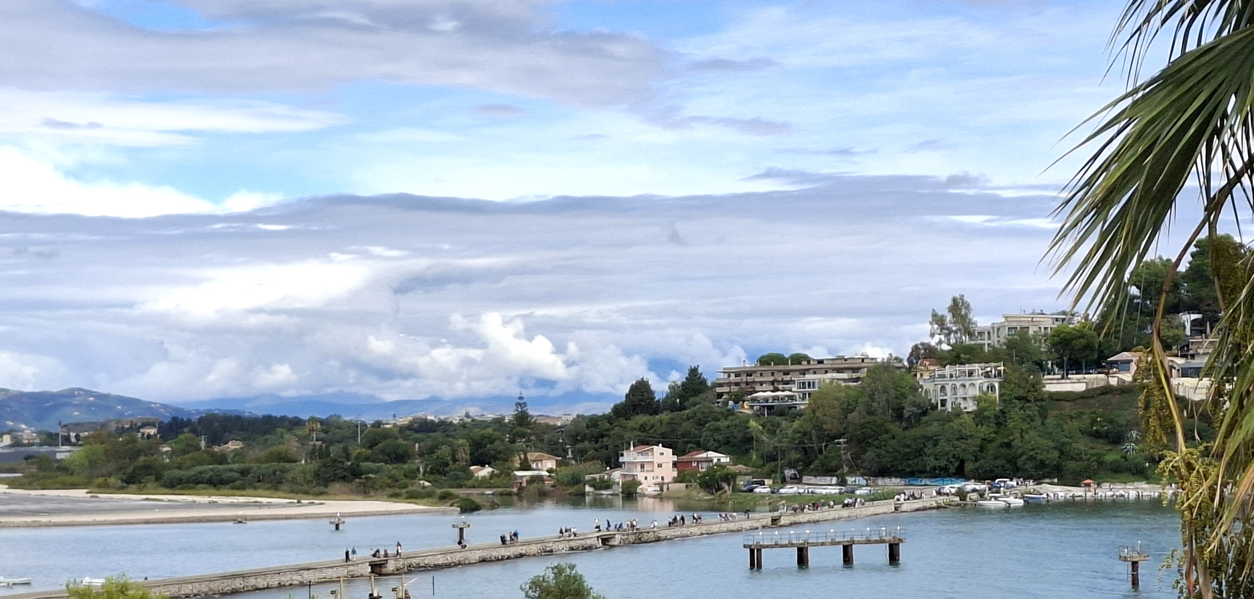
Corfu, Causeway between Kanoni & Perama.
Heading south, one line of the Blue Buses extends to Perama, the Achilleion and Benitses. Perama is essentially a suburb of Corfu Town that straggles along the main road to the south of the island. It has a wide selection of hotels and holiday apartments but seems to lack any real centre. Accommodation there is generally cheaper than in Corfu Town and some of the hotels are highly rated on review websites, but overall the place looks rather tired and grubby and the attractive setting is not enhanced by proximity to the airport.
Another way of getting to Perama is via a causeway from Kanoni with passes Mouse Island and Pondikonissi island. You can easily walk across this causeway in 5 minutes , even if you are distracted by low flying aircraft overhead.
The Achilleion is a 19th century palace built by the Empress of Austria. When I last visited Corfu, it was closed for renovations although its extensive – and attractive – gardens were still open to the public.
Benitses was one of the first holiday resorts to be developed on Corfu. It became very run down and gaudy but is now trying to upgrade itself and attract higher spending visitors. It still has some way to go and its beaches are remain small and pretty mediocre.
To the north of Corfu Town Blue Buses extend past the unappetising looking seafront villages of Kontokali and Gouvia, which back in the 1970s was known as Groovy Gouvia. That groove appears to be long gone. Things pick up at Dassia, which has a more rural, wooded atmosphere and a long and attractive sand and pebble beach backed by high end hotels, whose sun beds take up an increasing amount of space. Dassia is probably a good choice if you want a beach holiday with quick and easy access to Corfu Town, but don’t expect too much peace and quiet.
Dassia Beach
The Blue Buses finally terminate at Ipsos, which is on the next bay after Dassia. It’s always been a popular destination for young people, primarily attracted by its campsites and many noisy bars. The beach here is narrow and hard up against the main road. Not a place to stretch out and relax.
South Corfu

To be honest, I’m not overly familiar with the south of Corfu. It’s an area I’ve driven around without stopping too much or actually staying there. However, as you head on the main road south, the quieter, family beach resorts of Moraitika and Messalonghi look pleasant enough with some tourism development that hasn’t got out of control. They have a fairly laid back feel.
Lefkimmi is the largest village in the south and retains something of an authentic Greek feel. It also has a small port with ferries to Igoumenitsa and Paxos. One ferry company, Kamelia Lines, provide a pick up and drop off coach service to and from Corfu Airport to link with their Paxos ferries, which leave from Lefkimmi.
The road to the south ends just after the full on resort of Kavos, which was a major centre of beach raves and all-night techno music in the 1990s. Now it feels a little like a place whose time has come and gone. Nonetheless, it tends to be the cheapest place to stay on the island and still attracts groups of young people looking for misadventure.
West Corfu
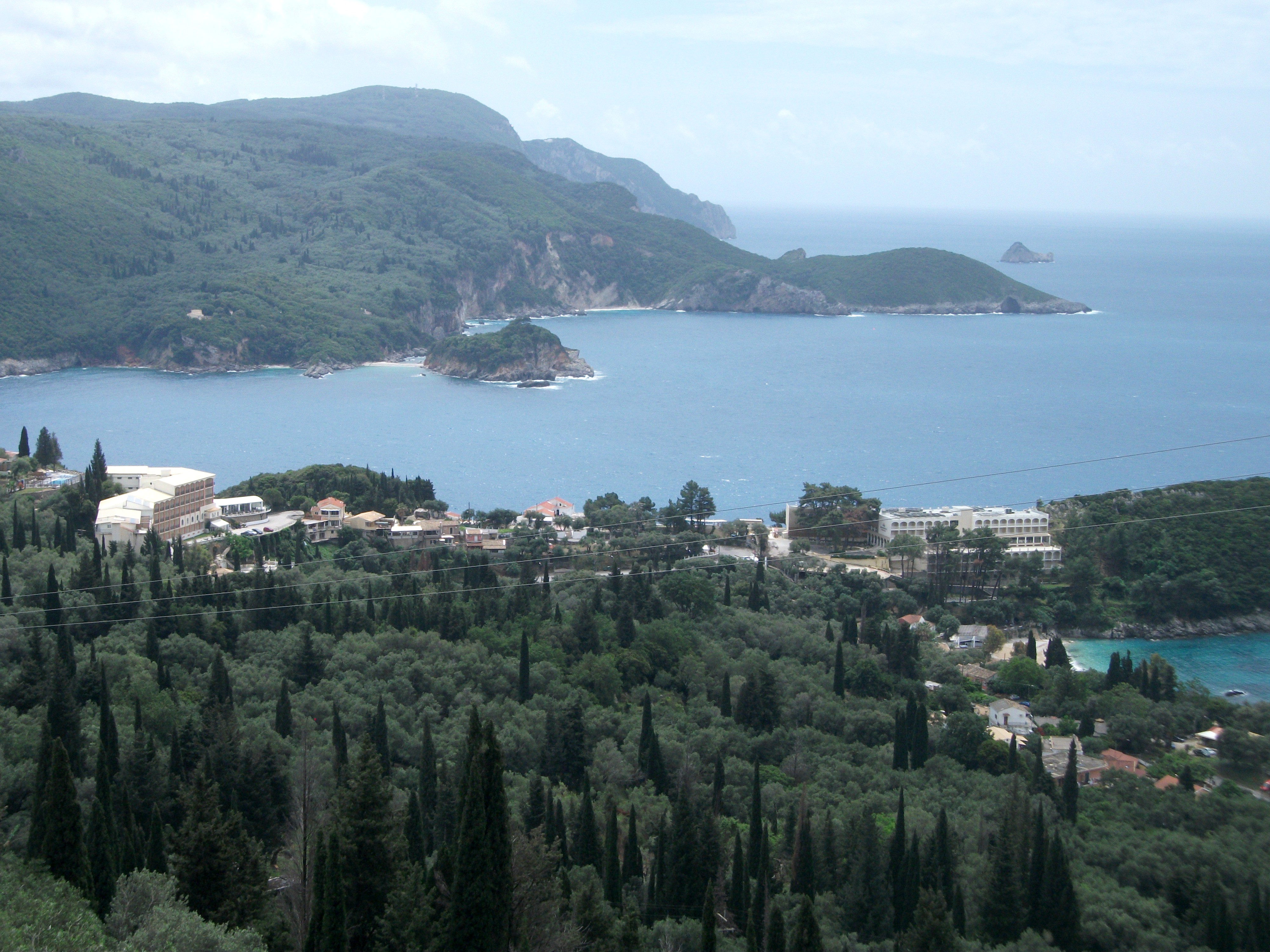
Paleokastritsa from Lakones
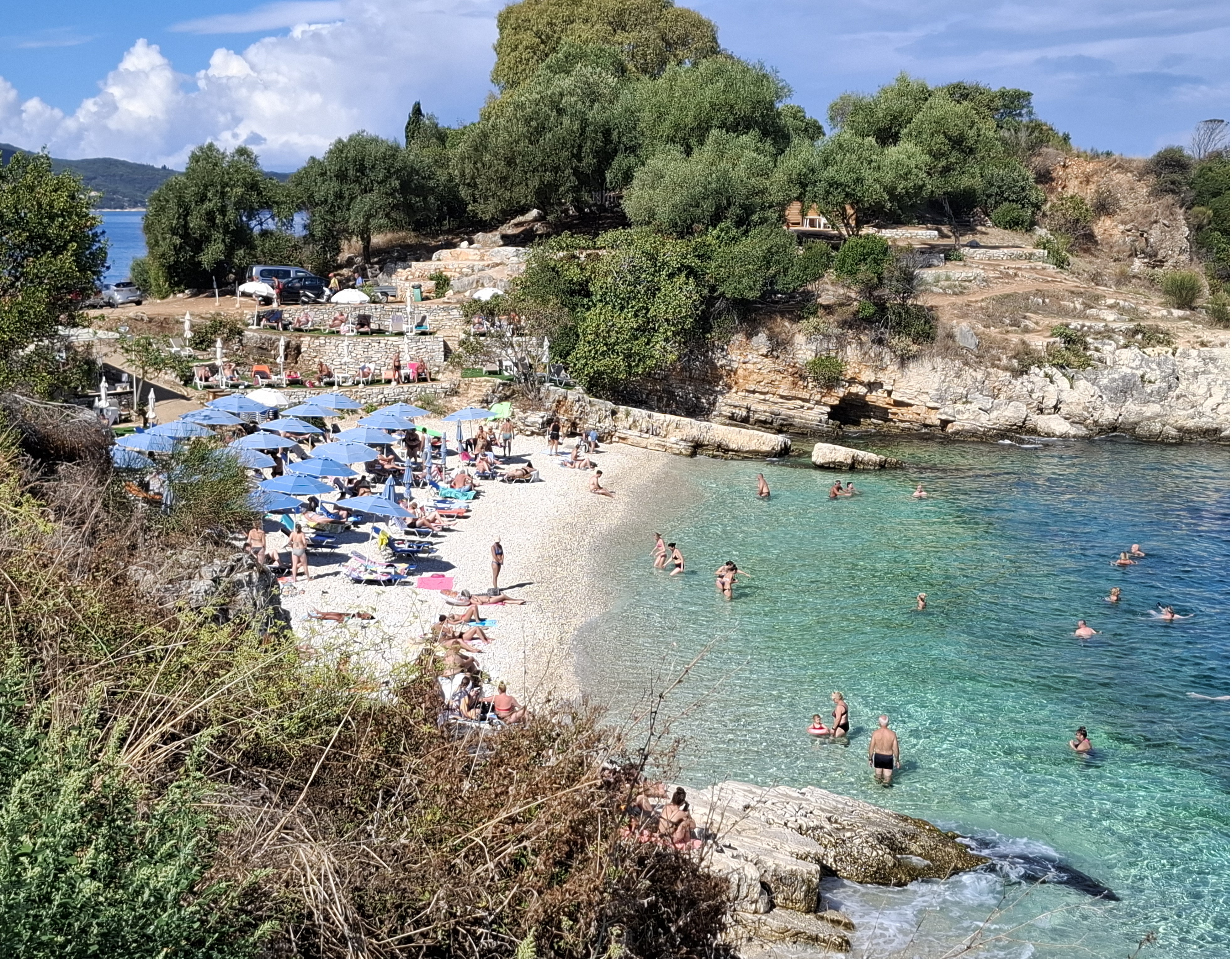
Paleokastritsa is the main west coast resort, about half an hour’s drive from Corfu Town. It is one of the island’s beauty spots spread out across three coves that romantics think form the shape of a heart. These coves are backed by impressive cliffs which shelter a number of seas caves.
However, in all honesty, Paleokastritsa is more attractive from a distance than close up. It lacks any real centre and tends to be unpleasant to walk around as pedestrians very much come second to cars and coaches that bring in thousands of day trippers. Despite there being a number of large car parks, many visitors prefer to park on the road side causing traffic jams and general disruption.

Paleokastritsa
The village does house the Corfu Aquarium and there are numerous excursion boats taking visitors out to the sea caves. There are also countless boat hire outlets. It appears you can hire a motor boat at relatively low cost with no previous experience and little in the way of instructions on how to operate it.
There is a busy but okayish beach in one of the coves and a number of good walking trails out of the village. One of the best is the steep climb from sea level up to the hillside village of Lakones that gives the most spectacular views across the coves. It takes about 45 minutes for a reasonably fit person to get to the top, although the less energetic can drive up to Lakones in a few minutes.

Paleokastritsa Beach
To the south of Paleokastritsa, the beaches and villages of Liapades, Ermones and Pelekas tend to be dominated by large, rather ugly resort hotel developments. The main Pelekas village lies inland away from its beach and is the most attractive of the three.
Further south on the west coast, Agios Gordis used to be a fairly laid back village on a huge, sandy beach. Now over development has turned it into another largely characterless and noisy family fun resort.
North Corfu
North Corfu is the most mountainous part of the island and the area I know best. It is home to many attractive but rarely visited mountain villages as well as a string of beach resorts that range from the magnificent to the utterly appalling. There is an extensive but badly maintained road network and numerous Green Bus routes linking the north to Corfu Town.
Heading along the coast north of Corfu Town and Dassia, you first come to the undistinguished villages of Barbati and Nissaki. Both have long beaches that are dominated by large hotels and apartment complexes. However, the coastal scenery looking across to the mountains of Albania is spectacular and you will find some quieter, smaller beach coves signed off the main road.
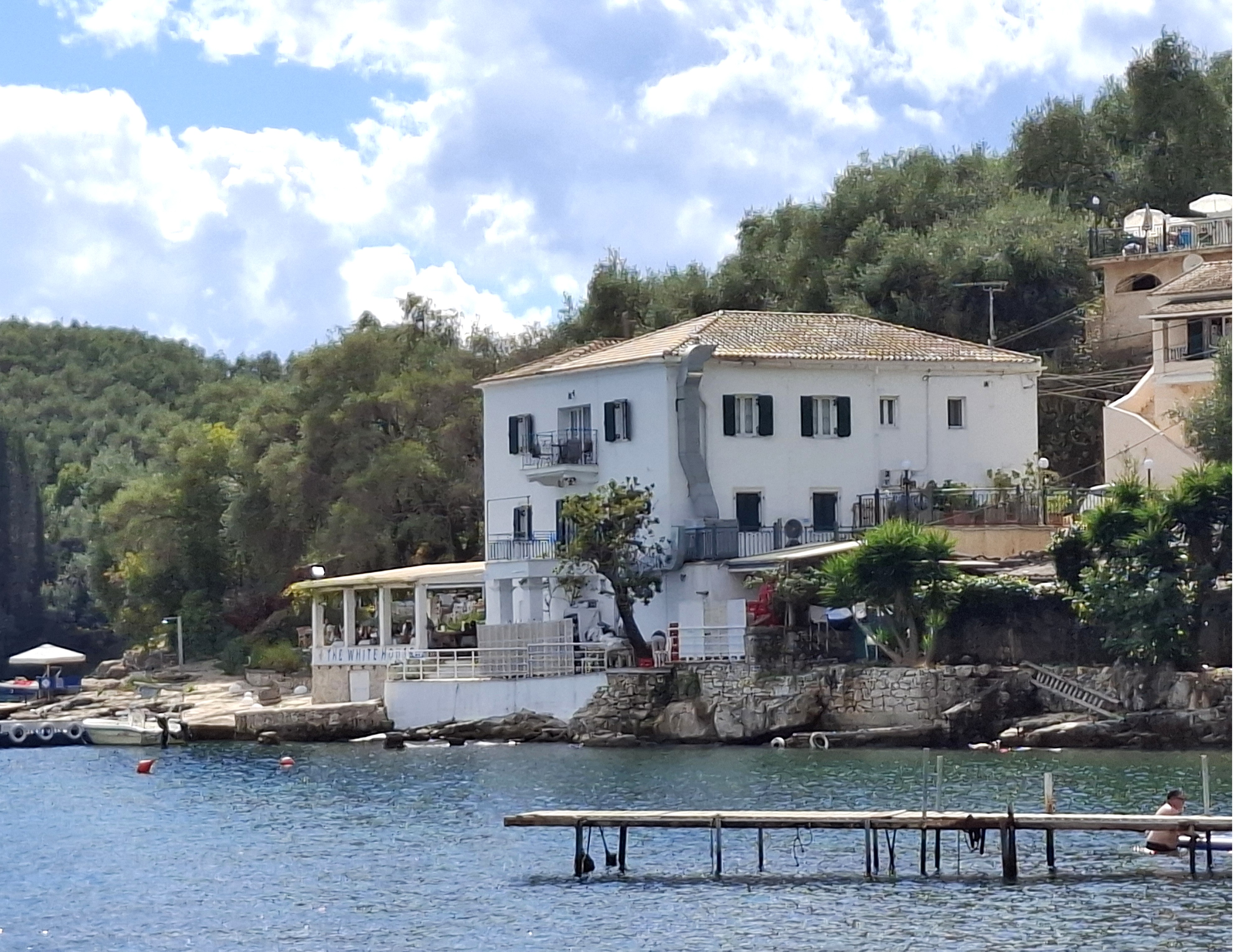
Kalami, The White House
The first place of genuine interest in this area is Kalami, a coastal village best known for its connections with the Durrell family who lived there in the 1930s in the White House at the end of the bay, which is now a holiday rental and restaurant.

Kalami
The village is small with some obtrusive development on its outer edges. The beach is pebbly and shelves very steeply into the sea. The access road is steep and car parking can be an issue. However, it is easy to imagine how it must have been when the Durrells made it their home.
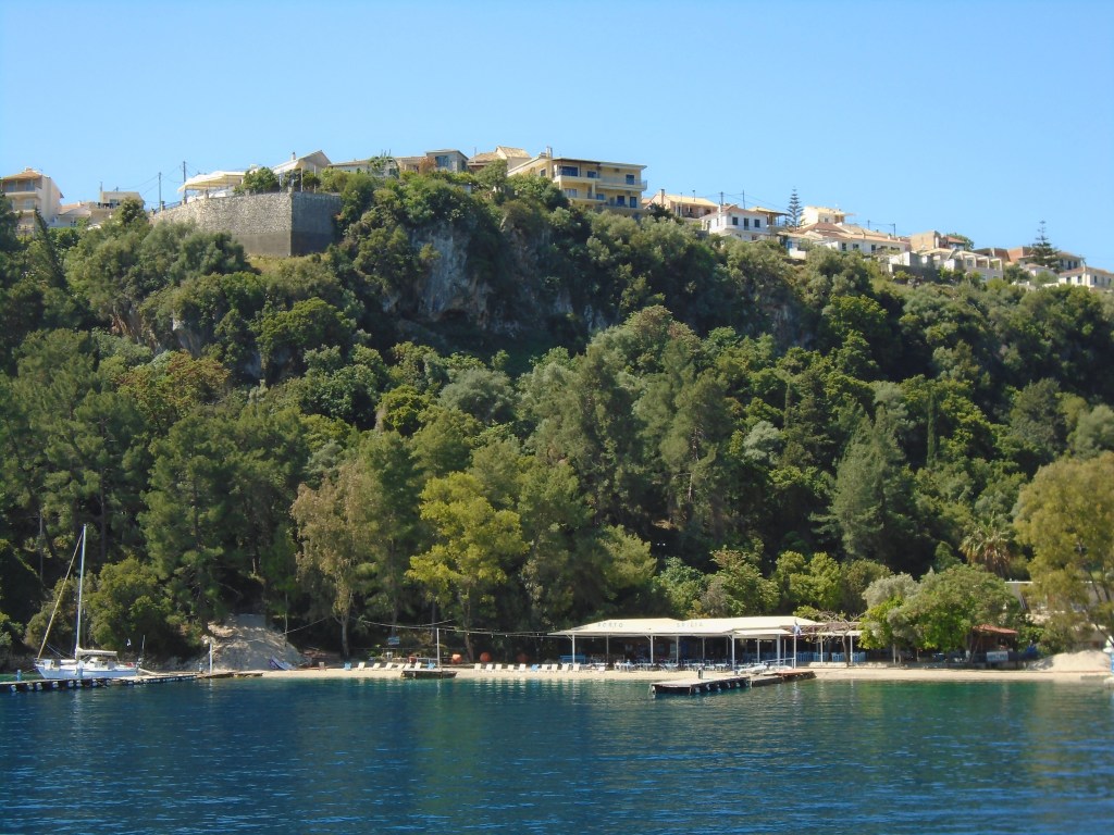
Kassiopi
Kassiopi is the largest and most popular resort in this part of the island. First impressions are not great as access roads into the village centre are congested and parking can be difficult. However, things get more relaxed as you get closer to the picturesque waterfront with its spectacular views across to the Albanian coastline and mountains. It’s easy to spend a couple of very pleasant hours in one of the cafes or bars simply watching boats and people come and go. For the more active there is a large ruined Byzantine castle and a few pretty churches to explore
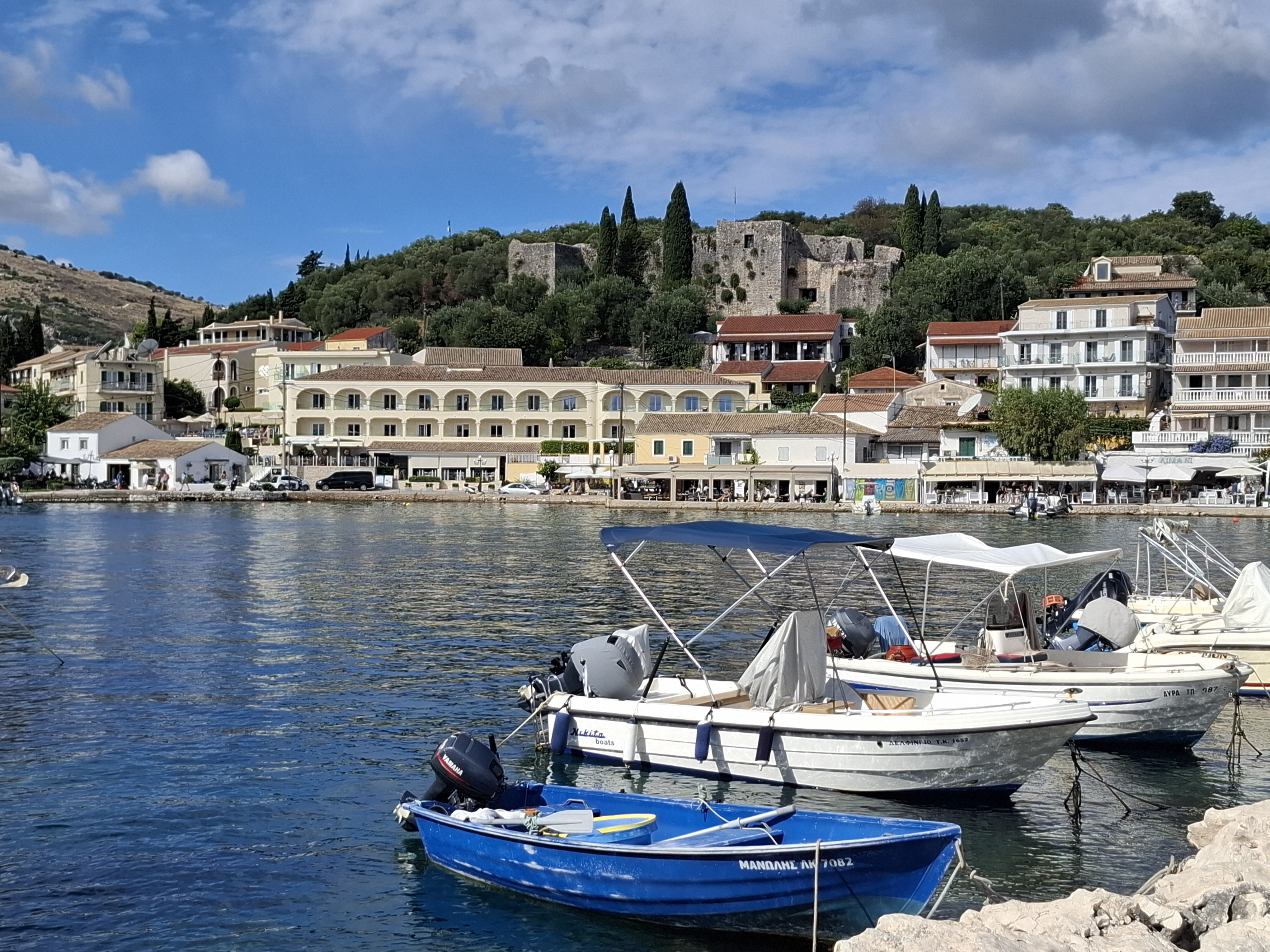
Kassiopi Waterfront & Castle
There are a number of small, often crowded, pebbly beaches in and around Kassiopi, but larger, quieter options can be found off the road to the north of the village. By all accounts, Kassiopi can be pretty loud and noisy at night but it hasn’t lost all of its traditional fishing village charm.
Kassiopi Beach
After Kassiopi the main road swings west away from Albania and brings you to the north coast resorts of Acharavi, Roda and Sidari. These are pretty characterless sprawls of studios and apartments spreading out from hard sand beaches. They seem to be particularly popular with British visitors. Sidari is spectacularly horrendous. Think of a dusty, downmarket version of Blackpool with a much poorer beach. That’s not a recommendation.
Thankfully things get better as you turn another corner onto the north west coast of the island and the three small resorts of Agios Stefanos, Arillas and Agios Georgios.
Agios Stefanos
Agios Stefanos has a large beach and a harbour from where excursion and ferry boats sail to the attractive, small Diapontia islands that can be seen on the horizon to the west. It’s the largest and most developed of the three north west coastal villages, but has nothing like the visitor numbers and infrastructure of the likes of Sidari or Roda.
Agios Georgios is the most southerly and smallest of the three. There’s no real village here, just a long beach of soft sand that has encouraged low key development of visitor accommodation, restaurants and bars.
Arillas
In the middle is the village of Arillas, my favourite place on Corfu and where I invariably gravitate towards as a base to stay. It’s small and rural but has good restaurants, a few bars for those who want at least some night time action, and a mix of good quality accommodation options.
Its long narrow beach changes each year with the winter storms, but always has enough sand for the limited number of visitors it attracts. Despite notices forbidding nudity on the beach, it’s southern end away from the village centre is predominantly occupied by naked people who are undisturbed by any authority figures.

Arillas Beach
It also enjoys spectacular sunsets and has good walking trails and routes. I always enjoy the cliff top path along to Agios Stefamos, about a 45 minute walk, and, in the other direction, the road that runs the 2 kilometres or so up to the pretty cliff top village of Afionas, which has magnificent sea and coastal views as well as a couple of good tavernas. From there the more enthusiastic walker or adventurous driver can continue down the steep road into Agios Georgios.
On my most recent visit to Arillas in late September 2025, I noticed a couple of changes in the village, or more specifically its visitor profile.. Firstly, there seemed to be a lot more mature lesbian visitors than I had ever noticed before, judging by the number of ladies of a certain age holding hands and generally being quietly intimate with each other.
Secondly, Arillas has always had something of an alternative vibe, which now seems to have strengthened and coalesced around Colibri Farm, a large self styled wellness centre on the outskirts of the village. Amongst other activities, this organises an annual Spirit Festival, which it describes as “A 7 day Consciousness Raising Journey with over 100 artists, healers and wisdom keepers”. You get the idea.
I note that those who run Colibri predominantly appear to be Northern Europeans rather than Greeks and the costs of a Consciousness Raising Journey are not insignificant. However, there are certainly a lot more dreadlocks, people meditating and doing yoga on the beach, and groups doing free form, self expressive dance on the little pier at sunset than there used to be.
I’m on old, unreconstituted punk rocker who still follows the old punk adage of “never trust a hippy”, but the new arrivals seem to be pretty harmless and add some colour and life to the village. I just hope they don’t take it over completely.
Arillas Sunset Revellers
Erikoussa
Visited in 2019
Small satellite island off northern Corfu with exceptional beaches and a sleepy main village. Very picturesque with good walking trails. I’d go back in a heartbeat.
Erikoussa is the most northerly of the three small Diapontia islands that lie to the north west of Corfu. Therefore by default, it is also the most northerly of the Ionians.
It lies a 45 minute ferry ride from Agios Stefanos on Corfu (2 – 3 crossings each way per week) and also has a regular 2 hour ferry link direct from Corfu Town which continues onto the other Diapontia islands.
With an official population of just under 500 residents, Erikoussa is the most populous of the Diapontias. I’d guess roughly half of the population live in the main port village while the rest are spread out across a number of small hamlets and individual houses in the hinterland.
Erikoussa Village
The main village is an attractive little place lying in a valley that runs inland from the sea. At one end is a recently enlarged harbour equipped to accommodate a large number of yachts. It was virtually empty during my visit in May. From the harbour a long, wide beach of soft sand runs around the bay. This is as good a beach as you will find in the Ionians and is the main focus of peak season excursion boats from Corfu which promote Erikoussa as a “desert island”. That description stretches things a bit, but I can see where they’re coming from.

Erikoussa Village
The village has one hotel, which has pretensions to being upmarket. Those pretensions are not justified if its restaurant’s limited menu and uninspiring food are anything to go by. I spotted four other tavernas/ bars of which only one – The Oasis – was fully operational during my visit. This is where the locals appear to hang out with chattering groups dining together on large platters of grilled meats. It has more atmosphere and better food than the hotel.
There are also two friendly, but poorly stocked mini-markets and a bakery, the owners of which operate the excellent Erikoussa Villas which I can highly recommend for comfort, location and value for money.
From the village a network of well-maintained concrete roads and dirt tracks fan out across the island. A large information board at the harbour suggests what to see. On route signage varies from the good to the confusing to the non-existent. The biggest attraction is probably the vast sandy beach at Brigani, a 45 minute walk from the village. Take your own supplies. There are no facilities at it – outside peak season at least. In peak season you may find yourself sharing it with some excursion boats.

Brigani Beach
The longest walk is to Meraviglia, the highest point on the island from where there are extensive views across to Corfu, the mountains of Albania, and the neighbouring islands of Mathraki and Othoni. It’s a comfortable walk that becomes rougher and more strenuous as you near the summit.
The word I keep using to describe Erikoussa is idyllic. It’s cute red roofed houses poking up out of dense jungle-like undergrowth reminded me of tropical Pacific islands I have visited. I almost expected to hear parrots and parakeets rather than swallows and sparrows. The island has a look and feel of quiet prosperity. The locals are friendly and welcoming, the beaches are superb, and the accommodation is of a good standard. What’s not to like? I hope to go back very soon.
Ithaca
First Visited in 2016. Most recently visited in 2019.
Home of Homer’s Odysseus. The main village is one of the most attractive in the Ionians. Relatively small but worth exploring. Popular with walkers and the yachting fraternity.
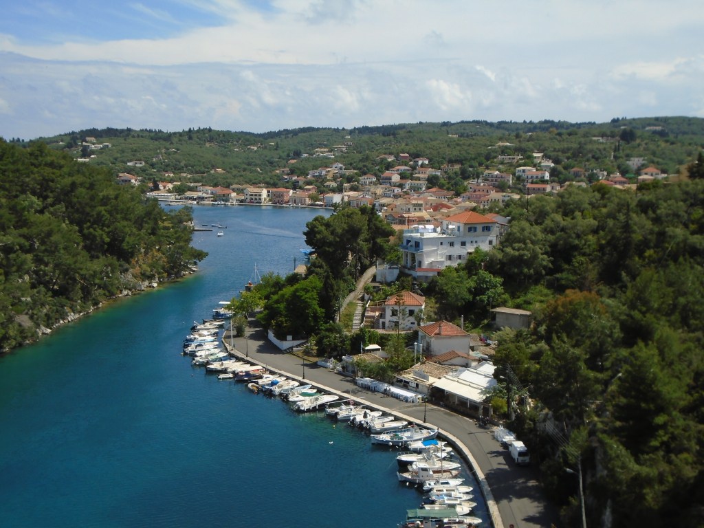
Legendary home of Homer’s Odysseus, Ithaca is a relatively small and mountainous island lying to the east of the much larger Kefalonia. Odysseus took some ten years to find his way back to his homeland after the Trojan War. I returned to Ithaca for an extended stay only three years after my first short visit.
There are peak season ferries from Fiscardo in the north of Kefalonia to Frikes in the north of Ithaca. They also run on to Vassiliki on Lefkada. However, the main route from Kefalonia runs from Sami on its east coast to Pisaetos in the middle of Ithaca’s west coast. Regular ferries from the mainland also come into Pisaetos.
Be warned, there are very few buildings or facilities at Pisaetos and local buses don’t go near it. Consequently, if you arrive on foot, you have a 5 kilometre walk into Vathy, the island capital, and a steep uphill climb out of the port unless you hit lucky and one of the few local taxis happens to be standing by.
Vathy is arguably the prettiest of all Ionian island capitals. It is set on a wide inlet off the vast Molos Bay, which almost divides Ithaca in half. Pastel coloured houses stretch along its waterfront; its back streets are a pleasing jumble of shops and tavernas catering for visitors and locals alike; and there are more accommodation and eating options than anywhere else on the island.
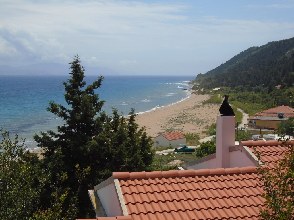
Skinos Beach
The nearest beaches are a 40 – 60 minute walk away (or a 5 – 10 minute drive). Skinos and Sarakiniko are the most attractive. At times Vathy can seem quite frenetic compared to the rest of Ithaca, but it is quieter than any other Ionian island capital.
The main road from Vathy to the north of the island forks after it climbs high above Molos Bay. The left fork runs above the west coast giving beautiful views across to Kefalonia, while the right fork meanders through the centre of the island passing the spectacular viewpoint of Katharon Monastery. The two forks join up again at Stavros, a pleasant hill village, which is the largest settlement in the north.

Molos Bay & Vathy from Katharon Monastery
From Stavros the main road continues down to the coast at Frikes, a small, untidy ferry port dominated by a large car park. It’s preferable to continue on a further 5km to the road end at Kioni, a picture postcard pretty village with an attractive waterfront and tempting bars and tavernas. Kioni is also the start point for half a dozen well waymarked walking trails, although the island as a whole caters well for walkers.

Kioni
The three main coastal villages are all popular havens for yachts and sailing flotillas. There are a lot of yachties about on Ithaca. Island beaches are predominantly pebbly. A few have the odd smattering of sand. Even fewer have any facilities, so take your own supplies.
Ithaca plays a lot of its Odysseus links – expect to see a lot of Homer related merchandise and signage. Nonetheless, it is peaceful, charming and extremely pretty. Definitely worth a visit.
Kalamos
First Visited in 2019. Most recently visited in 2024.
Close to the mainland but difficult to get to with limited ferry services and visitor accommodation. Quiet but friendly villages. Popular with yachting flotillas.

Kalamos and its neighbour, Kastos, are sometimes referred to as “the forgotten islands” as they are somewhat off mainstream tourist routes with few connections to other Ionian islands.
The larger of the two, Kalamos is basically a range of mountain tops that run for about 25 kilometres north to south. It is located between Lefkada to the west and the Greek mainland to the east. Access is primarily through a daily passenger ferry from the remote mainland port of Mitikas, which lies roughly halfway between Messalonghi and Preveza.
The ferry timetable revolves around the needs the island’s 500 or so residents rather than visiting tourists. It normally leaves Kalamos at 0645 for the 40 minute crossing to Mytikas from where it returns at 1415 in the afternoon. Times can vary at weekends and peak season, but day visits are normally only possible by renting a boat or hiring a water taxi in Mytikas.
There are two villages on the island – the main village of Kalamos halfway down its south coast and tiny Episkopi at its northern tip. The passenger ferry normally calls into both. They are linked by 9 kilometres of tarmac road that runs through heavily scented pine forest.

Porto Leone
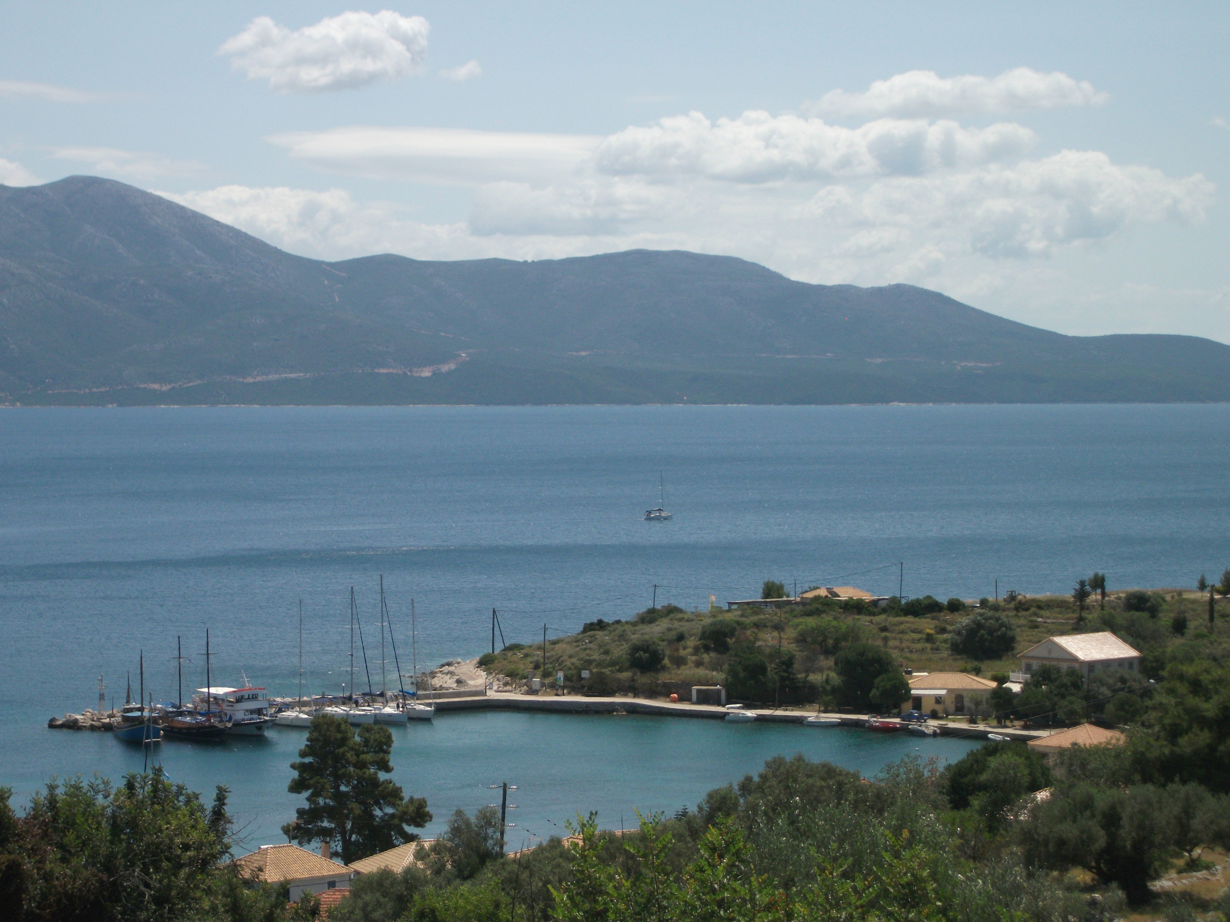
There is also another village, Porto Leone, at the southern end of the island, but this was abandoned after the devastating earthquake that hit the Ionian islands in 1953. In typical Greek fashion, the church is now its only maintained building. Despite its isolation, Porto Leone appears to be a popular, informal anchorage for yachts.
Most of Kalamos’ tourism business comes from the yachting fraternity, to whom it is well known and welcoming. During my most recent stay, I saw upwards of 50 yachts berthed overnight in the harbour of the main village. Others berth at Episkopi and simply drop anchor in one of the many bays and coves along the coastline.
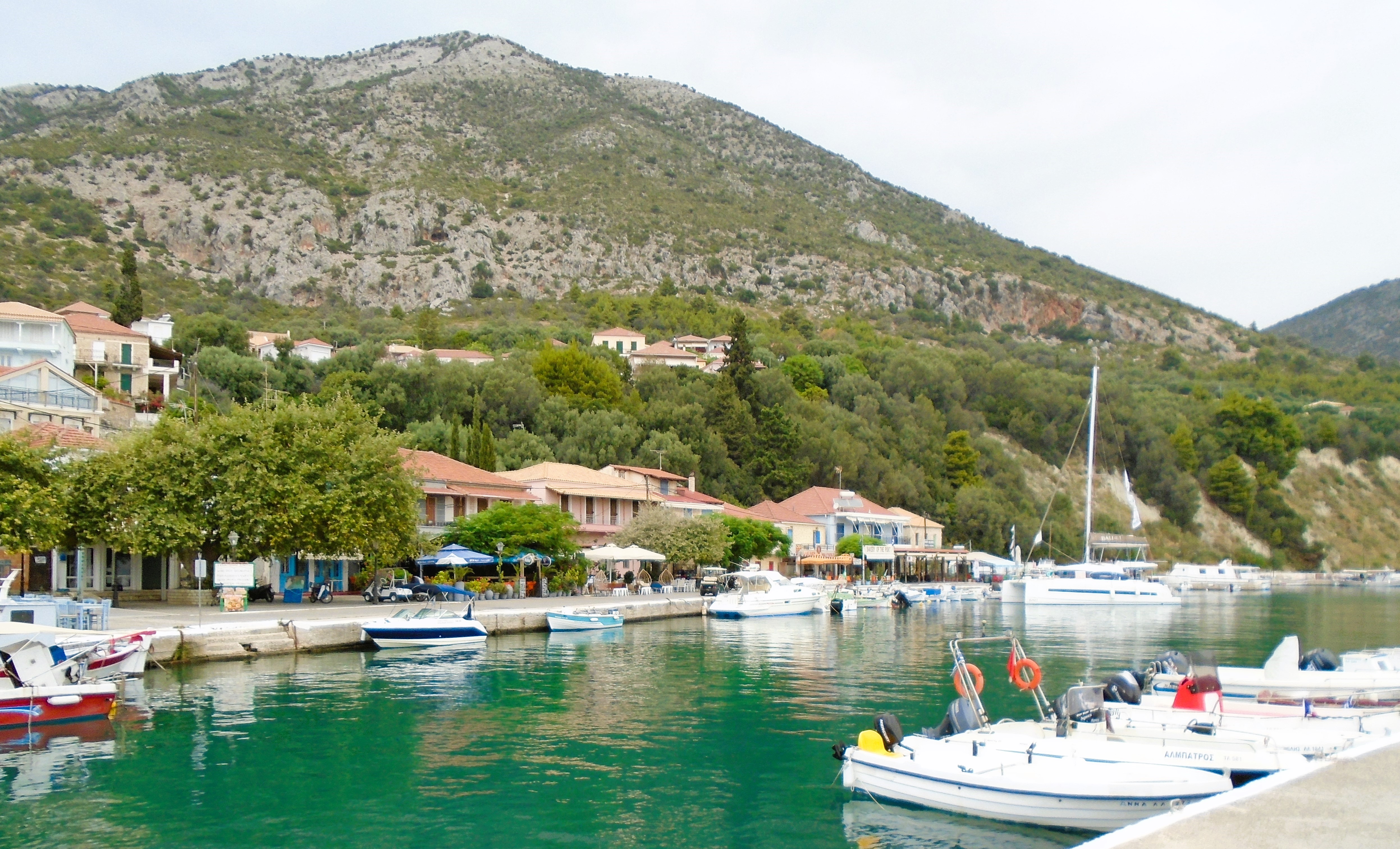
Kalamos Harbour
The harbour is the main centre of activity in Kalamos village. George’s Taverna on the waterfront is legendary among the yachting fraternity and there is a string of cafes and bars along the harbourside. Friendly In Panino at the far end is the only other one offering food, primarily breakfasts, crepes and waffles. The island’s only minimarket is also located there, as is one of the two village bakeries.
The main village rises steeply up from the harbour. There is no real centre to it but signs will lead you another better bakery, a small cafe and a decidedly rustic taverna, which surprisingly for an island had no fish or seafood on its menu.
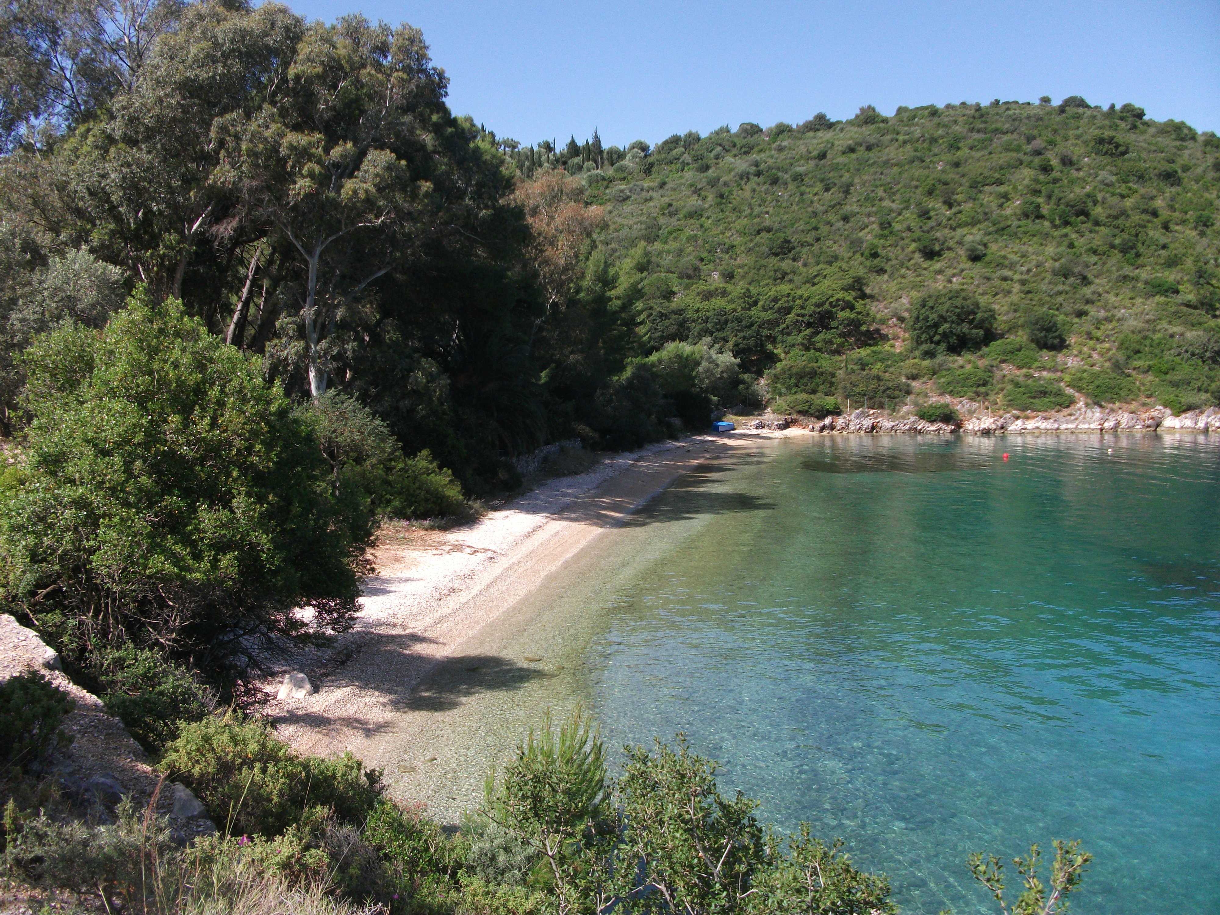
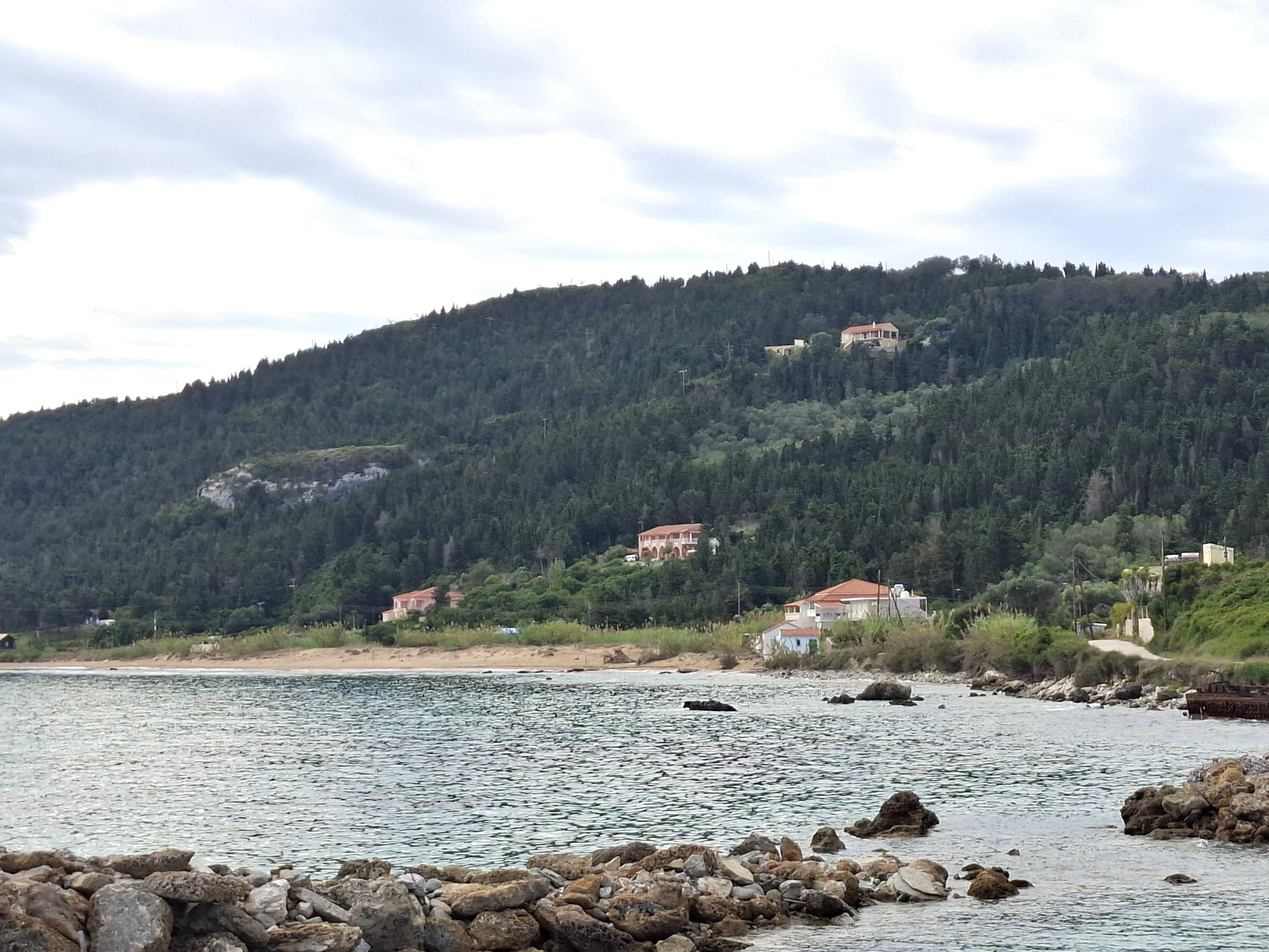
Agrapidia, the main beach is well signed from the harbour, from where it is a 15 – 20 minute walk. This is a long, picturesque curve of pebbles with a windmill at both ends. It has two small beach bars that serve full meals in peak season.
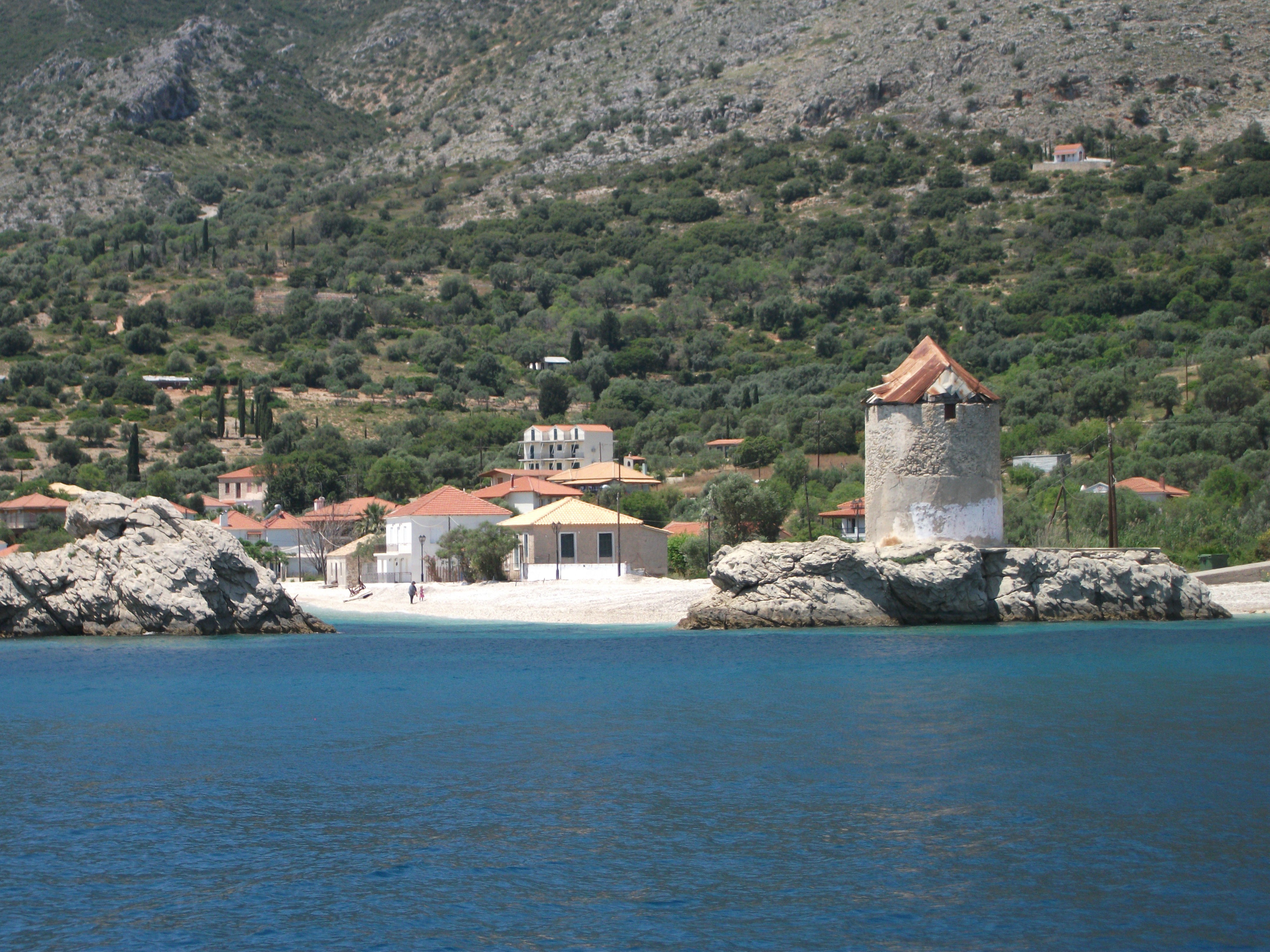
Agrapidia Beach
There is another long beach 30 minutes north of the village . It’s called Myrtia and is not signed in any way. Just look for the cement road to the right off the road to Episkopi. It’s just before a fenced off scrapyard. The beach is a mix of sand and pebbles . It has no facilities but the swimming is beautiful. If you are lucky, as I was, you might have it all to yourself.
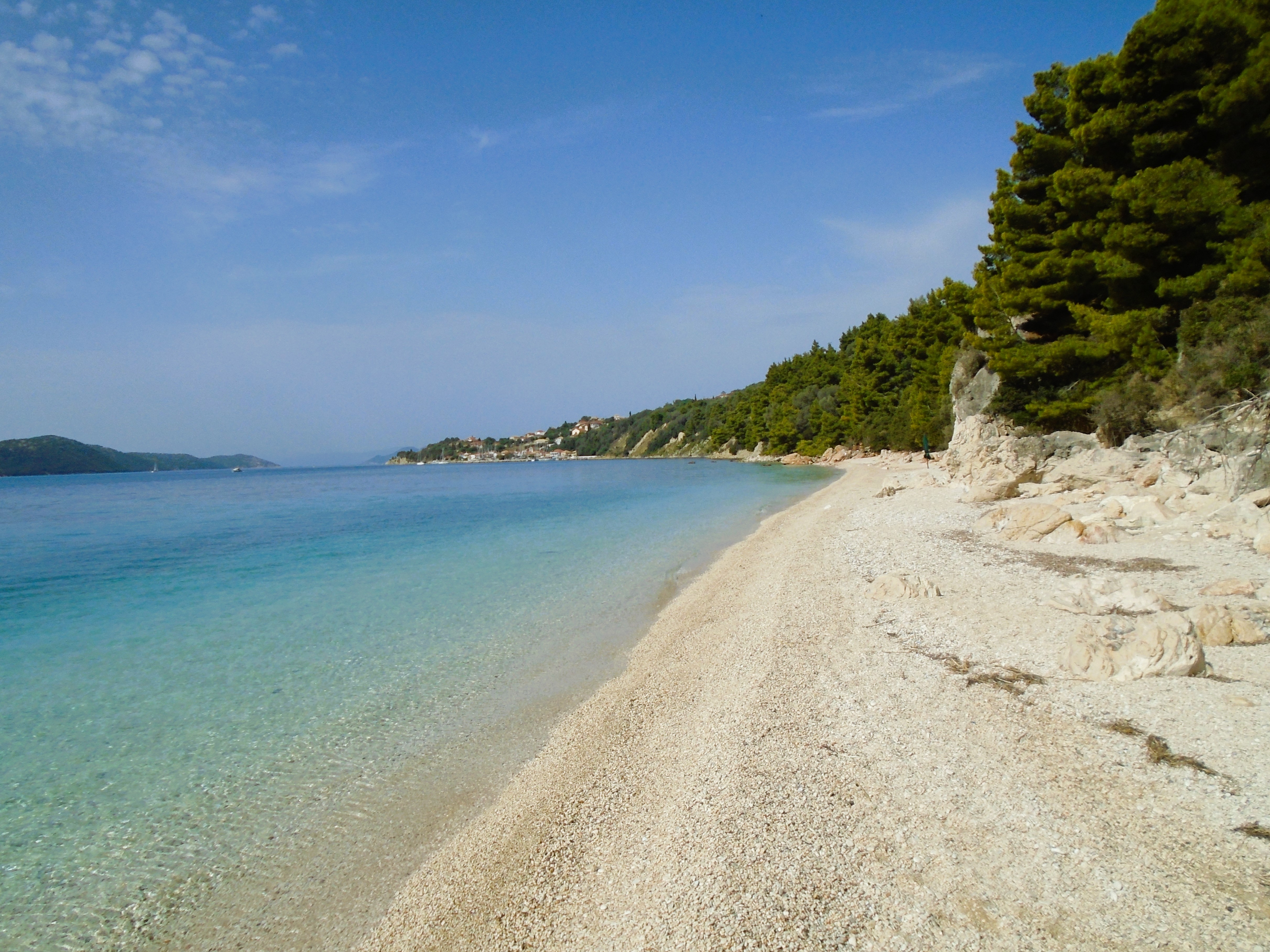
Myrtia Beach
I had planned to walk from Kalamos village to Porto Leone. I’m a sucker for abandoned villages. However, the lovely lady who runs In Panino talked me out of this idea saying it was too hot, offered no shade and necessitated walking back the same way. She suggested walking to Episkopi and getting the afternoon ferry back instead, which I did.
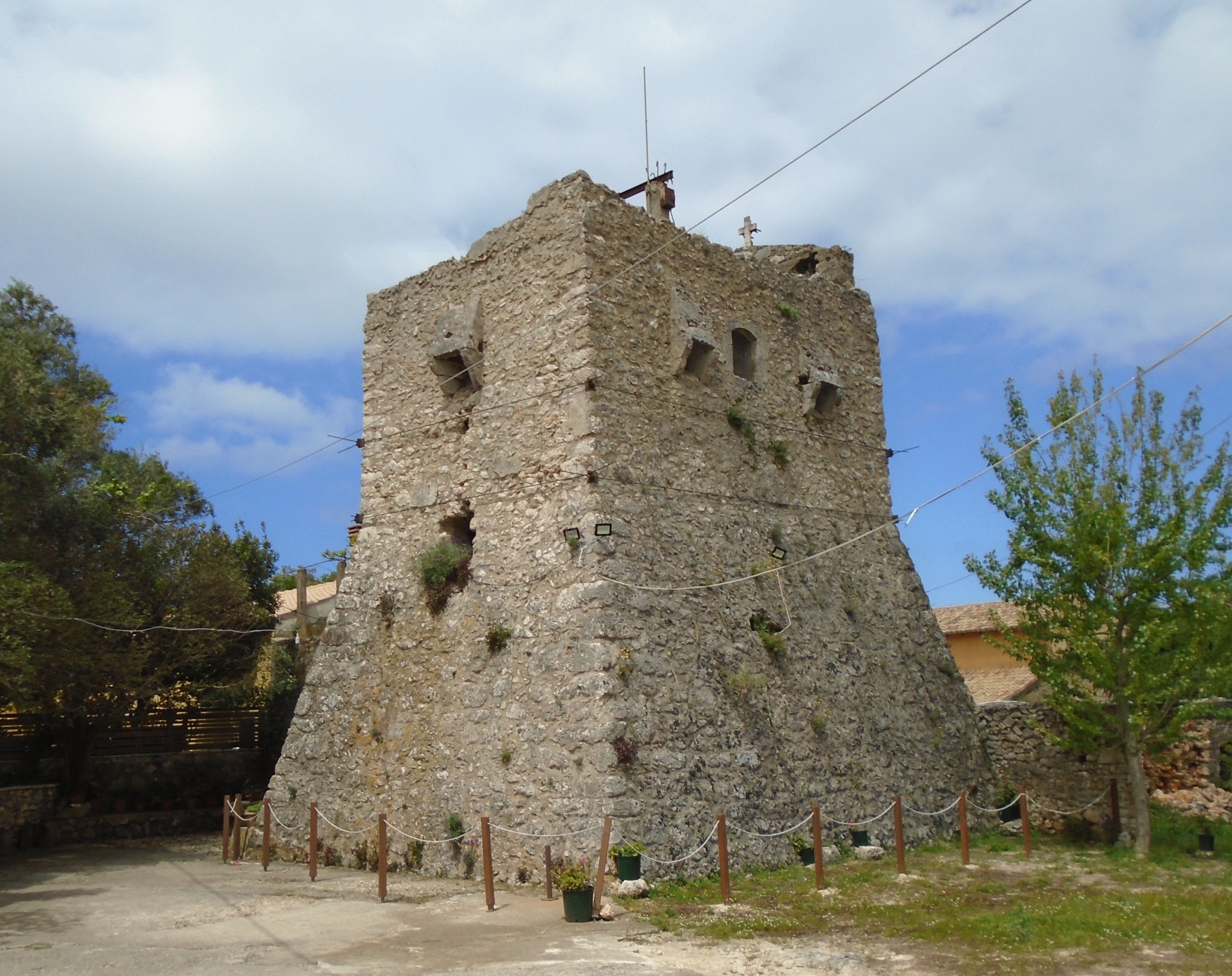
This was a gentle walk through the thick, shady forest with occasional views of the island coastline and the mainland beyond. On the final approach to Episkopi the road passes the ruins of a medieval Venetian castle, which must have been a substantial defensive building in its day. Nowadays it is overgrown and home to crows, insects and thorn bushes. Nonetheless it is well worth risking a few bites and scratches to fight your way into the interior of the castle, which is much more impressive and detailed than the bland exterior walls might suggest.
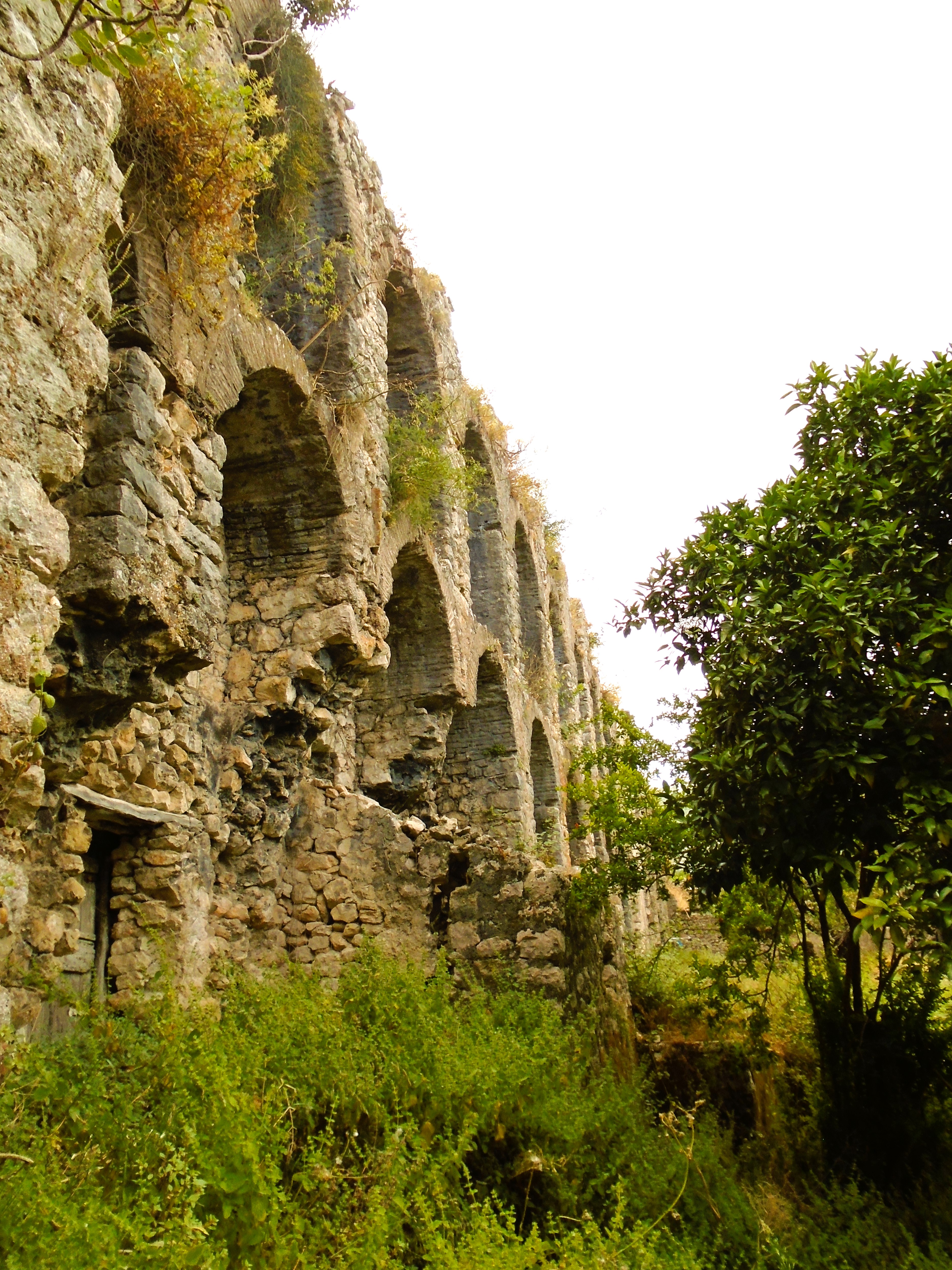
Episkopi Castle
The castle aside, the main attraction of Episkopi is Varkas, its only taverna, which is rated the best place on the island to eat on TripAdvisor. I had an excellent lunch there watching it fill up as a veritable flotilla of expensive looking vessels brought dozen of affluent looking customers until every table was filled. Advance reservations are recommended.
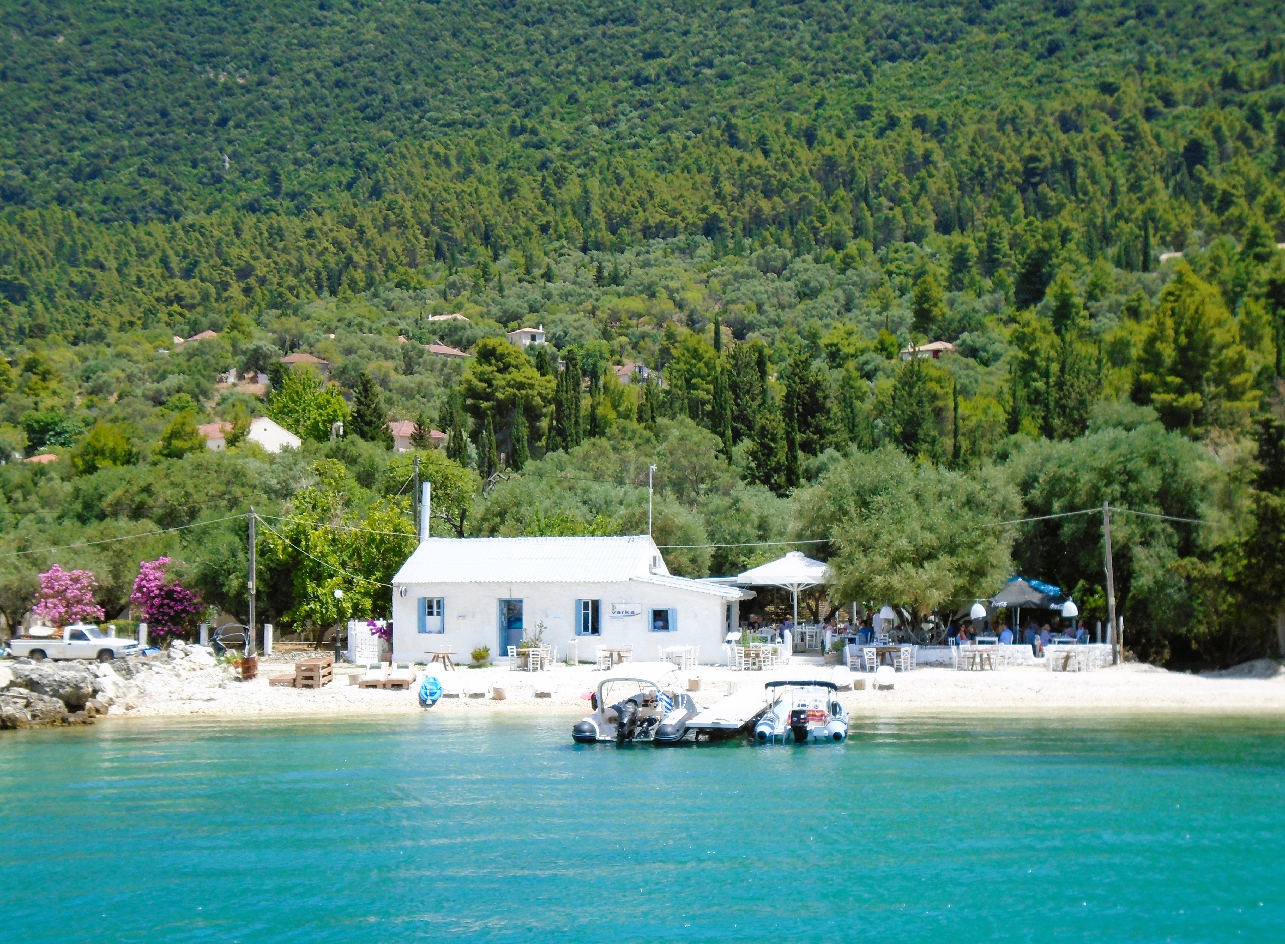
Varkas Taverna, Episkopi
Once upon a time it was almost impossible to find up to date on-line or on-site information about ferry services and accommodation in Kalamos. Things have improved slightly as some accommodation providers can now be found on Air B&B or Facebook. However, there is still limited accommodation stock and it is probably a good idea to book in advance rather than just turn up and hope someone offers you a room.
Kalamos is not the easiest island to get to. It is also not great for island hopping. But it is friendly, pretty and to use that word, authentic. Count me in as a big fan.
Kastos
Visited in 2016.
Kalamos’ smaller, flatter neighbour with the same limited ferry services and visitor accommodation. Very quiet and sleepy but does get some day visitors from nearby Lefkada
The other so-called “forgotten island”, Kastos lies about 2 km to the south of Kalamos. It is much smaller and lower lying than its neighbour but shares its extensive woodlands and greenery.
At one time, Kastos and Kalamos were served by a single single passenger ferry which linked both of them to Mytikas on the mainland. Currently Kastos has its own separate ferry service to the mainland and no official ferry link to Kalamos. However, I did see the Kastos ferry come into Kalamos harbour early one morning and wonder if it calls in there on demand.

Kastos
I visited Kastos on a day trip excursion boat from Lefkada. Another excursion boat visited the island at the same time and there were a number of yachts in the harbour as well as kayaks drawn up on the pebbly beach, all of which gave the waterfront of the only village a bit of a buzz.
Kastos has an official population of about 80. Additional summer visitors help to support three tavernas and a single island shop. Places to stay appear to be very limited. I was advised that one lady offers three rooms for visitors in peak season, but that’s about it. At the time of my visit, half a dozen new villas were being built on the edge of the village. I gather some are still unsold if anyone is looking to relocate and escape the rat race.
It only takes about 15 minutes to walk a circuit of paths around the top of the village. The few buildings of note are the attractive island church, a restored windmill at the harbour, which now houses a bar/cafe, and a large renovated stone house on the beach that appears to be the busiest taverna/bar (at least it was when I was there). Somewhere there is also now an idiosyncratic Maritime Museum run by an enthusiastic islander, but it wasn’t operating when I visited.
Kastos & The Mainland
Kastos is a small island. However, it has a very pleasant and laid back atmosphere. It’s a bit like the Ionians in miniature. Green and verdant with mainly pebbly beaches. Perfect for a day visit or maybe a night or two if you can find somewhere to stay. Committed escapists may consider staying longer.
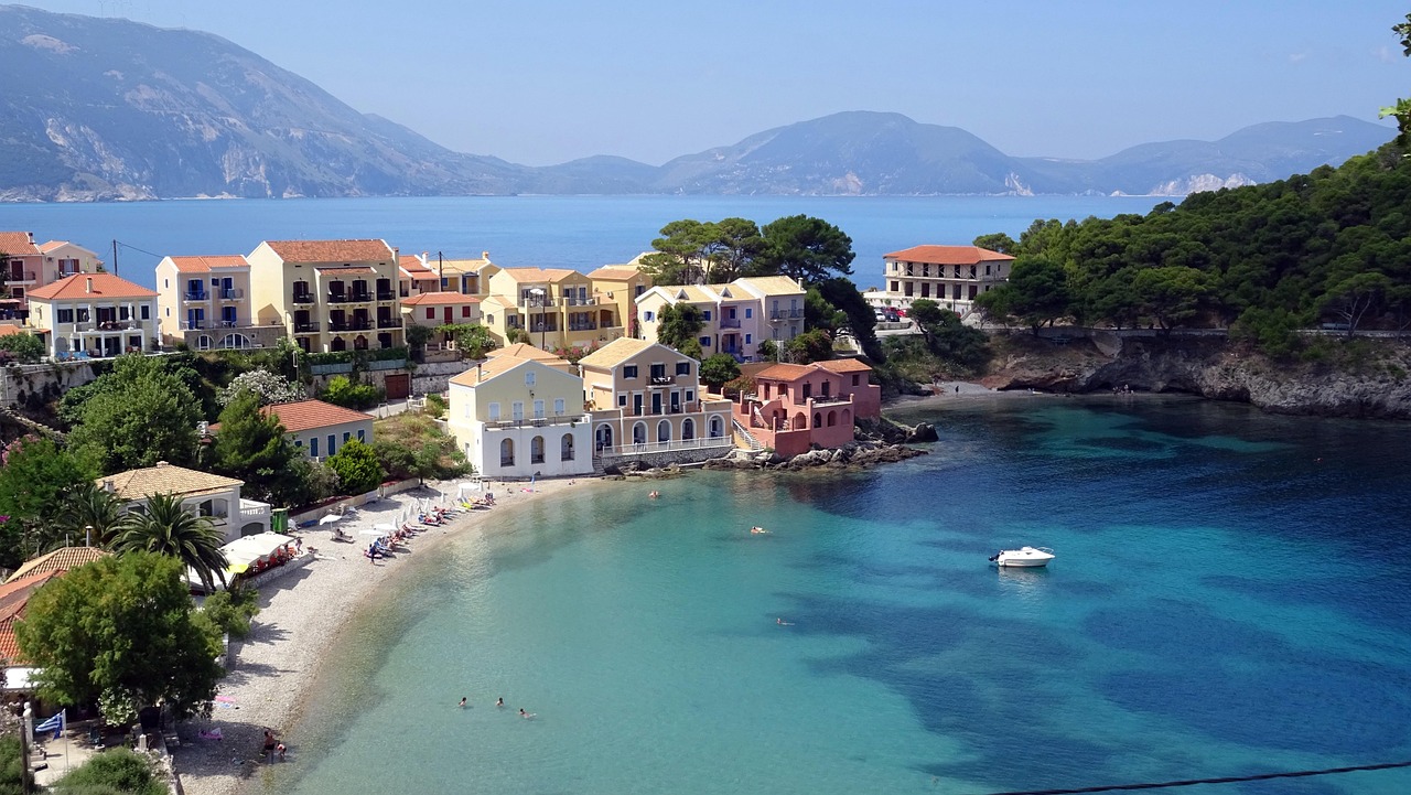
Kefalonia
Visited in 2016.
The largest of the Ionian islands. Famed as the location for “Captain Correlli’s Mandolin”. Lots to see and do and very scenic. The north of the island is particularly attractive.
Kefalonia is the largest of the Ionian Islands and attracts a significant number of international visitors who fly into its airport in the south west of the island. Greek visitors are more likely to use the regular ferries that run from a number of mainland ports to Sami and Poros on the island’s east coast. There are also regular summer ferries from smaller ports heading south to Zakynthos and north to Lefkada, all of which help to make Kefalonia one of the best bases in the Ionians for island hoping.
The airport is 7 km from Argostoli, the island capital. This is a large modern town that was completely rebuilt after the devastating earthquake in 1953. It’s a pleasant place whose main distinguishing feature is its attractive location on a headland between two bays, the largest of which separates it from the quieter Lixouri peninsula to the west. A local ferry plies a regular service between Argostoli and Lixouri. Regular bus services from Argostoli spread out across most parts of the island making exploration relatively easy.
The road south to the airport passes through the unattractive package holiday resort of Lassi, which is within walking distance of the capital. Thereafter it skirts round a couple of more upmarket resort hotels with what are effectively private beaches.

Kato Katelios
The main package holiday area is the south east corner of the island. Poros is a pleasant small town with a tidy promenade overlooking a rather scruffy beach. Skala has a much better sandy beach but looks and feels like a purpose built resort rather than a traditional village. Kato Katelios is much smaller than its neighbours but has more of an authentic village feel that is maybe beginning to be compromised by new development.
Further up the east coast, Sami is a friendly, workaday ferry port most notable for its proximity to the large cave systems at Drogarati and Melissani, both of which are open to the public and are well worth a visit. 9 km to the north, Ayia Efimia is an attractive coastal village with some good tavernas. It attracts a degree of package holiday business despite its very poor rocky beaches.

Myrtos Beach
The most impressive scenery and the prettiest villages on Kefalonia can be found in the north of the island. Myrtos is one of the most spectacular beaches in the Ionians but, apparently, can get crowded in peak season. Given its size, I found that surprising.
Assos
Assos is a charming coastal village on a narrow isthmus located at the end of a steep road. It has a limited choice of accommodation and tavernas and a small pebble beach, which are more than compensated by its awe inspiring location and sleepy atmosphere.
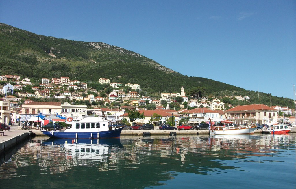
Fiscardo, a popular resort village located near the northern tip of the island, is much favoured by the yachting fraternity. With a wide bay, red roofed houses and views across to Ithaca, it is picture postcard pretty but knows it. There is a wide selection of places to stay and good quality tavernas and restaurants serving imaginative variations on Greek staples. However, prices are higher than elsewhere on Kefalonia. Nonetheless, this is where I would recommend staying for an authentic atmosphere with a bit of life to it. Don’t miss the wonderfully named Eclectic Museum in the village.
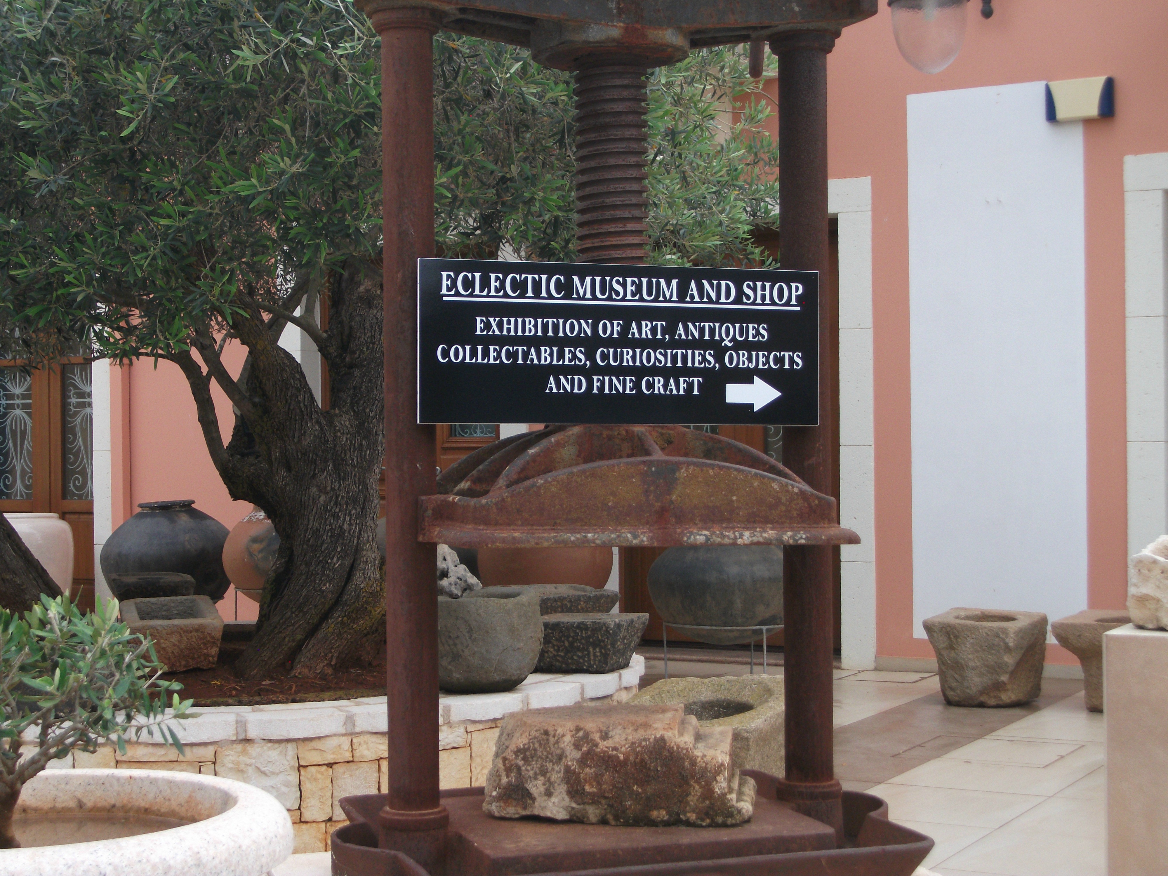
Fiscardo, Eclectic Museum
Overall, Kefalonia is an attractive and friendly island that merits a lengthy stay whether as an independent or package holiday visitor. It is easy to get around and rewards exploration.
Lefkada
First Visited in 2016. Most recently visited in 2019.
Accessible from the mainland by bridge. A charming main town, an over developed east coast and a wilder west coast which has superb beaches. Growing in popularity.

When is an island not an island? Maybe when it is Lefkada (also called Lefkes).
The northern tip of Lefkada was originally tenuously attached to the mainland of Greece by a series of shallow lagoons. In the 7th century BC, the ancients cut a canal through the lagoons turning Lefkada into a de facto island. This canal has since been maintained and refurbished and nowadays access from the mainland is by road across a short floating pontoon bridge which moves to allow yachts safe passage. This enables the nearby airport at Preveza on the mainland to act as a gateway to the island.
Lefkada Town
The capital, Lefkada Town, is at the northern edge of the island, next to the road bridge. First impressions are of a sprawling modern town with one of the largest marinas in Greece. However, the area near the port is a delightful mix of pedestrianised boulevards and wide squares with little churches and museums as well as shops and tavernas that cater for locals as much as visitors. It is a gem that perhaps has still to be fully discovered by visitors other than the yachting fraternity.
Vassiliki
Nidri and Vassiliki, the island’s two main package holiday resorts, lie on the east and south coast respectively. Both have spectacular coastal settings that are spoiled by ugly characterless ribbon strip over-development and mediocre beaches. Nidri primarily attracts a mix of families and older visitors, while Vassiliki appeals to active young adults particularly through its international reputation as a windsurfing centre. Neither has much about them that is distinctively Greek.

Sivota
The main road between Lefkada Town and Nidri is a succession of utterly featureless coastal villages with a myriad of signs for small hotels and studio/apartments. Things improve further south on the way to Vassiliki as the scenery becomes more rural. Lying just off this road, Sivota is a pleasant mini-resort set on a pretty bay with shops and tavernas catering primarily for passing yachts.

Agia Nikitas
Lefkada’s wilder west coast has much less tourism development and significantly fewer visitors, despite having spectacular scenery and some of the best beaches in Greece. Agia Nikitas is the main resort on this coast. It has the look and feel of a small fishing village where tourism is now the main industry. It is low-key with a pretty, pedestrianised main street that winds down to a sheltered sand/shingle beach. Vast sand beaches are nearby at Mylos (20 min walk) and Kathisma (10 min drive).

Mylos Beach
Lefkada Town, Nidri and Vassiliki all have ferry services to other Ionian islands. Nidri is the main centre for day trip excursion boats. However, the port at Vassiliki has recently undergone a major expansion and some of the ferries and excursion boats are starting to operate out of there.
All in all, Lefkada is a mix of the good and the not so good. The west coast is the least developed and has the best beaches. The beaches of the east and south coasts are much inferior and their main resorts are far from relaxed and can be a bit in your face. On the other hand, Lefkada Town is maybe still to be fully discovered and appreciated. Horses for courses, I guess.
Mathraki
Visited in 2019.
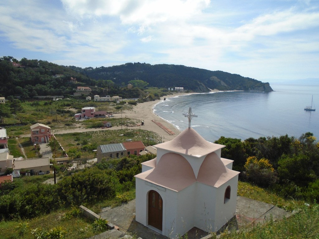
The smallest of the three islands located off the north coast of Corfu. Limited visitor facilities but a popular day visitor destination for its long, sandy beaches. Very friendly locals.
Mathraki is the smallest of the three Diapontia islands that lie off the north west coast of Corfu. It is also the nearest to its large neighbour, being a 30 minute ferry crossing from Agios Stefanos on the Pigasos supply boat that runs 2 – 3 times a week. Its schedule makes it possible to day visit Mathraki, giving just over 3 hours to explore the island. There is an additional ferry service from Corfu Town that takes about 3 hours each way and also provides a link to the other Diapontia islands.
For many the main attraction of Mathraki is its beaches, particularly the 4km long sandy Portello Beach that starts at the harbour and runs along most of the island’s Corfu facing coast. However, there is also some pleasant walking to be had and I found it easy to complete a circuit of about 10km round the island in just over 2 hours, leaving plenty of time for a beer before the return ferry.
Communities on the island tend to be rural scatterings of red roofed houses. Mathraki has an official year-round resident population of about 300, although one local insisted it is nearer 60 in reality.
Mathraki Port
The ferry port has a few houses and a couple of tavernas – one on the beach and one up the hill, which also serves as a mini market. The main road climbs up to and then along the central spine of the island, which is where most people live. The road surface is mainly made up of disintegrating concrete and is in very poor condition in places. Short, well signed side roads lead off to small hamlets or quiet beaches. There are also occasional signs to tracks that dart off into the dense undergrowth. I started following one but quickly turned back when it disappeared completely among the foliage.
The main settlement is a 45 minute walk from the port. It’s only real features are its church, children’s playground and small kafenion (closed of course). The road then continues back down to the coast at Port Asipia, where there is a seaweed clogged harbour and nothing else.

Avolaikia Beach
An alternative route back to the port runs down to Avolaikia Beach where there is a hotel/taverna. From there it becomes a sandy track running the length of Portello Beach. It’s a lovely scenic walk.
As well as the hotel, there are two or three rooms for rent operations on Mathraki and I suspect some of the houses I passed are holiday villas in peak season.
I found Mathraki to be a really friendly island. Every car that passed me – all 5 or 6 of them – stopped to offer me a lift. Everyone I walked past stopped what they were doing to wave and say hello or welcome. Some were keen to chat and talk about their island as well as to find out who the hell I was. I would happily go back to Mathraki tomorrow to spend more time there.
Meganissi
Visited in 2016
Lefkada’s smaller neighbour, but large enough to have three sizeable villages. Upmarket with mostly villa accommodation. Scenically attractive with a laid back atmosphere.
Lying just to the east of Lefkada to which it is connected by regular ferries that take around half an hour, Meganissi seems to be a real favourite with travel journalists looking to write about undiscovered Greek island hideaways. With about 1,000 local residents and a wide range of visitor accommodation, it is far from being an empty desert island, but it is considerably more relaxed, peaceful and upmarket than its larger neighbour to the west.
Most ferries from Lefkada call in at two ports on the island, Vathy and Spilia. The gentle inland walk between the two takes 2 – 3 hours and is the best way to see the island on a day visit.

Vathy
Vathy is the larger of the two ports with the widest selection of tavernas and places to stay. This is probably where to head if looking for what passes as action on Meganissi, but it is possibly the least visually attractive of the villages on the island.
The inland village of Katomeri is about a 20 minute walk from Vathy along a paved road with gentle uphill inclines. It is a pretty little place nestled among woodlands, but does have the only full service hotel on the island as well as a few cafés and tavernas. From here, it is gentle stroll through attractive countryside along the road to Sparthohori. There are detours to a number of quiet pebble beaches along the way, but some are not really practical to visit on a day trip.
Sparthohori
Sparthohori is probably the most picturesque place on the island, especially in late Spring when it is a riot of colourful flowers. I spent a very enjoyable half hour or so wandering among its whitewashed cottages before relaxing over an extended lunch in a taverna whose owners were keen to tell me about their son’s obsession with all things Scottish, providing photographic evidence to prove it.

Spilia
After lunch I strolled the ten minutes or so downhill to Spilia to lie on its pebble beach, wander past the yachts on its quayside and down a cool beer until the late afternoon ferry back to Nidri on Lefkada, which seemed rather frenetic and a bit shabby after a quiet day’s walking where I saw very few other people (but quite of lot of surprisingly friendly dogs!).
The regular local ferries from Nidri are by far the best way to get to Meganissi. Some excursion boats from Lefkada include it on day trips but many don’t actually berth on the island. Instead they sail close to sea caves on its south coast before moving onto uninhabited islets for swimming and barbeques. Meganissi is certainly worth more than a quick sail past and merits at least a day of exploration.
Othoni.
First Visited in 2016. Most recently visited in 2025.
The largest and most distant of the small islands off the north coast of Corfu. The most westerly point of Greece. Quiet, friendly and relaxed. Gets some day visitor groups from Corfu.

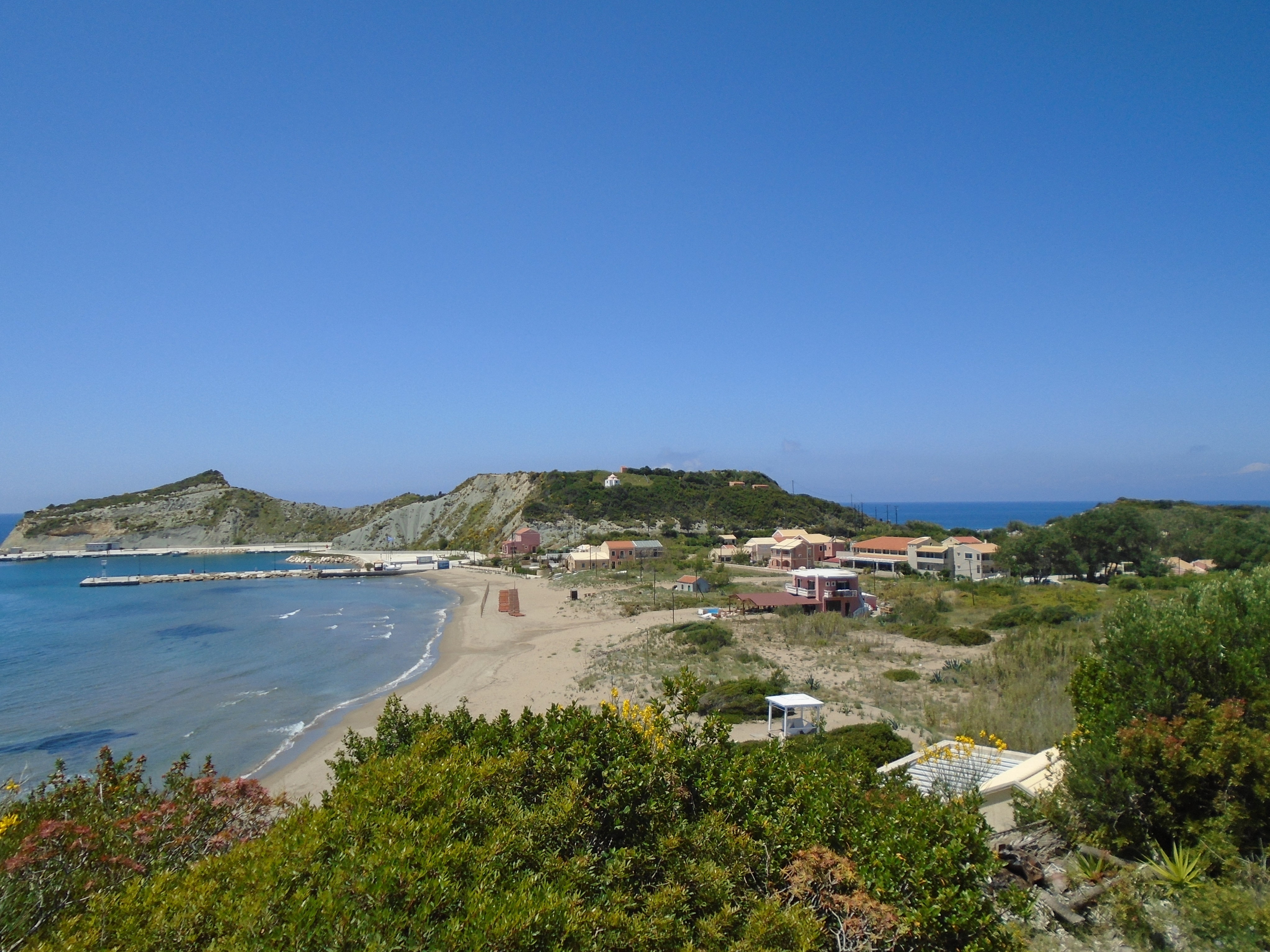
Othoni is the largest of the three Diapontia islands lying off Corfu and represents the most westerly point in all of Greece. The coast of Italy lies less than 50 nautical miles away, although I’m not sure how long a nautical mile actually is.
Being the furthest of the three islands from Corfu, it takes the longest to reach by local ferries, but is still only about an hour by passenger ferry from Agios Stefanos on Corfu’s north west coast. Summer ferry timetables run about three times a week and make it possible to day visit from Agios Stefanos with just short of 3 hours to explore the island.
A few peak season excursion boats also visit from Agios Stefanos, usually giving time on both Othoni and Mathraki, although they can be subject to late cancellation if there is limited visitor demand (that’s the voice of personal experience talking!). In 2025, the excursion boat schedule allowed for a 1 hour swimming stop off Aspi Ammos beach and 2 hours at Ammos, the main settlement on the island.
There is also a larger car ferry from Corfu Town, which runs two or three times a week. This leaves Corfu at 0600 and stops at the neighbouring islands of Erikoussa and Mathraki on the way, resulting in a four hour journey time. However, it is a very scenic route between the northern coasts of Corfu and the mountains of Albania. Unfortunately the vessel turns round straight back to Corfu Town giving virtually no time to explore Othoni.
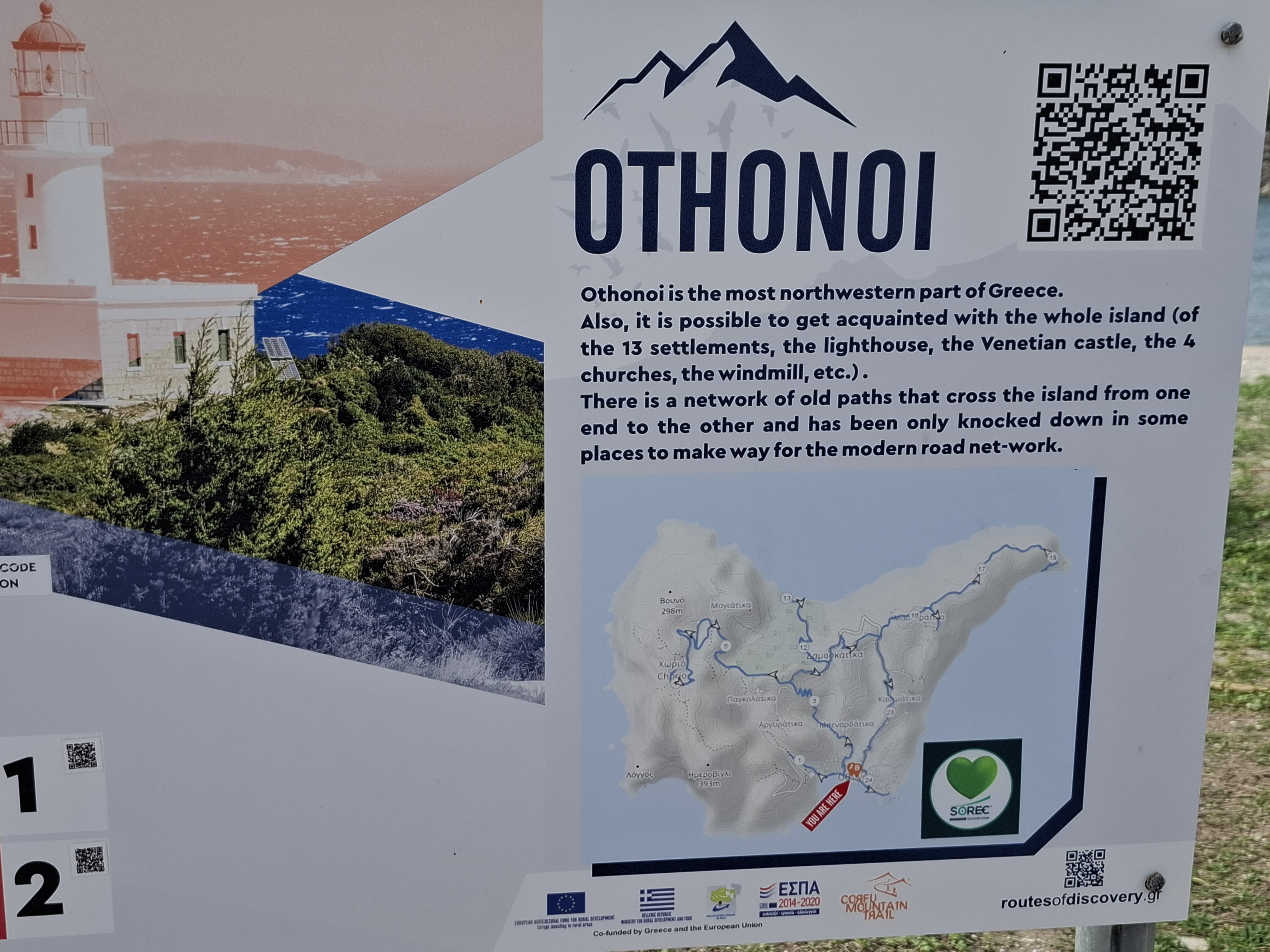
Othoni Information Board
Local information boards claim there are 13 settlements on Othoni, some of which must be very, very small. The port of Ammos is the largest settlement and has the island’s only hotel (highly rated on TripAdvisor), a couple of mini markets, some self catering accommodation and and a few tavernas, which is probably enough to cater for even peak season visitor numbers. The hotel and some of the self catering accommodation are not immediately obvious as they are located a little outside the village on uphill roads into the hinterland.
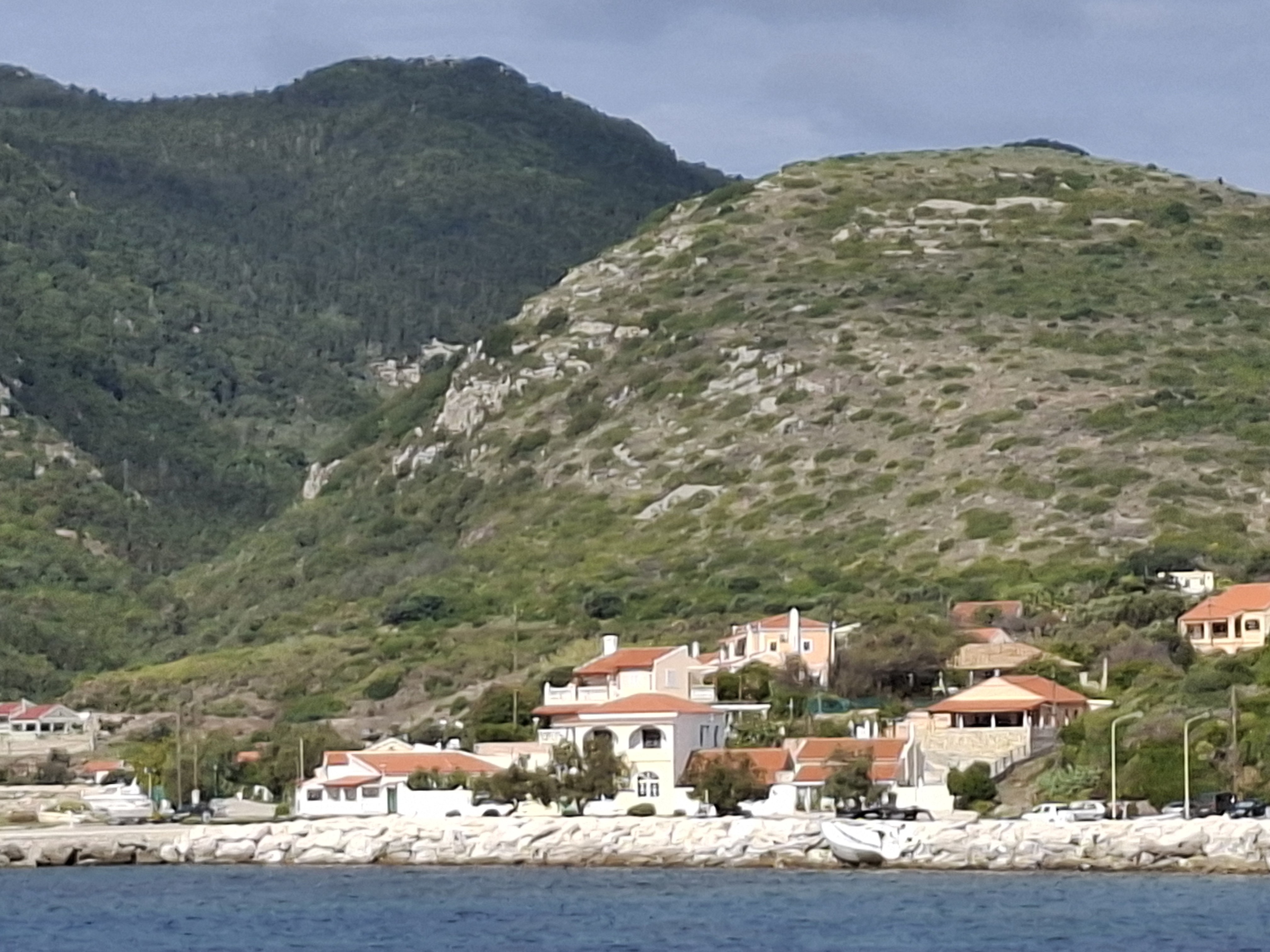
Ammos
Ammos has a wide, serviceable beach of greyish sand, which reverts to pebbles at either end. It also displays relics from different periods of war, ranging from medieval cannons to a monument to a World War 2 Greek submarine that was sunk nearby. Most are lined along the shoreline between the village centre and the port/marina area.
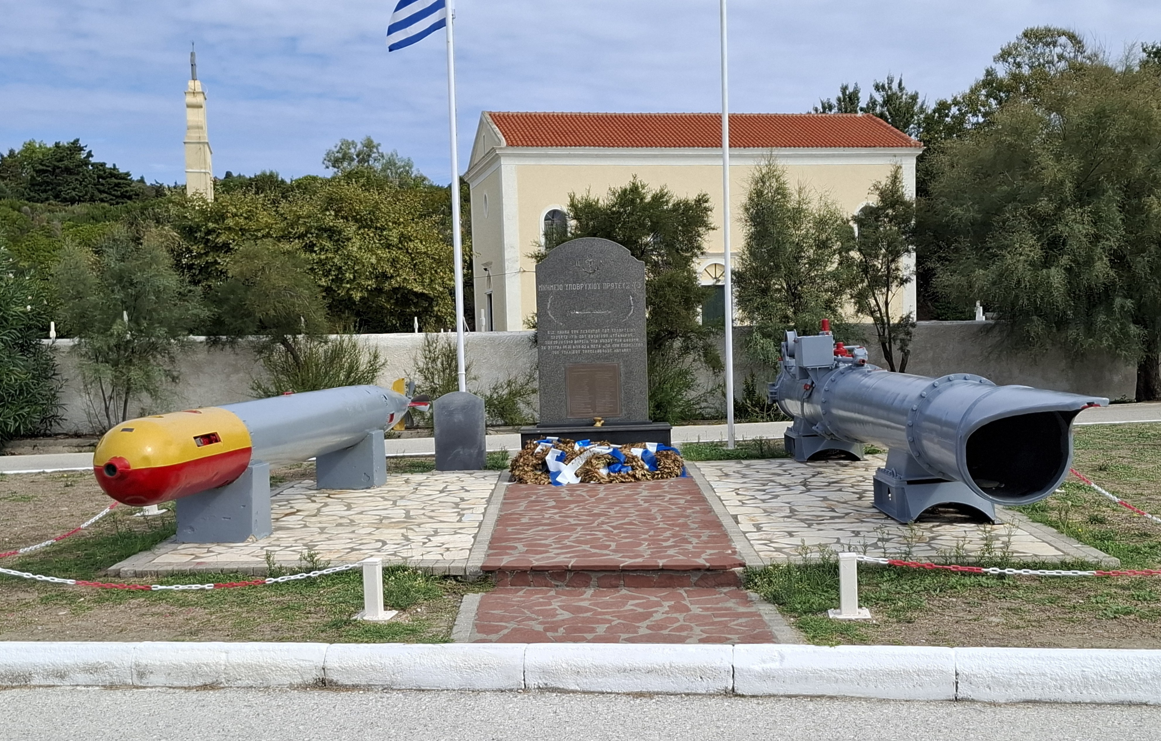
Ammos – World War Two Memorial
The paved road inland from Ammos climbs steeply to a picturesque wooded interior that was a riot of springtime colour with wild flowers during my first visit. The small inland village of Horio was very pretty with well-tended gardens but appeared bereft of any inhabitants or facilities.
Information boards in Ammos provide maps and QR codes that provide details of walking trails that run across the island using traditional footpaths and tracks.
Othoni Interior
For better or for worse, the island’s two best known attractions – the pebble beach of Aspi Ammos and the adjacent Calypso’s Cave – are only accessible by boat. Although they lie a relatively short distance from the main village, I have never seen anyone operating excursion boats to them from elsewhere on the island and I have heard visitors expressing disappointment at being unable to access them.
Nonetheless, they can occasionally get quite crowded with visiting yachts and excursion boats from Corfu. They have no on-site facilities and the beach has little shade. In theory, you can walk to Aspi Ammos, but it’s a very rough track that is difficult to follow and involves a fair bit of scrambling down a cliff face and an even tougher climb back up. I wouldn’t recommend it.
Aspi Ammos Beach
One guide book describes the Othoni locals as being “rather cool” towards tourism. I have found them very friendly, helpful and chatty. However, on my most recent visit on the first day of October, most visitor facilities appeared to be closed for the season with only one cafe open for drinks only business. The only food that was available was in one small mini market that heated up some pizza slices and pastries in a microwave for us.
Othoni Cat
Othoni is picturesque. It has the classic laid back, slightly lackadaisical small Greek island atmosphere. It also appears to have a large population of feral cats, which could be an attraction for JD Vance’s childless cat ladies such as Taylor Swift. However, it receives a microscopic percentage of the millions of visitors who come to neighbouring Corfu and is probably all the better for it.
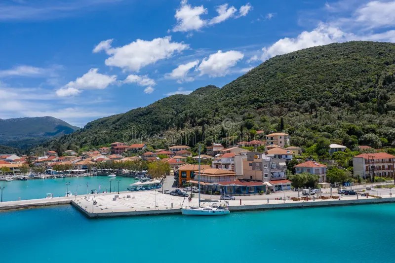
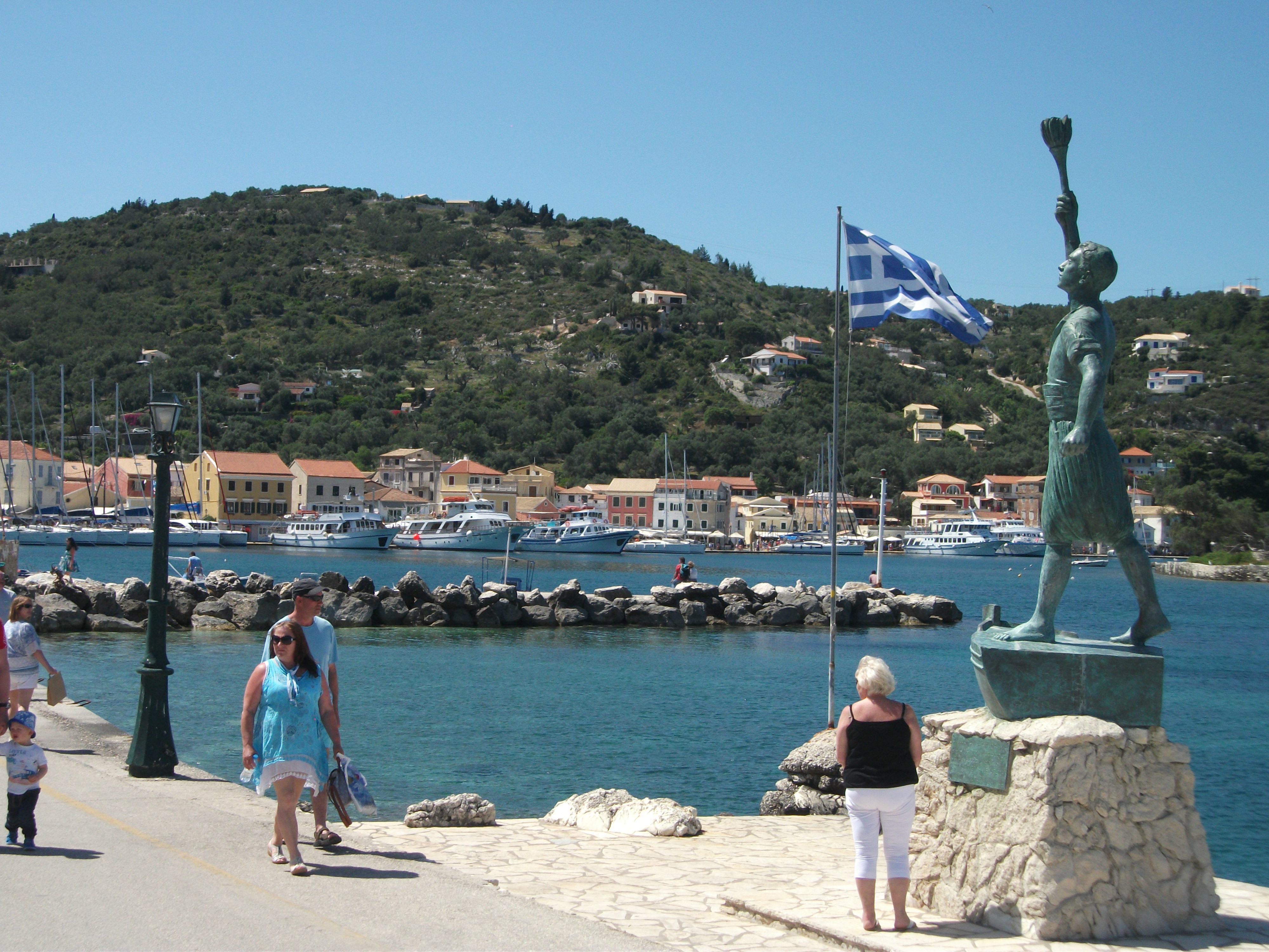
Paxos
First Visited in 2016. Most recently visited in 2025.
Corfu’s southerly neighbour. Upmarket with three very attractive villages and mainly villa accommodation. Beaches are pretty mediocre and prices can be higher than elsewhere.
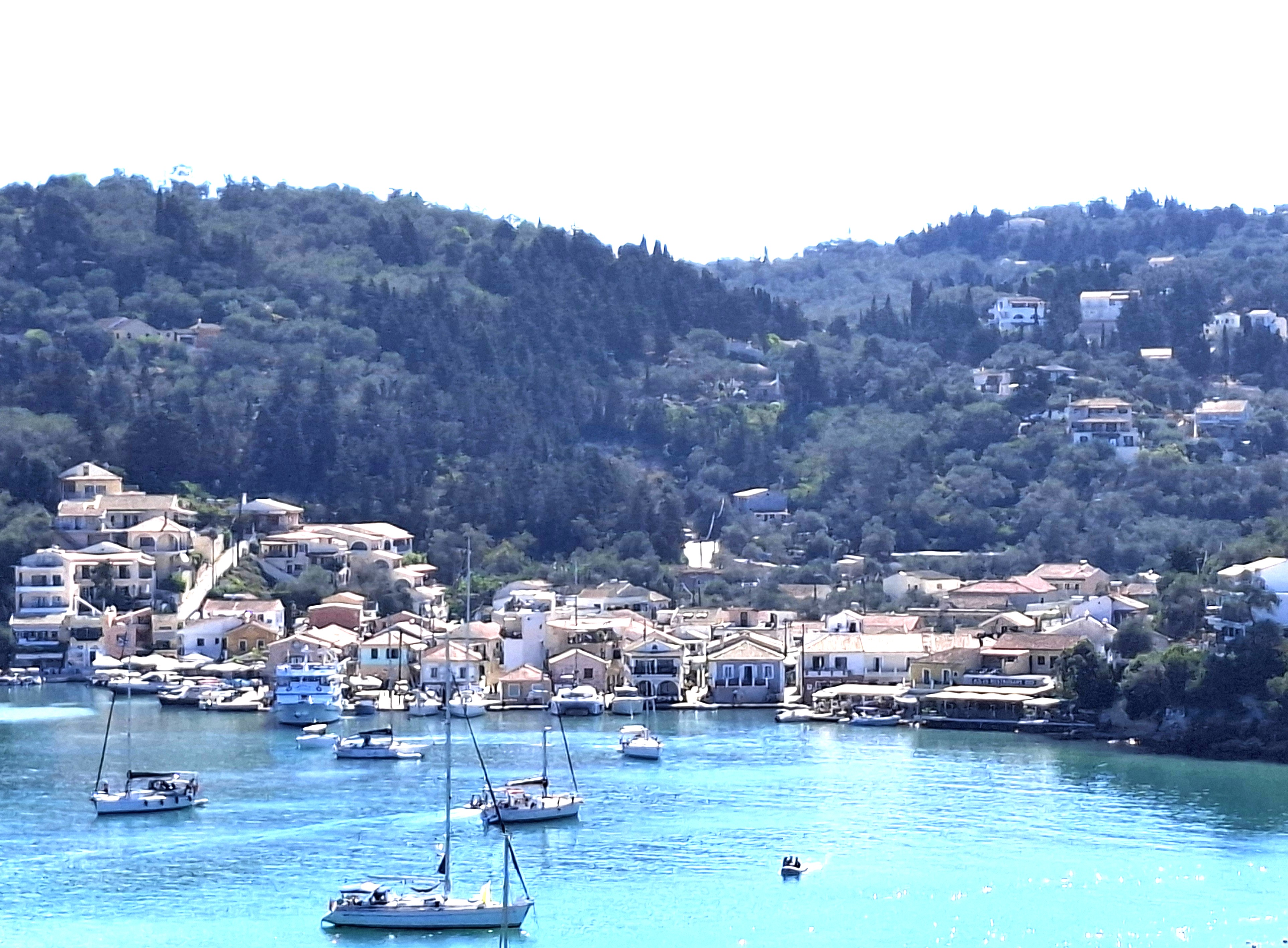
Paxos, Corfu’s smaller southerly neighbour, has established a niche for itself as an easily accessible, upmarket villa holiday destination. It is also popular with the yachting set and day trippers from Corfu. As a consequence, it can be busier and more expensive than other parts of the Ionians.
Numerous hydrofoils and ferries run between Corfu and Paxos during the summer months taking as little as an hour to make the crossing. There are also regular ferry links with Igoumenitsa and Parga on the mainland and packed excursion boats sail from Corfu Town every day in peak season. The latter generally sail past the sea caves on Paxos’ west coast and drop anchor for swimming off nearby Antipaxos before berthing for the afternoon in Gaios, the main port and village on Paxos.
Gaios is attractively located overlooking two small islets that provide shelter for the harbour and give something of the feel of travelling down a river when approaching from the sea. The waterfront is a pleasant but busy stretch of tavernas, bars and gift shops. Roads and lanes with more of the same run inland from a main square.
In peak season it can be advisable to book tables in the most popular restaurants in advance. I’ve never had a bad meal on Paxos, but particularly liked Genesis at the far end of the waterfront. It offers sophisticated cooking at prices below those of other competitors.
Gaios
Despite the often loud yachties, things quieten down considerably once the excursion boats return to Corfu. There is a wide choice of accommodation in and around the village but, nonetheless, advance booking can be advisable in peak season.
A main road runs north from Gaios through picturesque wooded scenery and the attractive old inland capital of Magazia to Lakka, a coastal village set on a beautiful bay. There are panoramic views along the road. There are generally three bus services a day each way. The journey takes just over half an hour.
Lakka
Lakka has a pretty jumble of lanes and alleyways spreading out from its quayside and offers enough tavernas, bars and accommodation options to satisfy the most demanding of visitors. The nearest beach of any note is Harami, a stretch of pebbles backed by beach bars and a hotel. It’s easily reached by a track from the village centre.
Lakka, Harami Beach
Lakka is a good centre for walking. A short route from the far end of Harami beach leads to a lighthouse with panoramic sea views. The route to the Erimitis cliffs on the west coast is longer and more challenging, but is popular for its sunset views. However I heard complaints about the taverna there overcharging.

Longos (and the road a full size bus comes down)
Longos lies on the east coast of the island and is the smallest of Paxos’ coastal villages. It is only five kilometres from Gaios, but getting there and back on foot involves some strenuous downhill and uphill walking, especially if you want to continue on the further three kilometres or so up the steep hill towards Lakka.
Longos has three buses a day from Gaios that continue on to Lakka. However, there are only two buses a day in the opposite direction. The bus somehow manages to squeeze along the narrow waterside road through the centre of the village without actually falling into the sea. An impressive bit of driving that sometimes involves local tavernas having to move their tables out of the way.
Longos
Many people consider Longos to be the prettiest village on Paxos and I can understand why. Its setting is sublime. It is also thought by many to have the best restaurants on the island. Certainly a large proportion of its space is taken up with the tables and chairs of local tavernas, which are quiet during the day but, presumably, very busy at night.
Beaches on Paxos are generally small and predominantly pebbly or rocky. Magonissi beach at the south of the island offers some sand but is limited in size and can get very crowded. There is accommodation all over the island, offering plenty of opportunities to escape the crowds while still having easy access to the main villages. But don’t expect too many bargains.
Skorpios
Visited in 2016.
Small private island owned by the Onassis family. Daily excursion boats from Lefkada sail past it at regular intervals, but landfall is not allowed.
Skorpios is an Ionian island I have seen but never set foot on. However, I have a good excuse as it is a private island that does not welcome uninvited visitors.
It is one of a number of small, heavily wooded private islands that lie just off the coast of Lefkada opposite Nidri, from where it is clearly visible. It is best known for being owned by the Onassis family, the late patriarch of which, Aristotle Onassis, is commemorated with a statue on Nidri’s quayside.
I’ve no idea why he bought Skorpios. As far as I’m aware, he had no personal connection with the Ionian Islands, having been born in the Turkish city of Izmir when it was called Smyrna and was part of Greece. Maybe buying islands is something that just comes naturally to the world’s richest men.
The island achieved a certain notoriety in the 1960s after Onassis married the widow of assassinated American president John F. Kennedy. The spot where paparazzi were able to photograph her sunbathing in the nude on the island is now known as Jackie O Beach.
Onassis included a condition in his will that the island must remain in the hands of his family and, if they did not want it, it should be transferred to the ownership of the Greek state. His grandchildren found a way round this condition by “renting” it to a Russian oligarch on a 99 year lease. Said oligarch protects his privacy but is well respected on Lefkada for helping to fund an extension to the island hospital and supporting local community groups.
Skorpios
Just about every excursion boat operating out of Nidri sails past Skorpios with a commentary. At one time, some boats were allowed to come into one cove where passengers could sunbathe on the beach for a short period, but that seems to have stopped for the time being. Nonetheless, the boats still come in close enough to see the main house on the island, the staff accommodation, the oligarch’s huge yacht and the polite but blunt “Keep Out” signs. I was informed that armed guards have been known to enforce the signs.
Maybe one day I’ll be invited on to Skorpios, but I doubt it.

Madhouri
Similarly, I’m unlikely to ever make it on to the smaller, neighbouring island of Madhouri, which is owned by the family of Greek poet and politician Nanos Valaoritis and is also off-limits to common scum like me. How exactly do poets afford to buy islands (he asks jealously)?
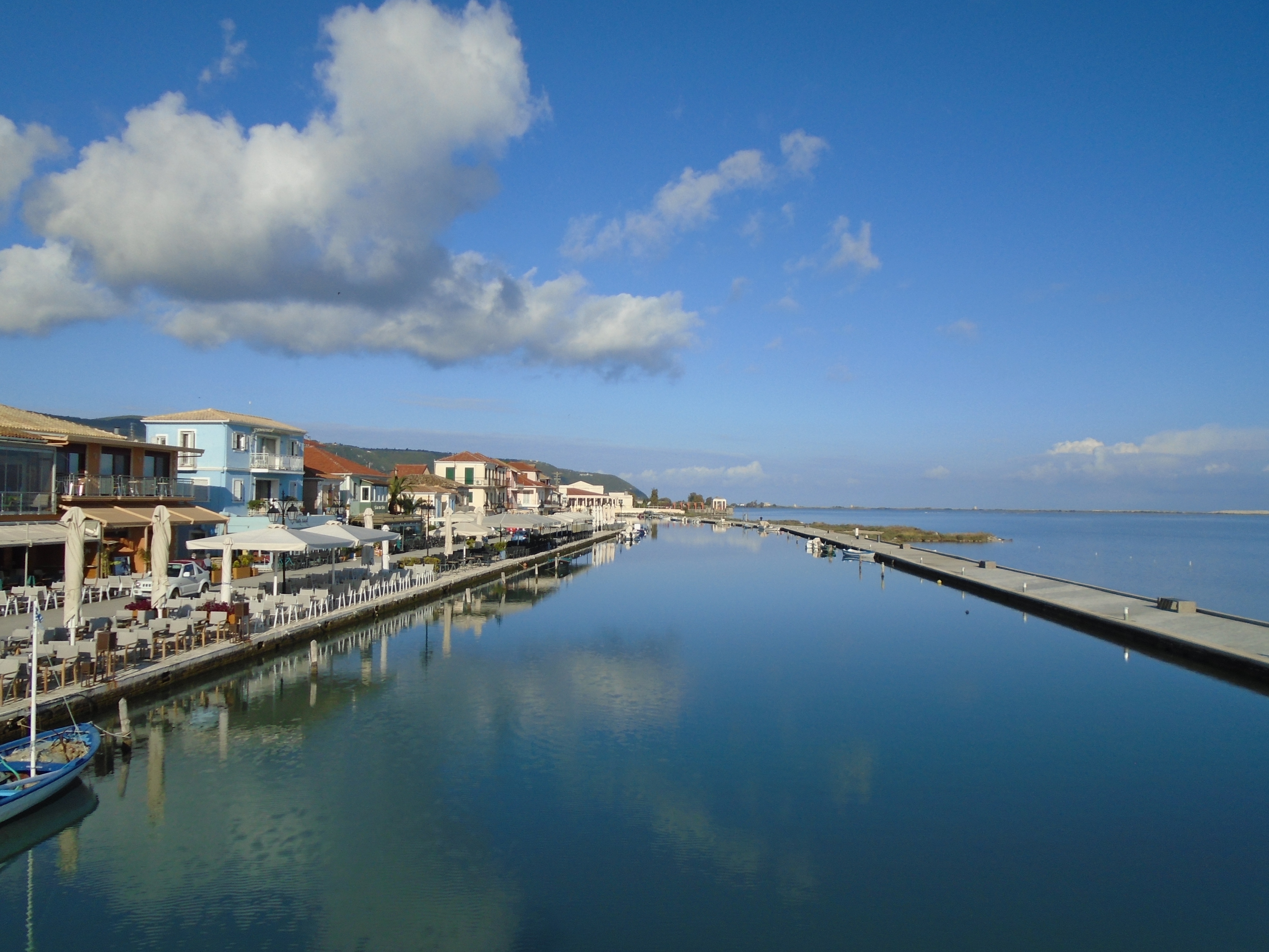
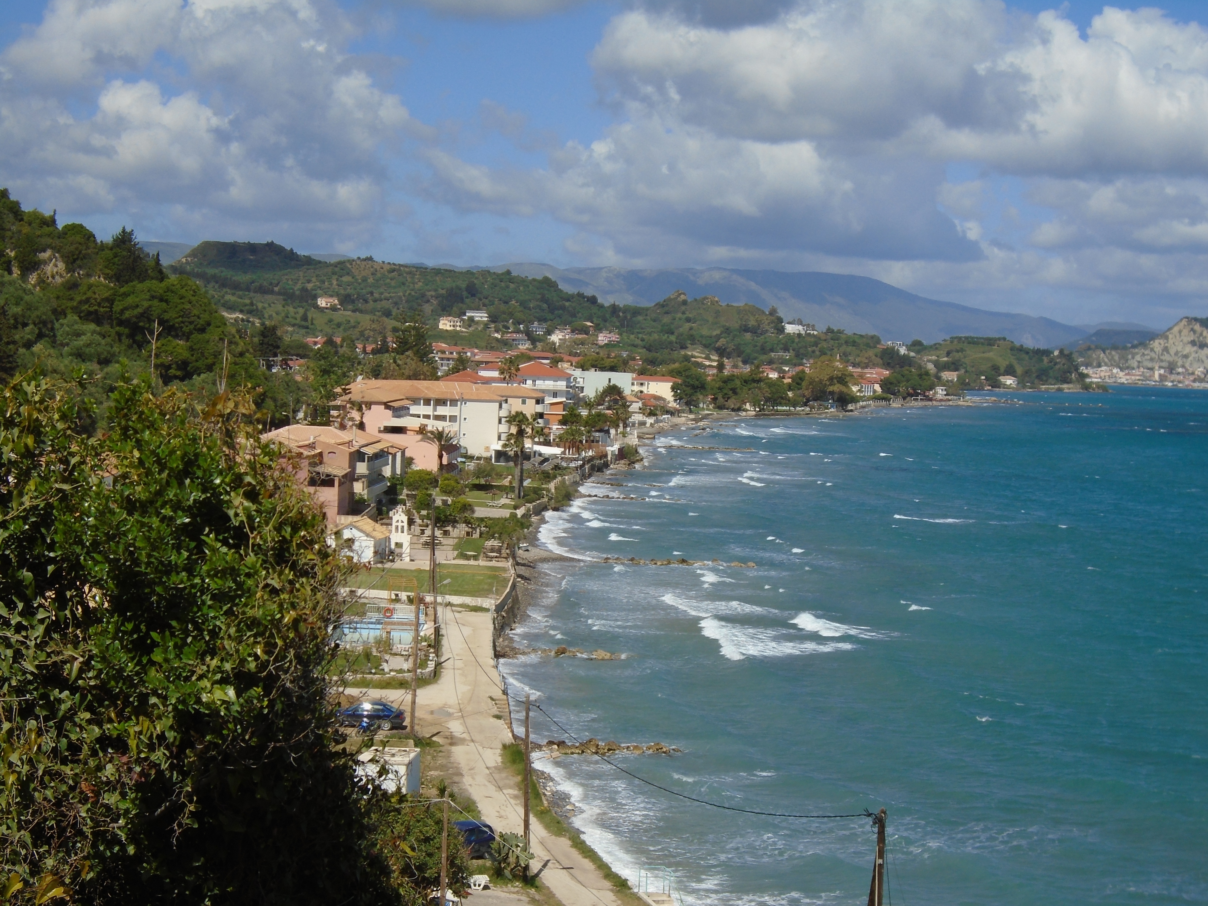
Zakynthos
Visited in 2019.
The most southerly of the Ionians. Large and easily accessible. Badly over developed in some parts, but the main town was rebuilt in an attractive style after a major earthquake.

Sometimes called the “Flower of the Levant”, Zakynthos (aka Zante) is the most southerly of the main chain of Ionian Islands. Slightly smaller and less mountainous than Kefalonia, its nearest neighbour, its scale of tourism development is second only to Corfu in the Ionians. Unfortunately, much of its tourism infrastructure is geared towards the low value end of the package holiday market.
The eponymous island capital lies on the south east coast close to the airport, which caters for international flights from across Europe as well as internal Greek services. It is also the main ferry terminal with 3 or 4 vessels a day making the 1 hour crossing to the rather isolated port of Kyllini on the Peloponnese from where there are bus connections to Patras and Athens.
Museum of Zakynthos, Zakynthos Town
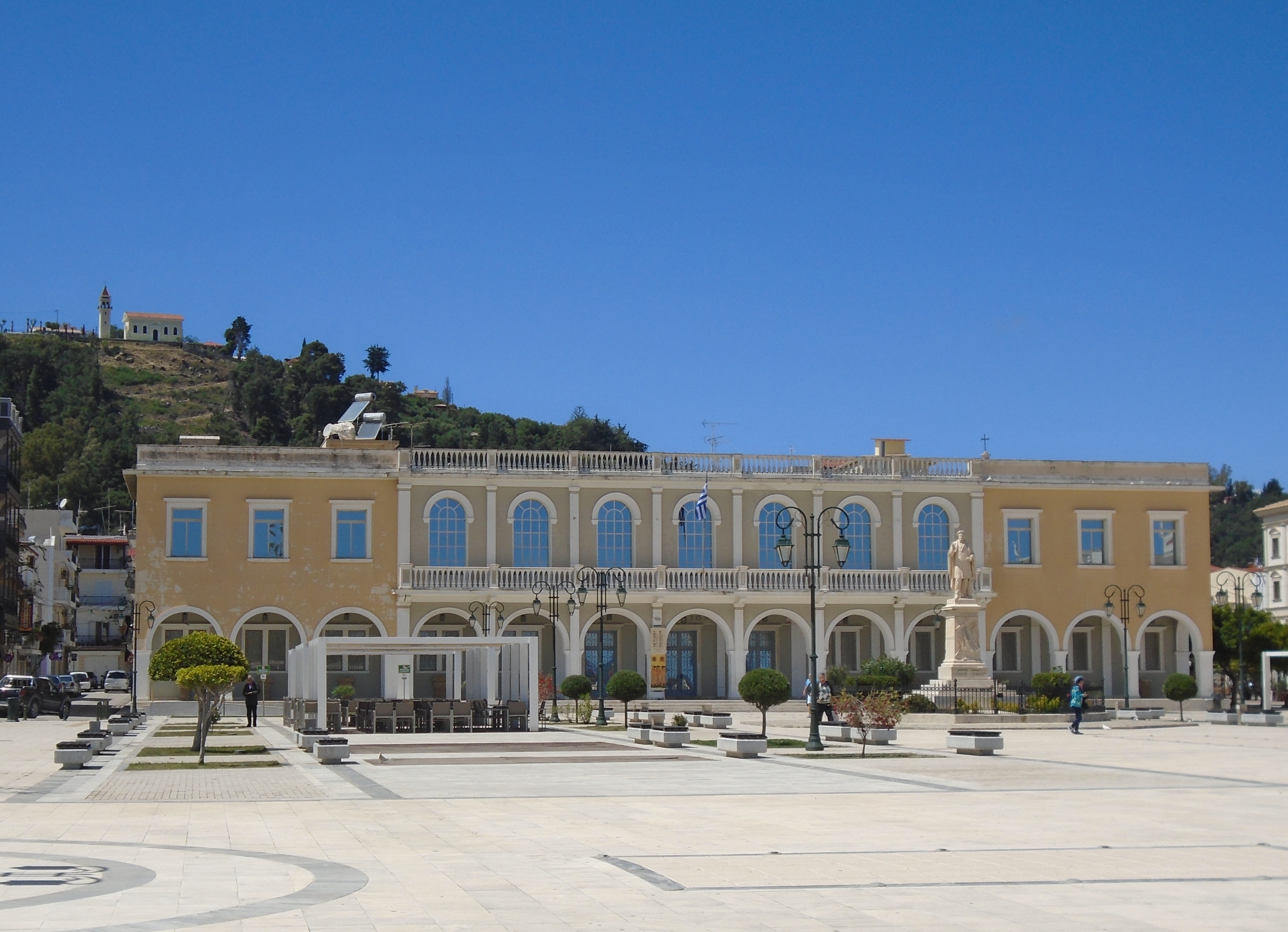
Like many places in the Ionians, Zakynthos Town was flattened in an earthquake of 1953. However, it has been rebuilt in an attractive manner with large open public spaces, impressive neoclassical-style buildings and a main shopping street with covered, collimated walkways. The area around Solomos Square is the main hub of restaurants and bars and also houses a couple of interesting museums.
Zakynthos Town itself has no beach to speak of and most holidaymakers are accommodated in one of the beach resorts that are relatively nearby.
Alykes
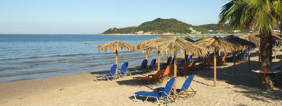
Laganas, the largest, is an appalling parody of a holiday destination that has the look and charm of an industrial estate. It’s nothing more than a cheap booze and sunburn factory. Kalamaki, its near neighbour, is smaller, more low key and has a better beach but suffers from proximity to the airport. Tsilivi and Alykes on the east coast have pretty locations and reasonable beaches. They are probably fine for frying in the sun, but the villages themselves lack much character.
Argassi
Argassi is the nearest beach resort to the capital, lying 4km south of Zakynthos Town. It aims for a more upmarket feel and has a quiet traditional village just inland. However, its beach is very narrow and can disappear completely at high tide.

Vassilikos
To the south of Argassi, the Vassilikos peninsula has some of prettiest scenery and best beaches on the island. Tourism development is fairly low key and a number of the beaches have restricted public access as they are important nesting sites for rare loggerhead turtles. Turtle spotting trips are a big sell for local excursion boats along this southern coast. There is also a beach that signs advise is for the use of Greek orthodox clergy only. That may be the place to go if you want to watch naked priests from a safe distance.
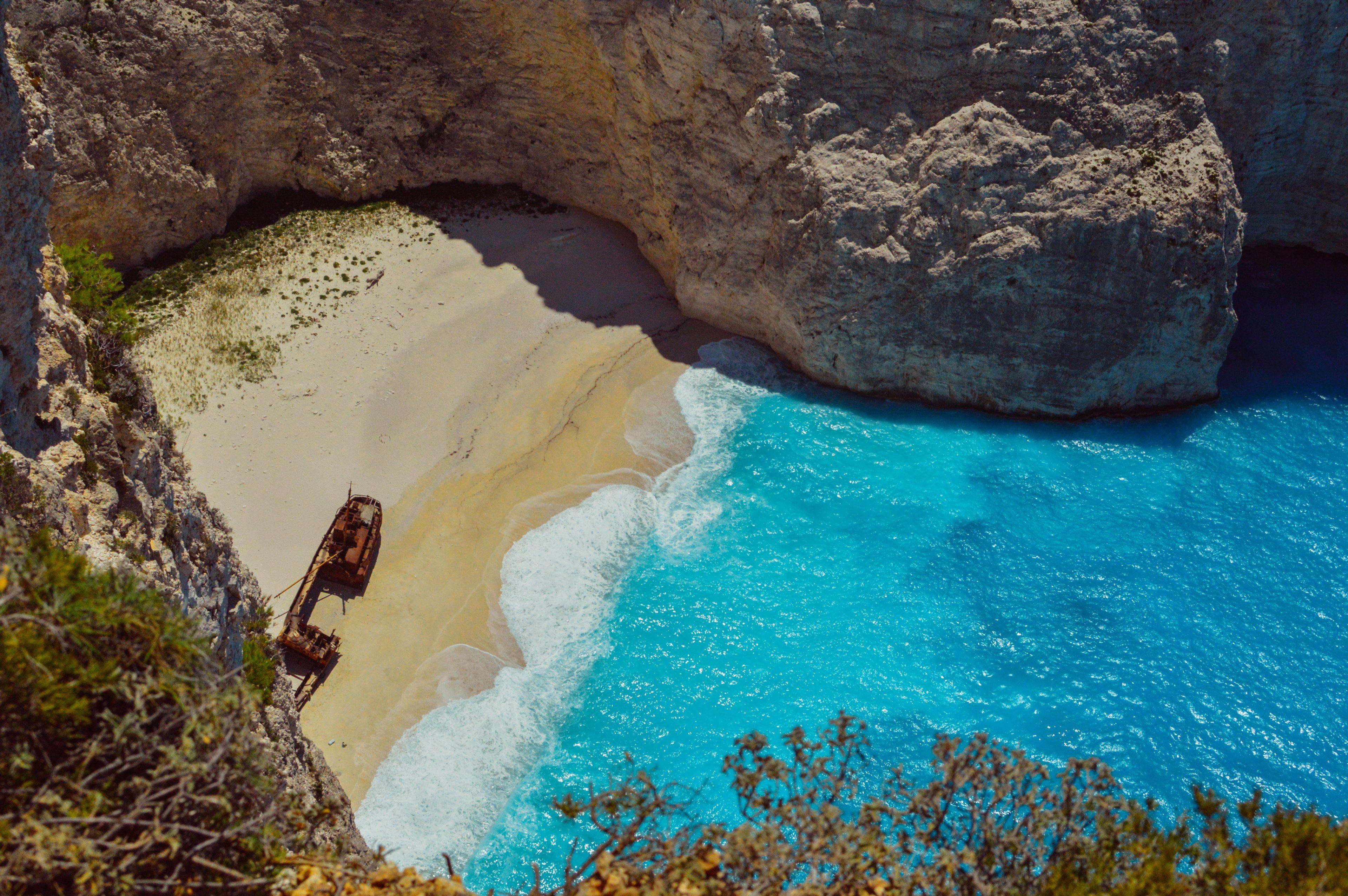
Shipwreck Beach
The north of the island is much more rugged than the south. Here the main attraction is boat trips to the iconic Shipwreck Beach, which is only accessible by sea, and to the Blue Caves at the very northern tip of Zakynthos. The coastal villages in the north are disappointing, but the inland hill villages are much more attractive, although they do cater for a lot of excursion coaches on their way to boat trips. Local wine, honey and olive oil are on sale from stands along most of the roads. Anafonitria is probably the prettiest inland village with its medieval monastery and scenic location.
Anafonitria Monastery
I put off visiting Zakynthos for a long time as I perceived it to be cheap package holiday country. Parts of it are. However, the appalling Laganas aside, its resorts are not as tacky as some on other islands. Zakynthos Town was an unexpected delight. However, I have now been to the island and ticked it off my list. I don’t imagine I’ll be rushing back in the immediate future. Nice enough but not that special.
