
This group of just over a dozen disparate islands are linked by geography more than any shared landscapes, culture or atmosphere. Spread out over a large area, their most common link is their proximity to the coast of Turkey. They only became part of the modern Greek state after the Balkan Wars of 1912 – 13, which effectively drove the largely moribund Ottoman Empire from Europe. Even so, two largish islands close to the Dardanelles remain part of Turkey to this day.
The islands of the North East Aegean range from the large and well populated Chios, Lesbos and Samos to the small and remote Agios Efstratios and Psara. The five largest islands have airports with regular flights to and from Athens and, in peak season, each other. They are also usually served by daily ferry links to and from Pireaus although journey times can be lengthy – well over 12 hours in some cases.
Some of the smaller islands receive less regular calls from Pireaus ferries and rely more on local operators from their nearest large neighbour. The most northerly islands of Samothrace and Thassos currently have no year round direct ferry links with the rest of the group (or each other) and are serviced primarily from different ports on the Thracian mainland to the east of Thessaloniki.
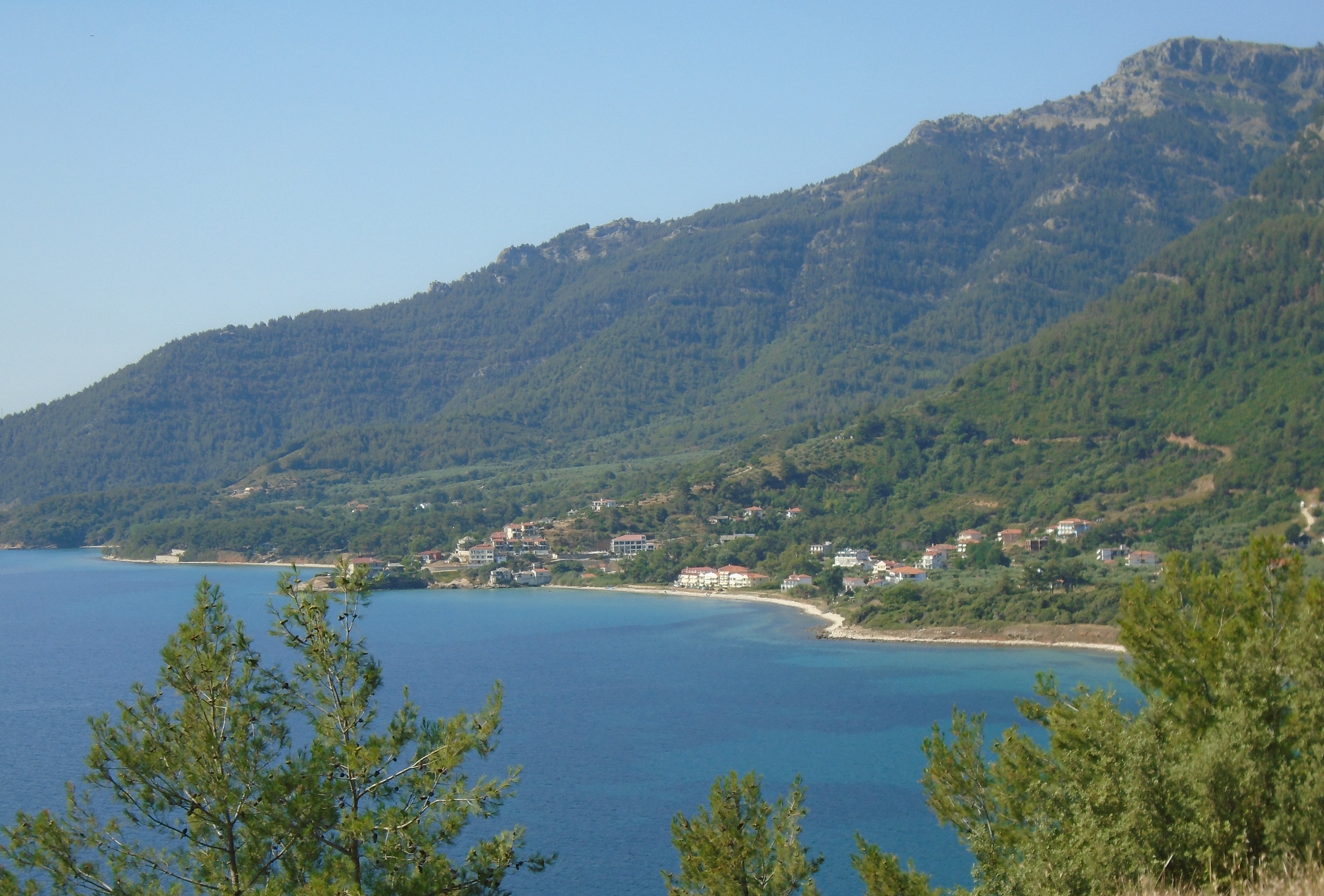
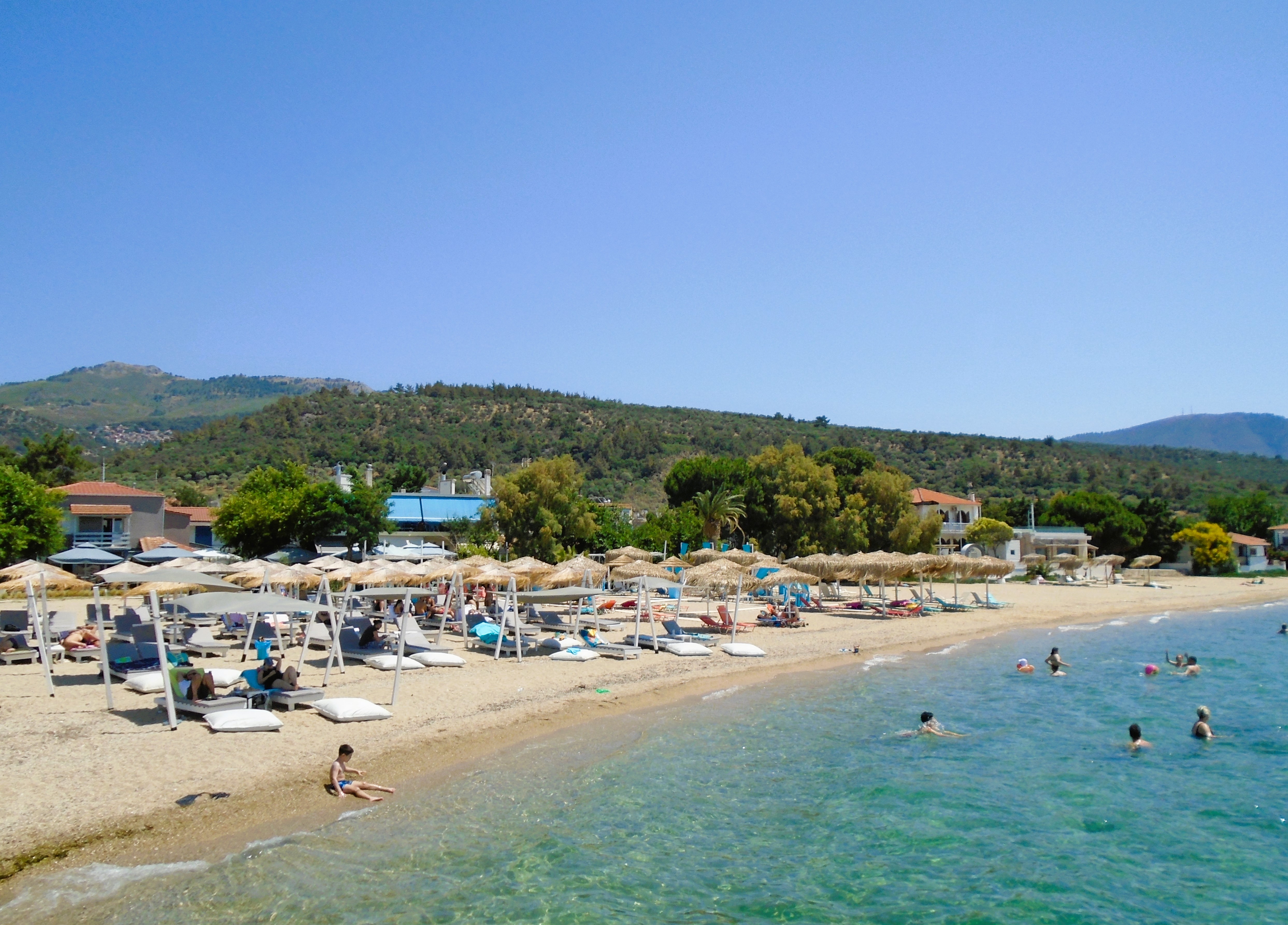
All of the islands have some degree of tourism infrastructure but, on the largest islands, tourism is very much one element of a wider mixed economy. Of the larger islands, Samos arguably has the most developed tourism sector, although smaller Thassos is probably the most economically dependent on tourism overall.
I first discovered the North East Aegean islands in 1981 when I feel in love with Samos. A few years later I visited its neighbour Ikaria for the first time and, thereafter, throughout the 80s and 90s most of my visits to Greece involved some time spent on both islands. The North East Aegeans are probably my favourite Greek island group and, if push comes to shove and I am forced to name my favourite Greek island, I invariably plump for Ikaria.
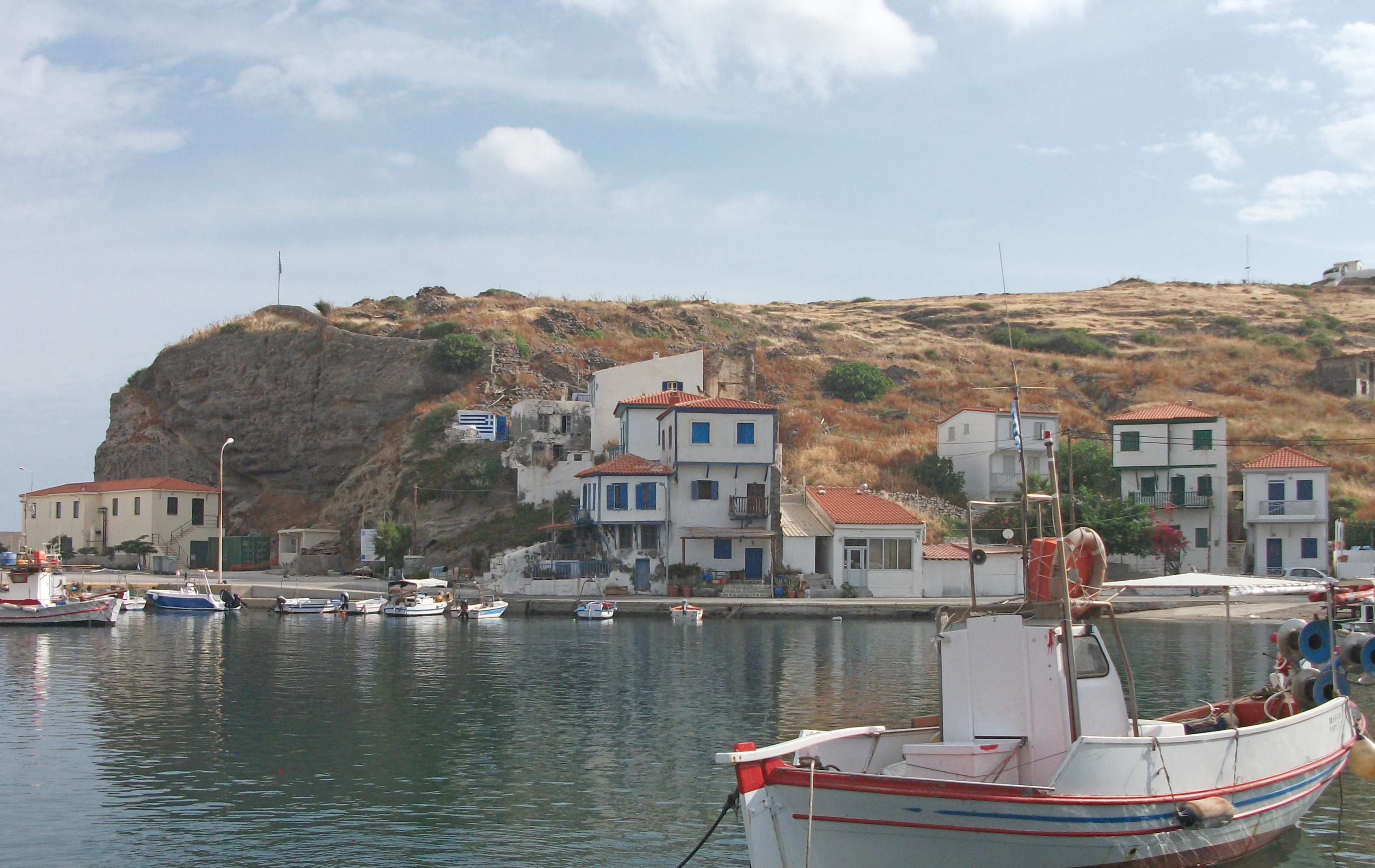
Agios Efstratios
Visited in 2018.
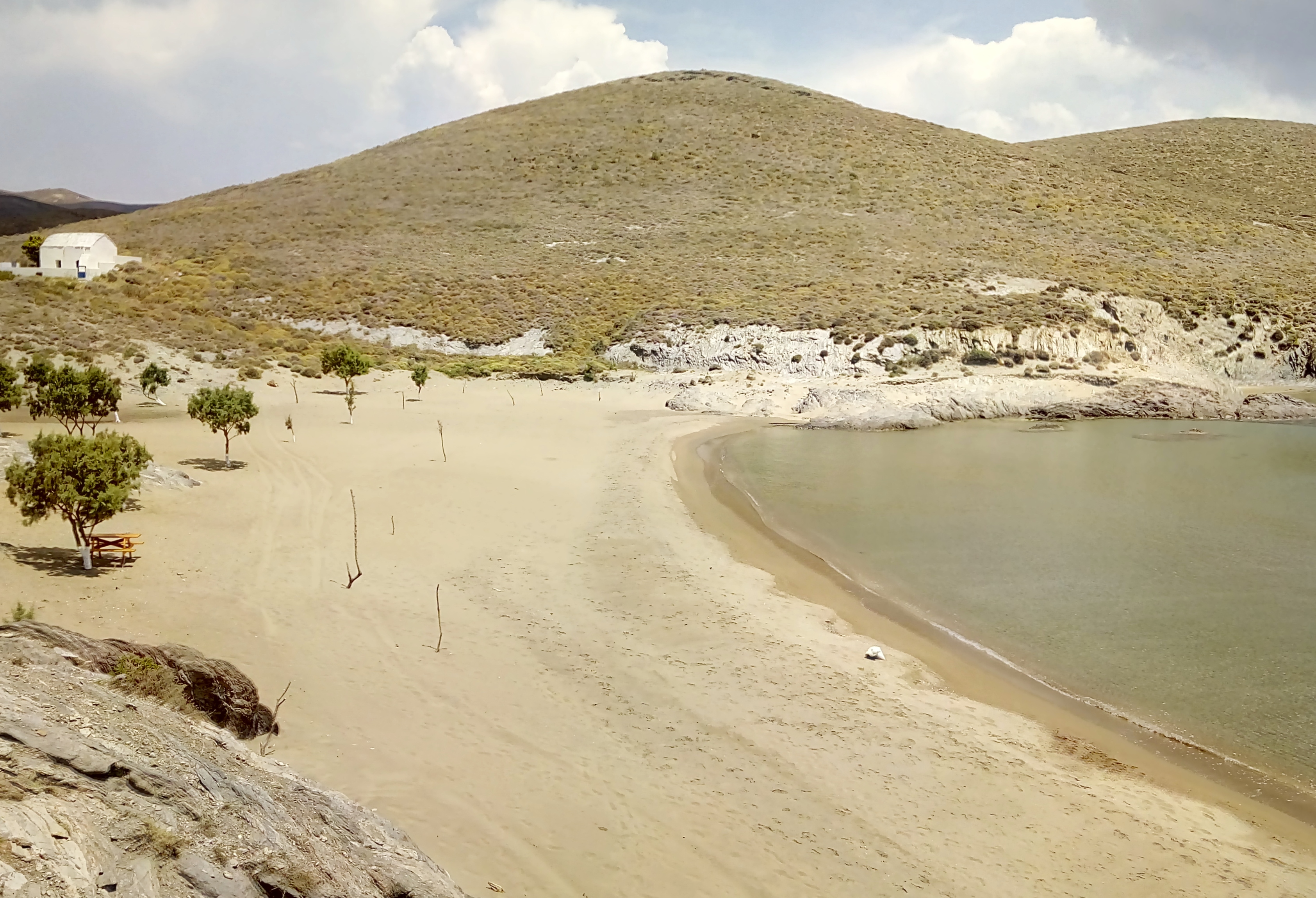
Small and as remote as remote gets in Greece. Rarely visited. One nondescript village, very few visitor facilities, but a varied and interesting hinterland. I loved it.

Located in rather splendid isolation, Agios Efstratios feels as remote as Greek islands get. Limnos, its nearest neighbour, is a 2½ hour ferry ride away on the almost daily local Aeolis ferry, a sluggish, ageing rust bucket of a ship if ever there was one. Less regular ferries link the island with the mainland ports of Kavala in Thrace and Lavrio in Attica, the former necessitating a 6½ hour sail; the latter an even longer 7½ hour crossing.
Long a place of political exile due to its isolation, the island’s only village was flattened by a fatal earthquake in the late 1960s, with only a few buildings surviving. This was the time when the military junta of the Colonels were in charge of Greece and the rebuilding contract was corruptly handed to one of their associates who created a new village of identical, flat roofed bungalows built on a relentless and very un-Greek grid pattern. One guide book describes it as “one of the ugliest villages in all Greece”, which is a bit unfair. Over time, locals have modified and individualised their bungalows and new private houses have been built giving more architectural variety. However, much of the village does still look more like a sixties Spanish or Portuguese urbanisation development than a traditional Greek settlement.
Agios Efstratios
A couple of tavernas, a couple of bars and a couple of minimarkets are about the only amenities for the 300 or so local residents and their visitors, apart from the wonderfully named Museum of Democracy which is presumably a repost to the Colonels. There are a few places offering rooms but choice and quality are limited. Being a small community, all visitor accommodation is a short walk from the village beach, a long stretch of greyish sand with calm, shallow water protected by the harbour walls.
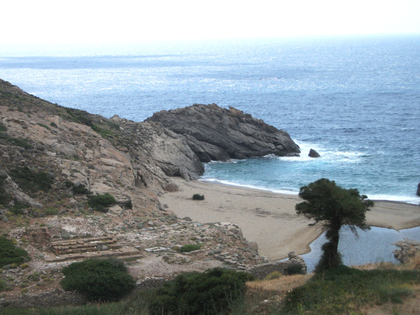
Away from the village, Agios Efstratios is surprisingly green and attractive with numerous swathes of oak forest interspersed with occasional livestock farms. An extensive network of very dusty dirt roads criss-cross all parts of the island often leading to spectacular viewpoints and large, undeveloped and deserted beaches. The walk north over the spine of the island to the expansive beach at Alontisis is particularly attractive and relatively well signed. Take lots of water with you. There are no facilities of any kind outside the village and some of the walks involve fairly steep and arduous uphill treks.

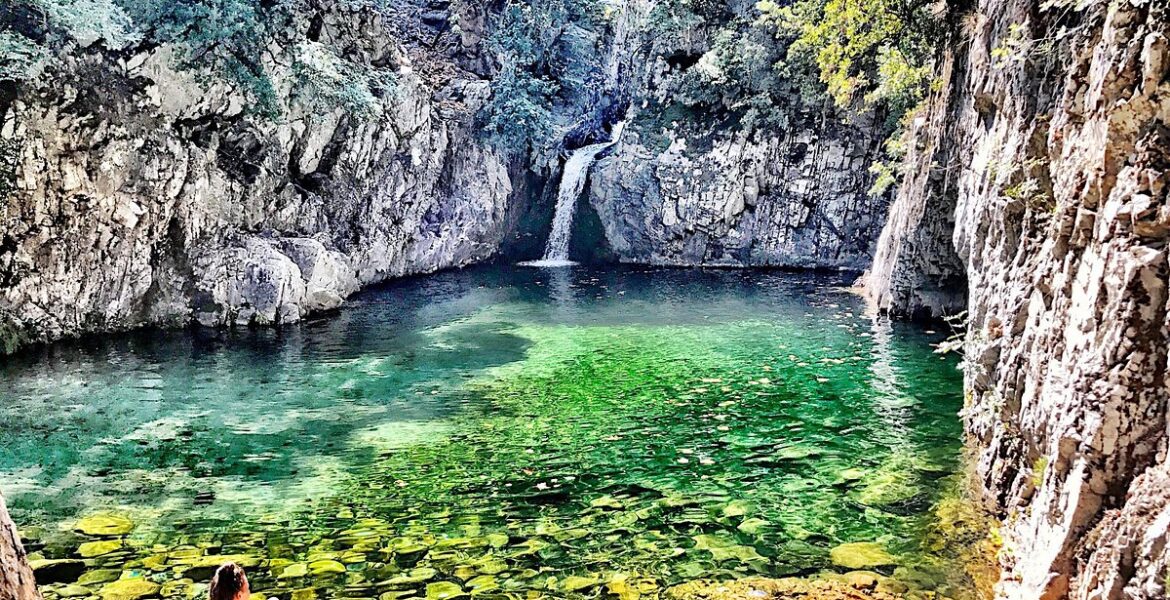
Alontisis Beach
Agios Efstratios is a bit rough and ready. Everything is a wee bit tatty round the edges. The people are friendly but in a gruff sort of way. It’s a place for the very committed island hopper and involves a long journey to get there. However, I really enjoyed my time on it, primarily for the excellent walking and the unexpected variety of scenery. I look back on the few days I spent there with a great deal of pleasure and certainly hope to visit again in the future.
Chios
First Visited in 2015. Most recently visited in 2018.
Large and varied with a mix of tourism and everyday local life. Picturesque villages in the south and good beaches throughout the island. Some distinctively Turkish architecture.

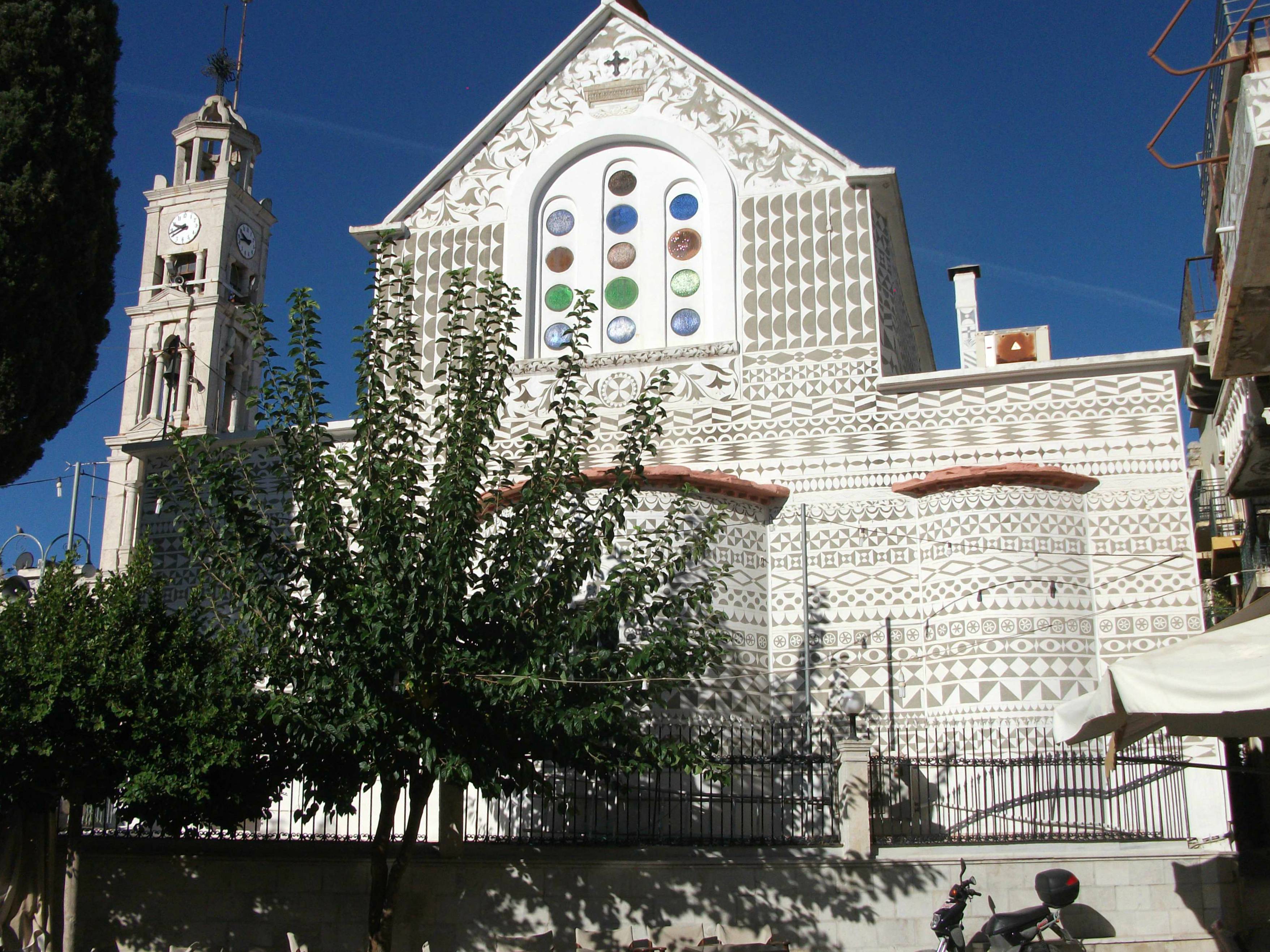
Chios has a rich history having been: the birthplace of Homer; a major exporter of mastic resin since medieval times; and the site of a notorious Ottoman massacre of 1822 when thousands of locals were put to the sword. In the 20th century, local families became major players in the Greek ship building industry and, consequently, tourism is a relatively small element within the local economy.
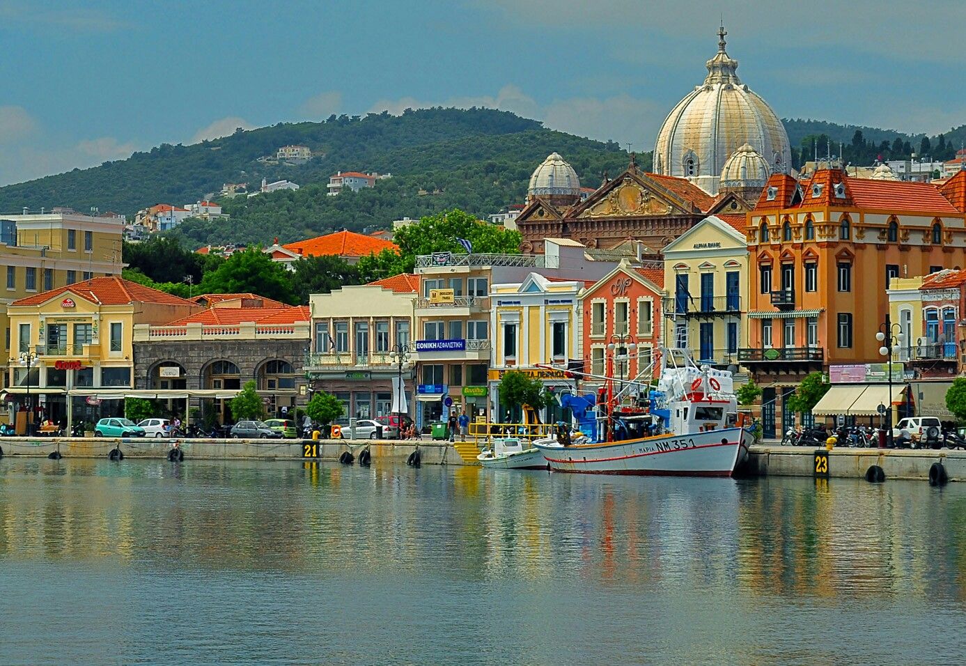
Chios Town
Chios Town is a busy city of 25,000 residents, where nondescript modern apartment blocks hide pockets of an older settlement particularly around the Kastro area with its mosque, Turkish baths and fountains. Both the Kastro and the waterfront promenade hold some attractions, but the latter’s workaday atmosphere and stench of car fumes will not be to everyone’s taste.
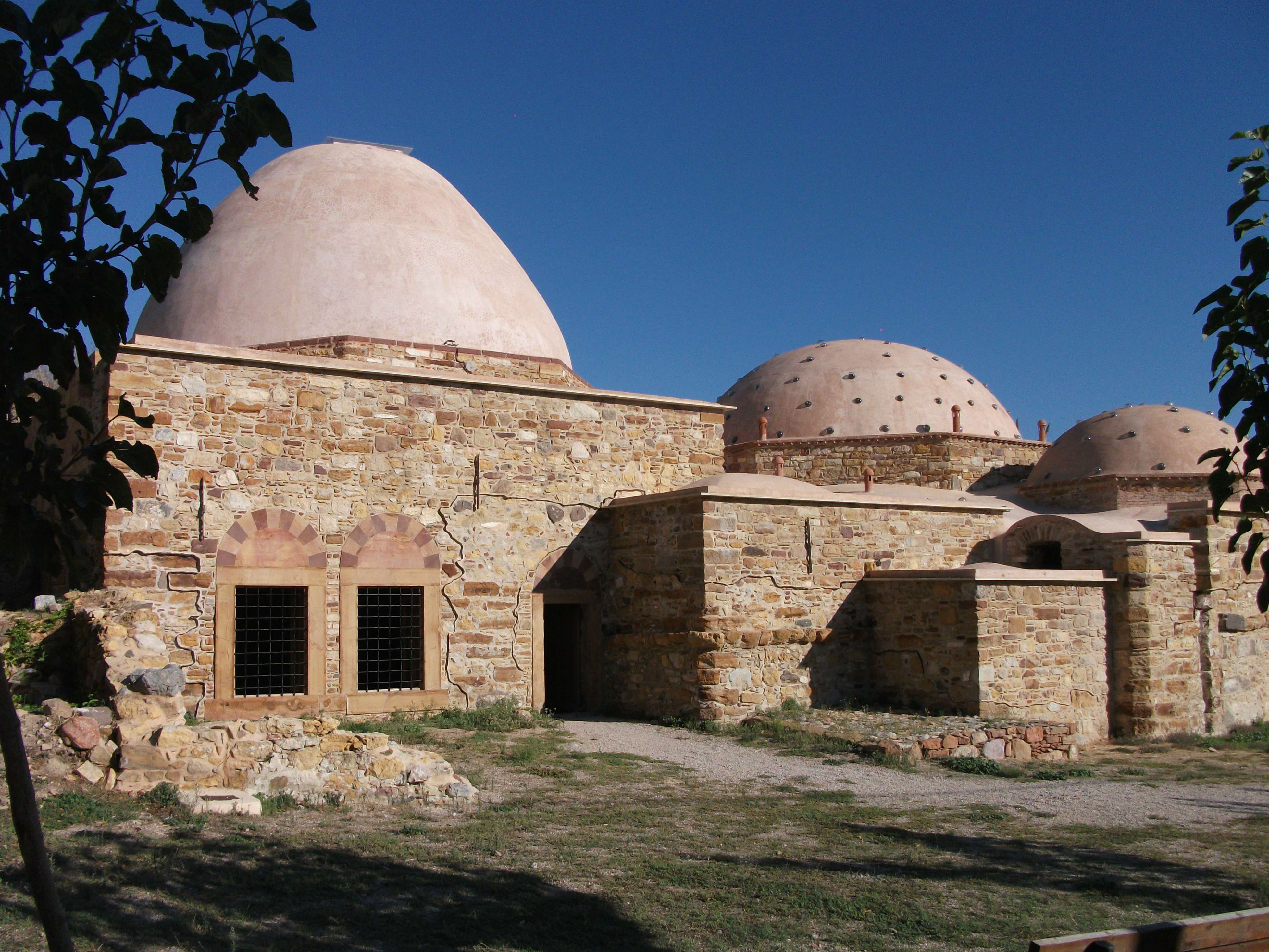
Chios Town, Turkish Baths
Many visitors head 7km south past the airport to the beach resort of Karfas where a wide, sandy beach is complemented by a variety of tavernas and places to stay. It can be a busy and noisy place in the peak summer months, but when I first visited in October most of the local businesses had already closed for the season. Smaller seaside resorts are found a few kilometres south at Agia Ermioni, Megas Limnionas and Agia Fotini, most of which are served by regular buses from the main town.
Karfas
Pyrgi
The most renowned area of Chios lies further south in a cluster of inland settlements known collectively as the Mastic Villages. Pyrgi is the most colourful with bold geometric patterns painted into the walls of many of its buildings. Mesta is the most historic and atmospheric with a maze of tight knit lanes and alleyways snaking between traditional sandstone buildings. Roads run off from most of the mastic villages to little sand or pebble coves, the largest of which offer rooms, tavernas and bars, albeit in moderation.

From the Mastic Villages, a good paved road swings north along the much quieter west coast of the island giving views across the sea to distant Psara. The route passes through largely unsung but charming little villages like Elata and Vessa and skirts numerous, quiet beaches before reaching hillside Volissos, where ruined traditional stone houses mix with their renovated neighbours, many of which are now let out as holiday accommodation.

Volissos
Just to the south of Volissos and its little port of Limnia a road climbs through the mountains to the east coast at Kardhamyla, the second largest town on Chios, which is divided into two parts – inland and waterfront – neither of which is immediately appealing. From here, the scenic main road turns south back along the east coast towards Chios Town, giving extensive views across to Turkey and the neighbouring Greek island of Inousses.
Traffic Jam on Chios
Chios is an island that doesn’t particularly try to be a major tourist destination, although it does have some package travel business in the beach resorts to the south of the main town. Visitors generally have to fit around everything else that goes on, although the large local population ensures plenty of places to eat and drink. The Mastic Villages and the west coast scenery are the main highlights and, away from the area around Chios Town, it’s easy to find your own beach and tranquil space.
Fourni
First Visited in 2013. Most recently visited in 2023.
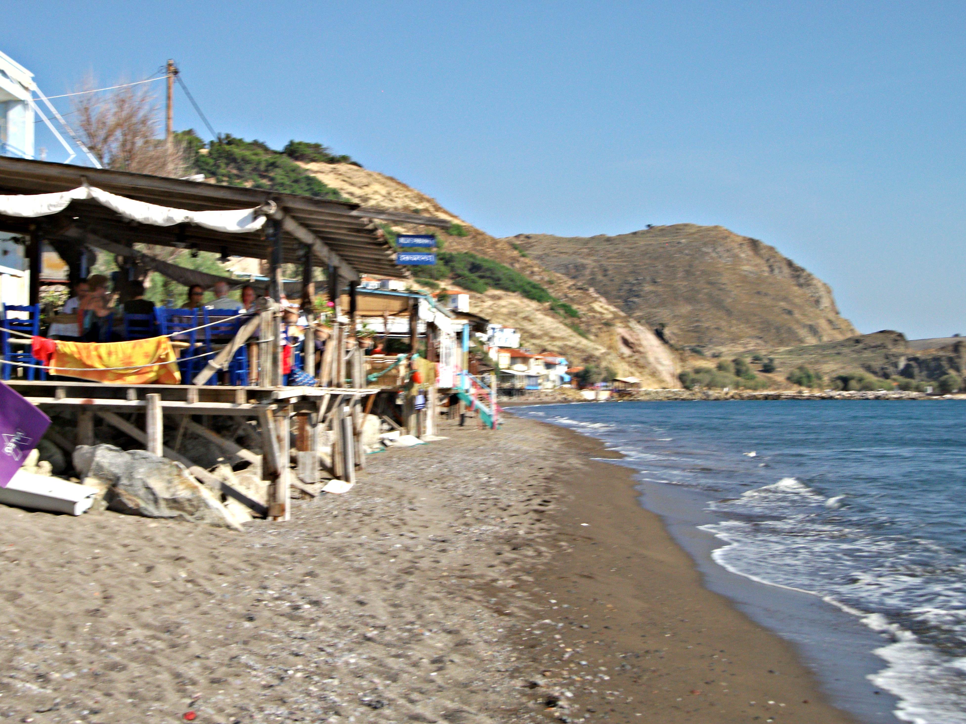
Located between Samos and Ikaria. Renowned for its fishing fleet and seafood. Charming main village, slightly weird little village in the north and some good beaches.

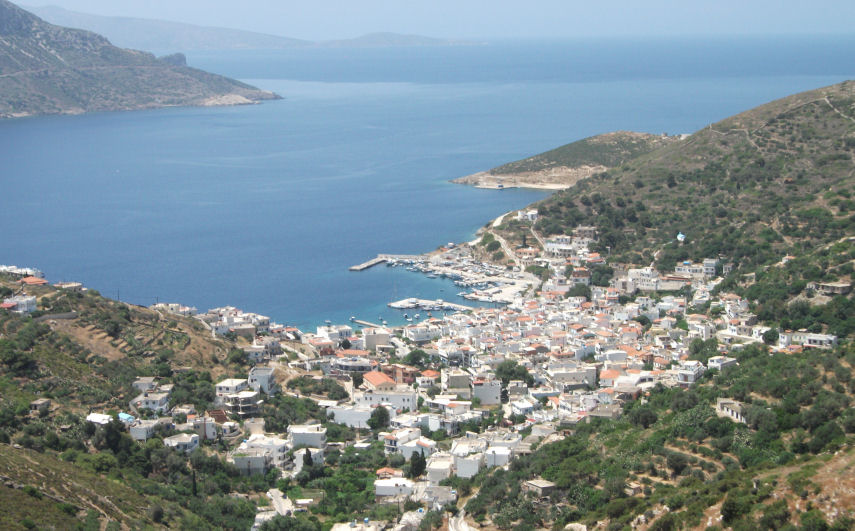
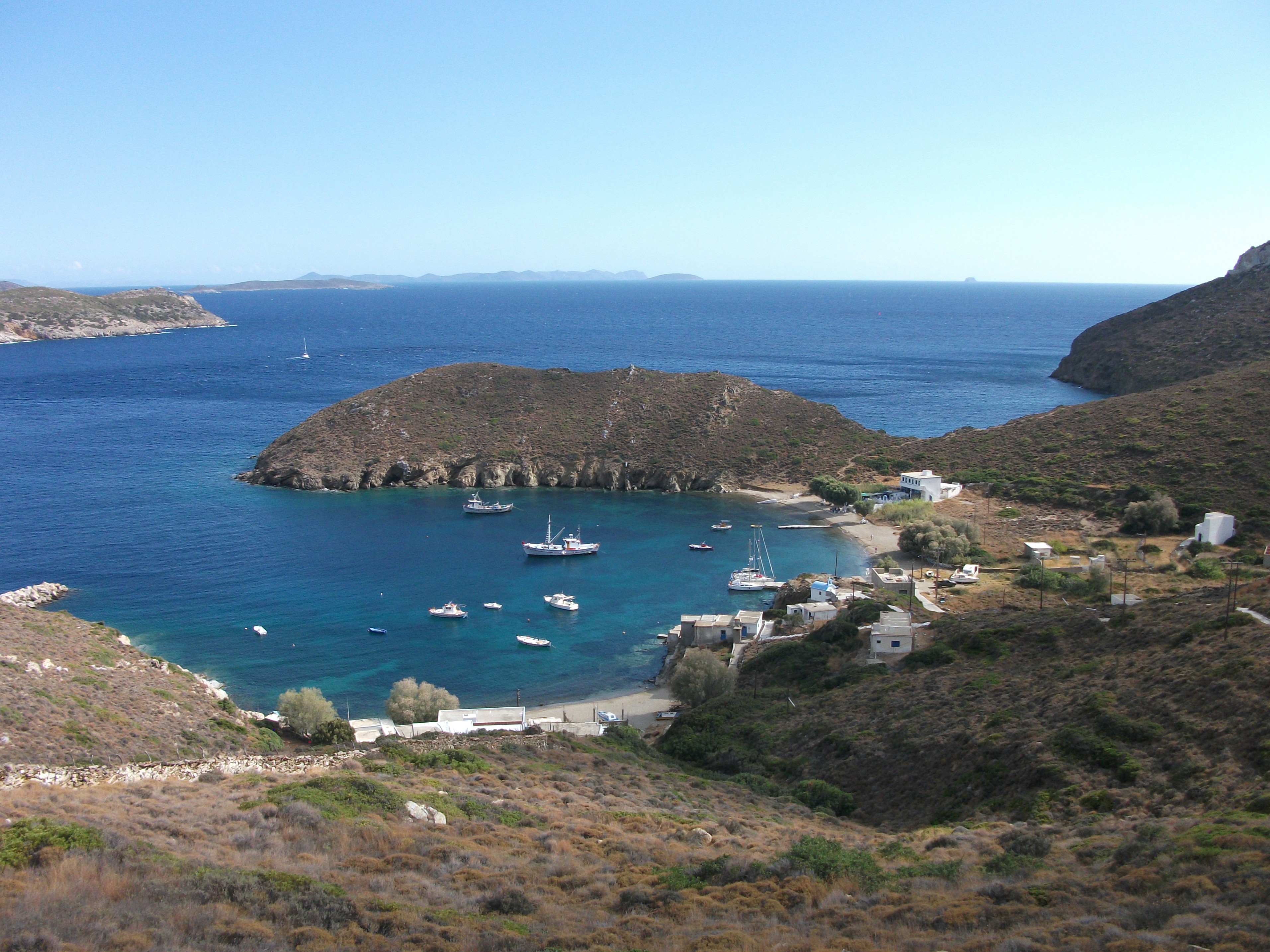
Fourni is the largest of a small archipelago of islands that lies between Samos and Ikaria. It was once a hiding place for corsair pirates and now is renowned for its large fishing fleet and the quality of its seafood, lobsters in particular.
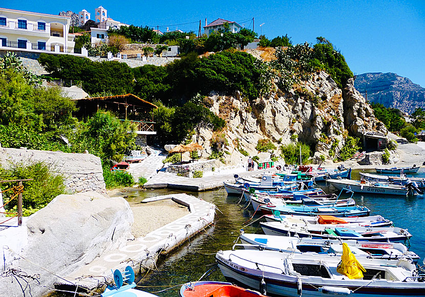
Most of the 1,300 or so residents live in the main village of Fourni Korseon, which is packed into a narrow valley that snakes up from the harbour. The waterfront tavernas make a big play of lobster dinners and the bars are a great place to watch the spectacular sunsets over the neighbouring island of Thymena.
The tree-lined main street running inland is closed to traffic at night and tavernas and bars spill on to its flag stones while shops do a roaring trade. The street ends in a pretty little square next to the main island church, where I was once invited in to enjoy a priest and two old locals performing some of the most amazing harmonic singing I have ever heard. To my ears, it sounded more like electronic than vocal music, but I was quite drunk at the time and may have had a heightened imagination.
Fourni Korseon at Night
Fourni Korseon has a small, serviceable beach which has been somewhat damaged by a recent extension to the harbour walls. There are a couple of mainly sandy beaches a short walk to the north, although the ambience of the first one is somewhat spoiled by the cement works located at the end of it. However, the best and most popular local beach can be found at Kampi, 15 – 20 minutes walk away, which has its own limited infrastructure of tavernas and places to stay. More deserted sandy beaches can be found along the paved road to the southern tip of the island.

Kampi
Until fairly recently, the village of Chryssomilia at the north of Fourni was most easily reached by sea. However, the rough track that was its only overland access has now been paved to provide a spectacular, but often windy 18km road, which crosses the tops and sides of the island’s mountains and passes the little seaside hamlet of Kamari along the way.

Chryssomilia
Chryssomilia is divided into a seafront area and a hillside settlement. The seafront area has a little harbour and rough and ready beach where grey whiskered, retired fishermen pass their days sitting on their terraces gazing wistfully out to sea with their shirt and fly buttons undone. The hillside village has few visitor amenities, although an initially suspicious local relaxed when he realised I was harmless and opened up the village church to proudly show me its medieval icons.
Large ferries from Pireaus call into Fourni fairly regularly on their way to Samos and there are a couple of Dodecanese Seaways hydrofoils from Patmos and Samos each week during the summer. A small local ferry runs almost daily to and from Agios Kirikos on Ikaria, invariably stopping at neighbouring Thymena and calling into Chryssomilia on about half of its voyages. This service often continues on to Karlovassi on Samos.
Fourni Korseon
Fourni Korseon is a surprisingly large and lively village for a relatively small island, which welcomes but is far from dominated by tourism. It’s a great place to escape the rest of the world without feeling totally cut off and a must for lovers of the freshest possible seafood.
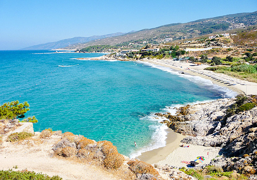
Ikaria
First Visited in 1985. Most recently visited in 2023.
My favourite Greek island. Wild and mountainous with great beaches and wonderful people. Not that easy to get to but worth any effort. An island with character and soul.
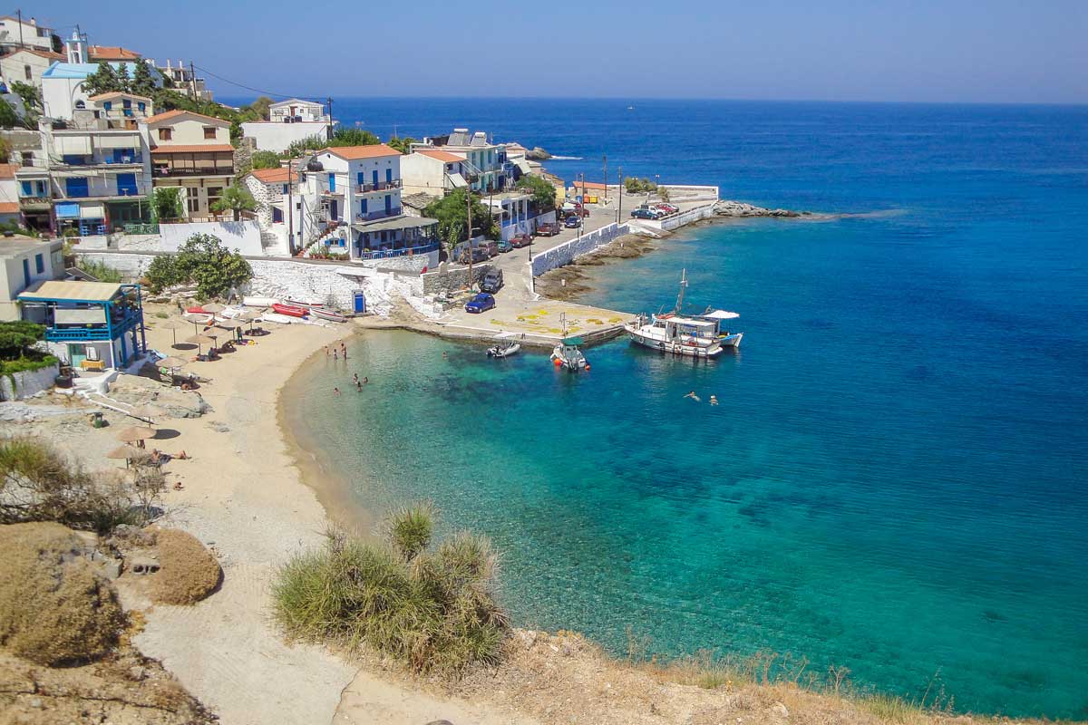
Armenistis
Long, thin Ikaria is primarily a range of mountain tops sticking out of the sea. The highest point rises to just over 1,000 metres, effectively dividing the island in half between the north and south coasts. The locals are noted for having the longest average lifespan in Europe, which Ikarian men attribute to eating home grown organic food; wine and cigarettes in moderation; and lots and lots of sex. The local women tend to roll their eyes at that last claim.
Agios Kirikos
Agios Kirikos, the capital and main ferry port, is on the south coast. Ferry arrivals used to be greeted by a large painted sign welcoming them to “The Island of Radiation”, an acknowledgement of the numerous natural hot springs that once supported a short lived spa tourism industry. This died out after scientists questioned if many of the springs were actually dangerous rather than beneficial to health.
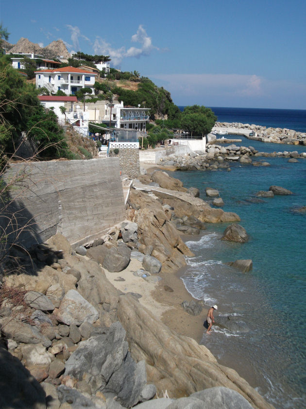
Once lackadaisical and somewhat shabby, Agios Kirikos has tidied itself up in recent years and now has an attractive waterfront area of tavernas and cafes. There is a good choice of accommodation spread throughout the town and it is also a good base for exploring the island further as local bus and ferry services radiate (sic) out from it. However, such services tend to be limited, especially outwith peak season. The large fleet of local taxis or car and motorcycle hire are the most practical ways to get around the island.

Therma
The smaller village of Therma, a mile north east, has the largest remaining cluster of organised thermal baths on the island as well as a coarse sand beach and some friendly tavernas to commend it. However, the village itself is still in need of a tidy up.
Most beaches on the south coast are pebble and rock. The main exception is the long sand and pebble beach at Fanari (aka Faros). This is close to the eastern tip of the island on the road out to the isolated airport, which is located on the only flat area of Ikaria. It usually has one flight a day to and from Athens and less regular services to Thessaloniki via Limnos.

Fanari
Fanari has a few tavernas and cafes, some rooms and great views across to Fourni. The beach is a bit reefy in places, which can make accessing and exiting the sea a little difficult. There are other beaches nearby within easy walking distance, including the mainly sandy Agios Georgios and a well signed “Nudist Beach”, which is essentially an extension of the main beach. The main site of historic interest are the ruins of Drakanos Tower, a fortress dating back to the 3rd century BC, where you can also see the remains of the fortified walls that once surrounded it.
The surprisingly unheralded main road from Agios Kirikos to the north coast is one of the most spectacular in Greece, climbing steeply through mountainside hamlets until it reaches its summit from where it cascades down the north coast through a series of mighty chasms and canyons high above the sea.
Evdilos
Evdilos, the island’s second port and the largest village on the north coast lies about 40 km from Agios Kirikos. When I first visited Ikaria, it was a sleepy backwater with few facilities. However, additional ferry services have helped its waterfront blossom with new tavernas and bars. The best local beach is at the tiny village of Kambos, a 30 minute walk to the west. Kambos allegedly has some ancient ruins but I’ve never found them. Not that I’ve tried too hard. The lure of the beach has always been too strong.
The main resort on Ikaria is Armenistis, a further 14km west along the north coast where two enormous and picturesque sandy beaches are spoiled only by occasionally dangerous currents and undertows. Armenistis itself is a charming village with a good choice of high quality accommodation and places to eat and drink. For some reason it always reminds me of a Cornish fishing village.
Livada Beach, Armenistis
Nas, three km further west, is a quieter option once loved by wild camping hippies and still attractive to alternative types. I once watched a naked yoga class on its beach, which is overlooked by the ruins of a Temple of Artemis. The sunsets here can be breathtaking and there is a fair selection of tavernas and rooms to rent.
Nas Beach
A paved road snakes inland from Armenistis to Rahes, a series of hamlets that appear deserted during the day but come to life at night when shops and tavernas open from about 10pm to 4am and locals go about their business until the small hours of the morning. It feels like some sort of secret, other worldly Shangri La. Rahes can also be reached from Nas via the challenging footpath up the magnificent but steep Halaris Canyon. The climb took me 3 hours of exertion and gallons of sweat. It’s not a route for vertigo sufferers.
From Rahes, a spectacular but, for the most part, rough dirt road descends to the isolated village of Karkinagri on the south west coast where streets were once named after Russian revolutionary leaders, reflecting Ikaria’s reputation as Greece’s “red island”. In the 20th century, successive Greek governments exiled “dangerous” communists to the island. To the government’s dismay, the local islanders tended to welcome the exiles as they included doctors, teachers, lawyers and the like who offered community and professional services that the bureaucrats in far off Athens had neglected to provide.
Karkinagri
Karkinagri has a pretty little harbour, a couple of places to stay, a few tavernas and a beach that comes and goes year on year depending on how stormy the winter seas have been. There is a rough road east to the even more isolated bay of Trapulo, which has a few houses and a seasonal taverna, but it can be hard to find the road in Karkinagri and it requires a vehicle with robust suspension.
Also on the south west coast, the pretty village of Maganitis was once only accessible by sea or rough footpath from Rahes. It is now has a paved road from Agios Kirikos and has seen new tavernas and bars open up to cater for local day trippers. Nonetheless, it remains one of the ultimate sleepy hollows.
Maganitis
The nearby pebble beach known as Seychelles is arguably the most photogenic on the island, but can be challenging to access. Look for the rough car park just after the long tunnel that was blasted through a giant cliff face to connect Maganitis to the outside world. From there, Seychelles is a 10 – 15 minute clamber over loose rocks and stones. If you’re lucky you might have the beach and its alluring turquoise water all to yourself. although that is increasingly less likely as its fame has spread.
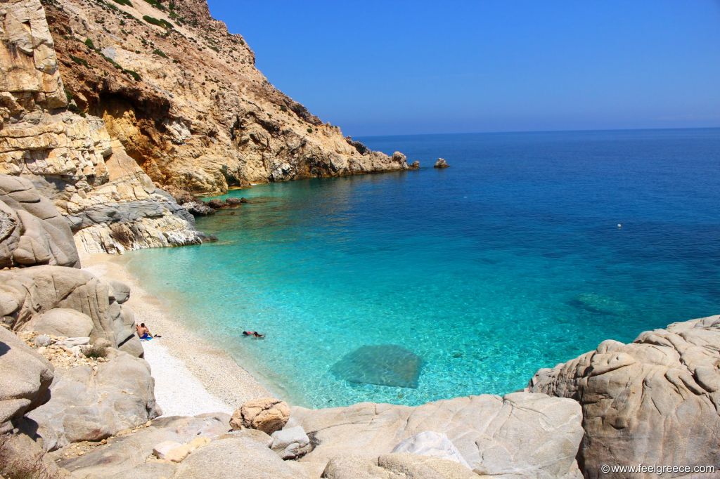
Seychelles Beach
The three villages of Maganitis, Trapulo and Karkinagri are also linked to Agios Kirkios by a local boat service that runs three days a week. Again, this service is primarily for locals with early morning departures from the three villages and a mid afternoon return from Agios Kirikos.
Ikaria is an eccentric island which visitors generally love or hate. I’ve been there with friends who found it far too rough and primitive for their sophisticated tastes. I love Ikaria, it’s probably my favourite Greek island and those friends are no longer on my Xmas card list. To my mind, Ikaria has soul and retains a sense of place that some other islands have largely lost. It’s scenically beautiful but, as always, it’s the people who make it really special.
Inousses
Visited in 2018.
Small and almost hidden away between Chios and Turkey. Attractive main village. Quietly prosperous with limited visitor facilities. Offers peace and quiet with a touch of style.
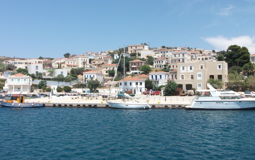
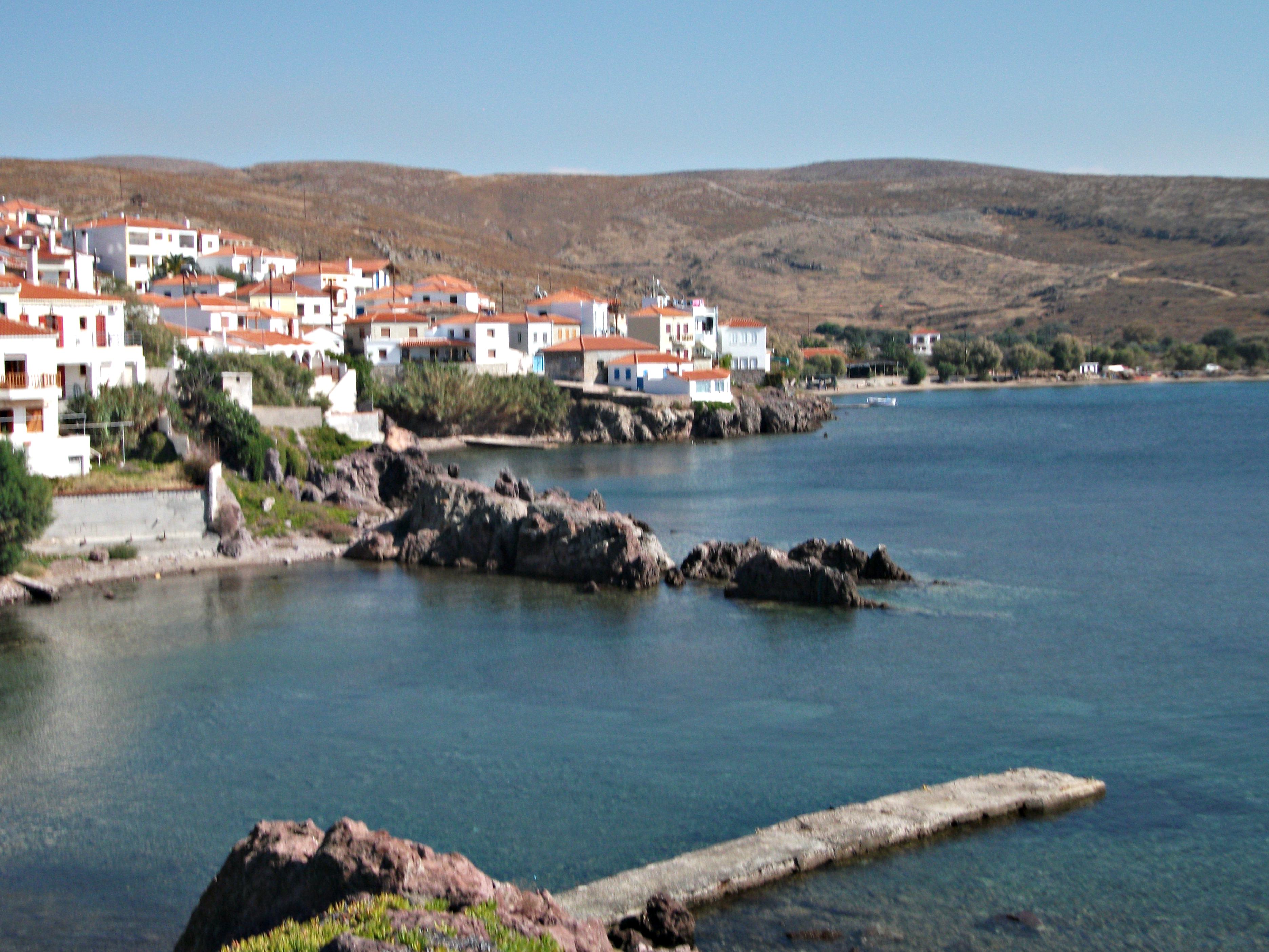
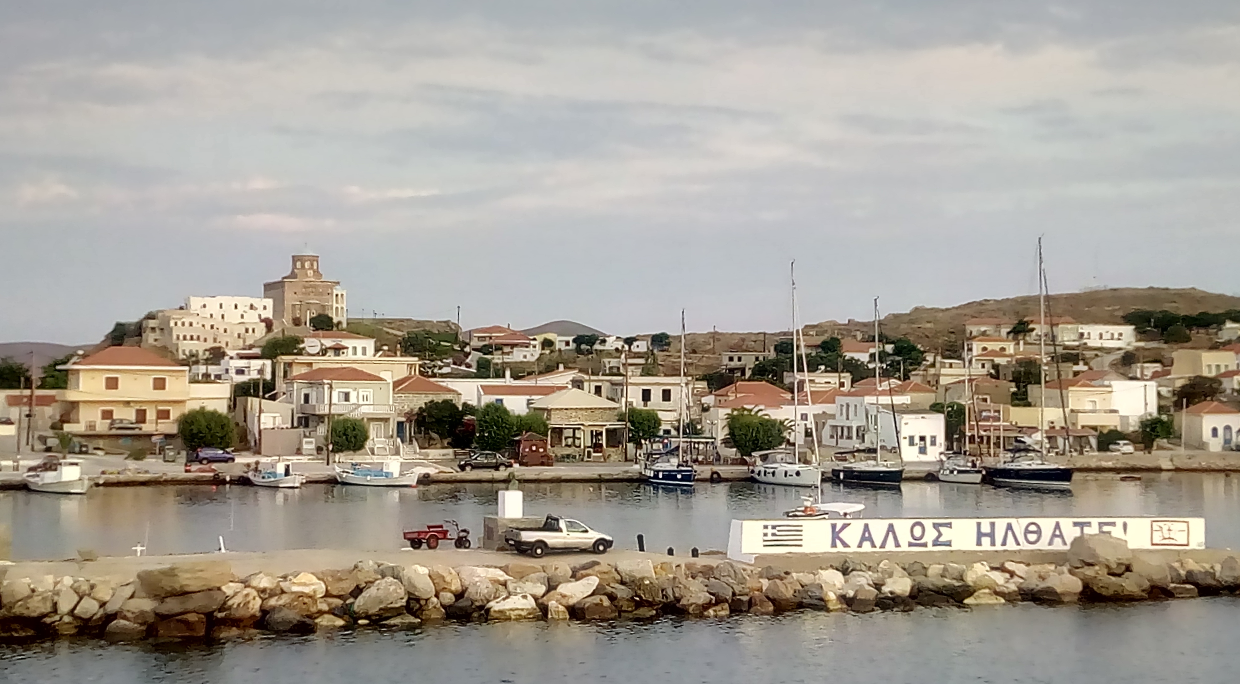
Inousses is the largest and the only inhabited island in a small archipelago lying very close to the coast of Turkey. It is a few miles north east of Chios to which it is linked by a daily ferry that takes an hour to make the crossing.
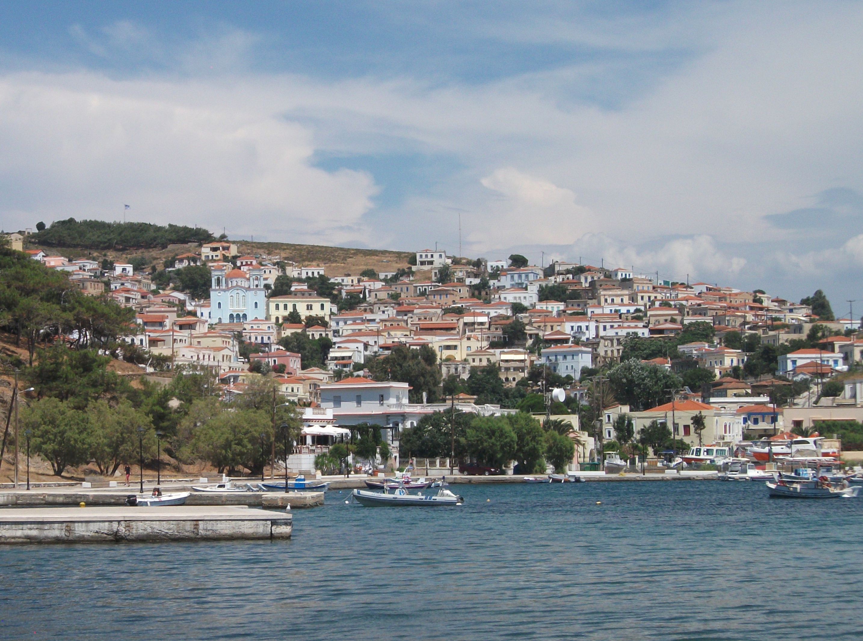
Inousses
The seaward approach into Inousses is particularly attractive with a large natural harbour protected by two offshore islets adorned with little churches. The houses of the only village on the island rise up steeply in a series of colourful tiers and the waterfront area is landscaped with a broad promenade housing tavernas and bars as well as numerous statues of people who were presumably local worthies. However, the even more numerous local seagulls show them little respect when leaving their mark on them.
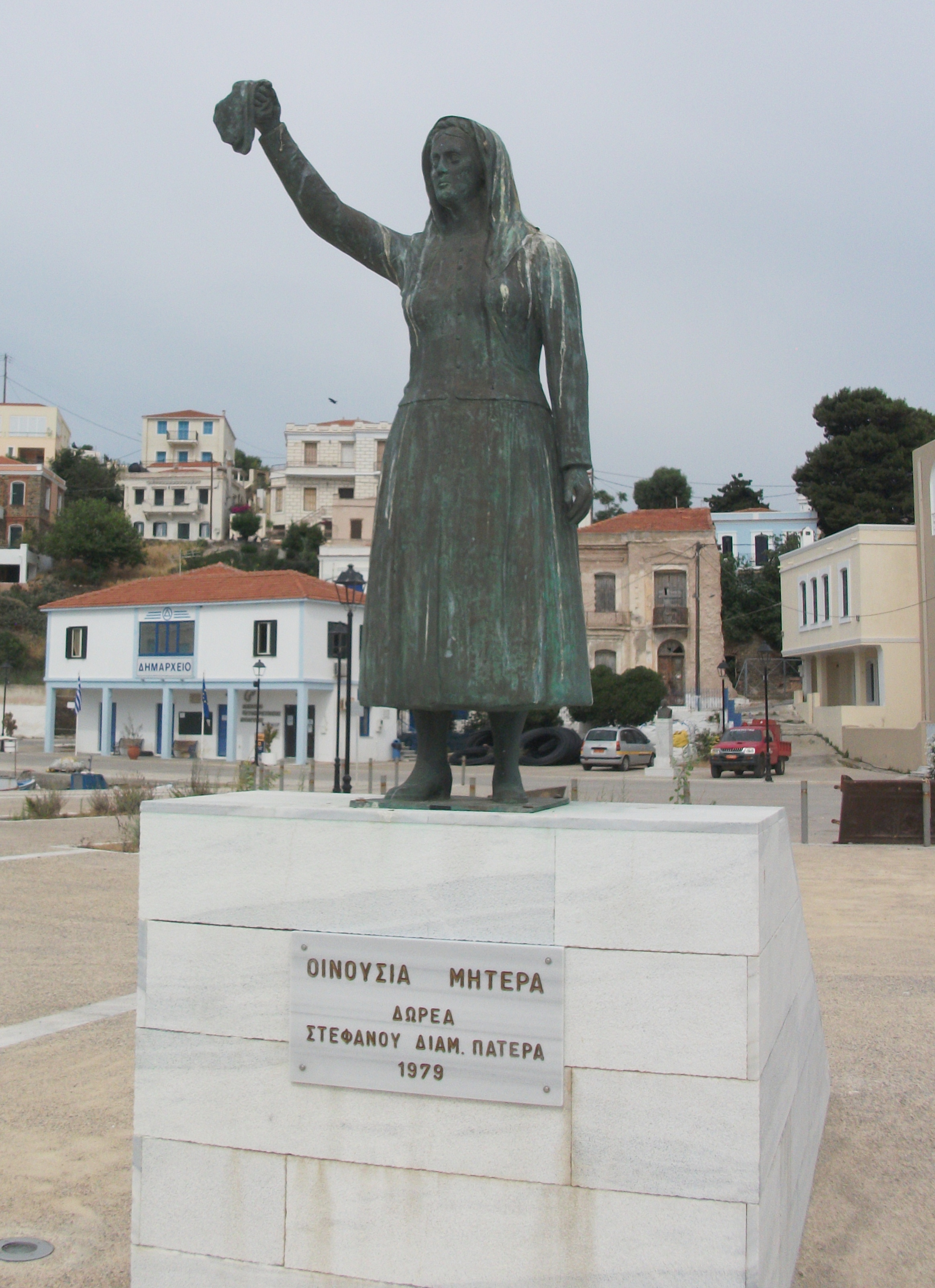
Statues & Seagulls. Inousses
The village has the look of a smaller, less commercialised version of Hydra Town and initial impressions are of prosperity and a touch of style in keeping with an island noted for producing well known and wealthy Greek shipping magnates.
The air of prosperity fades a little as you climb up into the village which has its fair share of empty, crumbling buildings. It’s a steep climb up narrow streets and lanes that, in places, are barely wide enough for a small car to pass through. This is definitely not SUV country unless you like dents as optional adornments.
Places to stay are not obvious. Allegedly there is a hotel and a studio complex in the village but I could locate neither and ended up asking around until finding an undoubtedly unofficial room in a converted cellar under a private house. Unfortunately ferry timetables do not make a day trip from Chios possible, although a few tour operators advertise peak season day excursions from Chios Town. However, mid-June was obviously not peak season.

Inousses
Outside the village there are plenty of roads and tracks for walking but not a lot to see. The scenery is pleasant rather than spectacular and the few beaches I passed were fairly rough with gritty sand, stones and a lot of bleached seaweed.
Inousses is at its best in the evening as the waterfront bars and tavernas fill up with talkative locals. The sunsets over Chios can be spectacular.
I felt like I was the only foreigner on Inousses, although I assume I wasn’t. The locals are friendly but make few concessions for visitors. I kind of hope it stays that way.
Lesbos
Visited in 2015.
Greece’s third largest island. Located very close to Turkey. Lots to see and do. Well worth exploring. Plenty of seaside villages of all sizes. Popular with lesbian visitors.
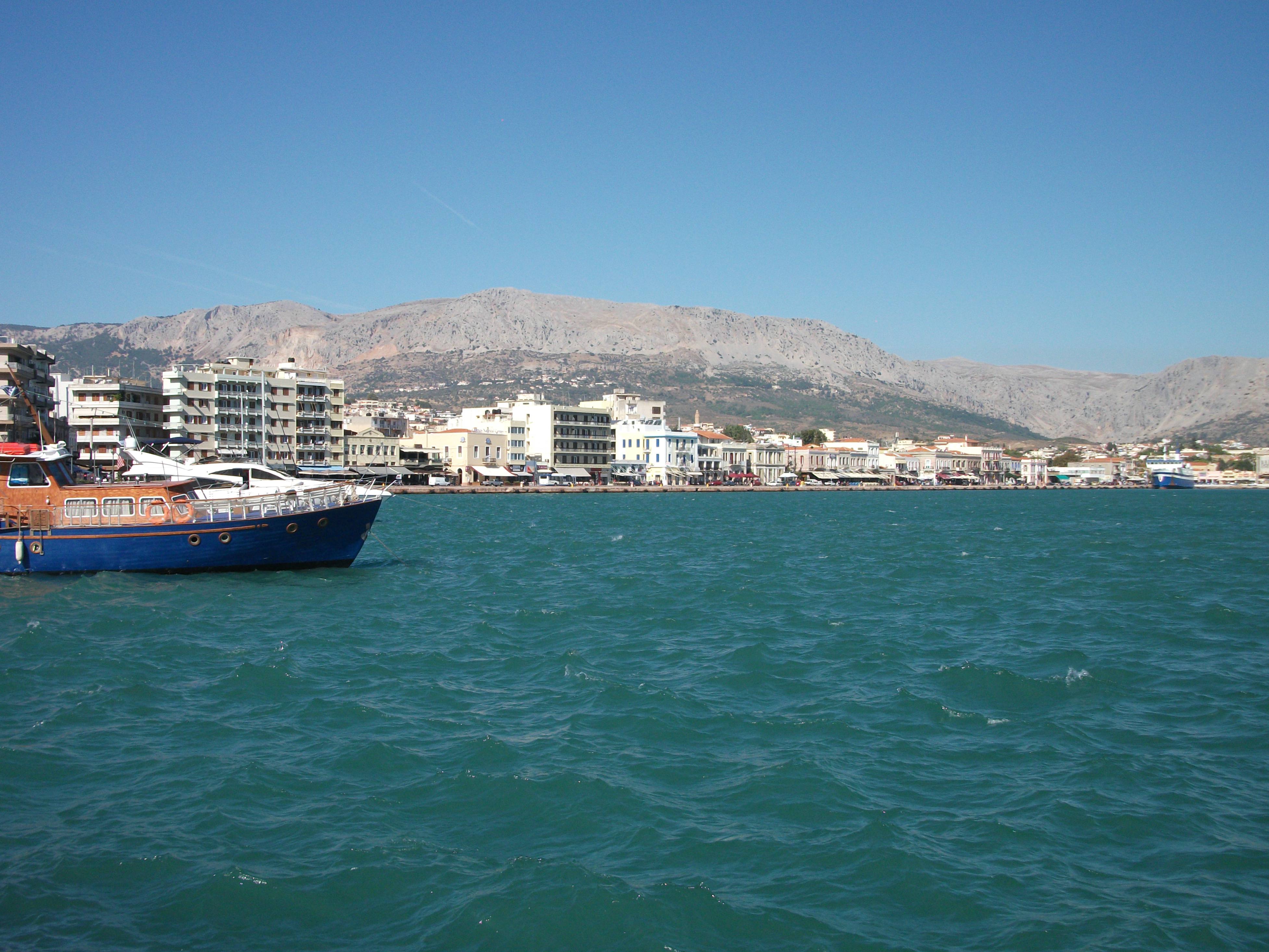
Almost hugging the Turkish coast, mighty Lesbos is Greece’s third largest island with a population of just over 90,000. Unwillingly thrown into the media spotlight by the migrant crisis of 2015, it nonetheless has a well-developed tourism industry that complements but does not dominate other sectors of the local economy such as olive oil and ouzo production.
Mytilini
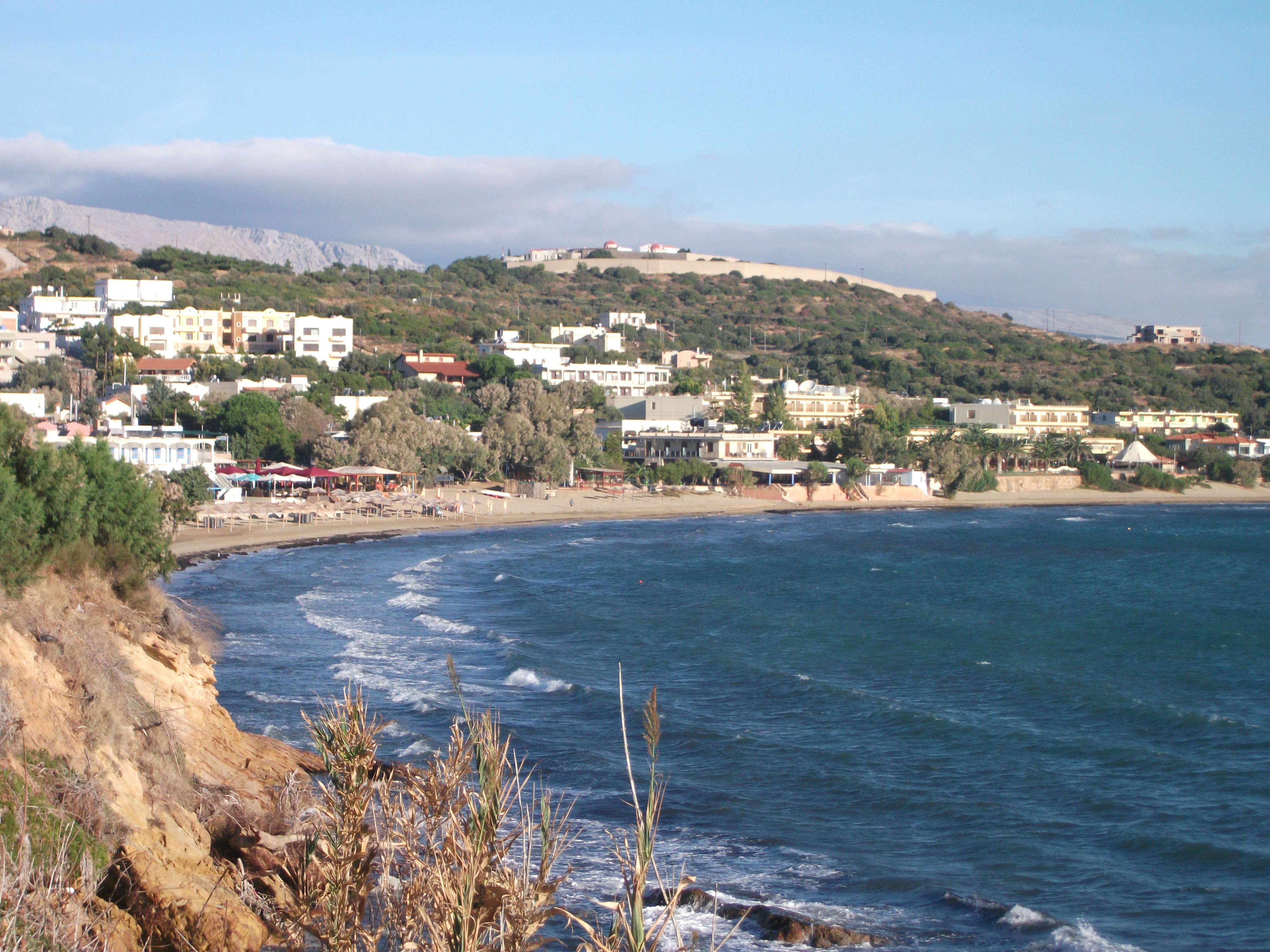
Mytilini, the island capital, is a large, predominantly modern town with little to detain visitors who arrive there by ferry or flights to the nearby airport. To the south of the town the road to the airport continues past some reasonable beaches before curving round to the almost landlocked Gulf of Yera and on to Plomari, the island’s second largest town and the main centre of ouzo distilling. This south east coast of the island has a number of small, sleepy beach resorts including the 7km sandy stretch at Vatera, judged by some to be the best beach on the island. On an overcast and windy October day, it did not look too appealing.
The huge Gulf of Kalloni to the west almost divides the island in half. Skala Kalloni at its head is a popular family package holiday destination, more for its long beach and shallow waters than the appeal of the village itself.
Skala Eressos
Beyond the Gulf, Skala Eresos has a 3km beach of greyish sand and is particularly popular with lesbian visitors attracted by its proximity to the birthplace of Sappho, the ancient poetess who extolled the joys of female to female love. There is a wide choice of accommodation, tavernas and bars, but the rather ramshackle village has little genuine beauty.
Sigri
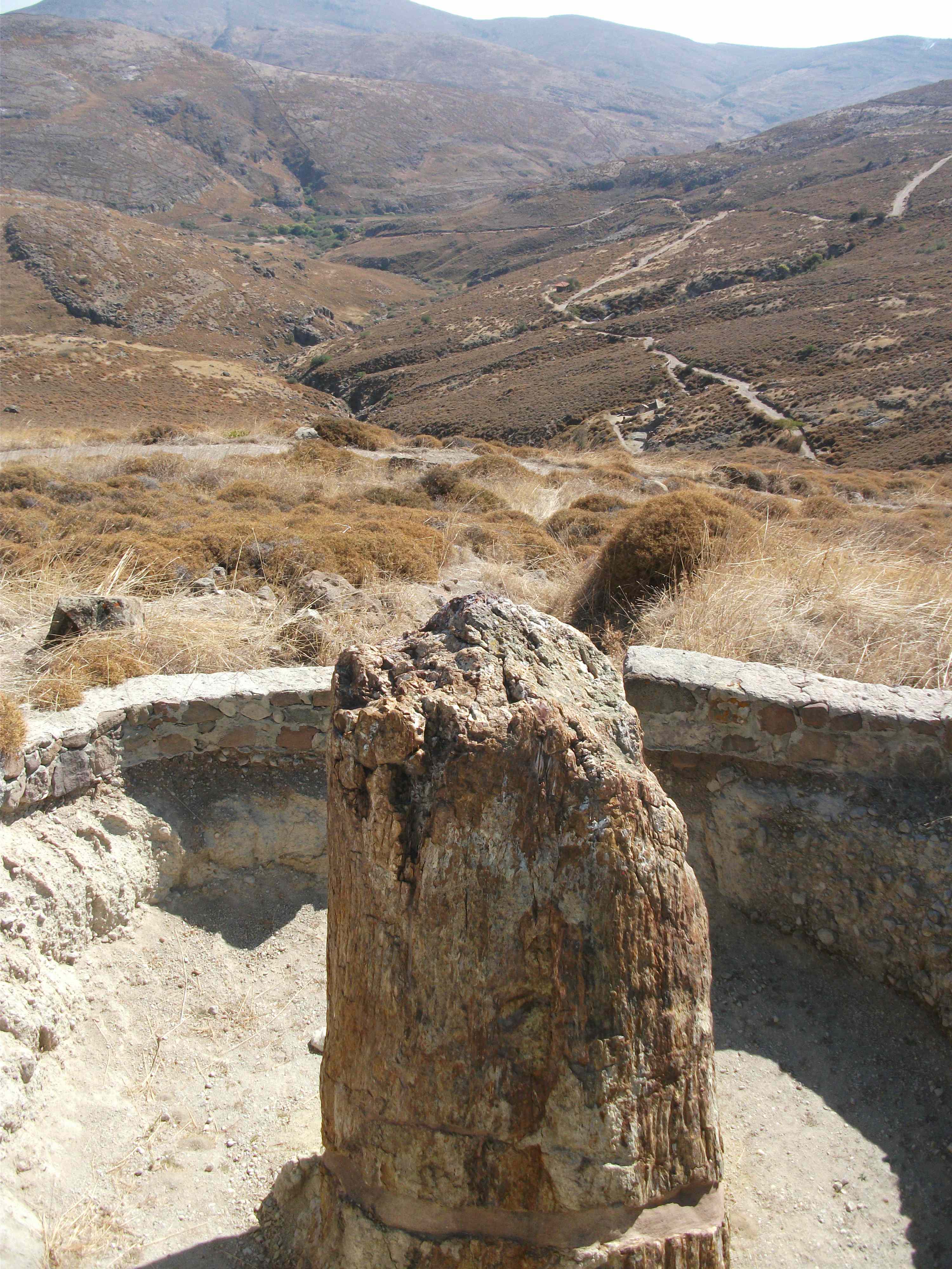
Sigri, at the western tip of the island, is quieter and more attractive with a ruined Ottoman castle, sandy beach and tavernas scattered along the seafront. Just inland, the Petrified Forest is one of Lesbos’ main attractions with fossilised tree trunks up to 20 million years old. The setting is beautiful but the tree fossils themselves are a bit underwhelming unless you’re really into that kind of thing.
Petrified Forest
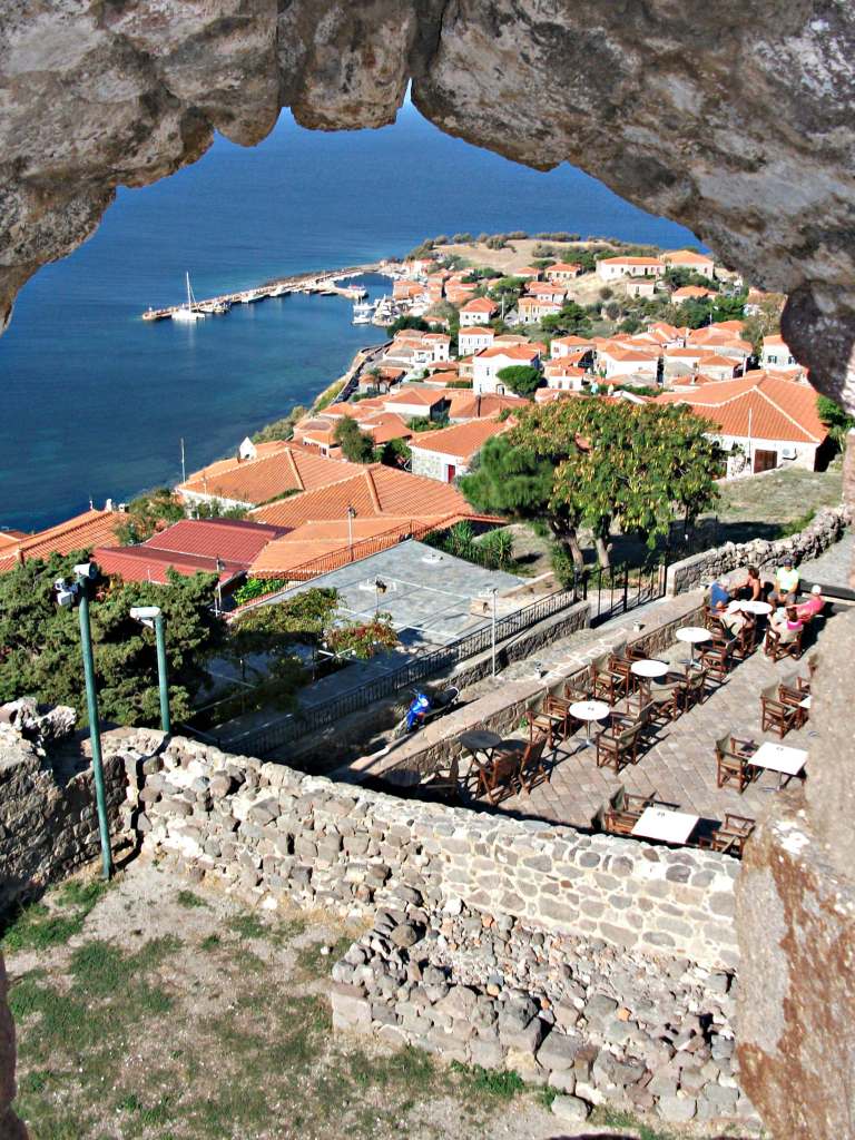
Molyvos, on the north coast some 60 km from Mytilini, is probably the biggest and most attractive resort on the island. Nestling under a Byzantine castle, it has a distinctly Turkish flavour with red roofed stone houses, fountains, bazaar like streets full of little shops, and a lively nightlife of tavernas, bars and music clubs. The village beach is largely stony and uncomfortable, but softer and sandier alternatives are available nearby at Petra and Anaxos, which have developed into rather sprawling resort villages. Anaxos is the prettier and quieter of the two.
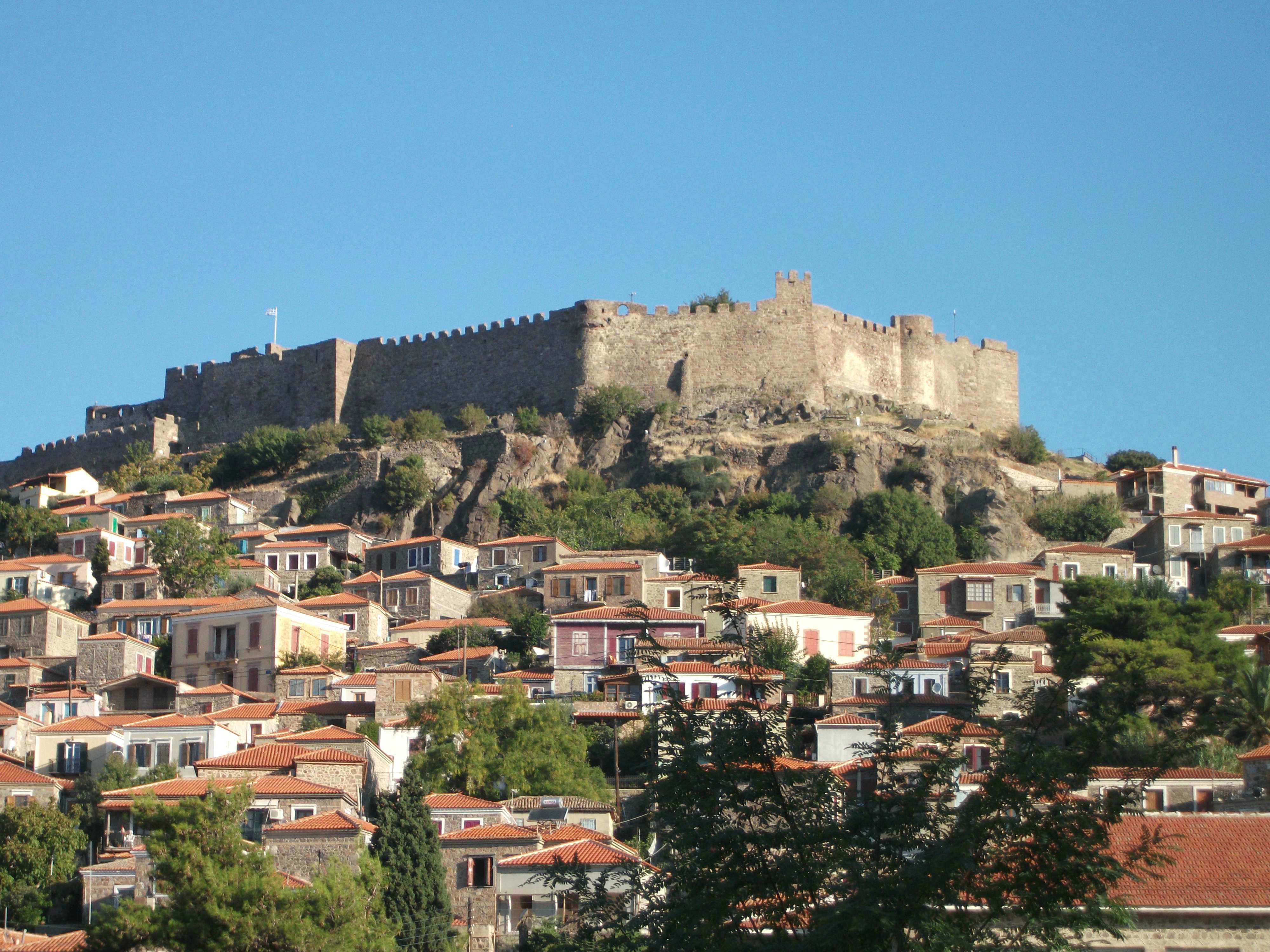
Molyvos
There are a number of excellent walking trails into the hills around Molyvos that pass through attractive villages and give spectacular views across to Turkey. The paved road round the very north of the island offers a less strenuous way to explore the views and villages. It detours down to the coast at Skala Syraminias, a tranquil and pretty fishing port with a few tavernas and places to stay.

Skala Syraminias
Lesbos is large and varied enough to appeal to a wide variety of visitors. Its Ottoman heritage is very evident in many places and you are always aware of its proximity to Turkey. Personally, I would head for Molyvos on any first visit. It has an authentic village centre, is a good touring base, and offers enough diversions to make one or two weeks pass by very pleasurably.
Limnos
First Visited in 2015. Most recently visited in 2018.
Fairly remote, large island. Mainly flat and agricultural. Launch pad for the WW1 Gallipoli campaign. Lovely main town, varied history, good beaches. Quiet but not too quiet,

Limnos looks and feels different from most other large Greek islands as it is predominantly flat and agricultural. It is also heavily militarised, reflecting its strategic position close to the mouth of the Dardanelles. It was the main launch site of the disastrous Gallipoli campaign of World War 1, the failure of which is poignantly remembered in the two moving, and depressingly large, Allied War Cemeteries on the island.
The civilian airport in the centre of the island is shared with a military air base and air travel is by far the quickest way to Limnos. Ferries from Pireaus tend to follow a convoluted route that can take the best part of 24 hours. A more direct route from Lavrio in Attica takes 9 hours. The quickest ferry crossing – a mere 4½ hours – is from Kavala to the north on the Thracian mainland.

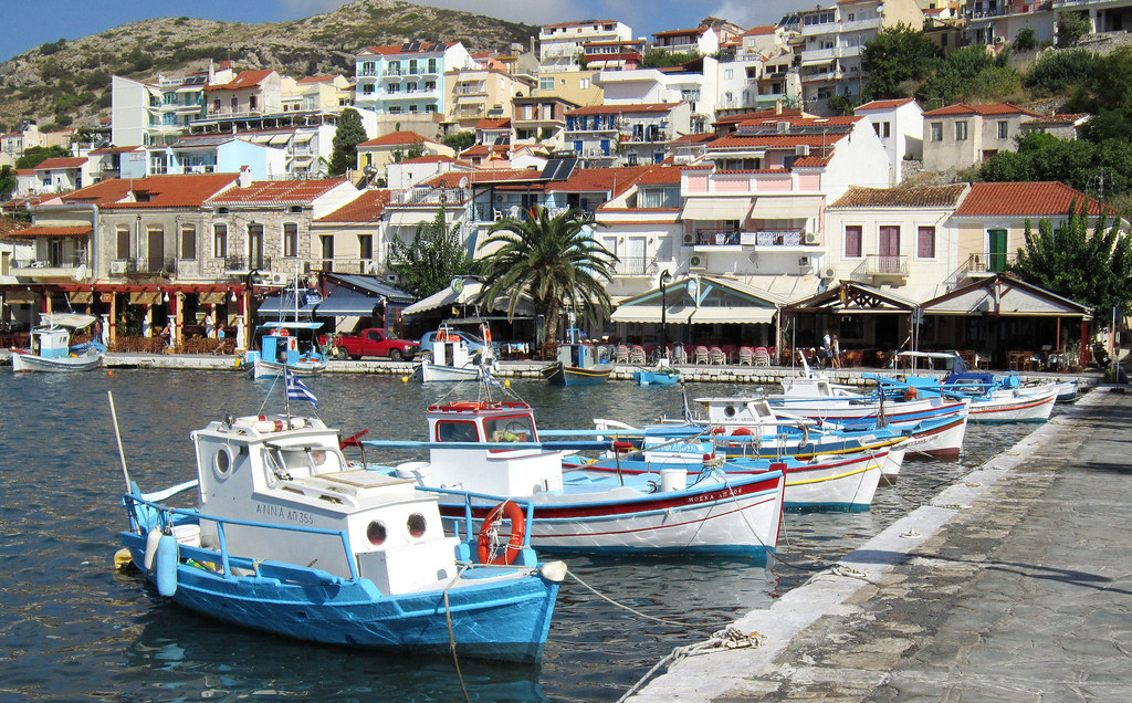
Myrina
Ferries call in at Myrina, the friendly main town on the west coast which is spread over two bays overlooked by a massive ruined Byzantine castle where visitors and timid, feral deer wander freely. One bay is taken up by the ferry dock and the other is Myrina’s main beach area with an attractive promenade and ornate mansions. Most of the shops and traditional tavernas are around the ferry port, but the beach area comes alive at night with music bars and more contemporary restaurants.
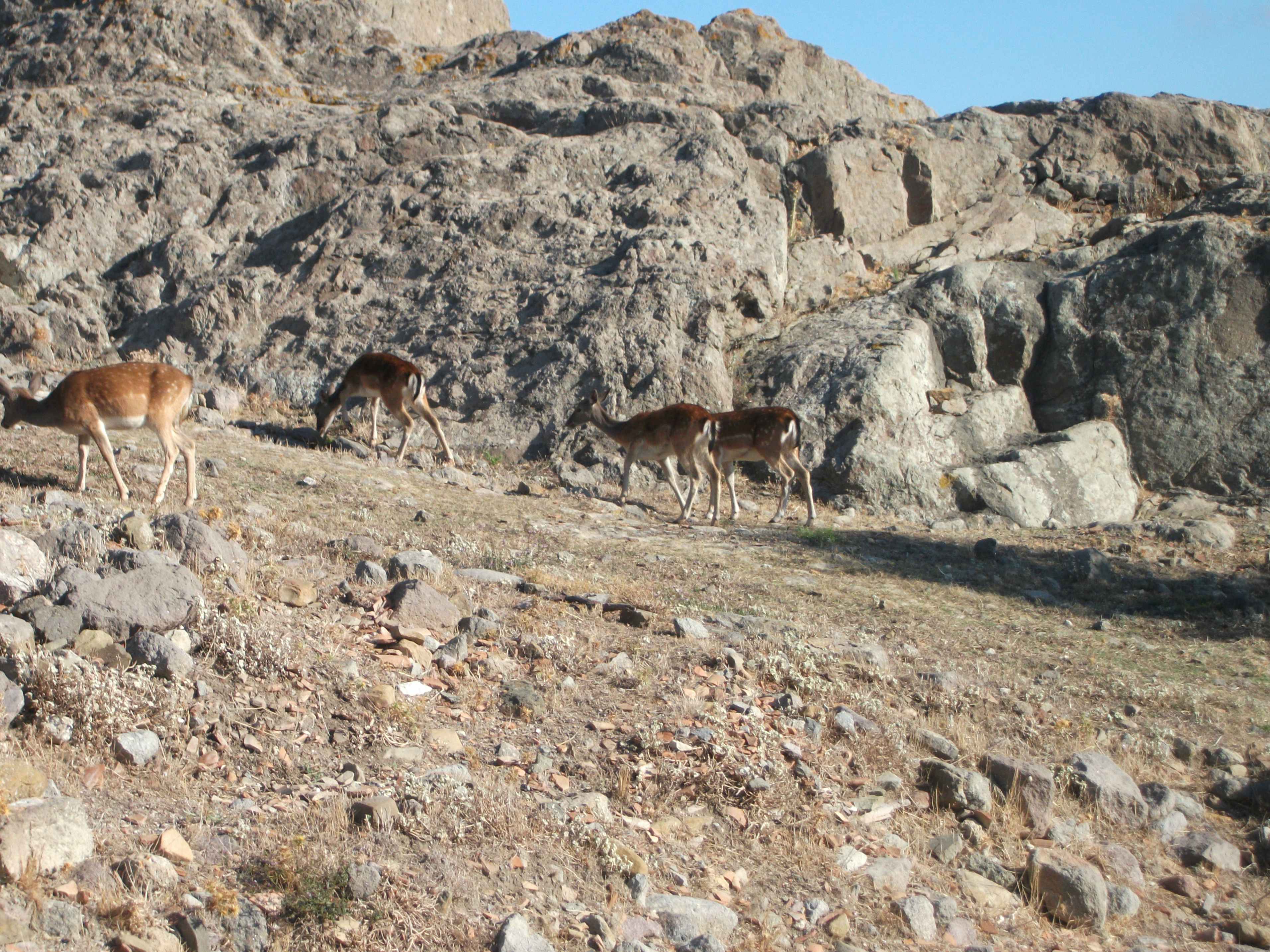
Kastro Deer, Myrina
Limnos has a good road network that makes exploring easy by hire car or motorbike. Bus services tend to be occasional and a bit erratic. In particular, bus links between Myrina and the airport appear to pay little heed to aircraft schedules and can leave you with several hours to kill before your flight departs.
Kastro & Myrina
The area north of Myrina is the hilliest on the island with a series of attractive villages and a good beach at Agios Ioannis. South of Myrina a road curves past the mini beach resort of Platy and round to the huge, open Moudhros Bay passing several large, undeveloped and relatively sheltered beaches.
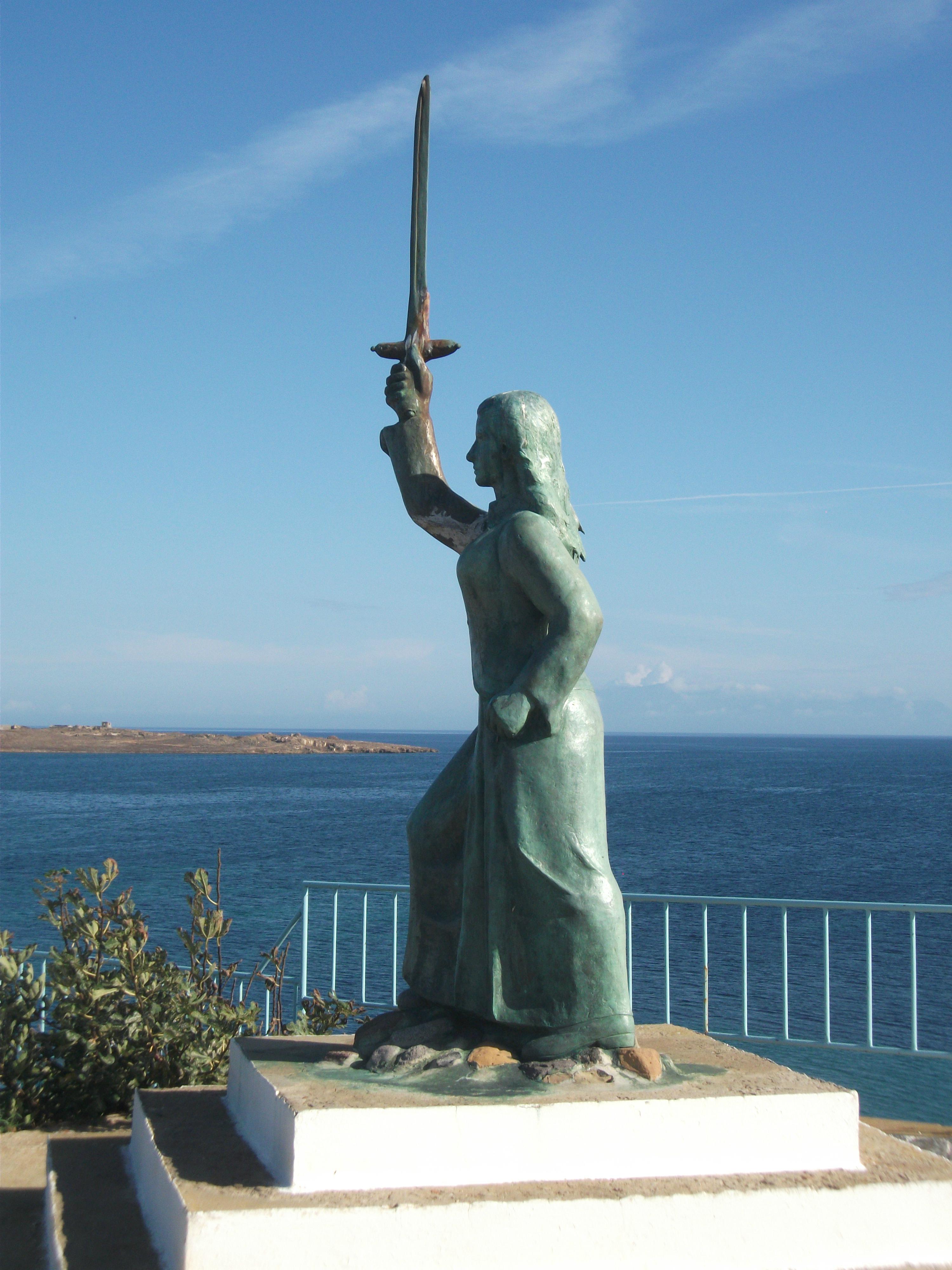
Statue of Maroula, Kotsinas
At the head of Moudhros Bay a road detours to the pretty fishing harbour at Kotsinas with its statue of local medieval heroine Maroula who fought the Ottomans. The main road continues round to Moudhros, the island’s second largest town which has a pleasant waterfront with tavernas.

Moudhros
This is the east side of Limnos which has significant ancient sites at Polyochni, Hephaestia and Kabirion, as well as large beaches at Plaka and Keros. The latter is fairly exposed and popular with windsurfers and wild campers. The former is sandier and more sheltered. I had it all to myself on a hot, sunny October day.
Limnos is another of those islands with a real sense of place and local identity, perhaps as a result of its relative isolation. It’s a bit of a pain to get to, but the open countryside is surprisingly seductive and Myrina is a delightful place to spend a few days doing not much other than sunbathing, swimming, eating and drinking. There are luxury standard resort hotels on the island – generally next to beaches – but also a good choice of less expensive, more authentic accommodation. I think it’s well worth a visit. I’ve certainly gone back to it.
Psara
Visited in 2018.
Small, remote island revered by the Greeks for its role in their War of Independence. Charming main village and outstanding beaches. Quiet with limited visitor facilities.

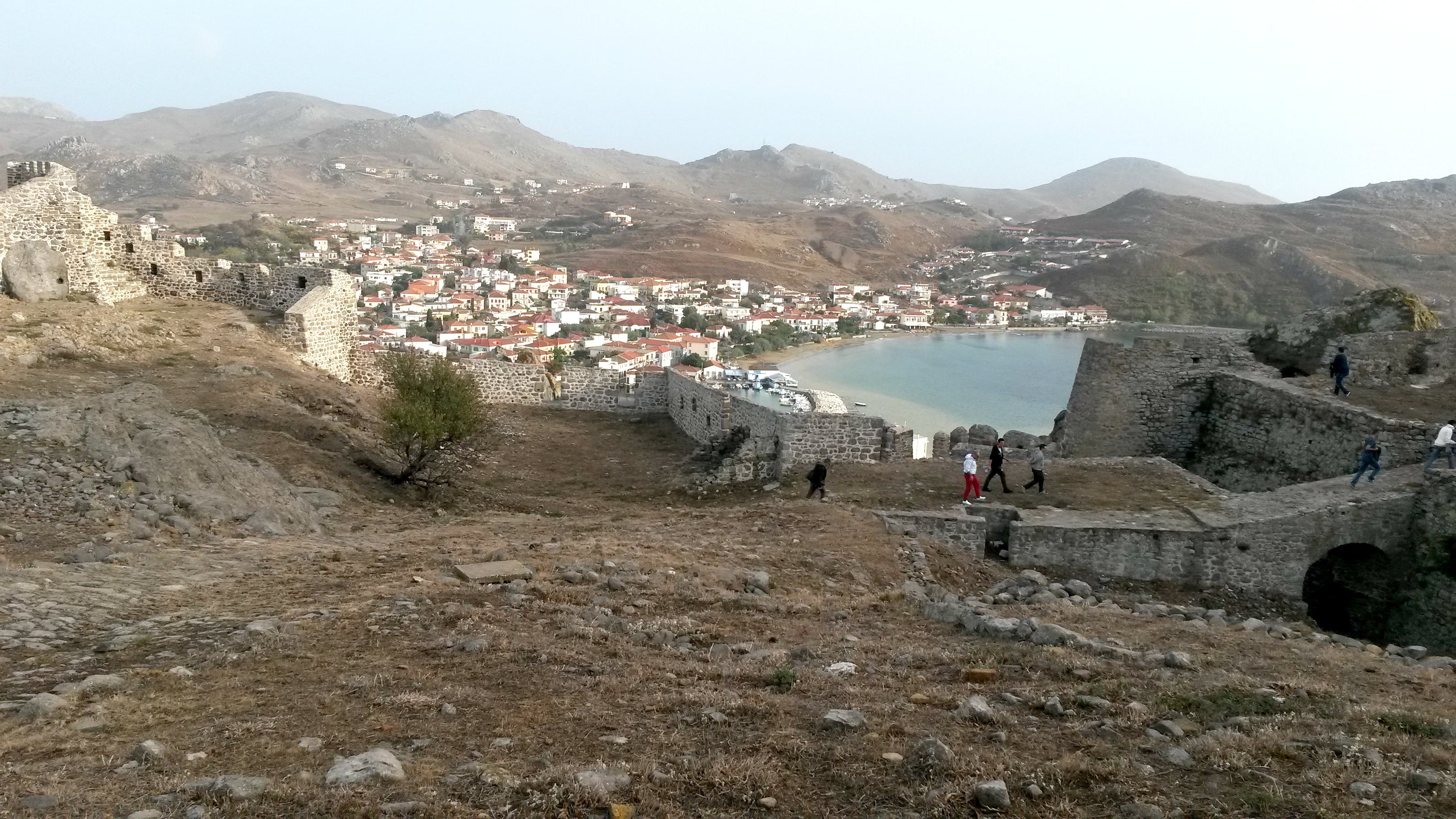
Little Psara has a big reputation throughout Greece for its role in the 19th century War of Independence against the Ottoman Empire, when it provided many leaders and ships for the Greek cause. It was such a thorn in the sides of the Ottomans that they invaded the island and massacred thousands of the inhabitants. Many women and children escaped their clutches by throwing themselves to their deaths from a high cliff above the main village. These acts are remembered in traditional Greek folk songs as well as statues and monuments on the island.
At that time, Psara is questionably said to have had 30,000 inhabitants. Today it has around 300, most of whom live in the main port village. Chios is Psara’s nearest neighbour and the local Psara Glory ferry takes slightly under 4 hours to make its daily crossing to and from Chios Town. From personal experience, ferry timetables can change at very short notice if any at all. You have been warned!

Psara Village & St Nicolas Church
Psara village is a friendly, attractive place overlooked by the imposing church of St Nicolas and the aforementioned high cliff. There is a limited range of places to stay and owners tend not to meet ferries, so you have to ask around when you get there. Psara Studios appears to be the largest operator and my studio there was comfortable if a little overpriced.
The village waterfront has a few good quality tavernas and bars. Spitalia, located in a renovated medieval hospital overlooking Katsouni beach has a great setting, friendly service and excellent food. The music bar at the other end of the beach, whose name I can’t remember, is where young people tend to go for what passes as night time action on Psara. It does a good gin and tonic.
Megalo Ammos Beach
A series of exceptional sandy beaches spread east from the village, all of them within walking distance. You should be able to find one to yourself but don’t expect any facilities other than soft sand and clear waters.
The only paved road on the island runs north for about 13 km to the large and usually closed Monastery of Kimisi Theotokou. Along the way it passes more beaches and an Archaeological Park, which is much advertised on local maps and leaflets but was fenced, gated and padlocked during my visit in June.
To be honest, the hinterland of Psara is rather boring scenically and I found the walk to the monastery a somewhat tedious succession of uphill climbs and sweeping bends to yet another view of bare rounded hills and little else. Westward views to the uninhabited neighbouring islet of Antipsara are a bit more interesting.
Psara Village
Despite its limited scenic value, Psara should satisfy beach lovers and anyone looking for an authentic Greek island village experience. Getting there is a bit of a lengthy process but well worth the effort. It has a genuine sense of place and history, lovely people and an appealing serenity.
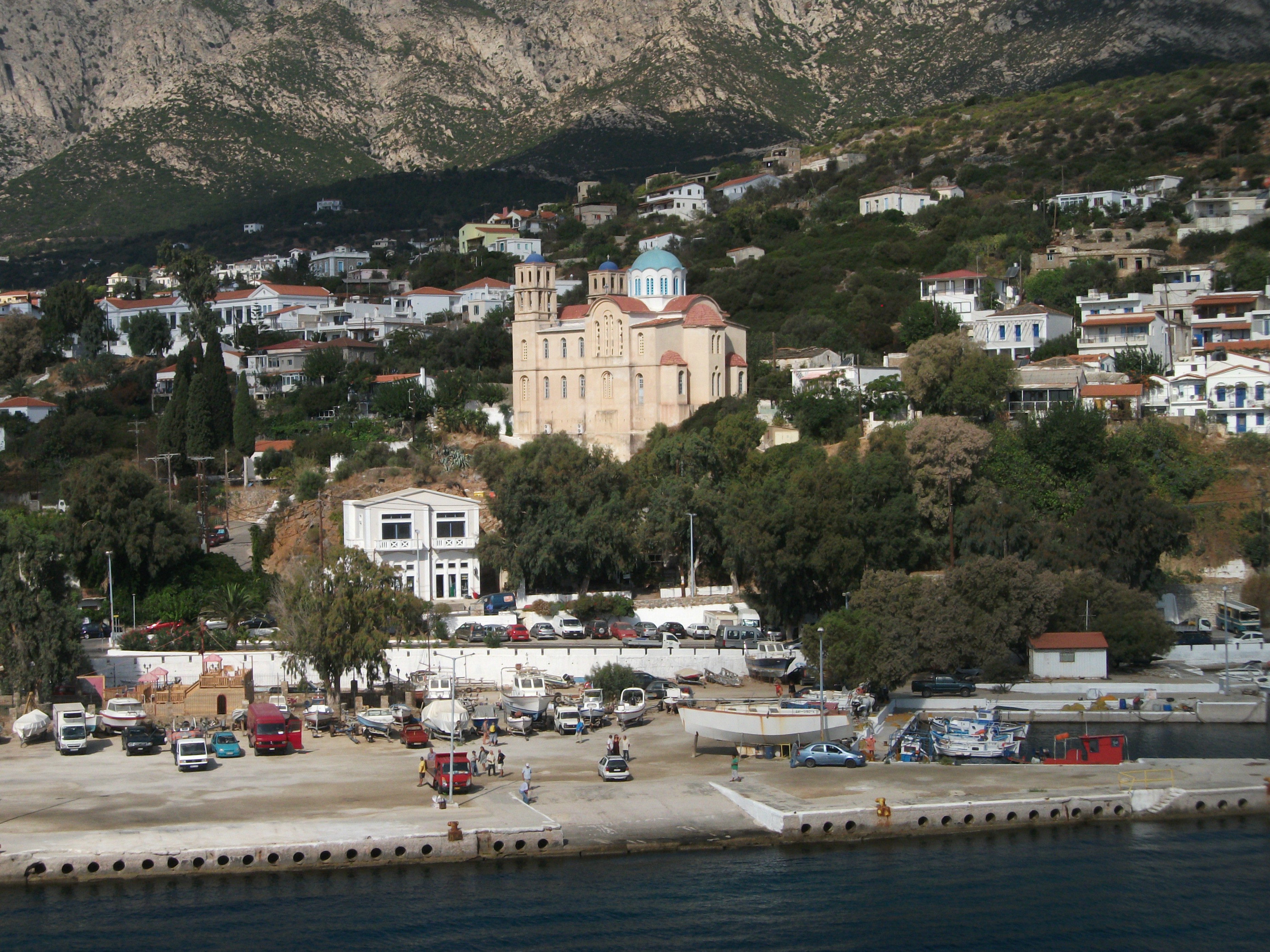
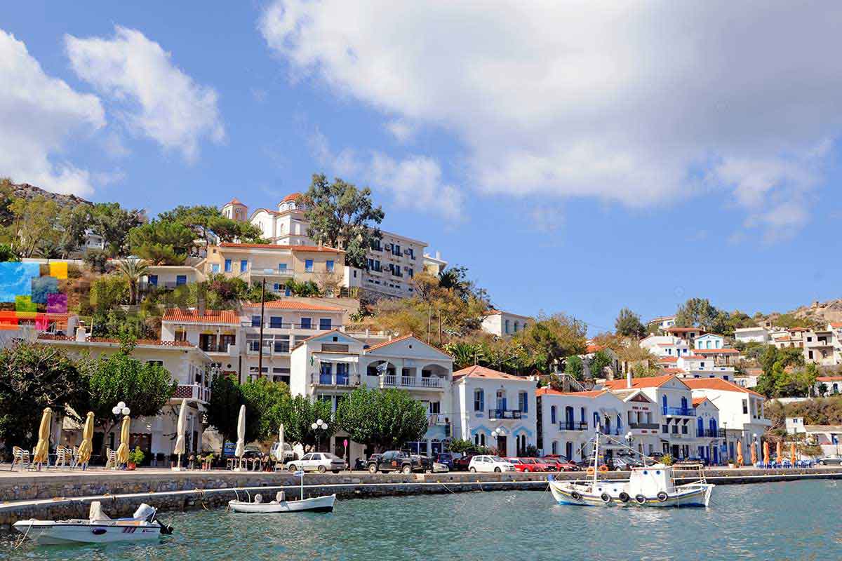
Samos
First Visited in 1981. Most recently visited in 2023.
Large and verdant with numerous towns, villages and tourist areas. Busy in places but with plenty of quiet corners. Has something for everyone. Good for walkers. I love it.
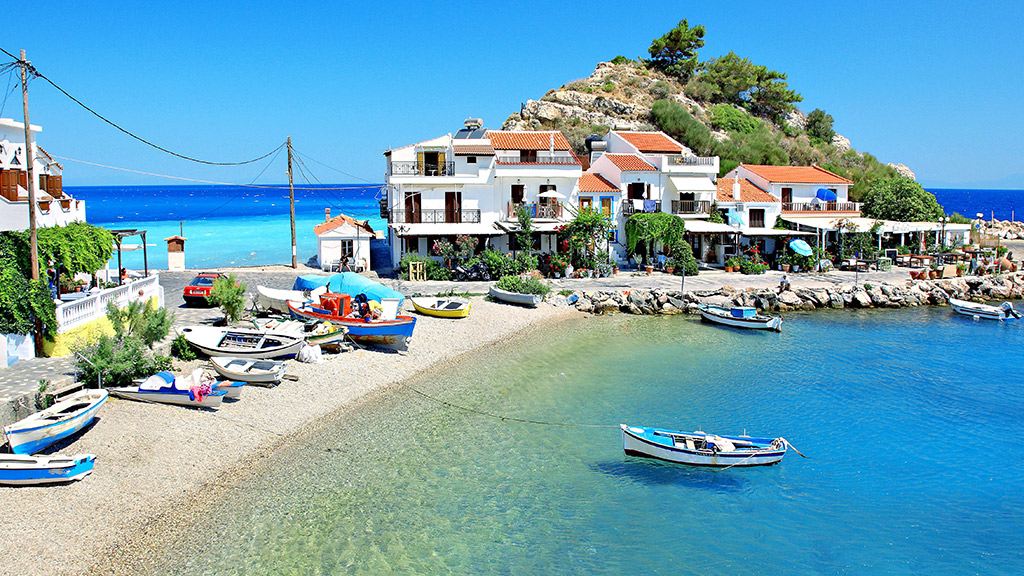
Pythagorion
Verdant Samos seems to be more appreciated by European than British visitors. Large and prosperous with some 35,000 residents, it offers history, good beaches and attractive scenery.
The two main towns and ferry ports of Vathy and Karlovassi lie on the north coast at opposite ends of the island. It’s a drive of about an hour between the two. Most, but not all ferries, stop at both of them.

Vathy
Vathy and Karlovassi are fairly workaday places. Vathy has the more attractive setting in a deep bay and the advantage of an atmospheric old hill village suburb. It also has a bit more tourism infrastructure, including the small but serviceable beach at Gangou. There are daily summer ferry excursions to the Turkish resort of Kusadasi, gateway to the renowned ancient ruins of Ephesus.
Karlovassi appears to be the main port for freight traffic. The harbour area is quite pretty but the town itself is of limited interest. However, it does act as the main gateway to the vast sandy beach at Potami – about a 30 minute walk to the west – and the less developed and quieter south west of the island.
Kokkari
There are three main beachside tourism areas on Samos – Kokkari, Pythagorion and Votsalakis. The first is a north coast village located between the two main towns. It has an attractive but busy waterfront area and a large, rather exposed pebble beach which is popular with windsurfers. There are more sheltered, well advertised beach alternatives close by but they can be somewhat tightly packed with sunbeds and noisy beach bars. The pretty, nearby inland hill villages of Vourliotes and Manolates are more sedate despite being popular day visitor destinations. There are attractive woodland walks in and around both of them.

Pythagorion, on the south east coast, is named after native son Pythagoras, the man who invented triangles. It clusters around a picturesque but busy harbour before extending out for several kilometres along a lengthy sand and shingle beach past the island airport. This usually has several flights a day from Athens and northern European airports. Plane noise can be an issue in out of town hotels and apartments close to the airport. Hydrofoils run from the harbour to the Dodecanese islands during the summer and excursion boats carry visitors to other local beaches like the tiny offshore islet of Samiopoula.
The extensive ruins of the ancient Temple of Hera lie 5km to the west of Pythagorion on the road to the dusty little resort of Ireon, which, personally, I have always found uninspiring. It’s beach is particularly mediocre.
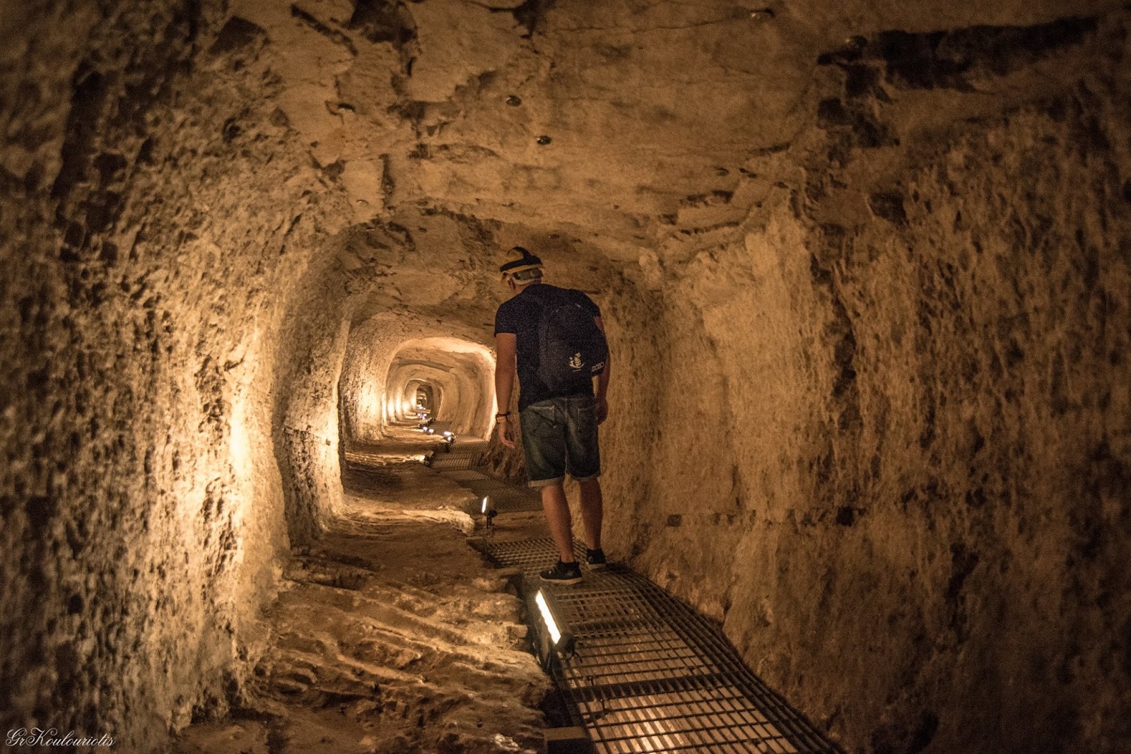
The Efpalinion
Closer to Pythagorion, it’s well worth visiting the Efpalinion, a 1,000 metre long tunnel dug through solid rock by ancient slaves to bring fresh water from the mountains. From here it’s a relatively short walk to the ruins of the city walls of ancient Pythagorion which demonstrate the village was much larger in the past than it is today. Inland, the mountain village of Pagondas has a particularly attractive main square from where a spectacular scenic road heads west clinging to the mountain side high above the sea and passing through pretty hill villages.

Votsalakis
The third resort area of Votsalakis can be accessed by this road from Pagondas but is more usually approached via the main road south west from Karlovassi. It is pretty much a purpose built package tourism resort located on a 2km long sandy beach. It has limited authentic Greek character but enjoys a beautiful location overlooked by Mount Kerkis, the island’s highest point. Quieter beaches with limited and more upmarket development can be found further west at Psili Ammos and Limnionas, The paved road continues on to sleepy, hillside Drakei from where it’s a 3 – 4 hour walk along trails back to Karlovassi.
Samos is good walking country with over 30 signed trails. They are graded for all levels of walkers, but many require solid footwear rather than flip flops or stilettos. Guided walks are available on some of them.
Pythagorion
When I visit Samos I invariably stay in Pythagorion, partly for sentimental reasons and partly because it’s a good base for onward travel and exploring the rest of the island. I’ve seen the village grow significantly in the past 40 years. It has got a lot busier and noisier as more and more traditional tavernas have turned into music bars serving exotic cocktails. However, local kids still run around the harbour front and local life still goes on in the back streets. Pythagorion has changed over the years, not always for the better, but it hasn’t completely lost its soul.
Samothrace
First Visited in 1983. Most recently visited in 2022.
Difficult to get to. Isolated with few links to other islands. Very wild and mountainous. Outstanding scenically with some places of interest. Pretty villages but poor beaches.

I first discovered Samothrace in 1983. Then I described it as “shabby and fly infested” and thought it was the most primitive place I had ever visited. 39 years later I went back – older, wiser and much more travelled – to see how it had changed. Why did it take me so long to return? Well, it is a somewhat difficult place to get to – from Scotland at least.
Sitting pretty much on its own in the north east corner of Greece, access is via a two hour ferry ride from the mainland Thracian port of Alexandroupolis, itself a one hour flight from Athens or a four hour bus ride from Thessaloniki. In the peak summer months, the ferry continues on to Limnos once a week but, for the rest of the year, Samothrace has no direct links to other islands.
The island itself is essentially a mountain top sticking out of the sea. Mount Fengari, the highest mountain on all the Aegean islands at 1,600 metres or 5,300 feet.
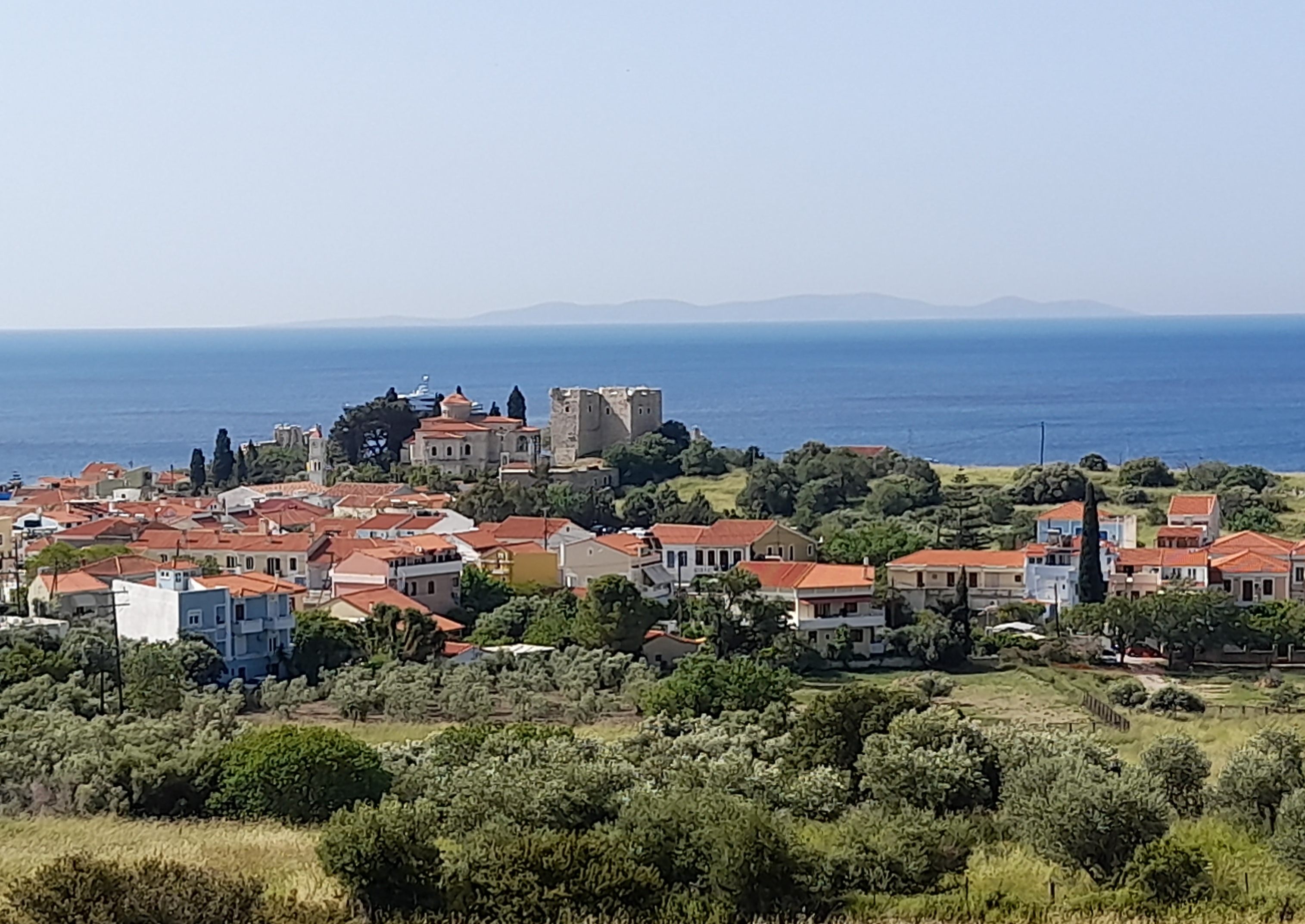
The ferry port of Kamoriotissa lies on the north west coast and is an agreeable village with a good selection of places to stay and eat. However, it’s beach is a mediocre mix of large pebbles and rocks, which is typical of most of the north coast beaches., Kamoriotissa is also the central point for the three local bus routes that make it relatively easy to explore the island, even if the limited timetables cater primarily for local school children.
The main route covers the 4 kilometres inland to the island’s Chora, which can also be reached via an easy uphill walk of about an hour. Chora is a charming jumble of lanes and stairways leading up to an imposing, ruined 15th century castle. Hidden away in a deep valley, it has a variety of arts and crafts shops and some good quality tavernas that reward longer exploration.

Sanctuary of the Great Gods
From Chora, another paved road (with no bus service) snakes back down to the coast at Paleopolis, a small hamlet that is home to the Sanctuary of the Great Gods, the most important archaeological site on the island. This was once the location of a mysterious ancient religious cult, of which much is still unknown. The site is now largely ruined, but a newish and well presented museum explains what you are looking at. The museum and the site are closed on Mondays, but the more adventurous can still see into the ruins by walking along a rough track that runs alongside the wire perimeter fence.
Therma
Paleopolis is about 7 kilometres east of Kamariotissa and is served by about three buses a day, which continue on to Therma (aka Loutra), the most popular “resort” of Samothrace. Therma is located about one kilometre from the coast in a picturesque wooded valley full of cascading streams. It’s a scattered village where every second house seems to offer rooms to rent. There are also a couple of smallish hotels and many more tavernas, as well as a somewhat shabby looking complex of thermal baths. which was closed when I visited in May.
Samothrace’s two official campsites lie a kilometre or so to the east of Therma on the road to the picturesque waterfalls at Fonikas, which are probably the island’s best known natural attraction.
Fonikas
Therma is particularly popular with young people looking for outdoor activities. It is the main start point for the strenuous walk up Mount Fengari. Guided walks are available and advisable for the less experienced. The village also held an annual techno music festival in pre-Covid times, but the pandemic appears to have stopped it permanently – much to the delight of locals who never really took to the hordes of dreadlocked new-agers that it attracted.
The third bus route on the island links Kamoriotissa with a series of small. agricultural villages that lie to the west. It terminates at the pretty hillside village of Profitis Elias, about twelve kilometres from the port. The road – but not the bus service – continues on to the sandy south coast beaches at Pahia Ammos and Vatos, which are the best on the island, but difficult to reach without private transport. The larger Pahia Ammos has a seasonal taverna with a few rooms to let. Vatos is only accessible by foot or boat and is popular with nudists.

Samothrace is a wild island that will not appeal to everyone and it is a bit of a pain to get to, with few options for onward inter island travel. In 1983 I was less than enthusiastic about it. Nowadays I can appreciate its rugged landscapes and hidden villages, especially as visitor infrastructure has improved immeasurably. I would happily go back again before another 39 years pass.
Thassos
First Visited in 1995. Most recently visited in 2024.
The most northerly of the North East Aegean islands. Located close to the mainland. Sizeable with many visitor facilities. Over developed in places but not over run.
Kinara
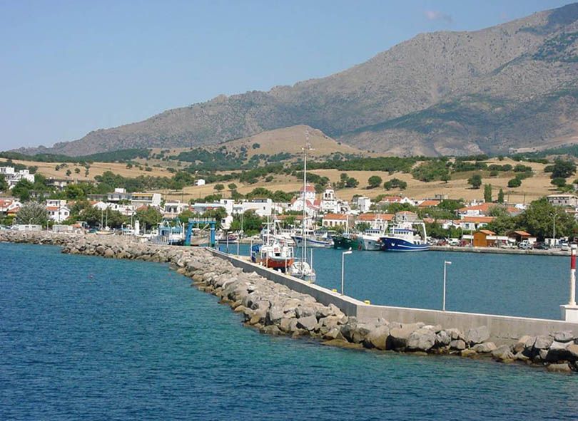
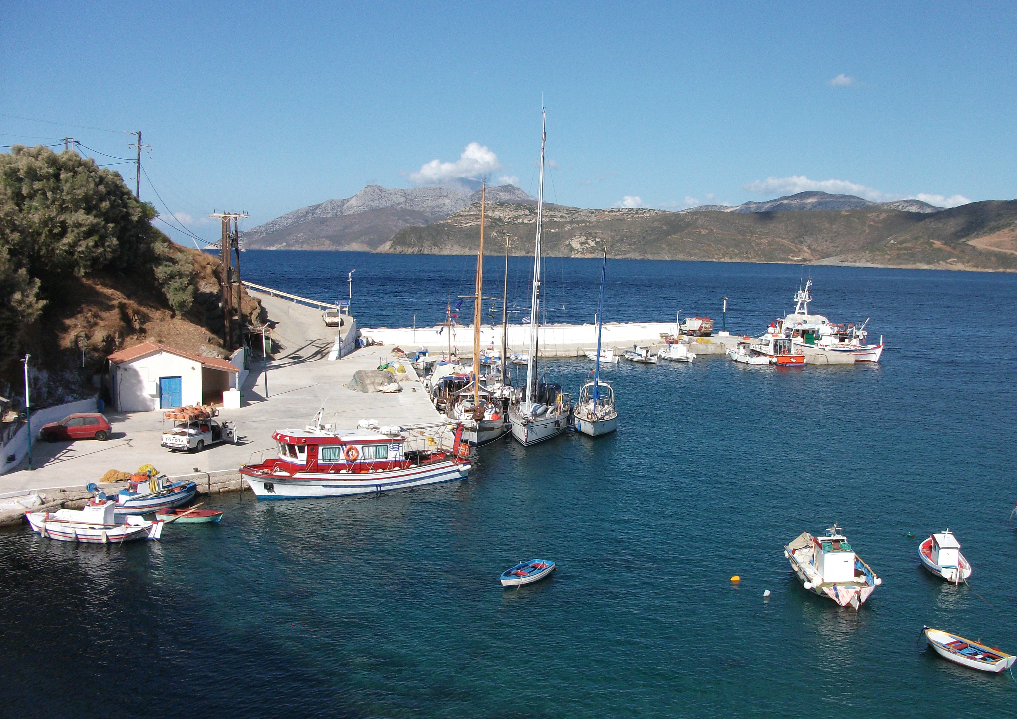
Thassos is a medium sized island with about 14,000 residents that lies pretty much on its own off the coast of Thrace in northern Greece. It has regular ferries from the city of Kavala and the smaller port of Keramoti 40 km to the east. The shortest crossing from Keramoti takes about 40 minutes with large car ferries running as often as every half hour. It has no regular direct ferry connections to any other islands, although routing through Kavala gives relatively easy ferry access to the rest of the North Aegean island group.
It has no airport of its own, although Kavala Airport receives regular domestic and international flights, a significant proportion of which presumably are primarily bringing visitors to Thassos. The airport is a short drive from Keramoti.
It was the first Greek island that my wife ever visited back in the early days of our courtship. We booked a package holiday to the seaside village of Skala Potimias and enjoyed our stay, although we did feel the island had a bit of a low end of the market package holiday vibe. Almost 30 years later I returned on my own to see what, if anything, had changed.
Firstly, it must be said that Thassos is scenically spectacular with high rugged mountains rising up from a beautiful coastline dotted with excellent beaches. It’s interior boasts several attractive mountain villages that are largely untouched by tourism and the circular main coastal road that runs round the island for about 100 km gives easy and enjoyable access to its seaside villages. Good local bus services cover most parts of the island for those who prefer not to drive.
However, the low end of the market package holiday vibe that my wife and I noticed on our first visit has increased with significant new developments on most island beaches, some of which are now forests of sun beds backed by noisy strips of frankly unappetising beach bars. But, thankfully, there are a few exceptions.
Limenas
The island capital and main ferry port of Limenas (sometimes called Thassos Town) doesn’t look up to much on first glance despite its mountain backdrop. It mostly comprises modern apartment blocks and has a bit of a workaday feel, especially around the ferry port area. However, it rewards a bit of exploration away from its main thoroughfares.
A walk along the waterfront promenade of small hotels and tavernas bring you to a quieter area housing a Folklore Museum, primarily depicting life on the island in the 19th century. Adjacent to this is an excellent Archaeological Museum showcasing exhibits from ancient times with detailed interpretation in Greek, English and French. It is one of the best museums of its kind that I have encountered in Greece.
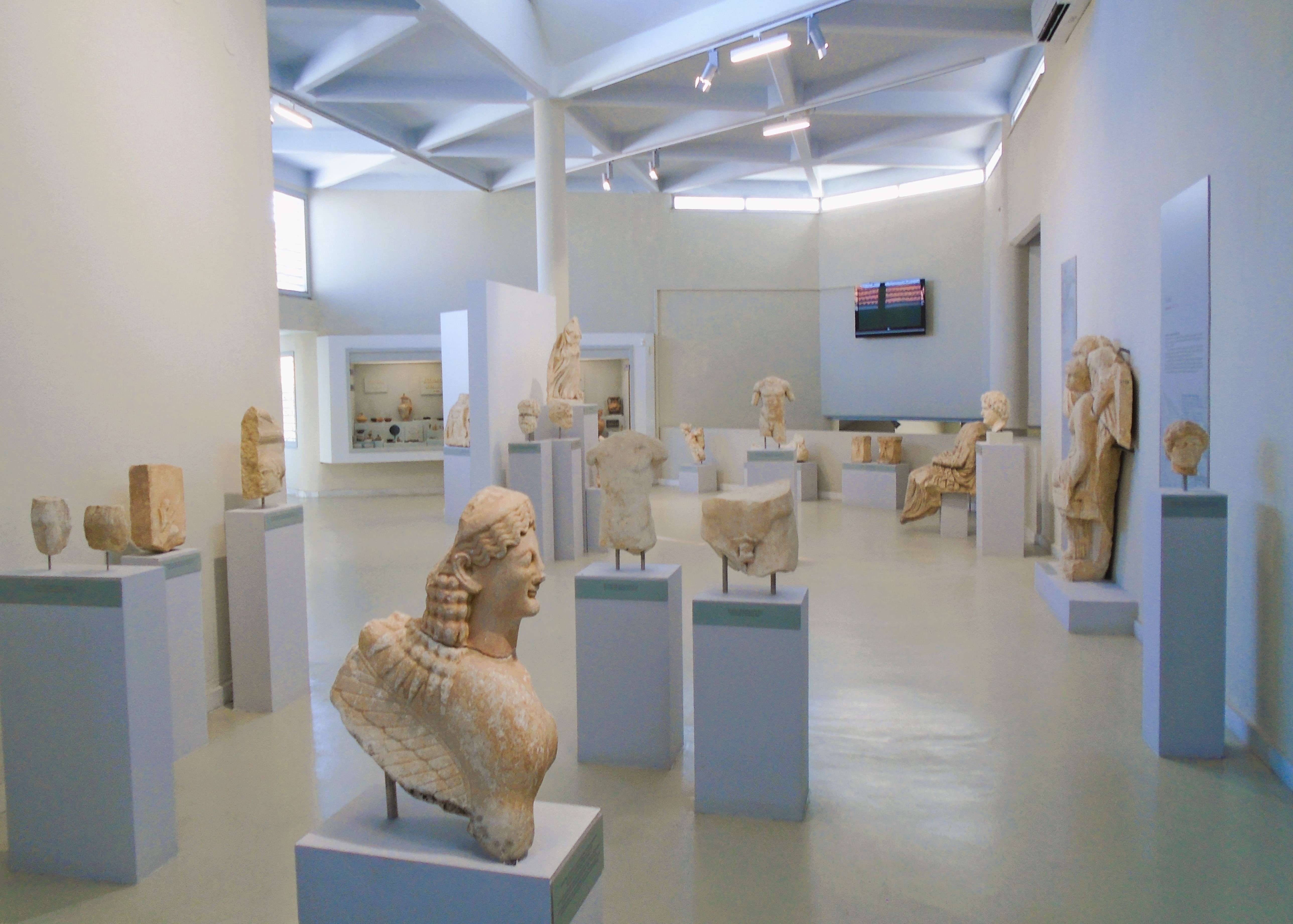
Archaeological Museum
The scattered remains of an ancient agora lie beside the Archaeological Museum, while a steep climb up many steps behind the Folklore Museum brings you to an ancient theatre, which, at the time of my visit, was undergoing what looked like a fairly major renovation. The chatty workmen there were delighted to be distracted by a new, early morning visitor and were keen to teach me some Greek words that are not repeatable.
Despite having a good number of hotels and a plethora of shops, restaurants and bars, Limenas does not have much of a beach (despite the many sunbeds) and most visitors head off to resort villages that are dotted around the coast.
Travelling clockwise round the coast, the main road climbs into the hills to the east of Limenas and passes one of the large marble quarries that continue to generate much of the island’s wealth. After a series of steep climbs and tight bends, the road descends into the adjoining beach resorts of Chrissi Alki, better known as Golden Beach, and Skala Potimias.

Golden Beach
At the time of my first visit to Thassos, these were two separate villages joined by a huge curve of sandy beach that backed on to largely rural countryside. Now the quality of the beach has led to a rash of building and it feels like every available bit of countryside has been filled with hotels, apartments, bars and restaurants. The beach itself is still one of the best on the island if you can find the sand under the serried ranks of sun beds. I was disappointed to see the changes made by apparently uncontrolled development.
Thankfully, things get a bit quieter after Skala Potimias. The sedate village of Kinara lies in some of the island’s most breath taking mountain and coastal scenery. It has low key tourism development but is very different to the buzz and noise of its neighbours to the north – for the time being anyway.
As you swing round to the south coast of the island, the little village of Alykes is a beauty spot with twin beaches and some ancient ruins. However, word has obviously got out about its beauty and main road above the beaches was packed with parked cars and tourist coaches, while the beaches themselves had fallen prey to the advance of the army of sun beds.

Alykes
Continuing on the main road brings you to the less mountainous and less scenic west coast, where there is significantly more tourism development. This starts at the rather ugly and noisy town of Potos, which is close to my idea of a holiday hell. It has a beach jam packed with sunbeds and overlooked by a menagerie of beach bars offering cursory service and poor quality food. The town’s only saving grace is that it is the start point for the 10 km inland road to Theologos, which is probably the most historic and attractive of the island’s mountain villages.
Pefkaria, a few kilometres north, is a much smaller and quieter alternative to Potos and retains a peaceful beach (despite the sunbeds) and a more relaxed atmosphere. Just to the north of Pefkaria lies Limenaria, the second largest town on Thassos, which manages to combine tourism with every day local life and is large enough not to be swamped by visitor numbers.
From here, you start swinging north back towards Limenas, passing a series of coastal villages that I call the Skalas, “skala” being the Greek word for a port or harbour and each being a coastal adjunct of a larger, more traditional inland village.

Skala Marion
Coming from the south, the first and by far the most attractive of these villages, is Skala Marion. Built on two headlands, it boasts no less than three good beaches of differing size and character. Tourism development is low key and low rise but there is still a choice of places to stay and places to eat as well as a few interesting shops. It reminded me a bit of Cadaques in Spain. This is definitely where I would stay if I was returning to Thassos.
Heading north, next up is Skala Kallirachi, which looked the largest of the villages but seemed to lack any real centre or focal point. The beach was nothing to write home about either.
On my most recent visit, I stayed in Skala Sotiros, a small village with a rural feel but still home to three or four tavernas, a few more beach bars and a couple of shops. The harbour area is very pretty and the main beach is a good size with other smaller and quieter coves within a few minutes walk. As with all the villages along the west coast, its sunsets were spectacular. It seemed to be visited mostly by Greeks rather than overseas visitors and the tavernas served up excellent seafood. I enjoyed my time there.
Skala Sotiros
Skala Prinos, to the north, is the second ferry port on Thassos from where twice daily ferries sail to and from Kavala. It has something of the feel of a ferry port i.e. somewhere you pass through rather than stay. Despite this, it does have a smattering of places to stay, a good range of tavernas and bars, and a serviceable if unremarkable beach. Like Skala Kallirachi, it seemed to lack a real centre other than the concrete quays and ticket offices of the port area.
Finally, Skala Rachoni largely straddles the main road and offered no obvious incentives to stop and explore it further as I drove through. However, from here it is only a ten minute drive back to Limenas and the completion of the island circuit.
It took me almost 30 years to return to Thassos and I saw a lot of changes. It was interesting to note the proportion of cars parked around the island that displayed Bulgarian, Romanian or Turkish number plates and the number of Romanian tourist coaches I encountered. I even saw some tavernas advertising their Romanian cuisine, although the one highlighting tripe soup and cornd (sic) meat failed to entice me to a table.
There has been a lot of over development in parts of Thassos, but it remains a scenic island with lots of points of interest. It’s maybe an option for visitors who have been to Greek honeypots like Mykonos, Rhodes and Corfu and are now looking to go somewhere new without finding themselves on a remote and basic island far from what passes for civilisation nowadays.
I like Thassos. I had forgotten how attractive it is. I hope my next visit isn’t for another 30 years, but I will be very careful about where I choose to stay on the island.
Thymena
Visited in 2017.
Small, one village island located opposite Fourni. Very quiet with few people and fewer visitor facilities. No historical sites but does have a great beach. Mostly attracts day visitors

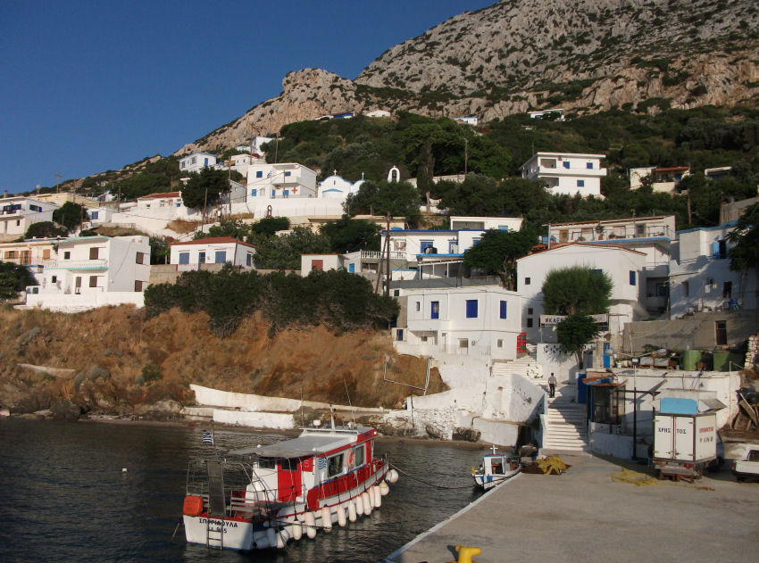
Thymena is Fourni’s little neighbour, a 10 minute ferry ride from Fourni Korseon. It’s little more than a mountain top sticking out of the sea with one village and about 120 residents.
The traditional whitewashed houses of the village climb up a hillside from the harbour amid a jumble of shady lanes, footpaths and stairways. There are only about 2km of paved road on Thymena and none of them go through the centre of the village where there are a couple of small shops and one or two tavernas/cafes which may or may not be open. Las Vegas it ain’t.
Kermaidou
The paved road heads north from the village to the sandy bay of Kermaidou, passing a little blue domed church on the way. Kermaidou is the perfect beach with soft sand, clear sheltered water, shade and a friendly taverna with tables on the beach and rooms to let above the kitchen. There’s no menu as such. It follows the old Greek custom of inviting you to inspect whatever is in the various pots on the hob so you can point to the one that looks most interesting. I don’t imagine it ever gets too crowded. Poor transport links will see to that.
South of the village a dirt road allegedly runs down to another completely undeveloped beach, but I can’t vouch for that. I didn’t see any need to move on from Kermaidou until the afternoon sun started disappearing behind the mountain.
Thymena
Thymena is somewhere that you have to be pretty determined to get to. The only access is through Fourni. Don’t expect any direct connections to the likes of Piraeus.
There is an early ferry most mornings that leaves Fourni at 7am and makes the return voyage from Thymena at about 3.30pm after it has been to Ikaria and Samos. A small caique operates from Fourni a couple of times a day in the early morning and early afternoon. The afternoon crossing gives you about 3 hours on the island before it heads back to Fourni, but makes no effort to link into the departure times of larger vessels calling into its more populous neighbour. I found this out the hard way by watching my connection to Patmos sail out of Fourni when I was halfway through the crossing back from Thymena.
Thymena
Thymena was on my must-do list for some time before I finally did do it and, even then, I only made a day visit as I wasn’t sure if it had any visitor accommodation still open in late September. I fell in love with it’s almost dream like atmosphere. I’ll be going back to stay sometime soon.
